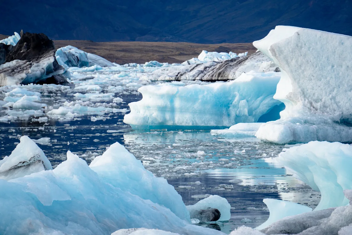
A recent study confirms that melting ice and ocean warming significantly contribute to rising sea levels, with an average increase of about 3 millimeters per year, highlighting the urgent need for climate mitigation efforts and providing valuable data for future climate projections.
A study shows that sea-level projections from the 1990s were remarkably accurate when compared to over 30 years of satellite data, confirming the understanding of human-induced climate change and highlighting the importance of regional monitoring for coastal decision-making.
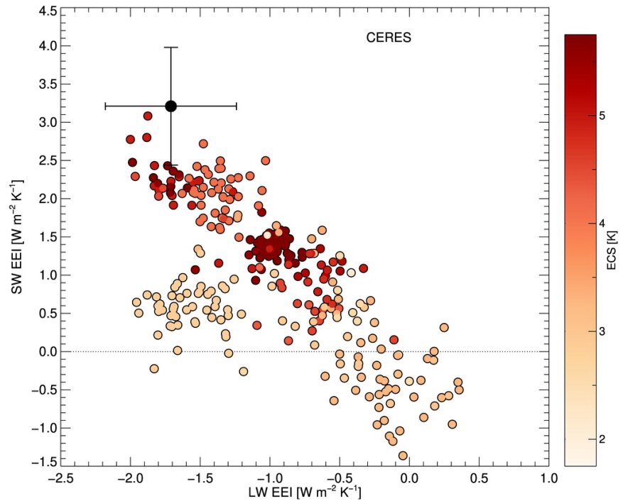
A recent study shows that climate models with low sensitivity to greenhouse gases do not match satellite data, indicating that future global warming may be more severe than previously estimated unless emissions are reduced further.
Satellite measurements show that the Earth's rotation is slowing down faster than before due to melting ice in places like Greenland and Antarctica, impacting the planet's core and overall rotation speed. This affects the timekeeping system, Coordinated Universal Time (UTC), and may require adjustments in the future. The redistribution of mass from melting ice and other factors are contributing to the Earth's slowing spin, highlighting how global warming not only impacts the environment but also affects our timekeeping systems.
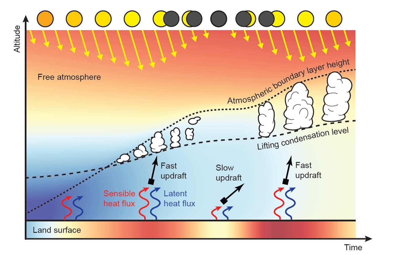
A study has found that cumulus clouds over land start to disappear almost instantly during a partial solar eclipse, with new cumulus clouds often forming once the eclipse is over. Satellite measurements during eclipses were previously unreliable, resulting in dark spots in cloud maps, but researchers have now developed a method to recover these measurements. The study's findings have implications for climate engineering, as disappearing clouds can oppose the cooling effect of artificial solar eclipses, potentially affecting local precipitation patterns.
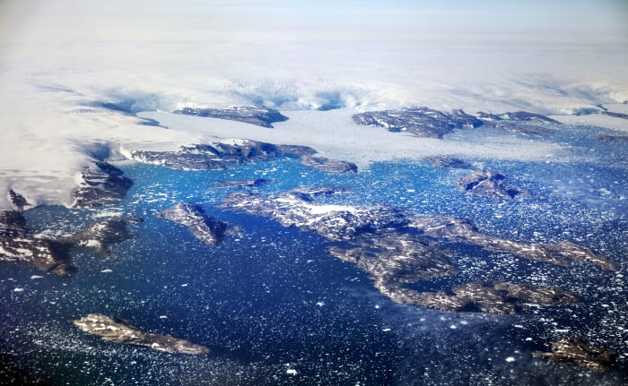
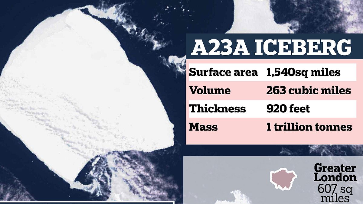
Satellite measurements reveal that the world's largest iceberg, A23a, has a surface area of 1,500 square miles, a volume of 263 cubic miles, and a mass just below one trillion tonnes. It is currently being carried northwards by wind and ocean currents at a rate of about 30 miles per day. The iceberg, which had been grounded for 30 years, is now drifting past the Antarctic Peninsula and may disrupt the feeding routines of wildlife. A23a is the surviving largest fragment of an iceberg that broke free in 1986 and is expected to break down once it reaches the open ocean.
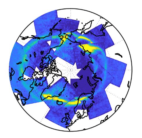
Scientists have used satellite measurements to observe aurora associated with carbon dioxide in Earth's thermosphere. Carbon dioxide becomes vibrationally excited during an aurora, emitting more infrared radiation than typically observed in the atmosphere. The Atmospheric Infrared Sounder, which gathers infrared energy emitted from Earth's surface and atmosphere globally, was used to observe elevated infrared signals from carbon dioxide during an aurora. This dataset and analysis method provides the first daily global observations over regions of the northern and southern hemispheres using a nadir-viewing satellite instrument.
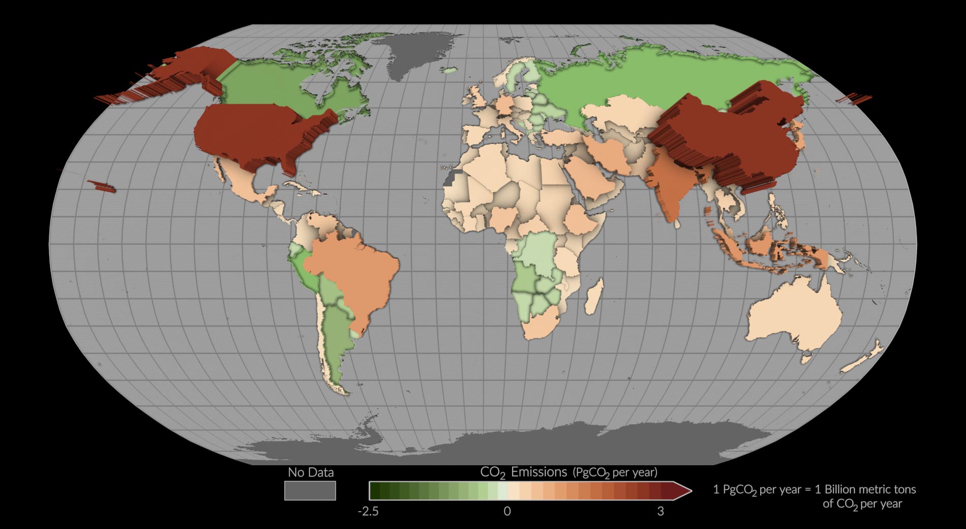
A pilot project using NASA's Orbiting Carbon Observatory-2 (OCO-2) mission has estimated carbon dioxide emissions and removals for more than 100 countries around the world. The study, published in Earth System Science Data, used a measurement-based approach to infer the balance of how much carbon dioxide was emitted and removed. The findings offer a new perspective on carbon dioxide emissions and removals, particularly for nations that lack traditional resources for inventory development. The study provides a new perspective by tracking both fossil fuel emissions and the total carbon “stock” changes in ecosystems, including trees, shrubs, and soils.