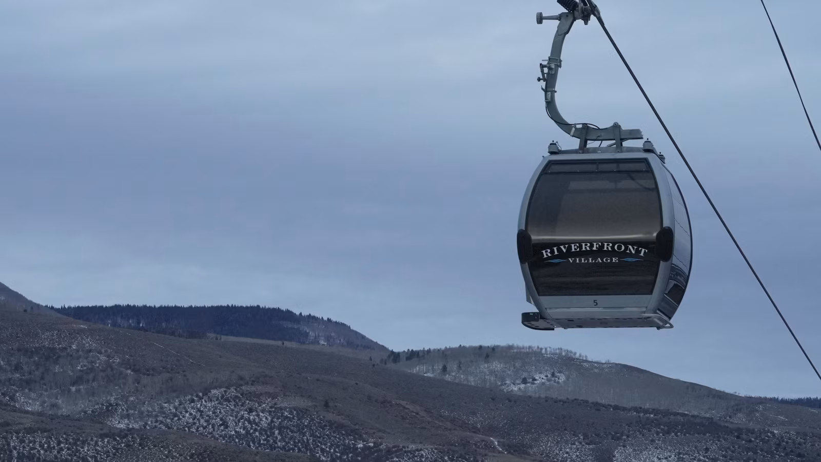
Warm weather and low snowpack are negatively impacting Western ski resorts, delaying openings and reducing snow-based attractions, while the Midwest and Northeast experience record snowfall, highlighting regional climate variability and concerns over drought and water supply in the West.
A study finds that heat from wildfires in the western U.S. may improve air quality in the eastern U.S. by altering weather patterns and increasing rainfall, which washes away pollution, highlighting a complex paradox in wildfire effects.
Recent intense storms across the U.S., exacerbated by climate change, have led to more frequent and severe flash floods in cities like Texas, New York, and New Mexico, as rising temperatures increase atmospheric moisture and rainfall intensity, posing growing risks to communities.
The article discusses the reasons behind the recent increase in extreme rainfall and flooding in the U.S., highlighting changing weather patterns and possibly climate change as contributing factors.
A study published in Geophysical Research Letters suggests that land radiative management (LRM), a climate adaptation strategy involving reflective surfaces to cool urban areas, may inadvertently increase temperatures in neighboring regions by altering weather patterns and reducing rainfall. This could exacerbate climate inequity if applied in high-income areas adjacent to low-income ones. However, the researchers note that LRM could still be beneficial if implemented over appropriate scales, minimizing unintended warming effects.
NOAA has issued an update indicating that a weak La Niña is expected to develop in the coming months, but it is likely to be short-lived and have less impact on global weather patterns, including winter weather in the U.S. Current neutral conditions in the Pacific Ocean suggest that while a La Niña watch remains in effect, the event's influence on typical winter temperature and precipitation patterns may be less pronounced. The likelihood of La Niña forming by the end of December has decreased to 57%.
New research from Penn State suggests that microplastics in the atmosphere may influence weather and climate by acting as ice nucleating particles in clouds. These particles can alter precipitation patterns and cloud formation, potentially impacting climate models and aviation safety. The study found that microplastics can cause water droplets to freeze at warmer temperatures, affecting cloud dynamics and possibly contributing to climate change. The full extent of their impact remains uncertain, but the findings highlight the need for further investigation into how microplastics interact with the climate system.
A significant decline in Antarctic sea ice, described as a once-in-2,000-years event, has been observed, with 2023 seeing a reduction of over 2 million square kilometers. This unprecedented loss, linked to climate change, could have major impacts on marine ecosystems and global weather patterns, according to a study by the British Antarctic Survey. Researchers used climate models to assess the likelihood and implications of this decline.
A study using CMIP6 climate models found that the unprecedented Antarctic sea ice loss in 2023, equivalent to ten times the size of the UK, was significantly influenced by climate change. Without climate change, such an event would be a one-in-2000-year occurrence. The long-term reduction in sea ice could have serious implications for global weather and marine ecosystems, highlighting the need for ongoing research to understand and predict future changes.
The Hunga Tonga-Hunga Ha'apai volcanic eruption in January 2022 has had significant and unusual climate impacts, including contributing to a large ozone hole in 2023 and altering weather patterns for years. Unlike typical volcanic eruptions, it released massive amounts of water vapor into the stratosphere, which is a potent greenhouse gas and aids in ozone layer destruction. Climate models predict lasting effects, such as colder and wetter winters in northern Australia and warmer winters in North America, potentially disrupting weather patterns for the rest of the decade.
A new study reveals that the 2022 Hunga Tonga volcanic eruption, which released massive amounts of water vapor into the stratosphere, could cause unusual weather patterns for the rest of the decade. The eruption has been linked to the large ozone hole in 2023 and unexpected wet summers in Australia. The study predicts colder and wetter winters in northern Australia, warmer winters in North America, and colder winters in Scandinavia until 2029.
The 2022 eruption of the Hunga Tonga-Hunga Ha’apai volcano has had significant and unusual impacts on global weather patterns, including an enlarged ozone hole and unexpected wet summers. The eruption injected massive amounts of water vapor into the stratosphere, a potent greenhouse gas, which could affect weather patterns for the rest of the decade. Climate models predict colder and wetter winters for northern Australia, warmer winters for North America, and colder winters for Scandinavia until 2029.
Americans gearing up for the April 8 total solar eclipse may have to dodge clouds due to historical weather patterns, with the likelihood of experiencing a cloud-free sky at this time of year being closer to the exception than the rule. The path of totality, stretching roughly 2,500 miles from the Texas border to northeastern Maine, presents varying odds for clear viewing, with areas in Texas, Oklahoma, Arkansas, Missouri, Illinois, Indiana, Great Lakes, Pennsylvania, and New England facing different challenges. While the weather may impact visibility, the 2045 total solar eclipse offers another chance for viewing.
The polar vortex above the Arctic is spinning in the opposite direction following a surprise warming event, causing a record-breaking "ozone spike" and disrupting the jet stream. While this reversal is not expected to lead to extreme cold weather in the U.S., it has drawn in large amounts of ozone from lower latitudes, creating a temporary ozone spike. The event, caused by sudden stratospheric warming, is the second of its kind this year and is linked to the current major El Niño phase, potentially making further disruptions more likely over the next year.
The strong El Niño is fading and expected to vanish by late spring or early summer, with a La Niña likely to follow by late summer, potentially impacting global weather patterns. NOAA's Climate Prediction Center assigns over a 60% chance of La Niña developing by summer, rising to over 80% by late summer into early fall. This transition could lead to a hotter summer in the central and eastern U.S., a more active Atlantic hurricane season, and varied winter conditions across different regions of the U.S.