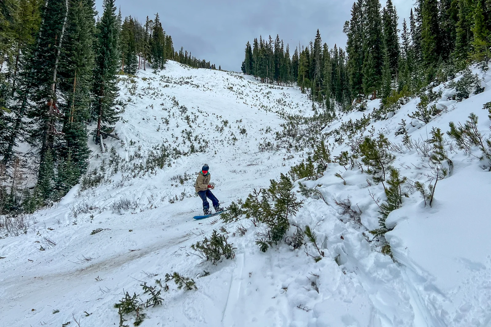
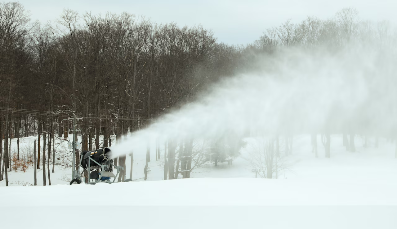
Unseasonably warm winter weather has significantly impacted Colorado's outdoor recreation industry, including delayed openings of ice parks and ski resorts, low snowpack levels, and challenges in maintaining typical winter activities, with many resorts resorting to creative solutions amid uncertain weather patterns.
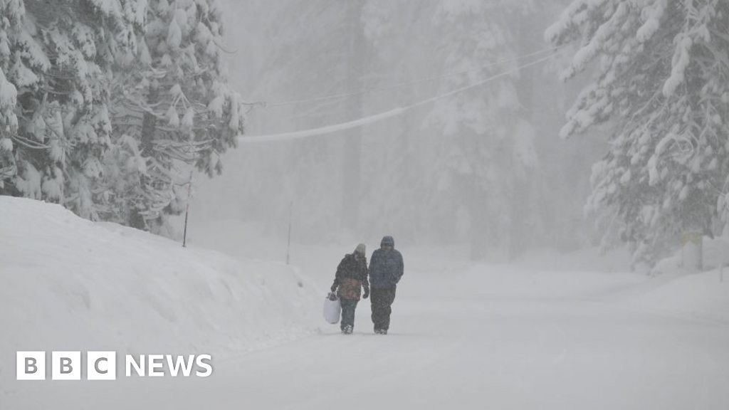
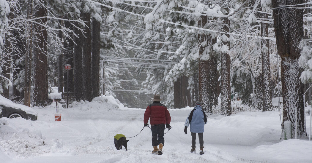
Snow continues to fall in Tahoe, improving conditions on the slopes, with several ski resorts now open or announcing opening dates, offering hope for winter sports enthusiasts.
Warm weather and low snowpack are negatively impacting Western ski resorts, delaying openings and reducing snow-based attractions, while the Midwest and Northeast experience record snowfall, highlighting regional climate variability and concerns over drought and water supply in the West.
A study by GOBankingRates ranks Aspen, Colorado, as the most expensive U.S. tourist destination, with a three-day trip costing around $2,708 for two people, primarily due to high airfare and hotel prices. Other costly destinations include Santa Barbara, Anchorage, Bar Harbor, and Fairbanks, while Florida remains the most affordable state for travelers.
Gaylord, a ski town in Northern Michigan, set a new record for its largest single-day snowfall with 24.8 inches on November 29, 2024, surpassing the previous record of 17 inches from 1942. This significant snowfall, part of a lake-effect snow event, benefits local ski resorts like Treetops and Otsego, as well as the Michigan Snowmobile Festival, which relies on early-season snow. The heavy snowfall is timely, coinciding with the opening of state-designated snowmobile trails on December 1.
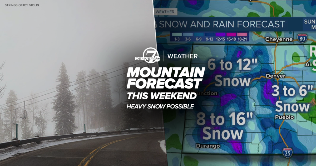
Heavy snow is expected in Colorado's mountains this weekend before Denver sees a chance of snow by Monday. Ski resorts are forecasted to receive varying amounts of snow, with Winter Park, Copper Mountain, Eldora, Keystone, Loveland, Steamboat, and Wolf Creek all expecting snow showers. Denver's weekend forecast includes mild and pleasant conditions on Saturday, cooler weather on Sunday, and the potential for rain showers switching to snow Sunday night into Monday. While the metro area may not see heavy snow, the mountains, foothills, and Palmer Divide are likely to experience snow-related impacts. Overall, Colorado has seen above-average precipitation since January, with Denver reaching 250 percent of average precipitation and Fort Collins and Boulder also exceeding average levels.
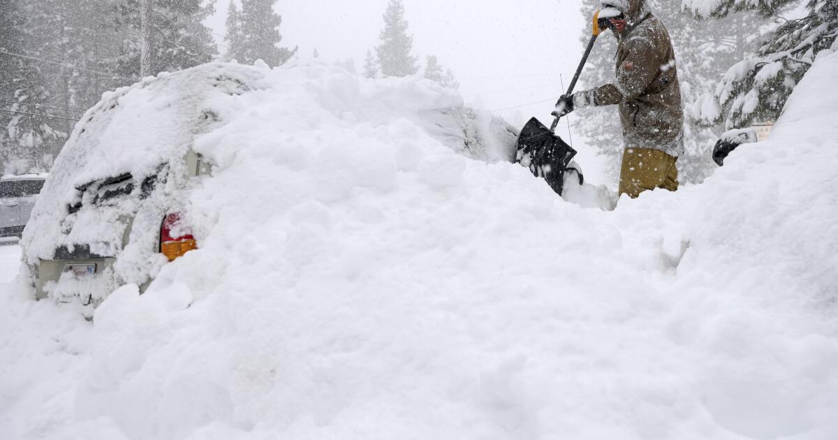
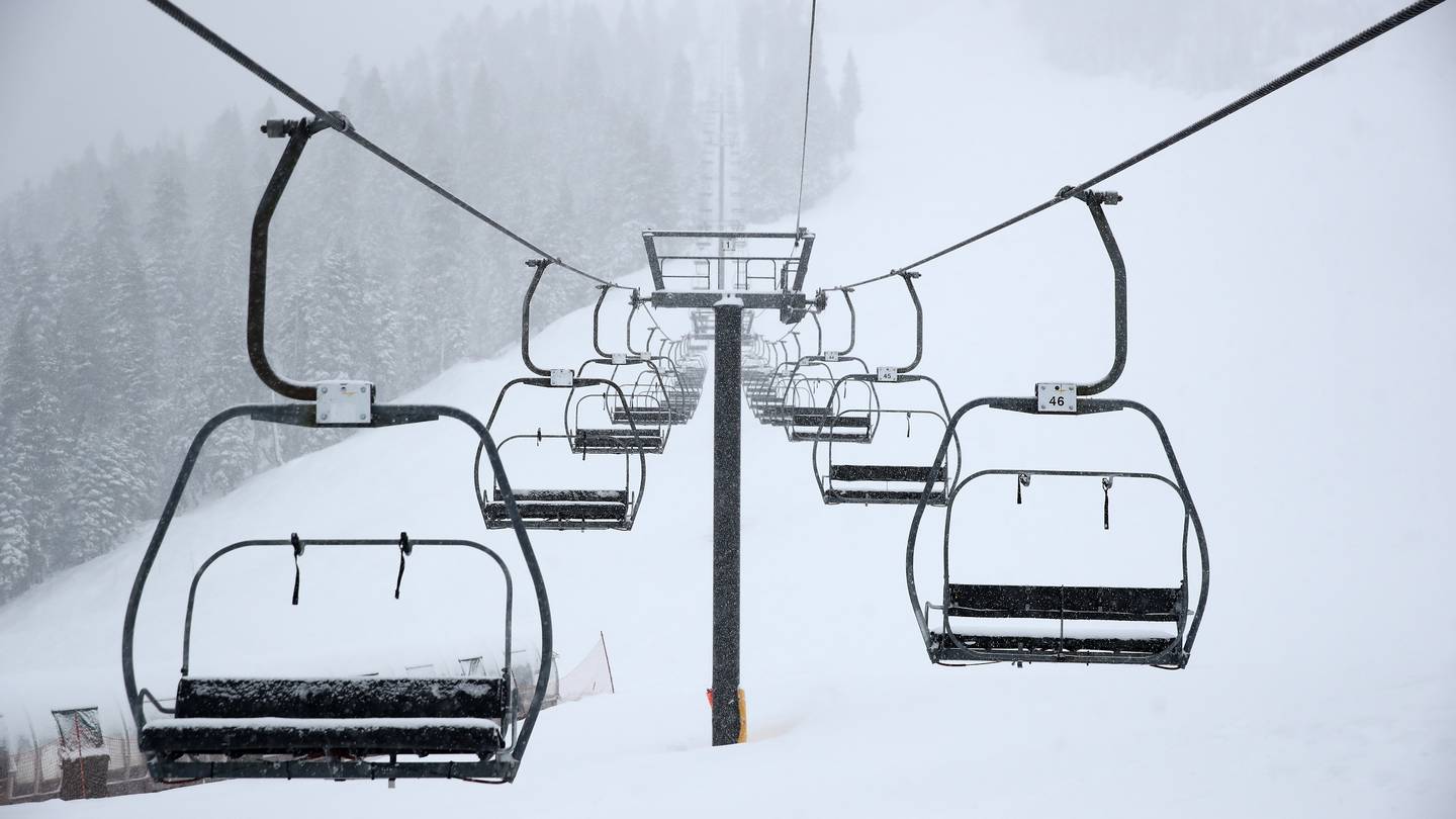
A powerful blizzard has moved out of Northern California, but more snow is expected for the Sierra Nevada mountains. Highways and ski resorts were closed due to the blizzard, with over 7 feet of snow falling in some areas and fierce winds lashing the region. A new, less powerful system is forecasted to bring moderate mountain snow, causing traffic backups and closures. Some ski resorts remained closed due to snow, wind, and low visibility, with thousands of homes and businesses experiencing power outages. Residents and tourists are advised to stay home due to unsafe road conditions.
A rare blizzard in California's Sierra Nevada shut down ski resorts, closed major roads, and brought 5 to 7 feet of snow to the region. High winds and heavy snowfall led to hazardous conditions, with road closures and ski lift shutdowns. Another storm is expected to bring more snow, while an avalanche warning remains in effect. Despite the challenges, the snowpack and water supplies in the Sierra Nevada have significantly improved.
California prepares for a massive snowstorm in the Sierra Nevada region, with up to 10 feet of snow and wind gusts of 140 mph expected. Ski resorts have closed, roads are shut down, and travel conditions are deemed extremely dangerous to impossible. The storm is forecast to bring heavy snow and fierce winds, with potential for avalanches, and has already caused car collisions and road closures. The snowpack in the mountains is crucial for California's water supply, and conditions are expected to improve by Monday.
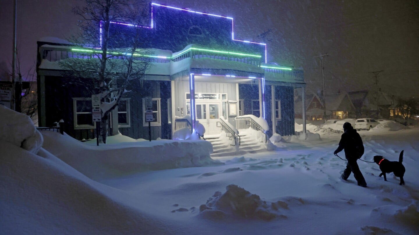
A major snowstorm is hitting the Sierra Nevada, including the Lake Tahoe area, with up to 10 feet of snow expected at higher elevations. Blizzard warnings have been issued, leading to travel disruptions and closures of ski resorts and Yosemite National Park. Residents are advised to hunker down, and the approaching storm could bring life-threatening blizzard conditions with over three feet of snow through Sunday.
Living and working in a ski resort involves a mix of holiday romances, after-dark secrets, and a "work hard, play harder" culture, with staff coping with demanding service through drinking and drug-taking. Relationships intensify in the confined mountain town, while a different social hierarchy applies, and misbehaving is normalized. Despite the challenging economics, many seasonaires find the experience worth it, with some relying on support from family and friends to make ends meet.
Several popular ski resorts in New Hampshire and Maine were forced to close due to heavy rain from a wind-driven rainstorm that melted snow on the mountains and caused flash flooding. Ski operations at Sunday River, Sugarloaf Mountain, Saddleback, Bretton Woods, and Loon Mountain were temporarily halted for repairs to roads and infrastructure. The National Weather Service reported over 5 inches of rainfall in some areas, leading to major flooding. The resorts are working to reopen as quickly as possible and rebuild snow cover with snowmaking.
Several ski resorts in Maine and New Hampshire, including Sunday River and Loon Mountain, have been closed due to major flooding caused by heavy rain. The road leading up to Sunday River was washed out, and employees are currently assessing the damage and making repairs. Other resorts, such as Attitash, Cranmore, and Wildcat Mountain, are also closed for the day to drain and prepare the trails for skiing. The storm brought torrential rain and snowmelt, causing rivers to reach their highest crests ever.
Several ski resorts in Maine and New Hampshire have announced closures on Tuesday as they recover from a powerful storm that brought heavy rain and strong winds. The resorts are assessing and repairing roads, equipment, and terrain that were affected by the storm. Some areas experienced significant flooding, with roads collapsing and culverts being washed away. Ski operations will resume once necessary repairs are made.
Snow is expected to hit Colorado on Thursday night, with some areas potentially receiving up to 9 inches. The Palmer Divide, including cities like Parker, Castle Rock, and Monument Hill, is forecasted to see several inches of snow. Higher elevation towns like Conifer could get up to 5 inches. Ski resorts such as Aspen, Beaver Creek, and Vail are expected to receive fresh snow, with totals ranging from 6 to 9 inches. Commuters are advised to exercise caution on the roads.