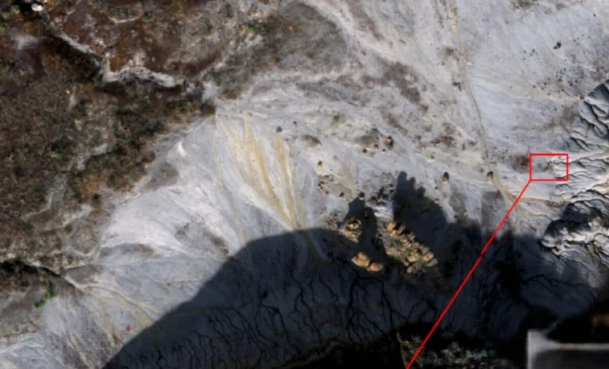
Scientists in Canada are using drone technology and the presence of specific lichens to efficiently locate dinosaur fossils in rugged terrain, marking a significant advancement in paleontological fieldwork by enabling large-scale, non-invasive fossil hunting from the air.
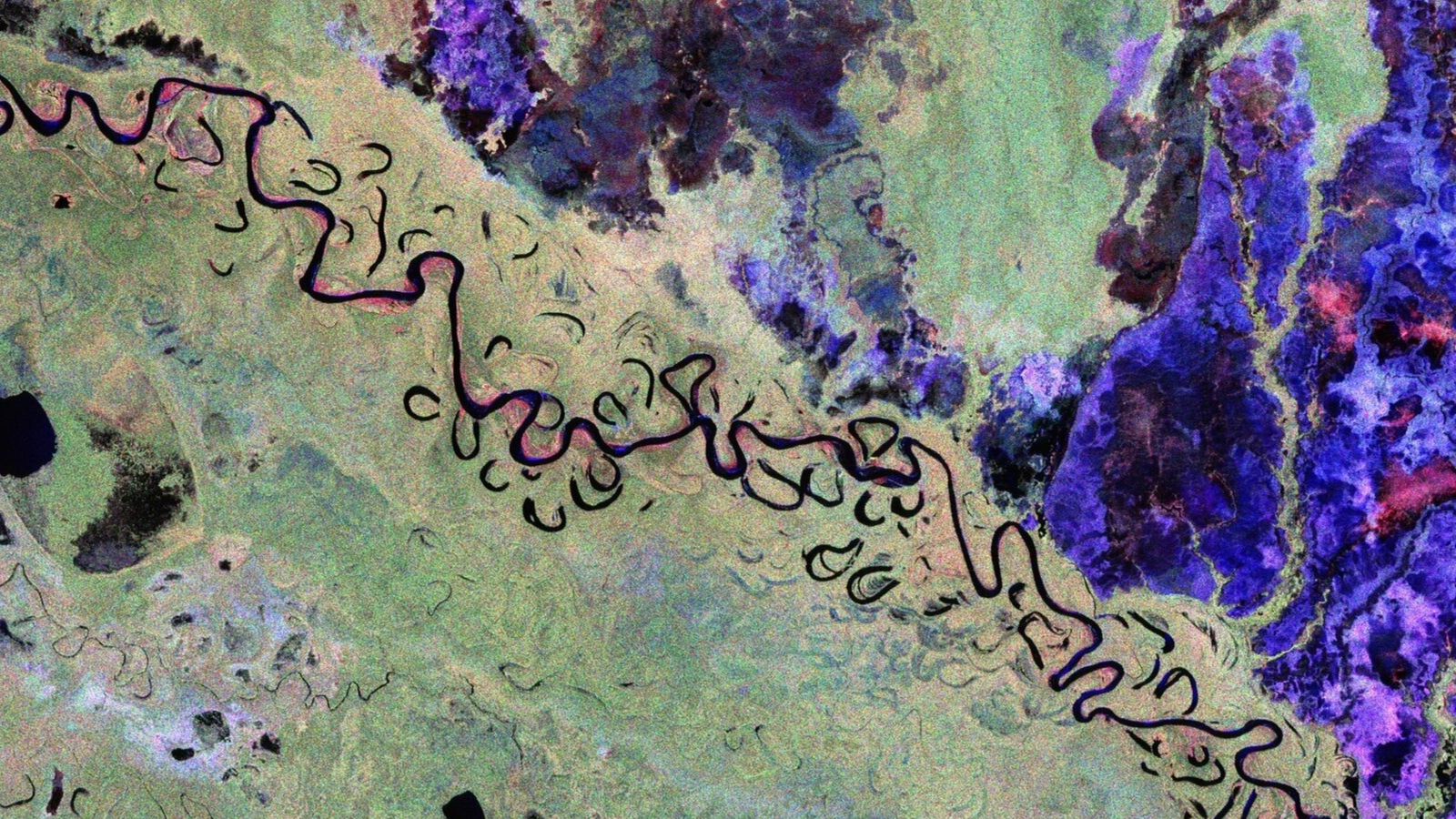
ESA's Biomass satellite has released its first stunning images of Earth's forests, deserts, and glaciers, demonstrating its advanced radar capabilities to measure forest biomass and monitor ecosystems, which is crucial for understanding carbon storage and climate change impacts.
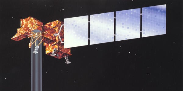
Landsat 7, a satellite that provided 25 years of Earth imaging, has been decommissioned, marking the end of an era in Earth observation. Its data contributed significantly to environmental monitoring and scientific research, and it will now drift in orbit for decades before reentry, while newer Landsat satellites continue to monitor the planet.
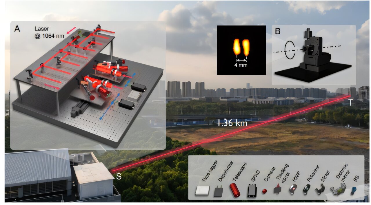
Researchers have developed a high-resolution laser device using intensity interferometry that can read millimeter-scale text from over a mile away, demonstrating super-resolution imaging at 1.36 km in an outdoor environment, with potential applications in remote sensing and surveillance.
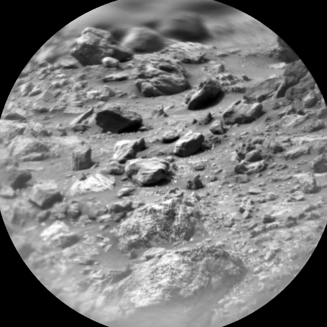
NASA's Curiosity rover completed a fully loaded first sol, conducting a drill to expose a fresh surface on a bedrock target, followed by remote sensing activities including ChemCam LIBS and long distance RMI mosaics to assess the stratigraphy at Gediz Vallis ridge and the distant butte Kukenan. The plan also includes monitoring of rover deck movement, search for dust devils, and atmospheric dust. The second sol involves untargeted activities and post-drive imaging in preparation for the next plan, as the rover continues to make progress along the margin of upper Gediz Vallis ridge on Mars.
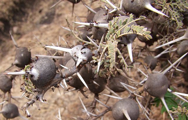
Scientists are using lidar technology, traditionally used for archaeological sites, to identify tiny ants in Kenya's acacia trees with over 80% accuracy, significantly reducing the time and effort required for field surveys. This efficient technology has the potential to track tree pests and invasive species, offering a faster and more cost-effective method for biodiversity sampling and conservation efforts.
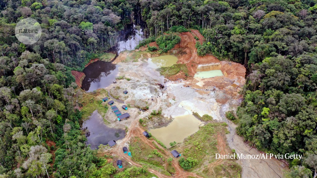
A significant portion of the world's mining activities, including their environmental and community impacts, remains undocumented due to data gaps and lack of comprehensive inventories. Researchers face challenges in assessing the sector's global impact due to incomplete databases, such as the S&P Capital IQ Pro, and the prevalence of illegal operations. The article advocates for improved data collection and sharing, transparency, and the use of remote sensing and AI to fill information gaps. This is crucial as the demand for minerals, especially for clean technologies, is expected to increase, necessitating better data to assess future impacts and risks.
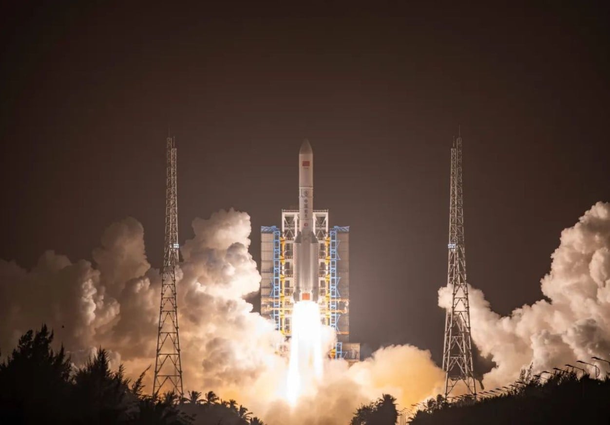
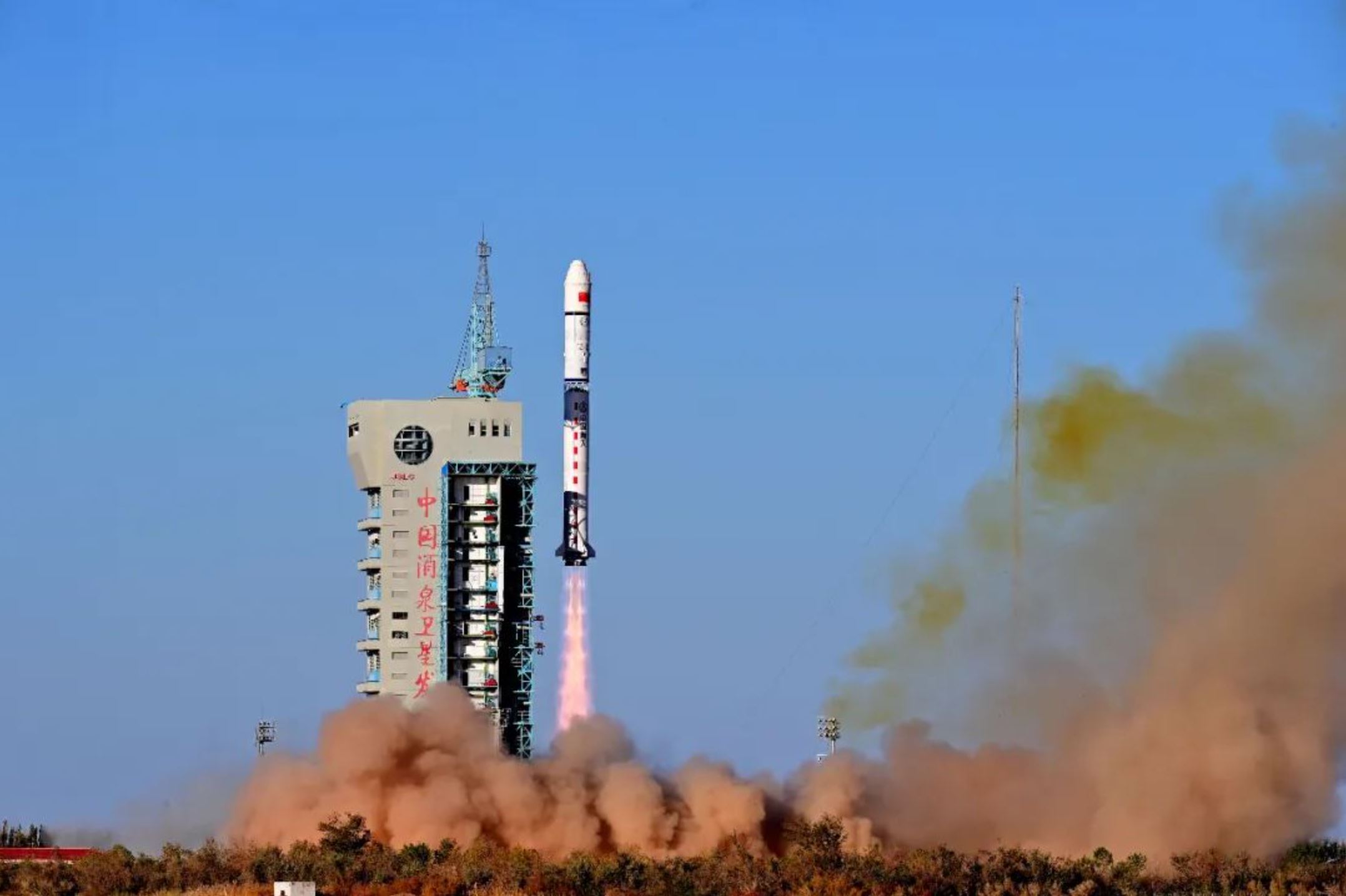
China successfully launched the classified Yaogan-41 optical satellite into geostationary orbit using its largest launch vehicle, the Long March 5. While the satellite's purpose was described as optical remote sensing for land survey, crop yield estimation, and environmental management, outside observers believe it has military applications. If positioned in geostationary orbit, Yaogan-41 will provide continuous observation of one-third of the Earth's surface, aiding in security, meteorology, climate studies, and environmental monitoring. The launch adds to China's growing on-orbit remote sensing capabilities and follows the recent launch of an experimental reusable spacecraft.
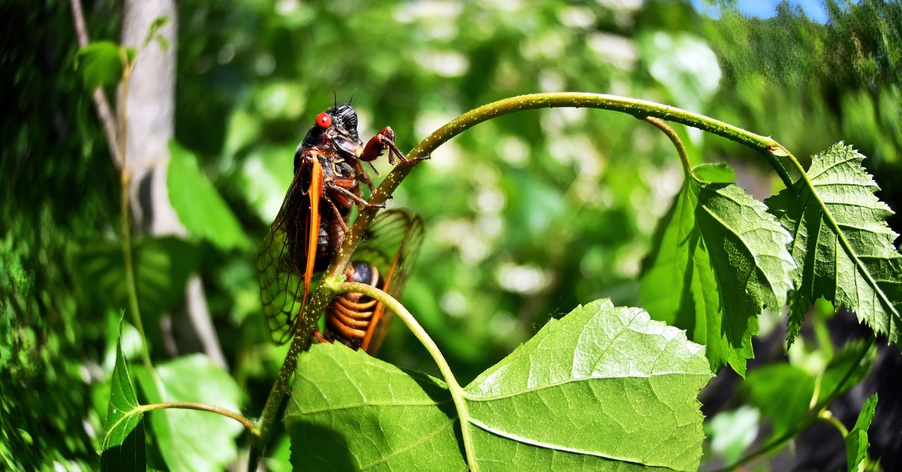
Fiber optic cables equipped with distributed acoustic sensing (DAS) technology have inadvertently picked up the loud sounds of cicadas, offering entomologists a new way to remotely monitor insect populations. DAS, which can track seismic activity, uses fiber optic cables to analyze light disturbances caused by vibrations. The researchers in Princeton noticed a distinct buzzing frequency in the DAS data, which they suspected was the sound of the emerging Brood X cicadas. By monitoring the volume of cicada noise, entomologists can estimate population sizes and study the effects of temperature on their mating behavior. This technology could complement other monitoring techniques and provide valuable data on insect populations, especially in remote areas.
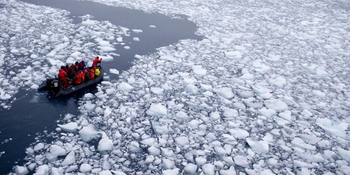
Scientists have discovered an ancient river landscape buried beneath over a mile of ice in Antarctica, providing insights into a long-lost world shaped by rivers and vegetation. The discovery, made using satellite observations, suggests the presence of other undiscovered ancient landscapes beneath the East Antarctic Ice Sheet. The findings could help scientists predict how the continent might respond to human-driven climate change. The study reveals a landscape older than 34 million years, when Antarctica was warmer and supported vegetation, before becoming mostly glaciated. Researchers aim to extract more details about the terrain to reconstruct the evolution of the ice sheet and understand its sensitivity to climate change.
Scientists have discovered an ancient river landscape buried beneath over a mile of ice in Antarctica, providing insights into a long-lost world shaped by rivers and vegetation. The discovery, made using satellite observations, suggests the presence of other undiscovered ancient landscapes beneath the East Antarctic Ice Sheet. By studying the terrain, researchers hope to understand the evolution of the ice sheet and its potential response to human-driven climate change. The findings highlight the significance of Antarctica's past and its relevance to predicting future climate scenarios.
Scientists have discovered an ancient river landscape buried beneath over a mile of ice in Antarctica, providing insights into a long-lost world shaped by rivers and vegetation. The discovery, made using satellite observations, suggests the presence of other undiscovered ancient landscapes beneath the East Antarctic Ice Sheet. By studying the terrain, researchers hope to understand the evolution of the ice sheet and its potential response to human-driven climate change. The findings highlight the significance of Antarctica's past and its relevance to predicting future climate scenarios.
China successfully launched the Yunhai-1 (04) remote sensing satellite, adding to its series of Yunhai satellites. The satellite, developed by the Shanghai Academy of Spaceflight Technology, is described as providing services for detecting atmospheric, marine, and space environments, disaster prevention, mitigation, and scientific experiments. The Yunhai series is believed to be military meteorological satellites. This launch marks China's 47th orbital launch of 2023, with a goal of surpassing 60 launches for the year. China is also preparing for the launch of the Shenzhou-17 crewed mission and the Einstein Probe, a wide-field x-ray space observatory.
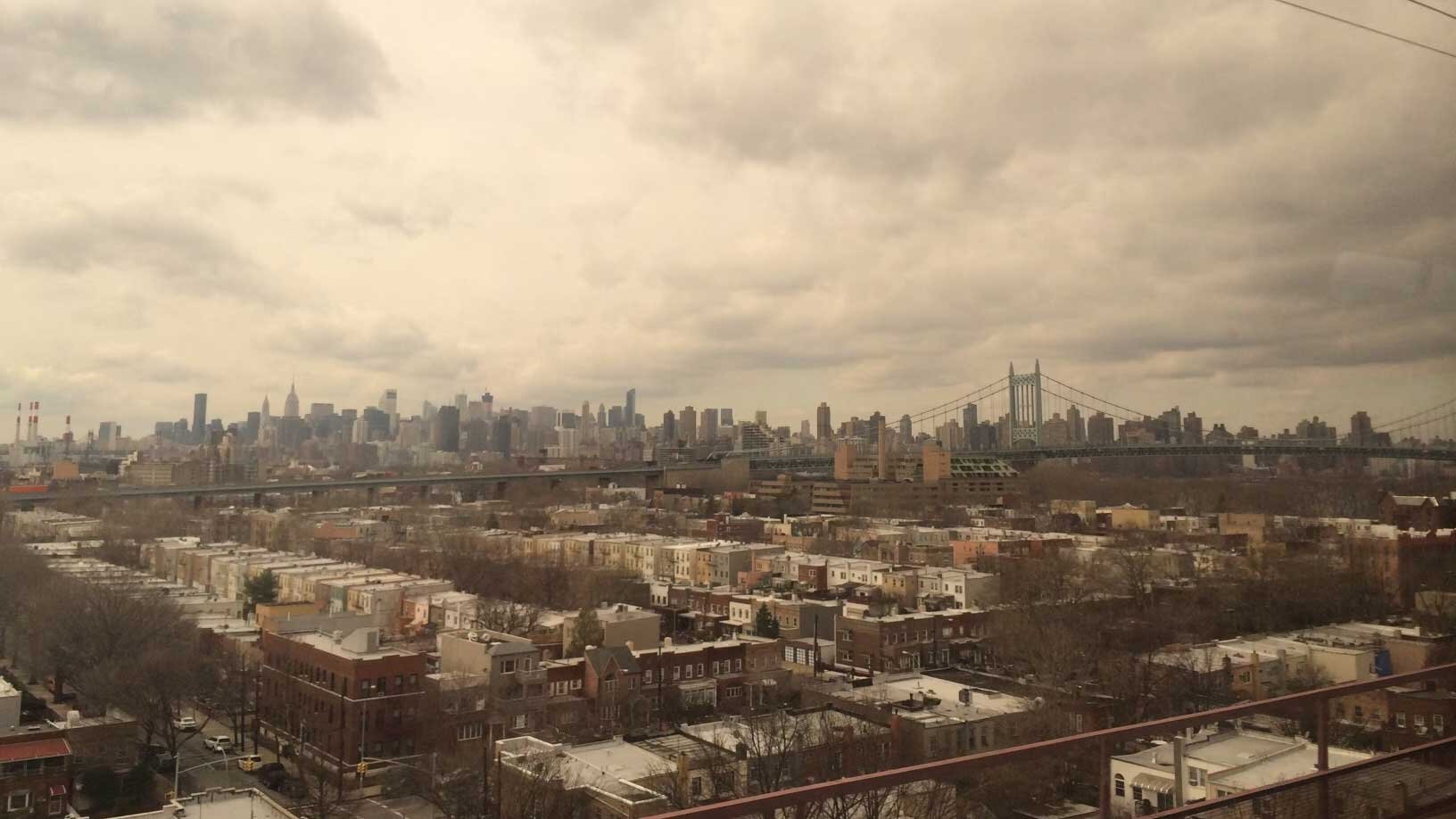
A new study using remote sensing techniques has identified areas in New York City that are sinking and rising at different rates. Factors such as land-use practices and the legacy of glaciers contribute to these elevation changes, which can impact local flood risk associated with sea level rise. The study found that the metropolitan area is subsiding by about 0.06 inches per year on average, with certain neighborhoods and landmarks experiencing more rapid subsidence. The research highlights the importance of tracking land motion for flood mapping and planning purposes, particularly as climate change leads to higher sea levels and increased storm surges.
Scientists overly reliant on remote sensing and models may miss important details about wet weather events, according to a recent study. Researchers argue that direct, on-the-ground observations are crucial for understanding the complexities of wet weather and its impacts on the environment. This "umbrella science" approach can lead to the oversight of localized events and phenomena that escape remote detection. The study advocates for direct observation to improve data accuracy, inspire creativity, and enrich environmental education.