planet-earth68.125 min read
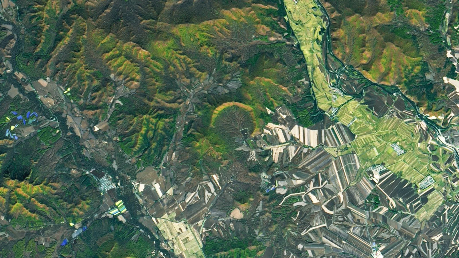
China’s forest hides Earth's youngest major crater
5 days ago•Source: Live Science
The latest planet earth stories, summarized by AI

Coastal deserts form where cold ocean currents chill the air and fog limits moisture, while nearby mountains create rain shadows that block precipitation, producing arid zones right along shores (as seen in the Namib and Atacama).
Live Science•11 days ago
Live Science•14 days ago
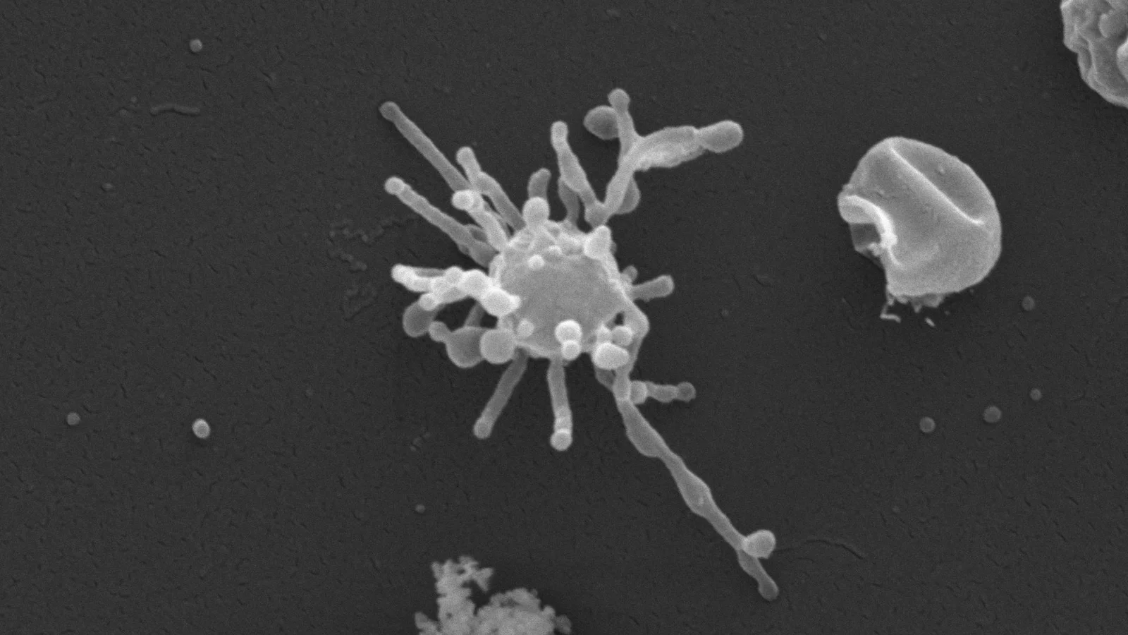
A Live Science feature explores 'intraterrestrials'—microbes living deep in Earth's crust that can remain dormant for hundreds of thousands to millions of years. Scientists propose these organisms may awaken only when slow geological processes bring them back to nutrient-rich surface environments, raising questions about Darwinian evolution in nongrowing life and suggesting long-term dormancy could offer a selective advantage (GASP) as they wait for events like island subsidence, volcanic activity, or plate movement to “reawaken” them.
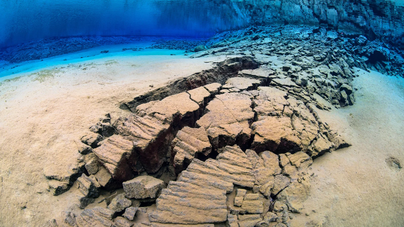
Scientists found wrinkle-like fossil imprints in 180-million-year-old turbidites in Morocco's Central High Atlas, likely formed by ancient chemosynthetic microbial communities rather than photosynthetic life, suggesting deep-water habitats preserved in rocks may hold clues to early life and expanding where researchers search for oldest microbial life.
Advanced modeling of magnetic data from Australia’s Northern Territory has uncovered a large magnetic anomaly shaped like the country, revealing buried geological boundaries and structures (faults, folds, basins) that conventional maps missed. Led by CSIRO researchers, the work refines the 1999 Bonney Well Survey data with a new gridding algorithm, producing clearer imagery and offering clues about Australia’s geological history and potential mineral resources, including hidden features exposed at the surface in the Hatches Creek Formation dating to 2.5–1.6 billion years ago.

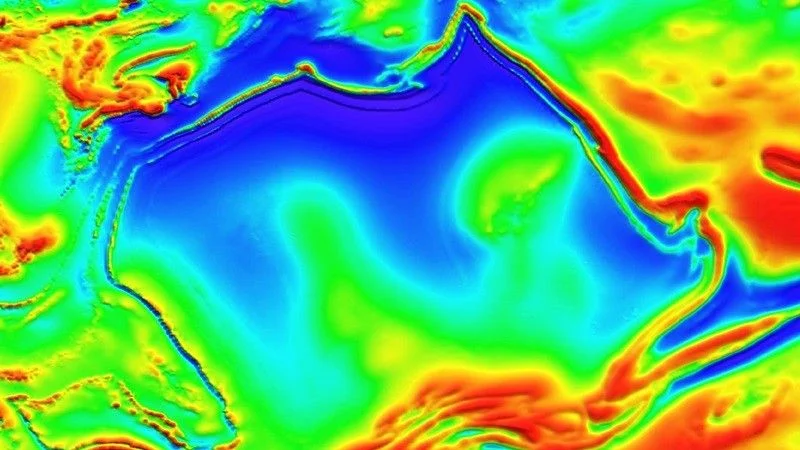
A new study combining P- and S-waves finds a massive, iron-rich, solid mega-ultralow velocity zone beneath Hawaii, which could anchor and fuel the Hawaiian hotspot by concentrating heat and guiding mantle flow.
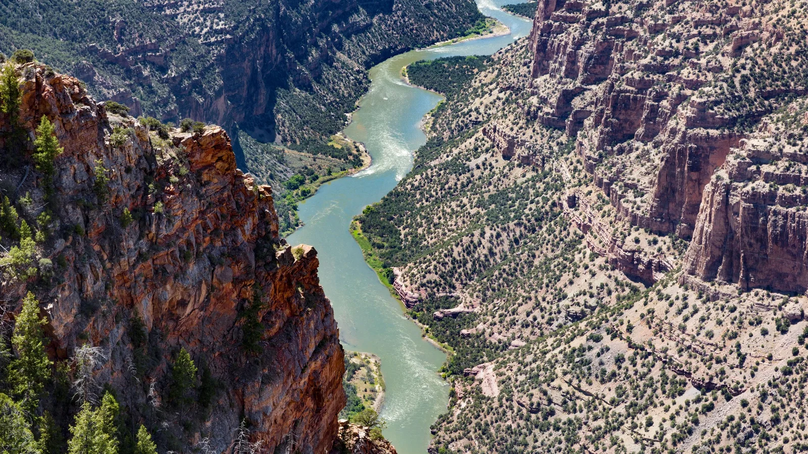
Geologists propose that a deep mantle “lithospheric drip” under the Uinta Mountains lowered the range, allowing the Green River to carve an uphill route through the Uintas about 8 million years ago. The mountains later rebounded after the drip detached from the mantle around 2–5 million years ago, enabling the canyon and current river path (including the Canyon of Lodore) to form. The idea is supported by seismic-imaging data and landscape modeling, and is published in the Journal of Geophysical Research: Earth Surface.
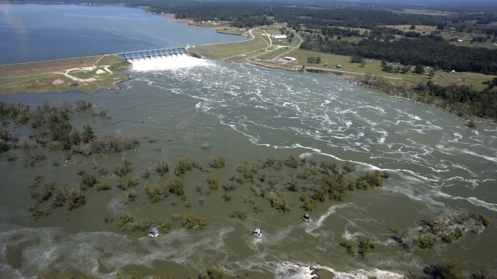
A decade-long Sentinel‑1 radar study flags ground movement beneath several aging U.S. dams, including 41 high-hazard structures over 50 feet tall, with some sections sinking while others rise. While deformation doesn’t mean imminent collapse, it highlights potential weaknesses as climate-driven extreme weather increases stress and maintenance costs rise. The U.S. has about 92,600 dams, more than 2,500 showing damage, and repairing them could cost billions; satellites could help prioritize repairs but aren’t a substitute for inspections.
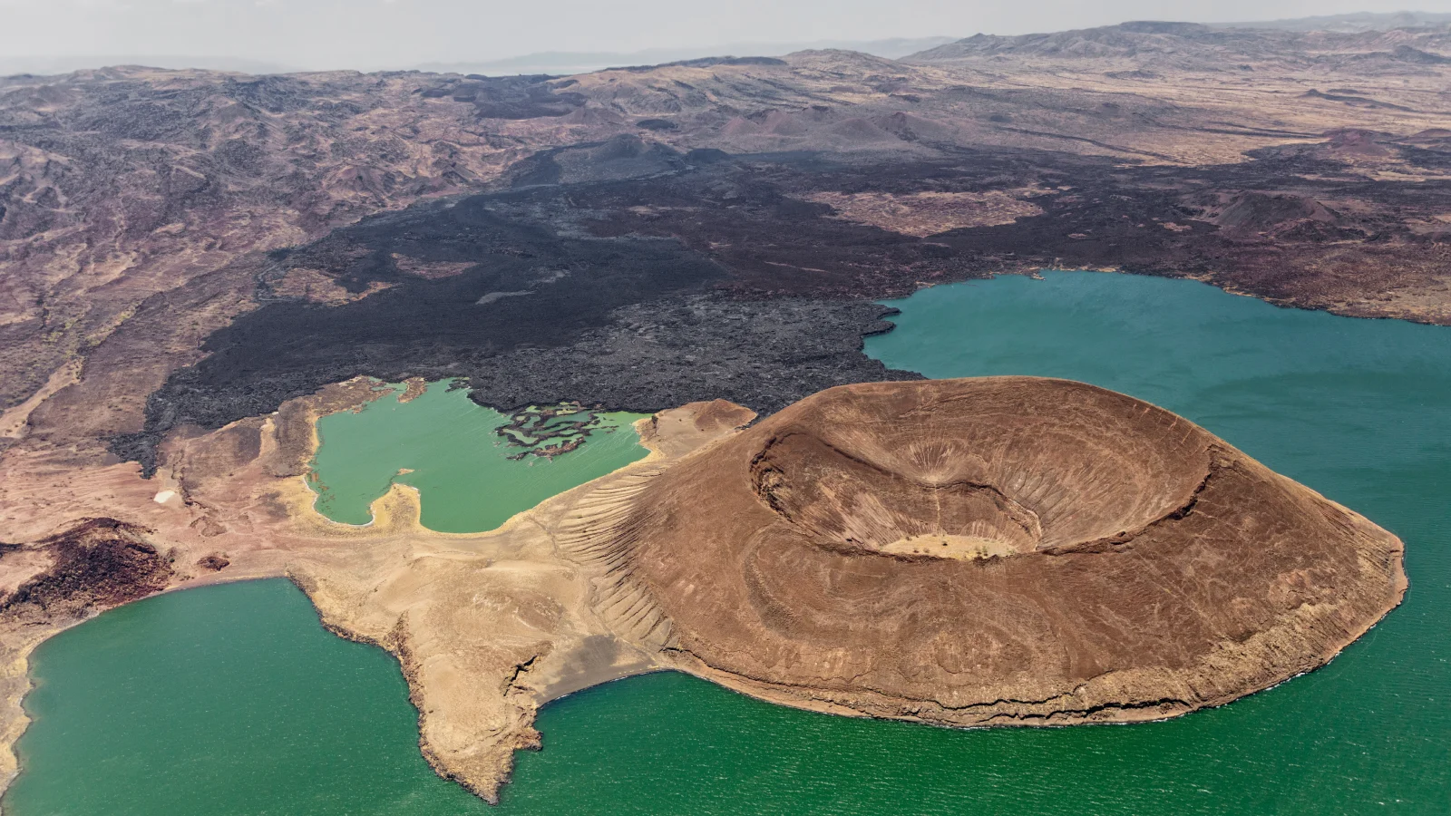
New research links the shift from humid to dry conditions in East Africa with faster fault movement in the East African Rift, measured at about 0.17 millimeters per year of extra movement on top of the regional 6.35 millimeters per year baseline. The dewatering of lakes after the African Humid Period reduces crustal pressure, while a nearby magma chamber may receive more melt, increasing tectonic activity around Lake Turkana and potentially accelerating continental breakup; scientists are expanding the study to Lake Malawi for broader climate-tectonics insight.
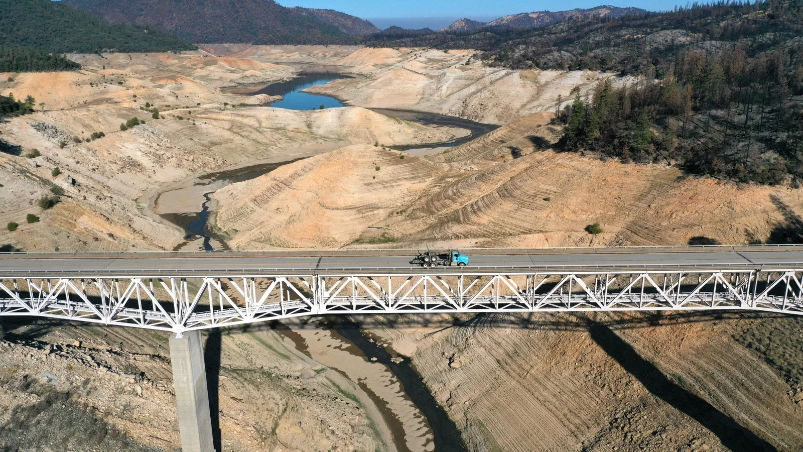
A Virginia Tech study finds California's water use from 2000 to 2020 was consistently lower than suppliers’ projections, with five-year demand overestimates averaging 25% and 20-year estimates about 74%. The drop in per-capita demand, driven by efficiency programs and landscaping rebates, decouples use from population growth and supports drought resilience, but it also implies forecasts may be too high, potentially raising costs if extra supply or infrastructure is needed. The research highlights ongoing opportunities to save water across residential, commercial, and agricultural sectors and the importance of accurate forecasting for long-term planning.

Scientists drilling off the Massachusetts coast confirm a massive freshwater reservoir buried beneath the seafloor, likely formed during the last ice age about 20,000 years ago. Early data suggest the pool may extend farther than first thought, potentially providing a city the size of New York City with hundreds of years’ worth of water (around 800 years), with more definitive results expected in about a month.
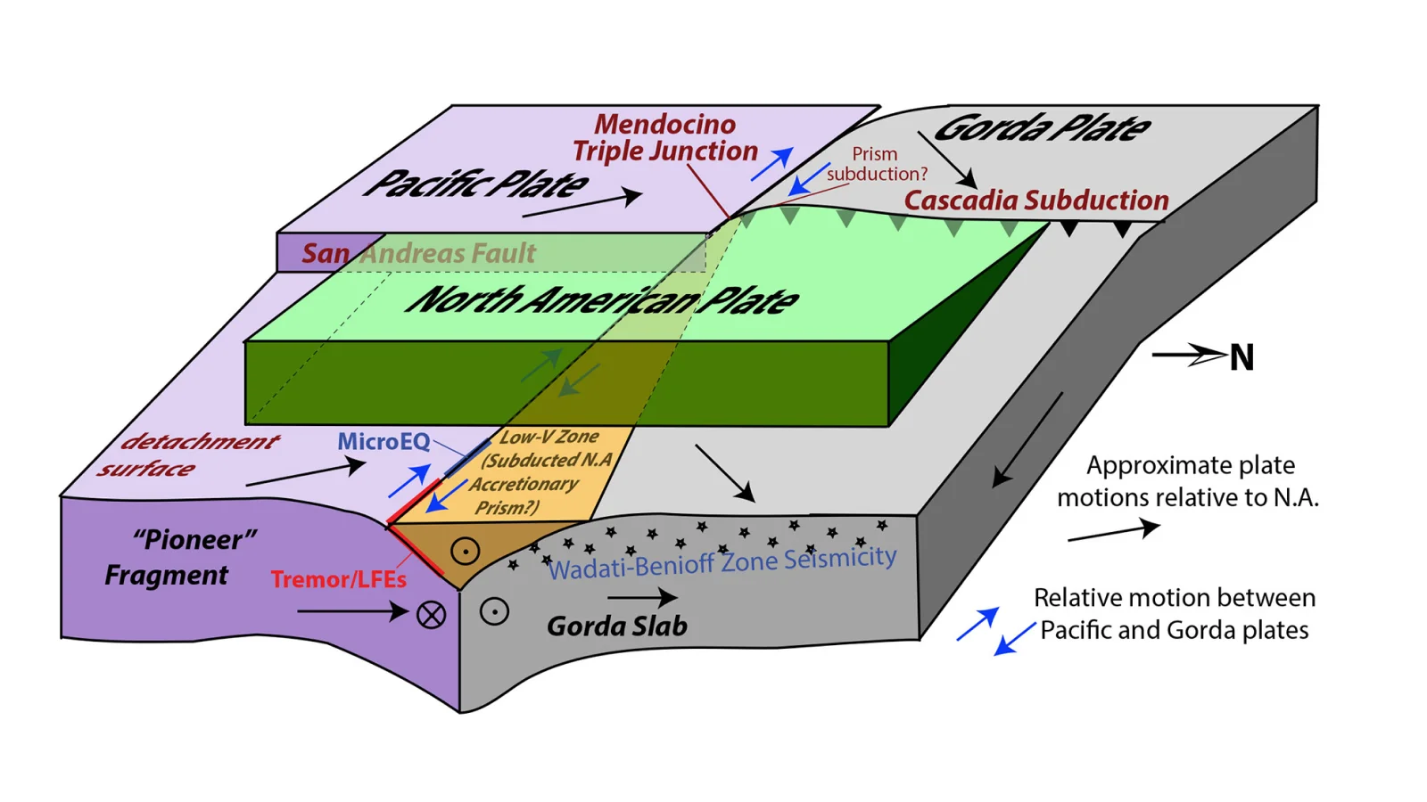
A long-lost oceanic plate fragment called the Pioneer Fragment is now stuck to the Pacific Plate at the Mendocino triple junction, moving northwest under North America and interacting with the Gorda Plate, increasing contact with the Cascadia subduction zone and potentially adding a previously unmodeled fault to regional earthquake risk models.