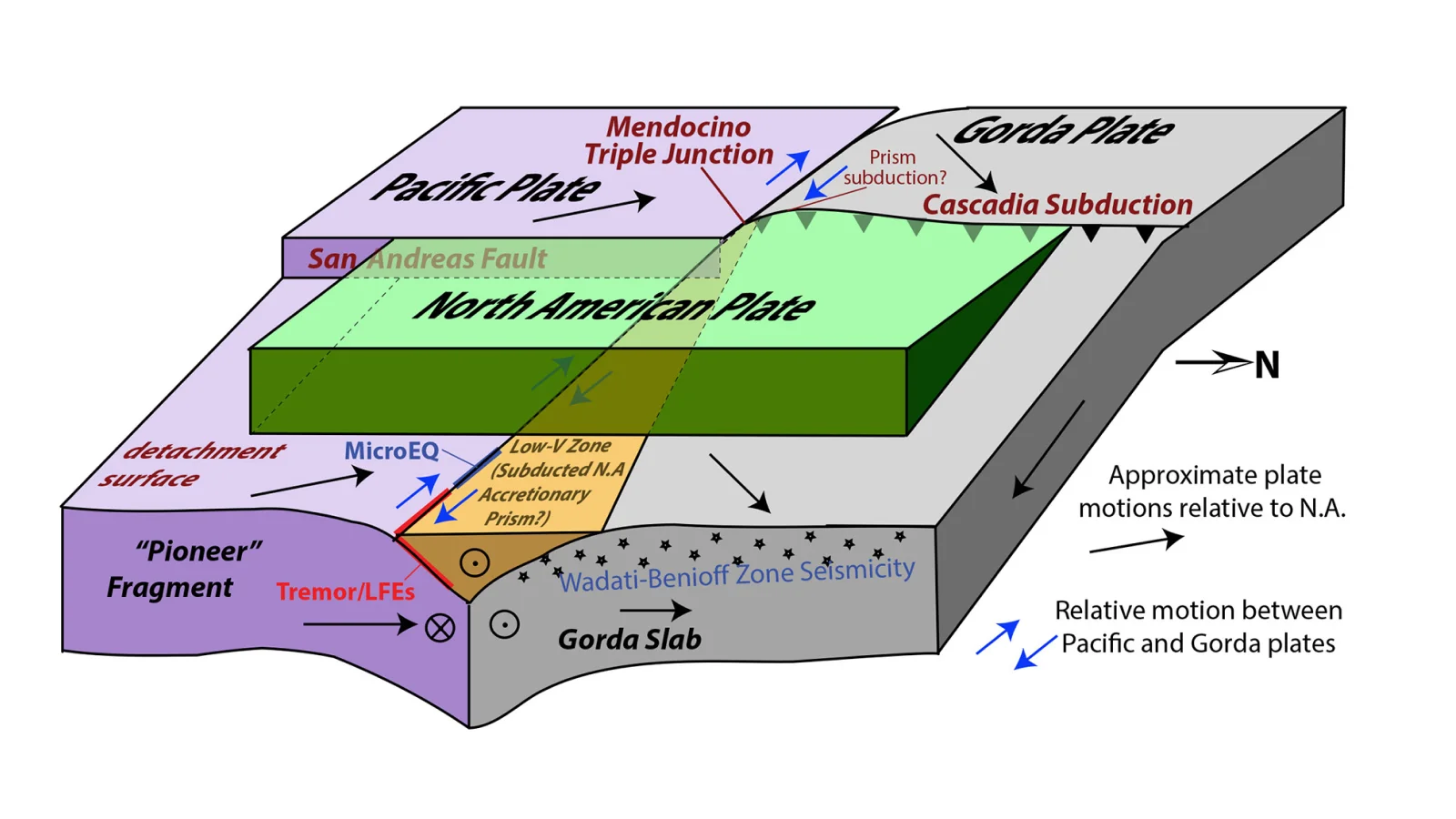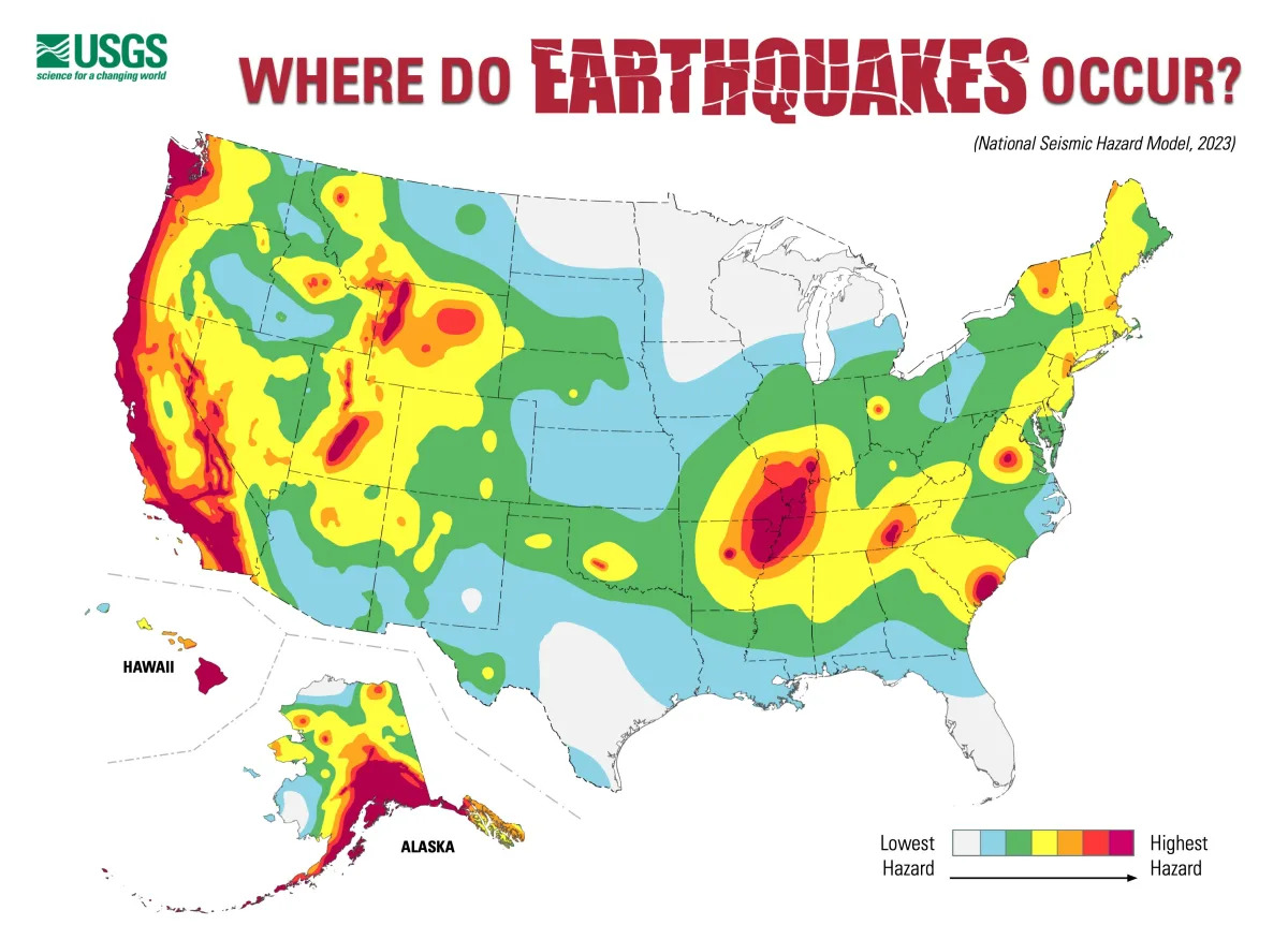
Hidden Plates at U.S. Seismic Hotspot Could Spark Magnitude-8 Quakes
Scientists found that California’s Mendocino Triple Junction, a hotspot where three tectonic plates meet, actually comprises five moving plates (including two hidden ones). Using a network of seismometers, researchers revealed under-surface configurations and a shallower subduction zone, suggesting the area’s quake risk may be higher than previously thought and could trigger magnitude-8 earthquakes, with implications for millions in the region and offering context for past events like the 1992 Humboldt County quake.