Tag

Swot Satellite

All articles tagged with #swot satellite

science9 days ago

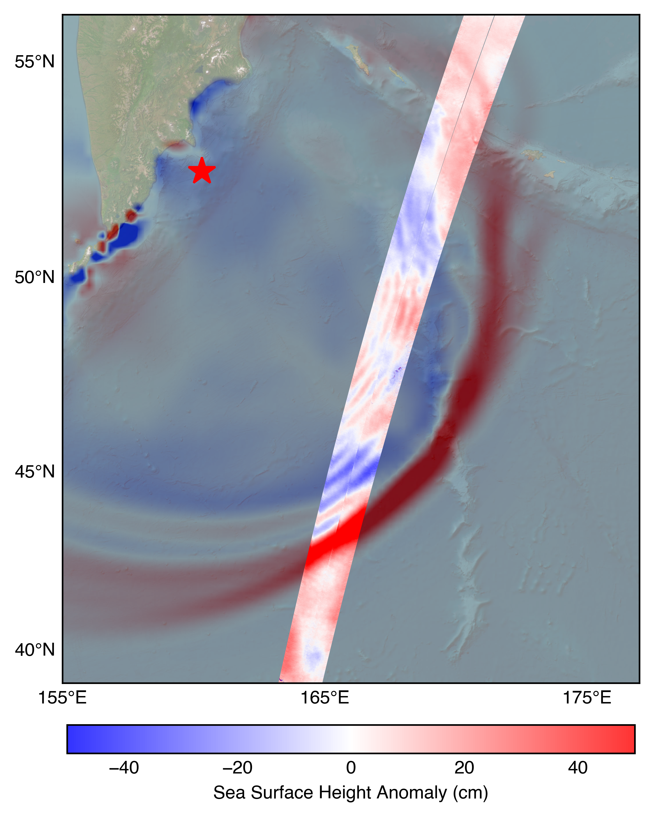
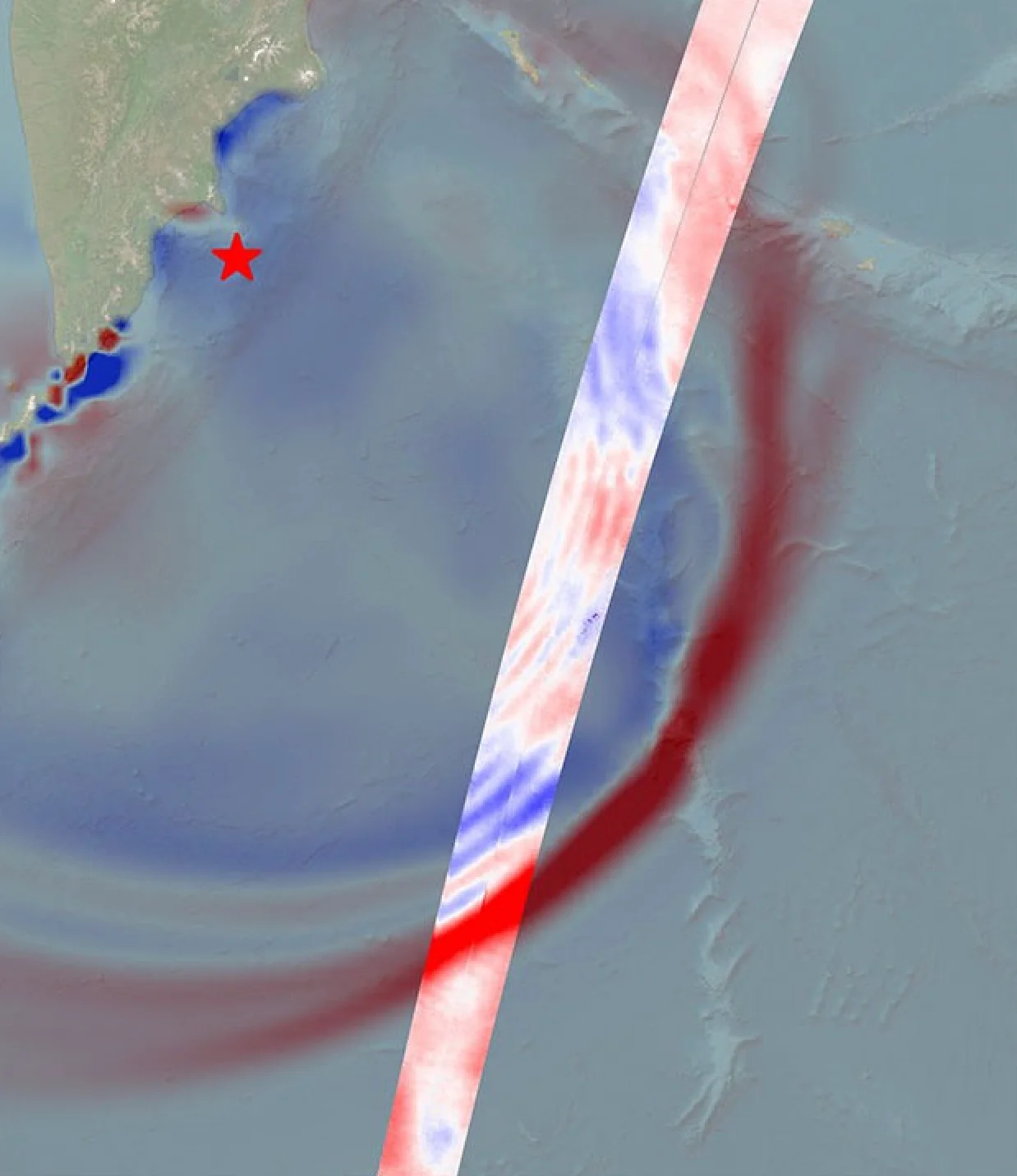
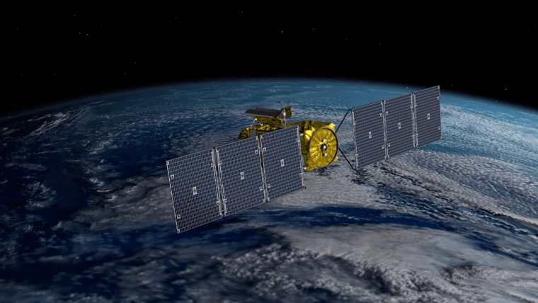
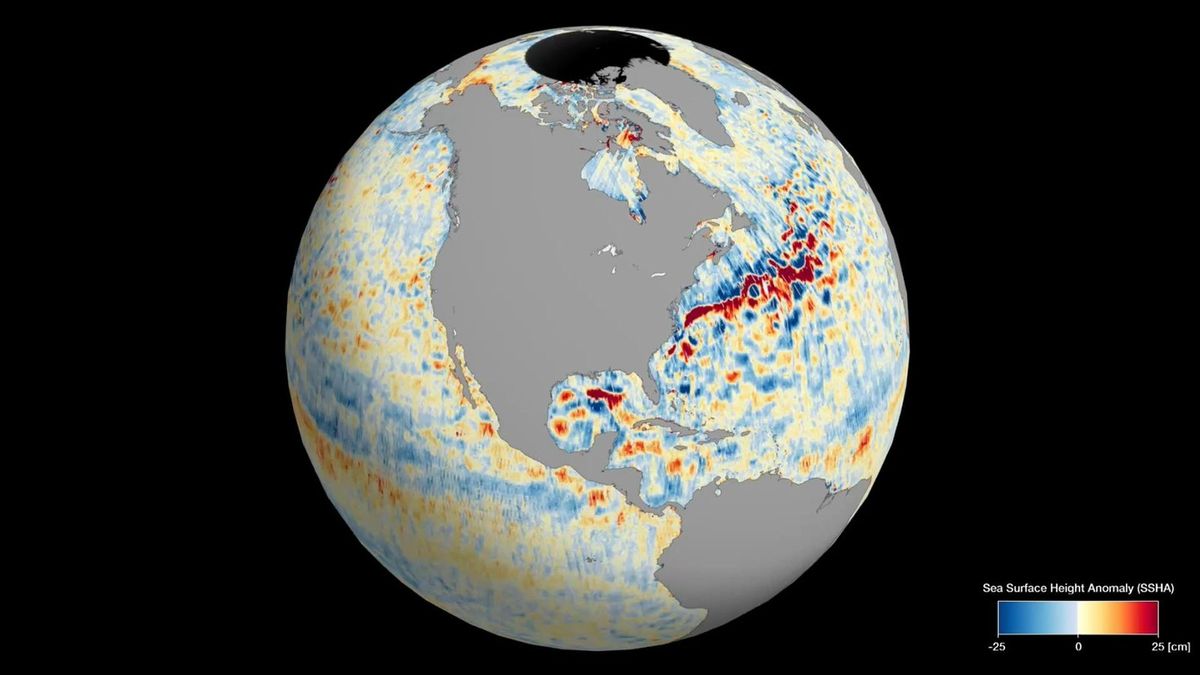
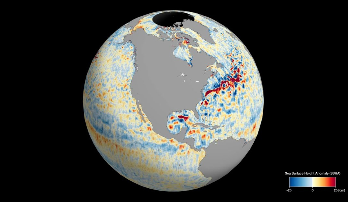
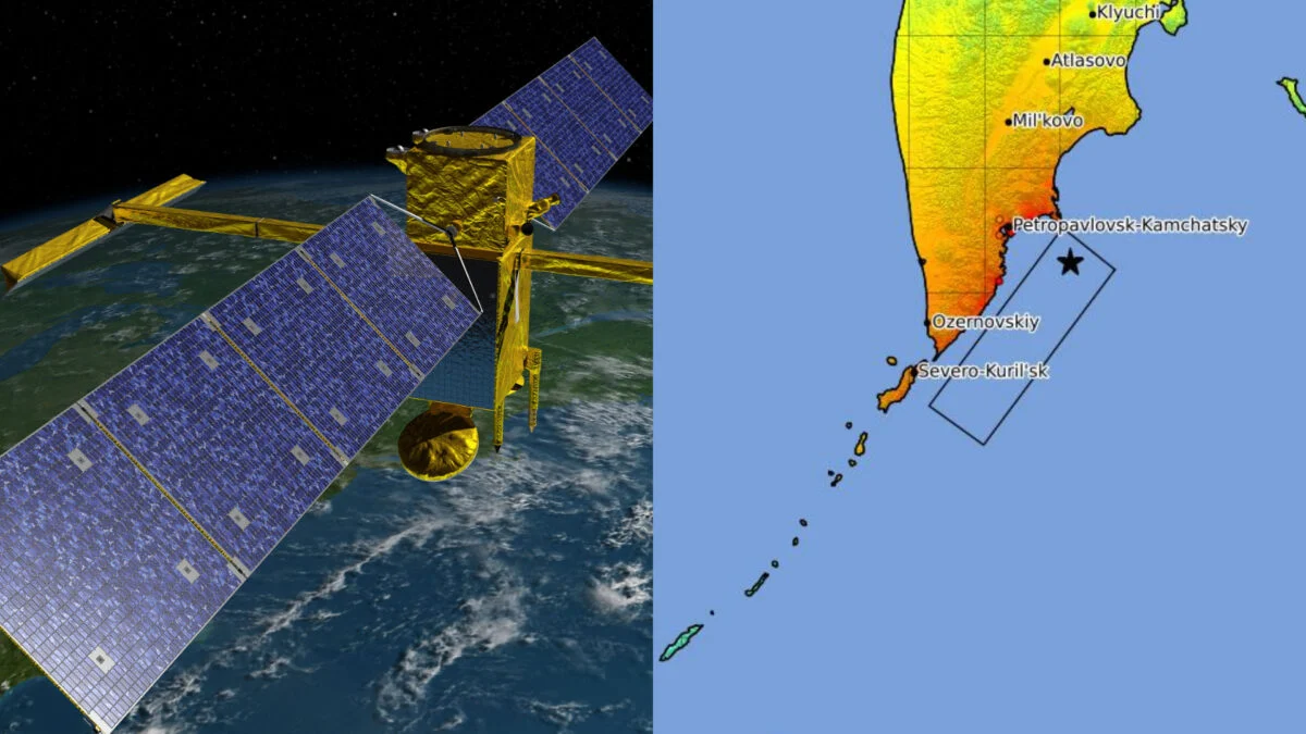
NASA Satellite Reveals Unexpected Tsunami Behavior After Russian Quake

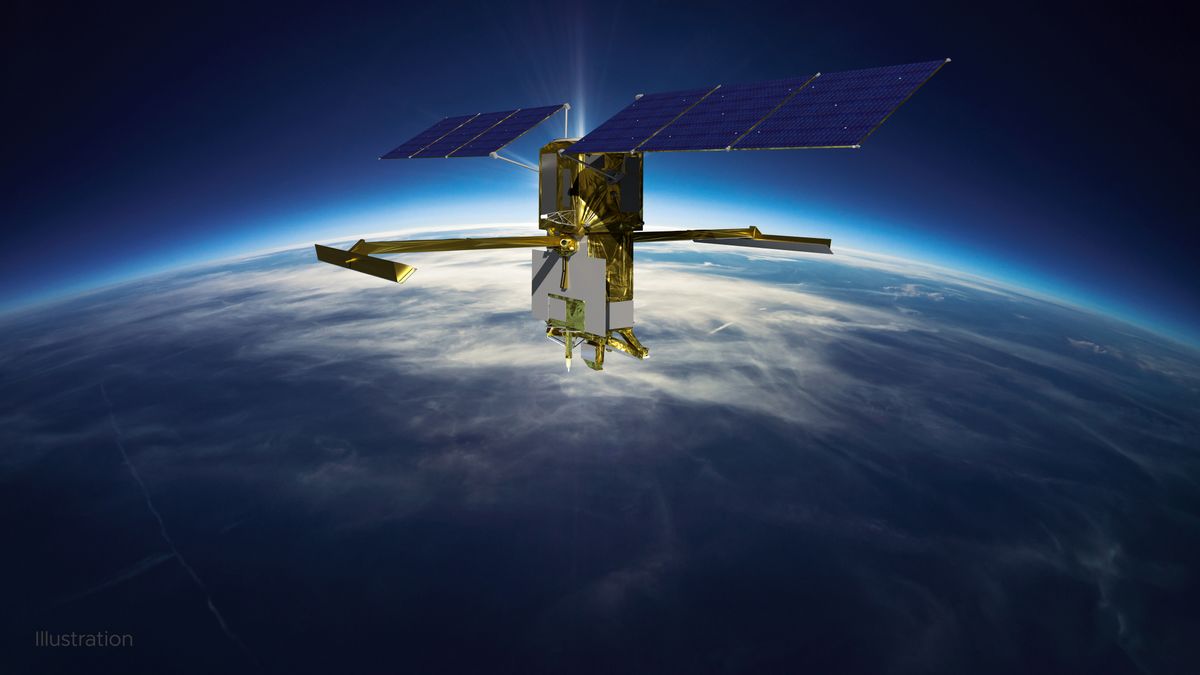
A massive earthquake in Russia triggered a tsunami that was captured in unprecedented detail by the SWOT satellite, revealing complex wave interactions that challenge traditional models and refining the understanding of the quake's rupture length, highlighting the importance of integrating diverse data sources for accurate tsunami prediction.

science1 year ago

Satellites Unveil Detailed Seafloor Maps

NASA's SWOT satellite, launched in December 2022, has mapped Earth's ocean floors with unprecedented detail, revealing underwater hills, volcanoes, and tectonic boundaries previously undetectable by older satellites. This data, collected in just one year, surpasses 30 years of previous satellite and ship data, offering new insights into ocean currents, nutrient transport, and Earth's geologic history. The satellite's findings could significantly advance scientific understanding of tectonic theories and oceanic processes.

science-and-technology1 year ago

"Unveiling the Depth of Death Valley's Ephemeral Lake with SWOT Satellite Imagery"

NASA-led analysis using the U.S.-French SWOT satellite calculated water depths in Death Valley's temporary lake, ranging from about 3 feet to less than 1.5 feet over six weeks, showcasing the satellite's capabilities. The lake, known as Lake Manly, experienced varying water levels and dimensions, with SWOT providing crucial data for understanding unique lake systems. SWOT's KaRIn instrument, a Ka-band radar, is instrumental in measuring water surface levels and providing detailed views of Earth's water bodies, filling data gaps for inland features like lakes and rivers.

science-and-technology2 years ago

"NASA's SWOT Satellite: Mapping Earth's Vast Water Resources"

NASA's Surface Water and Ocean Topography (SWOT) satellite has provided stunning views of Earth's water, mapping the planet's global sea levels. The satellite collected data during its first full 21-day science orbit, revealing the varying surface heights of oceans, freshwater lakes, and rivers. Scientists are excited about the detailed information SWOT is providing, which will advance research on climate change and help communities prepare for a warming world. The satellite's Ka-band Radar Interferometer (KaRIn) instrument was used to create an animation showcasing sea surface height differences worldwide, highlighting ocean currents and regions of warmer water. SWOT's mission aims to measure water height over 90% of Earth's surface every 21 days, offering one of the most comprehensive views of Earth's water.

science-and-technology2 years ago

SWOT Satellite Reveals Unprecedented Global Sea Level View

The SWOT satellite, jointly developed by NASA and CNES, has completed its first full science orbit and provided an incredibly detailed map of global sea levels. Using the Ka-band Radar Interferometer (KaRIn) instrument, SWOT collected data on ocean heights, allowing for the mapping of phenomena such as ocean currents and warming. The mission aims to advance climate change research and help communities prepare for a warming world by providing unprecedented knowledge about Earth's surface water.

spaceflight2 years ago

NASA's Climate Change Satellite Restored to Full Functionality.

NASA and CNES have resolved an issue with the KARIN instrument on the Surface Water and Ocean Topography (SWOT) satellite, which shut down suddenly in January. The team used a backup power unit to get KARIN working, and SWOT is expected to begin science operations in July. The mission will assess and monitor global water levels to better understand how carbon dioxide influences rising water levels influenced by global warming.