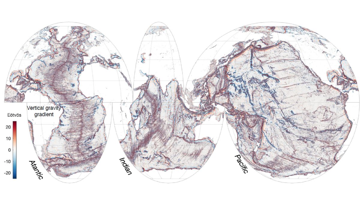
NASA's SWOT satellite, launched in December 2022, has mapped Earth's ocean floors with unprecedented detail, revealing underwater hills, volcanoes, and tectonic boundaries previously undetectable by older satellites. This data, collected in just one year, surpasses 30 years of previous satellite and ship data, offering new insights into ocean currents, nutrient transport, and Earth's geologic history. The satellite's findings could significantly advance scientific understanding of tectonic theories and oceanic processes.
Saildrone, a California-based technology startup, has completed a historic, crewless mission to map over 17,000 square miles of the previously unknown ocean floor around Alaska’s Aleutian Islands and off the California coast. The mission was undertaken by the Saildrone Surveyor, which took 52 days to map the area around the Aleutian Islands before embarking upon its second mission off the California coast. The missions, which mapped “high priority” areas across “key regions” in high resolution, yielded unexpected discoveries, such as “a previously unknown seamount standing approximately 1,000 meters [3,200 feet] high.”