SWOT Satellite Reveals Unprecedented Global Sea Level View
TL;DR Summary
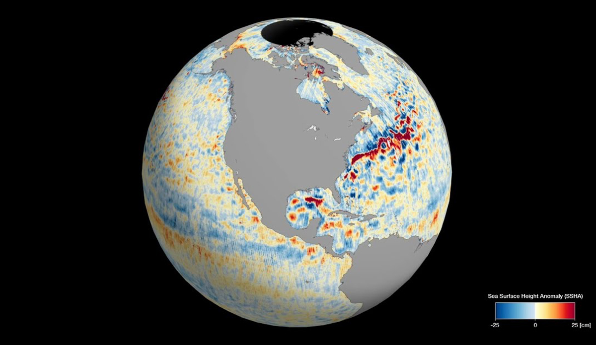
The SWOT satellite, jointly developed by NASA and CNES, has completed its first full science orbit and provided an incredibly detailed map of global sea levels. Using the Ka-band Radar Interferometer (KaRIn) instrument, SWOT collected data on ocean heights, allowing for the mapping of phenomena such as ocean currents and warming. The mission aims to advance climate change research and help communities prepare for a warming world by providing unprecedented knowledge about Earth's surface water.
Topics:science#climate-change#data-collection#ocean-currents#science-and-technology#sea-levels#swot-satellite
- SWOT Satellite Gives Us Insanely Detailed Map Of Global Sea Levels TheInertia.com
- Video: Satellite captures unique view of the planet’s oceans from space India Today
- See This Space-Based View of Global Sea Levels From SWOT Data NASA Jet Propulsion Laboratory
- See SWOT mission's unprecedented view of global sea levels Phys.org
- See SWOT Mission’s Unprecedented View of Global Sea Levels NASA
- View Full Coverage on Google News
Reading Insights
Total Reads
0
Unique Readers
8
Time Saved
1 min
vs 2 min read
Condensed
78%
338 → 75 words
Want the full story? Read the original article
Read on TheInertia.com