"NASA's SWOT Satellite: Mapping Earth's Vast Water Resources"
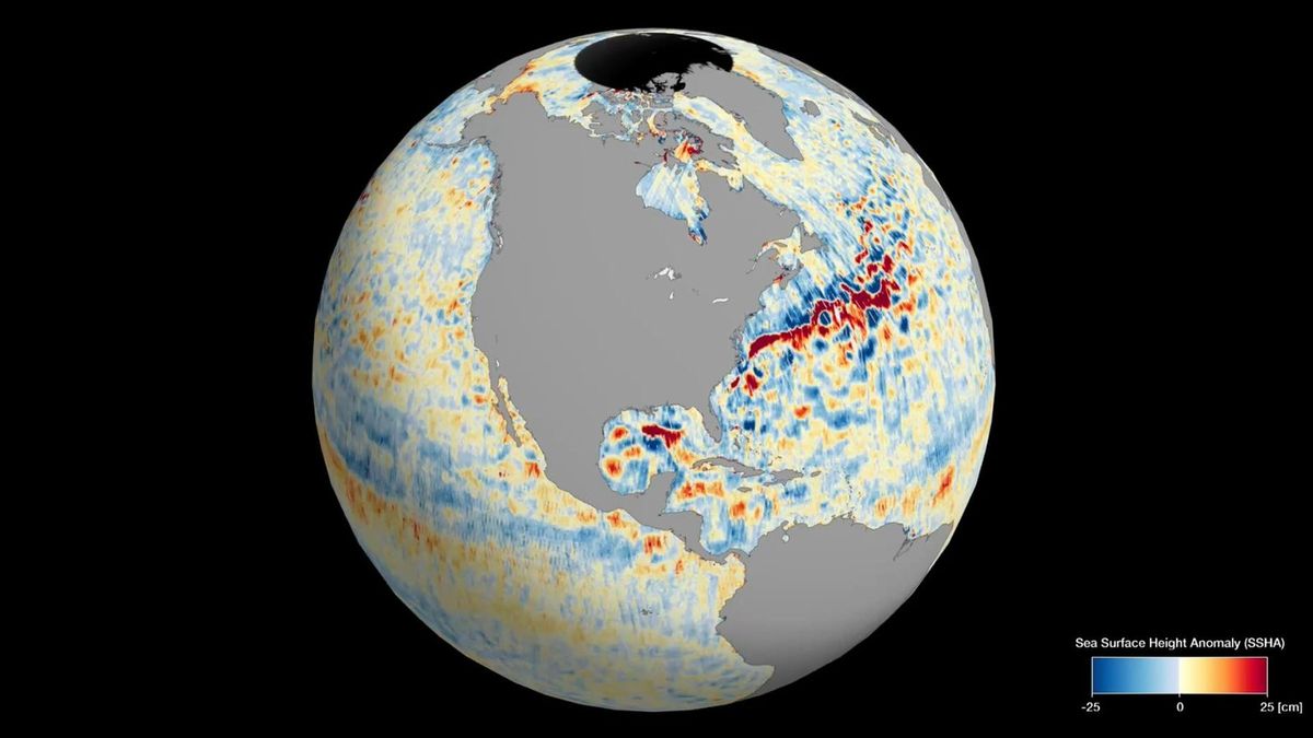
NASA's Surface Water and Ocean Topography (SWOT) satellite has provided stunning views of Earth's water, mapping the planet's global sea levels. The satellite collected data during its first full 21-day science orbit, revealing the varying surface heights of oceans, freshwater lakes, and rivers. Scientists are excited about the detailed information SWOT is providing, which will advance research on climate change and help communities prepare for a warming world. The satellite's Ka-band Radar Interferometer (KaRIn) instrument was used to create an animation showcasing sea surface height differences worldwide, highlighting ocean currents and regions of warmer water. SWOT's mission aims to measure water height over 90% of Earth's surface every 21 days, offering one of the most comprehensive views of Earth's water.
Reading Insights
0
7
2 min
vs 3 min read
76%
495 → 120 words
Want the full story? Read the original article
Read on Space.com