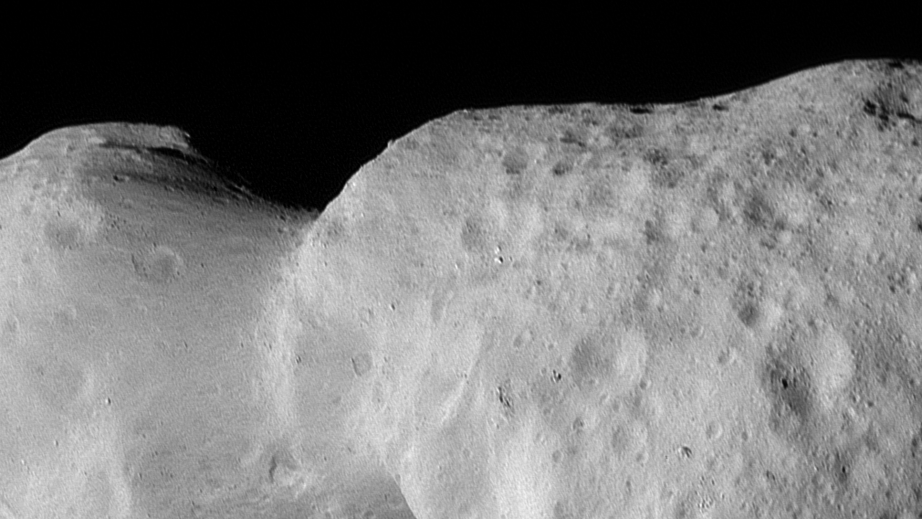
NASA's Lucy spacecraft flyby of asteroid Donaldjohanson led to the official naming of its geological features, with names inspired by human origins and significant paleoanthropological sites, highlighting the connection between space exploration and human history.
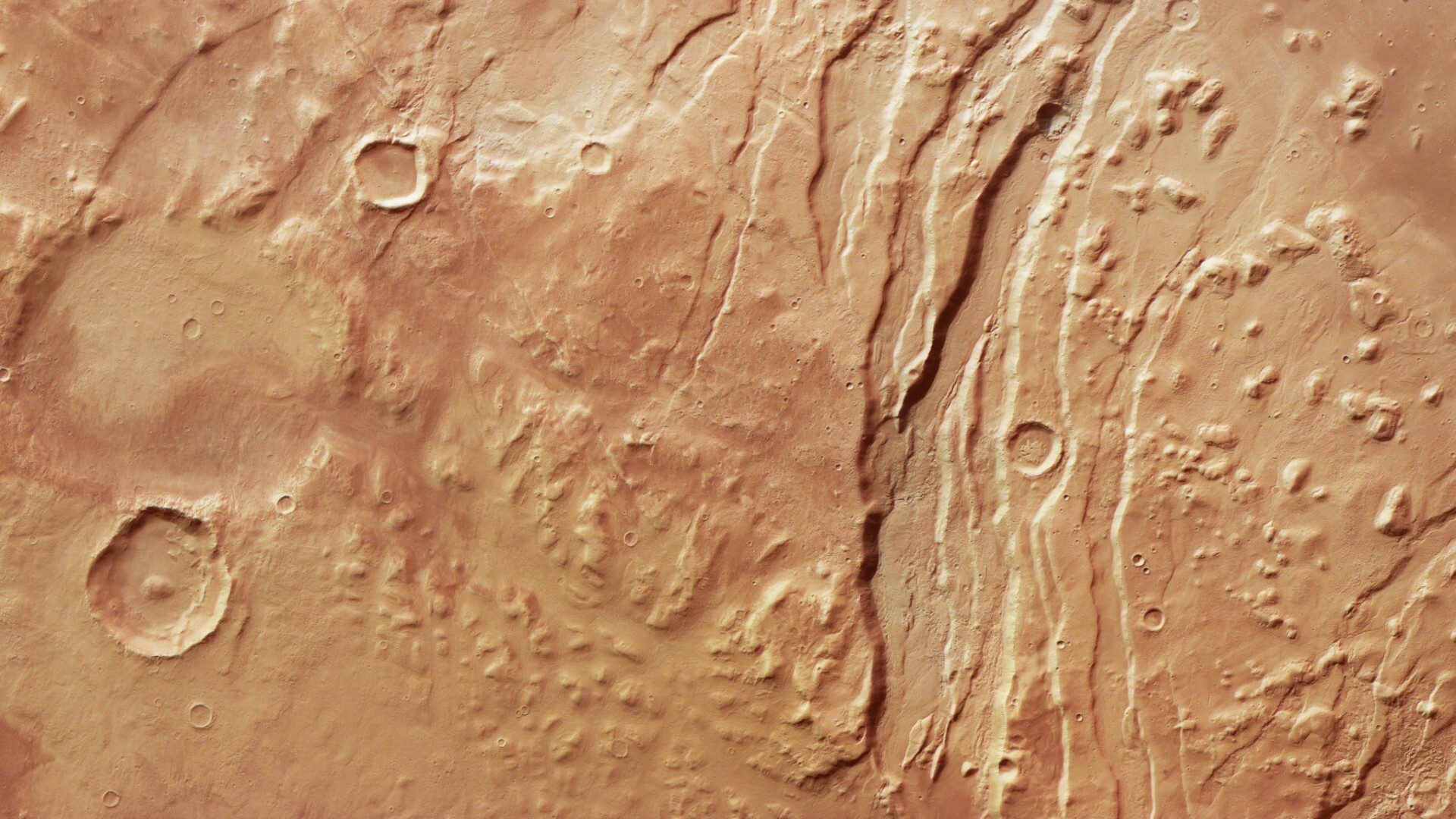
The European Space Agency's Mars Express orbiter has captured a detailed image of the Acheron Fossae region on Mars, revealing complex geological features such as fault-like channels, ridges, valleys, and the influence of ancient rock glaciers, providing insights into the planet's geological history and ongoing surface processes.
Researchers suggest that the Atlantic Ocean could eventually develop a "Ring of Fire" similar to the Pacific, due to an invasion of the Gibraltar subduction zone. This process could take up to 20 million years and would result in increased volcanic activity and earthquakes. While the Atlantic's thick oceanic lithosphere may provide some resistance, understanding and preparing for this potential future scenario is crucial for future generations.
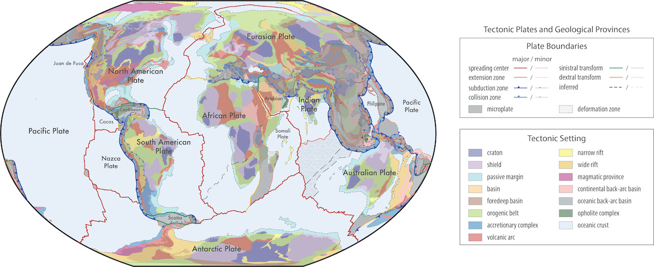
Researchers have developed comprehensive maps that provide unprecedented insight into the Earth's geological and tectonic architecture. By integrating various geological, geochemical, and geochronological data, the study presents global models of active plate boundaries and geological provinces, enhancing the accuracy of plate and province boundaries and capturing the complex interplay of geological processes. These models, available in an open-source format, are poised to become a standard for classifying geological data and will continually evolve with contributions from the scientific community, paving the way for more precise and comprehensive geological and tectonic models.
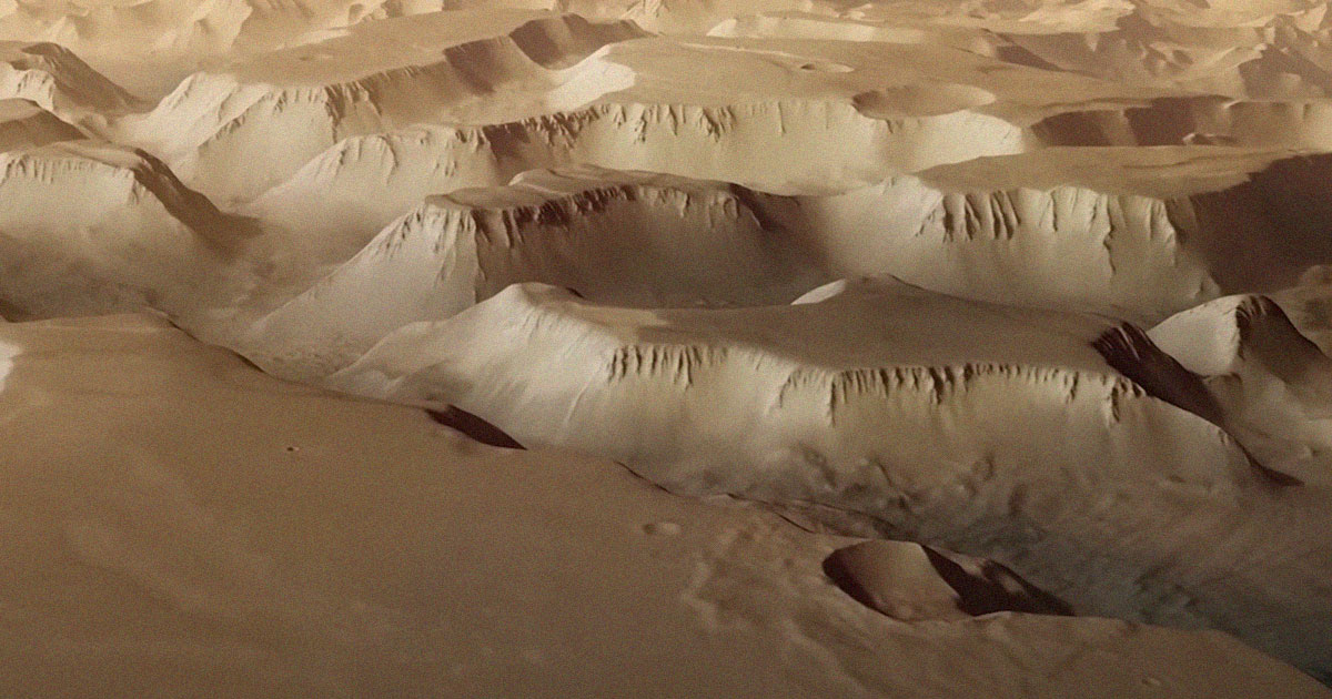
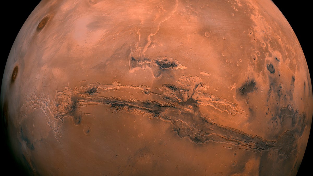
The European Space Agency has released a stunning video showcasing the vastness of Mars' Valles Marineris, the Red Planet's equivalent of Earth's Grand Canyon. The video provides breathtaking views of the canyon's Noctis Labyrinthus, a labyrinth of night spanning 740 miles. The footage was created using detailed stereo images taken by ESA's Mars Express orbiter and existing topographic data. The canyon's valleys measure up to 18.6 miles across and 3.7 miles deep, making it larger than the Grand Canyon. Scientists believe the canyon was formed by tectonic fractures and possibly influenced by water billions of years ago.
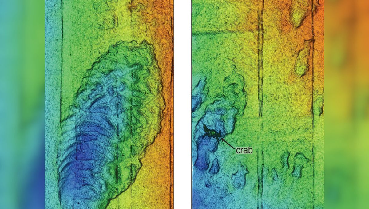
Scientists have successfully mapped the Monterey Canyon, an underwater gorge off the west coast of North America, with unprecedented detail using advanced sensor technology. The canyon, comparable in size and shape to the Grand Canyon, stretches for 153 kilometers (95 miles) and reaches depths of 4 kilometers (2.5 miles). The high-resolution data collected reveals not only the geological and geochemical features of the canyon but also the diverse marine life, including crabs, that inhabit its seafloor. This mapping effort provides valuable insights into the dynamic nature of the canyon and its potential vulnerability to global changes such as the climate crisis.
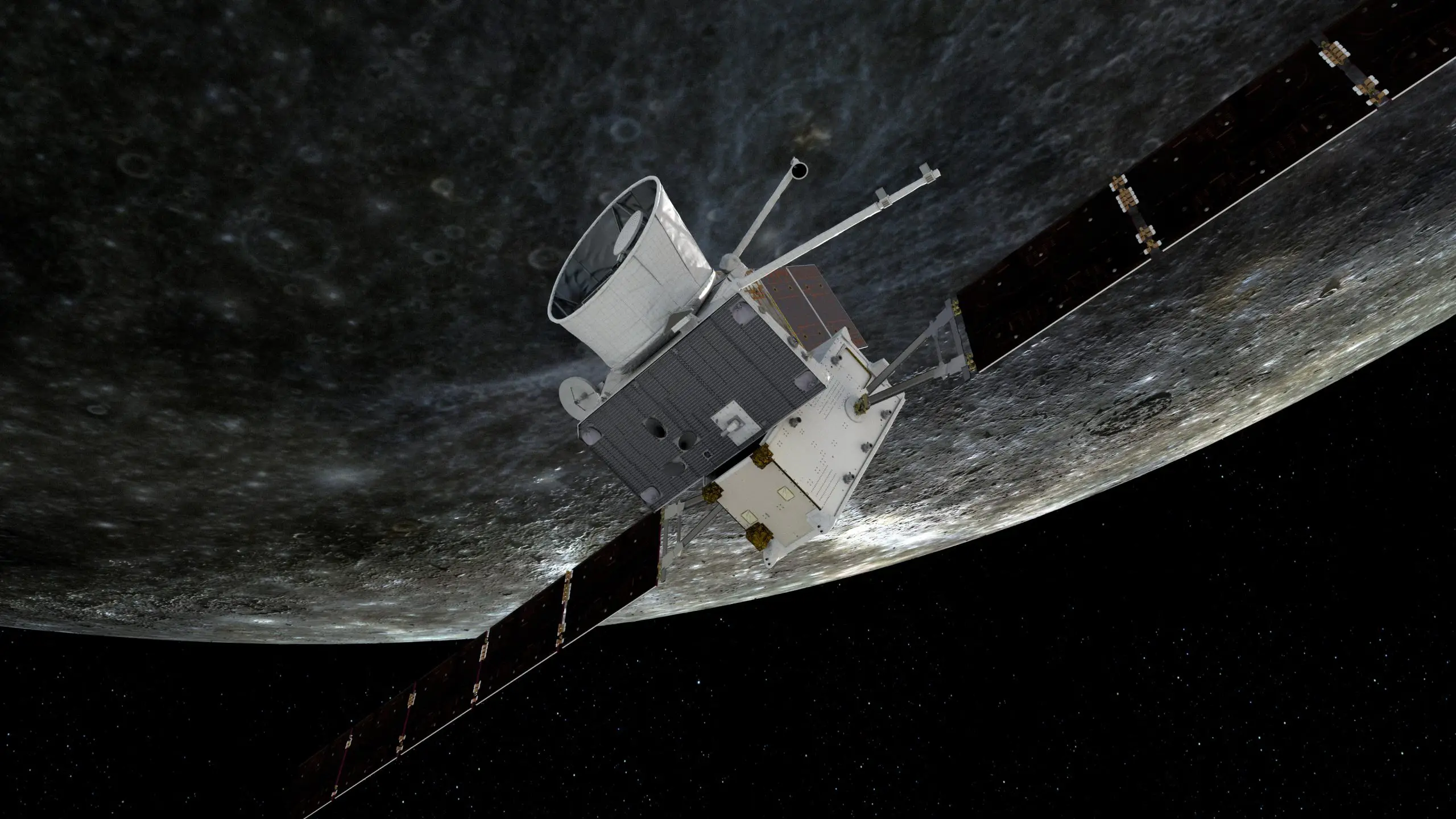
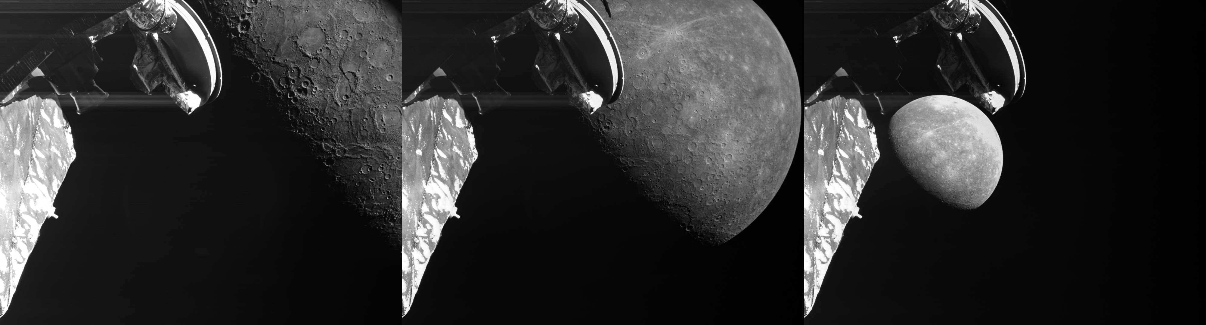
The BepiColombo mission has completed its third flyby of Mercury, capturing images of geological features including the newly named Manley Crater. The spacecraft is gradually adjusting its trajectory for entering Mercury’s orbit in 2025. The mission’s main science phase will begin in early 2026 following several more adjustments and another flyby in 2024. The flyby images show a bounty of geological features, including a newly named crater, and one of the most spectacular geological thrust systems on the planet.
The BepiColombo mission has completed its third flyby of Mercury, capturing images of a newly named impact crater, tectonic and volcanic features. The spacecraft is adjusting its trajectory for entering Mercury orbit in 2025. The next flyby is scheduled for September 2024. The mission will soon enter a challenging phase, gradually increasing the use of solar electric propulsion to brake against the enormous gravitational pull of the Sun. The spacecraft will complete over 15,000 hours of solar electric propulsion operations over its lifetime, guiding it towards Mercury orbit.
China's Zhurong rover has found evidence of possible water activity on Mars between 1.4 million to 400,000 years ago, according to a report by a Beijing-based team. The discovery of certain cracks and surface designs on small Martian sand dunes formed in Mars' Utopia Planitia in May 2021 suggests that the planet may have had water more recently than previously thought. The study revealed the existence of liquid water indirectly by showing that there are some geological features that can be produced specifically in the presence of liquid water, thus indicating its availability. The finding also suggests new fertile areas in the warmer regions where conditions might be suitable enough for life to exist on the planet.
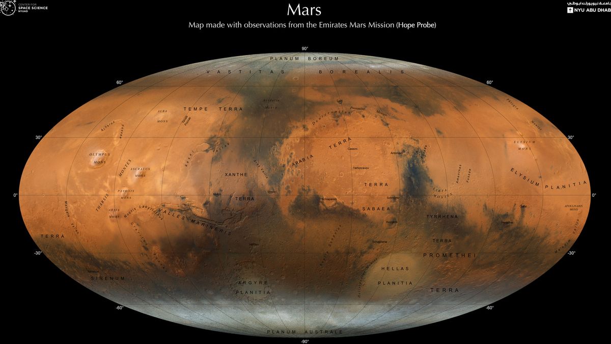
The United Arab Emirates (UAE) Center for Space Science and New York University Abu Dhabi (NYUAD) have created a high-resolution map of Mars using data collected by the Emirates Mars Mission (EMM), also known as Hope or Al-Amal. The map shows the Red Planet's geological features in stunning detail, including polar ice caps, mountains, and remnants of ancient rivers, lakes, and valleys that once overflowed with liquid water. The map could help scientists better understand how Mars became a dry and barren landscape despite once being abundant with liquid water. The map will be made available to the entire planet as part of the new and more advanced Atlas of Mars.