Tag

Geoscientific Data

All articles tagged with #geoscientific data

science-and-technology2 years ago

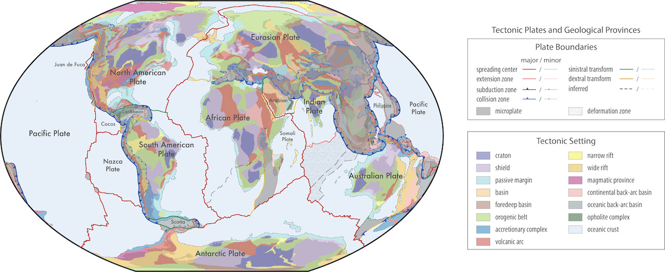
"Revolutionary Tectonic Model Unveils Earth's Breathtaking Beauty"

Researchers have developed comprehensive maps that provide unprecedented insight into the Earth's geological and tectonic architecture. By integrating various geological, geochemical, and geochronological data, the study presents global models of active plate boundaries and geological provinces, enhancing the accuracy of plate and province boundaries and capturing the complex interplay of geological processes. These models, available in an open-source format, are poised to become a standard for classifying geological data and will continually evolve with contributions from the scientific community, paving the way for more precise and comprehensive geological and tectonic models.

science-and-technology2 years ago

"Digitizing Outcrops: Unveiling Arctic Landscape Changes Amid Climate Acceleration"

The Svalbox Digital Model Database (DMDb) has been introduced as a valuable resource for geoscientists working in the remote Svalbard archipelago in the Arctic. The database contains 135 digital outcrop models (DOMs) that provide georeferenced three-dimensional representations of geologic outcrops, allowing researchers to virtually explore and study the region's unique geological features. The Svalbox DMDb follows FAIR principles, making the data findable, accessible, interoperable, and reusable. It offers a valuable teaching aid and extends the field season by providing access to sites that are not easily reachable through traditional fieldwork.