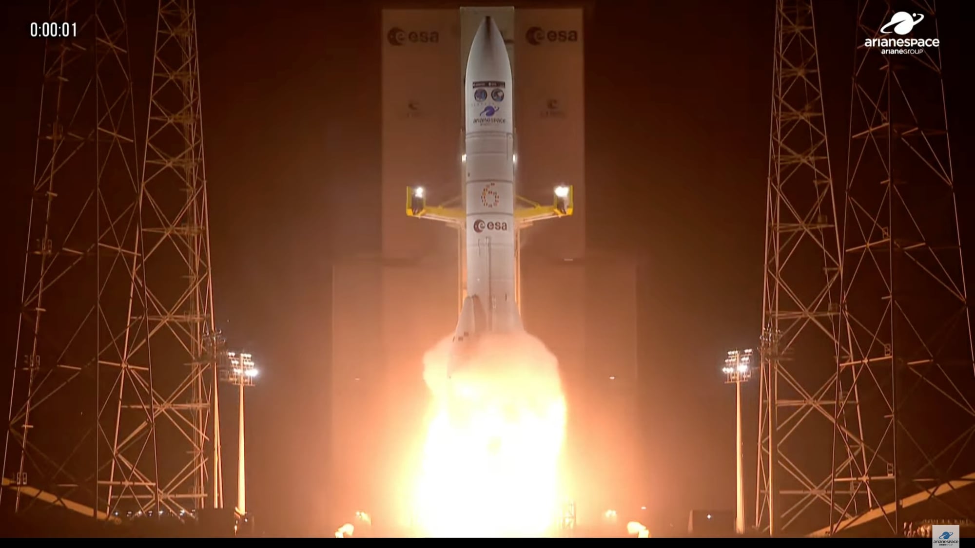
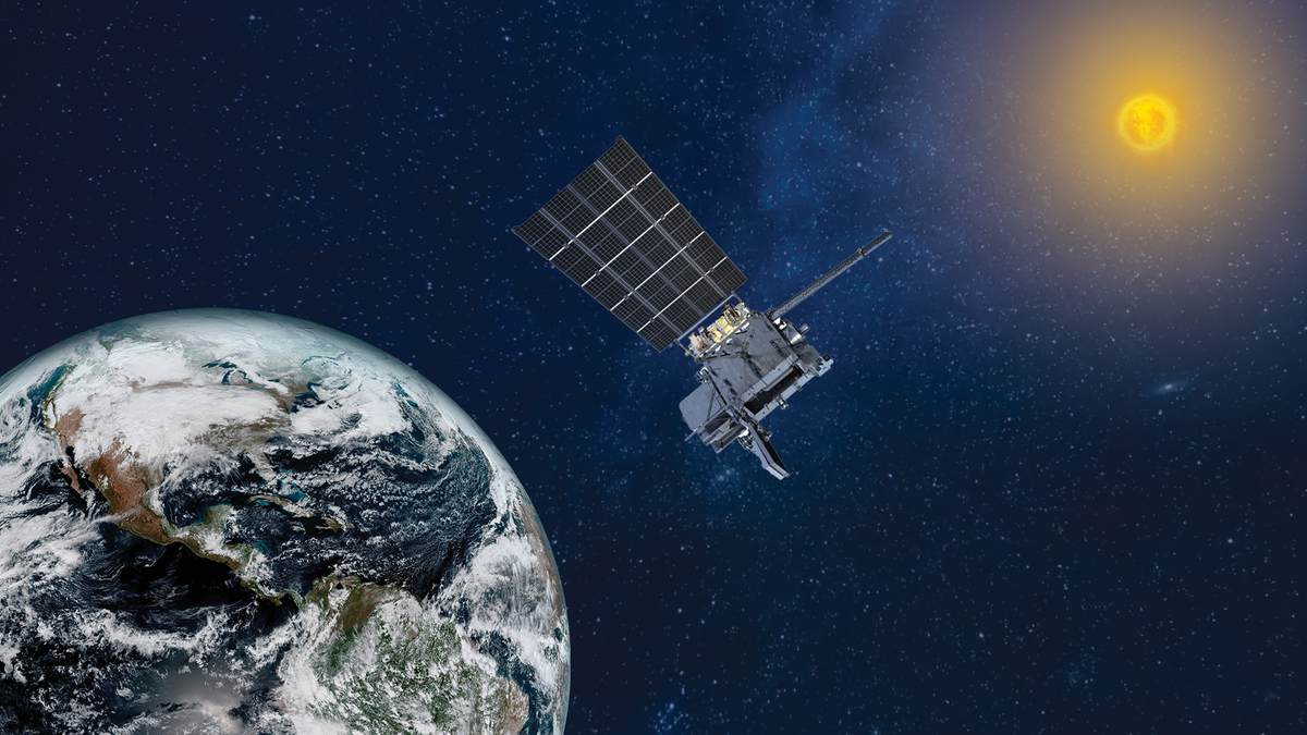
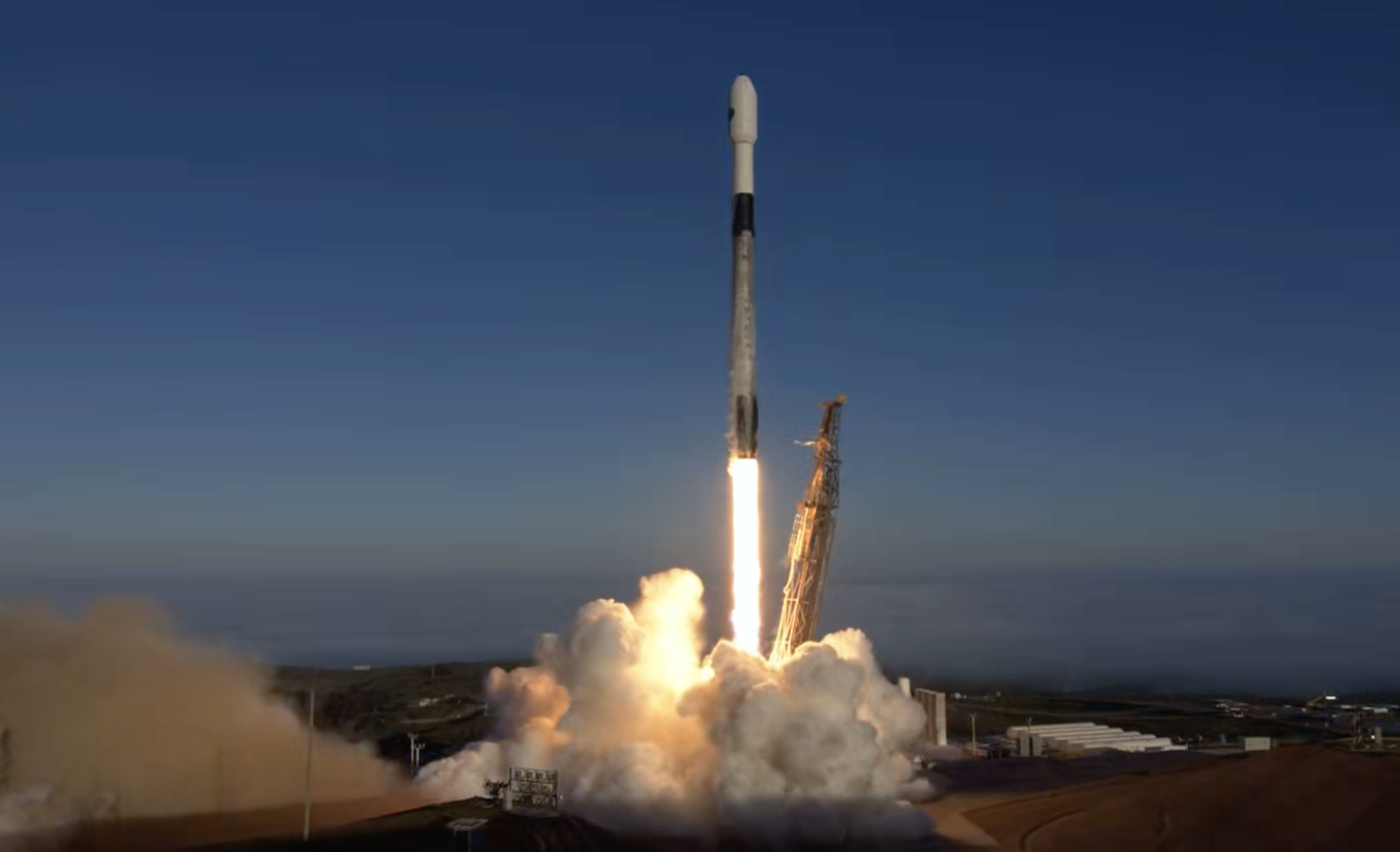
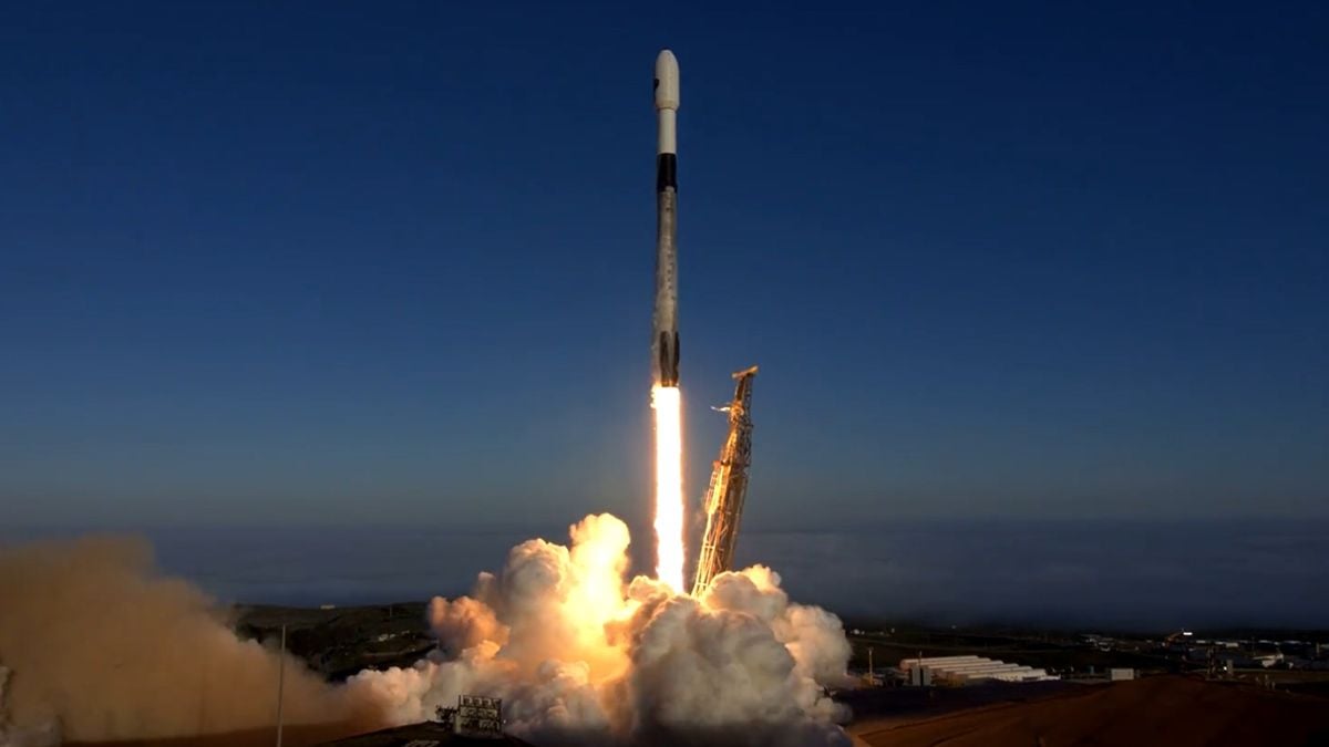
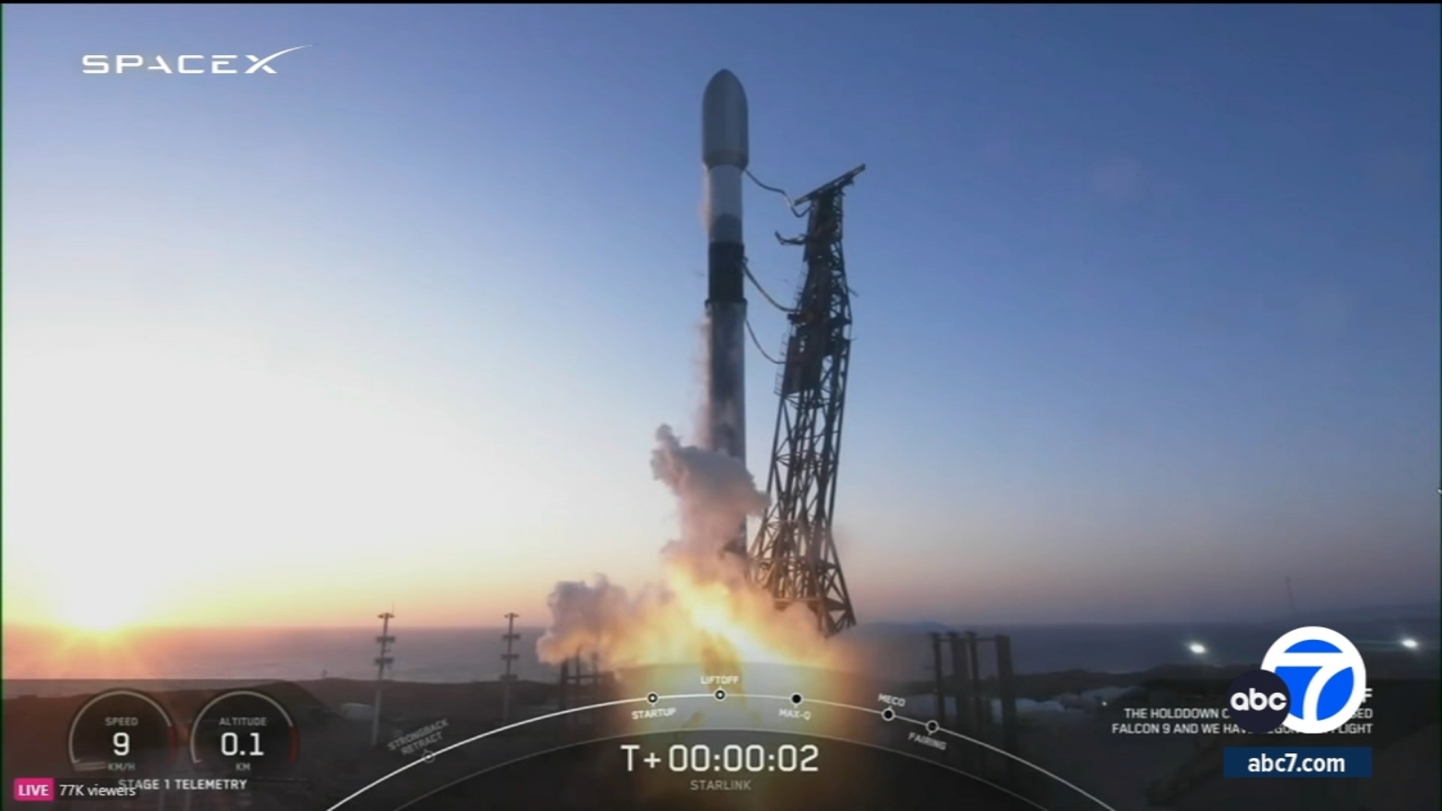
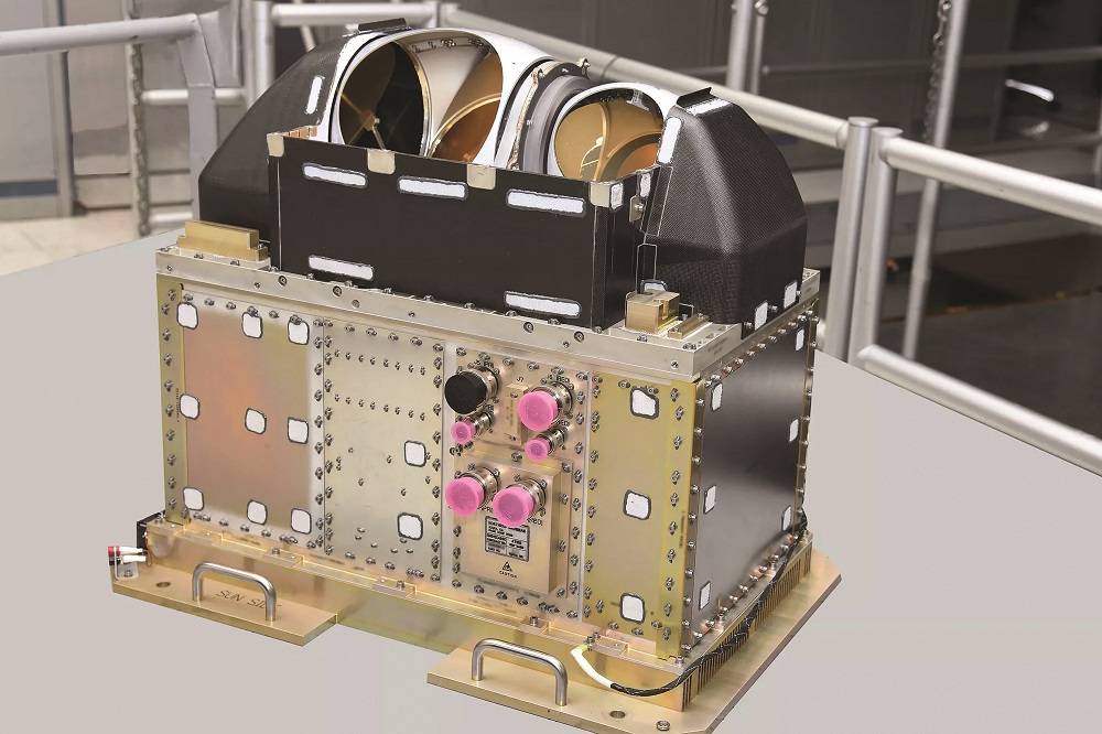
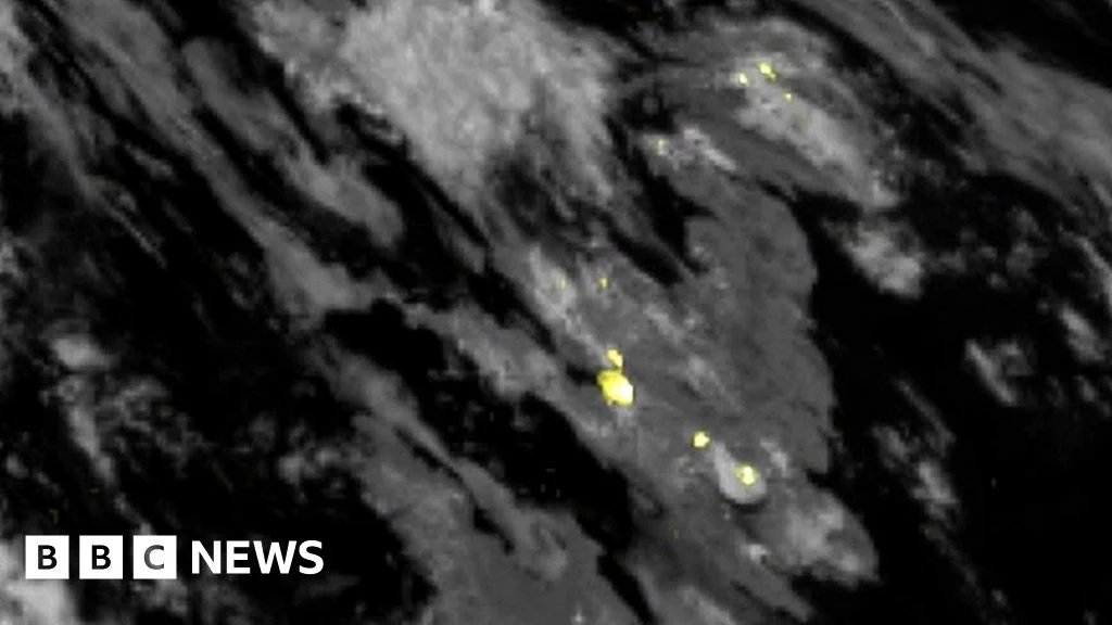
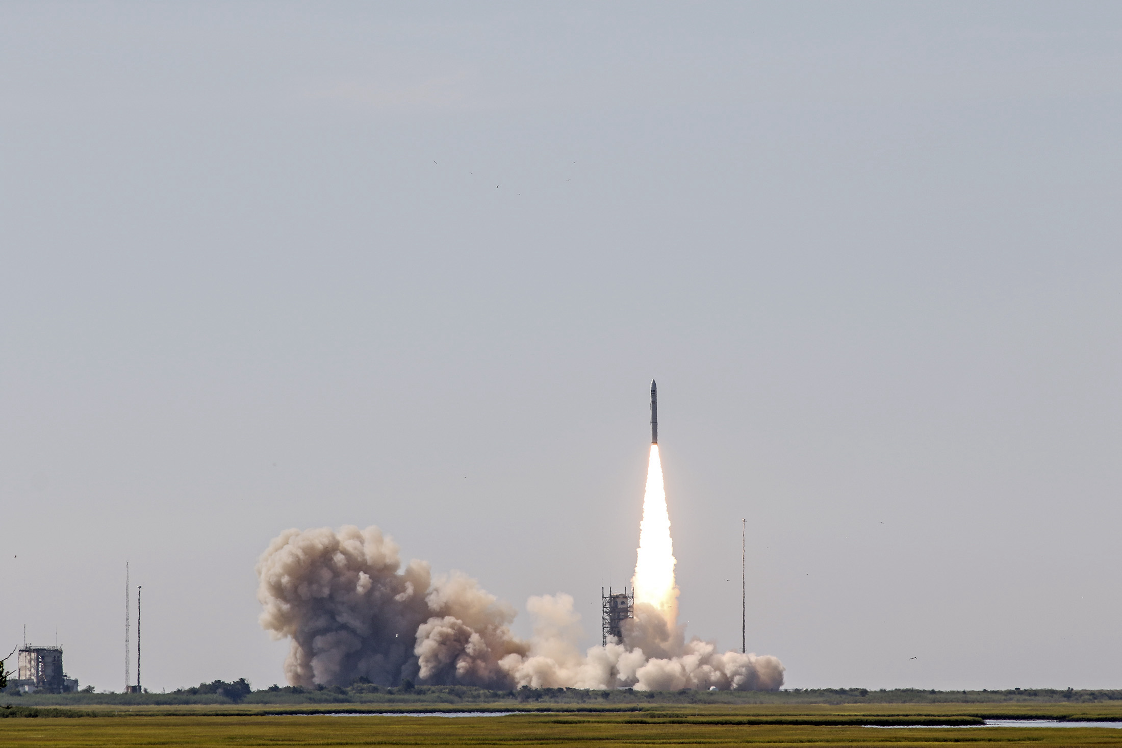
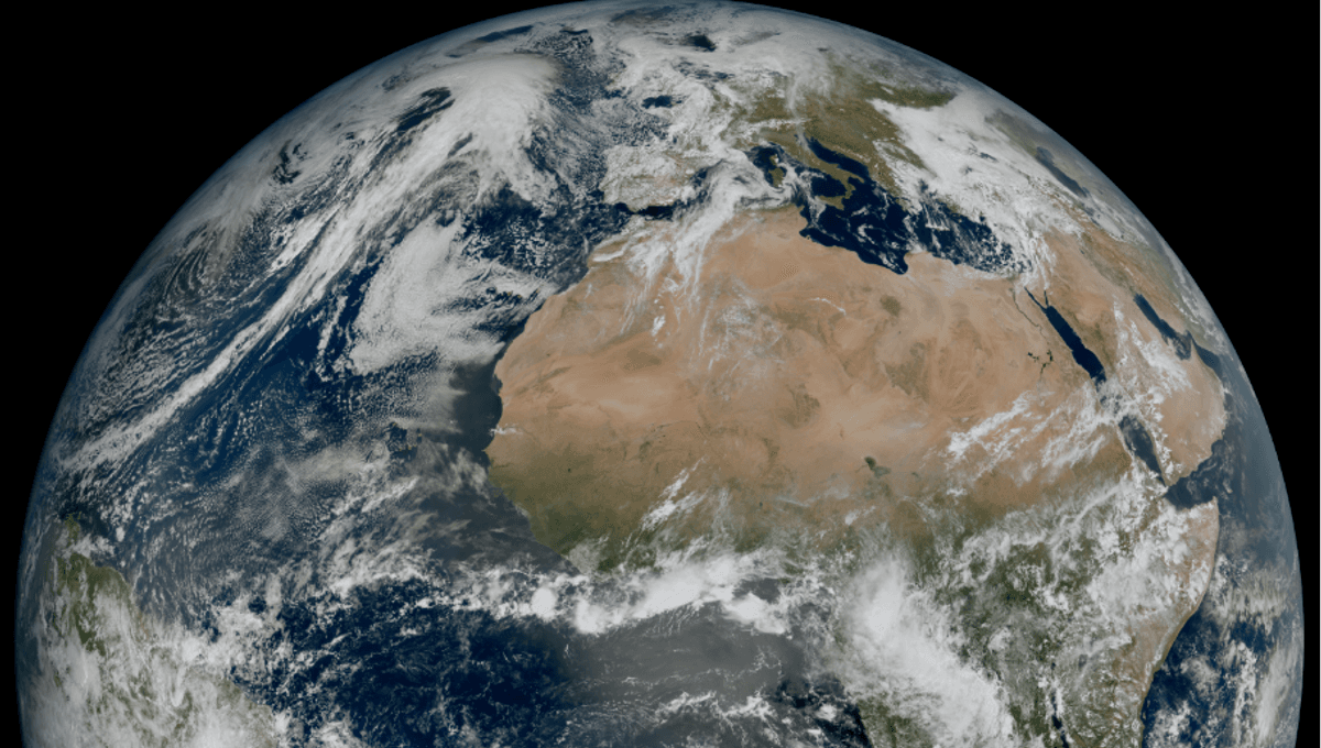
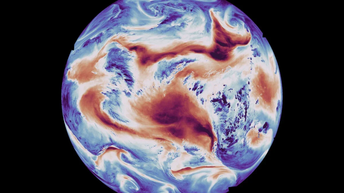
Europe's Ariane 6 rocket successfully launched for the third time, deploying the Metop-SGA1 weather satellite into polar orbit to enhance global weather and climate observation capabilities, marking a significant milestone in European space efforts.
SpaceX has secured an $81.6 million contract to launch the USSF-178 weather-monitoring satellite in 2027, marking its third consecutive win under the US Space Force's National Security Space Launch program, and will include the final WSF-M2 satellite and secondary payloads for advanced weather and space weather monitoring.
NOAA's GOES-U weather satellite is set to launch on June 25 aboard a SpaceX Falcon Heavy rocket from NASA's Kennedy Space Center. This fourth satellite in the GOES-R series will feature advanced instruments for improved weather forecasting and space weather monitoring, including a new compact coronagraph for better solar observations. The satellite will undergo final preparations and testing before its launch, and once operational, it will enhance weather monitoring capabilities across the Western Hemisphere.
SpaceX successfully launched the USSF-62 mission, carrying the U.S. Space Force's first Weather System Follow-on Microwave (WSF-M) satellite, from Vandenberg Space Force Base, California. The satellite, built by Ball Aerospace, will collect weather data crucial for military planning and operations globally. This launch marks SpaceX's 37th mission in 2024 and the second national security space launch of the year, demonstrating the company's continued involvement in military space programs.
SpaceX successfully launched the USSF-62 mission for the US Space Force, deploying the Weather System Follow-on — Microwave (WSF-M) satellite to low Earth orbit. WSF-M, developed by BAE Systems, will provide critical weather intelligence to military operations. The Falcon 9's first stage safely returned to Earth, marking its third launch and landing, while the rocket's payload fairing also made history as a spaceflight veteran. This is SpaceX's 37th launch of 2024 and its second for the Space Force this year.
SpaceX successfully launched a Falcon 9 rocket from Vandenberg Space Force Base in Santa Barbara County, deploying a weather satellite that will aid military mission planning. The reusable rocket returned to Vandenberg about eight minutes after launch, providing a spectacular sight for Southern California skywatchers.
SpaceX is scheduled to launch a rocket from Vandenberg Space Force Base in Santa Barbara County on Thursday morning to deliver a weather satellite into low orbit, with a 10-minute launch window opening at 7:25 a.m. A livestream of the launch will be available 15 minutes before liftoff, and a backup launch is planned for the same time on Friday if today's launch is scrubbed.
SpaceX is set to launch a weather satellite from Vandenberg Space Force Base, potentially creating a visible and audible spectacle for early risers in parts of California. The launch, scheduled for 7:25 a.m., may be accompanied by a sonic boom as the rocket's booster separates and descends back to the base. The Falcon 9 rocket, known for its reusability, is expected to livestream the event, with the satellite designed to monitor weather and environmental conditions.
The Southwest Research Institute (SwRI) has been awarded a $55 million contract to develop and supply the QuickSounder weather satellite for the National Oceanic and Atmospheric Administration (NOAA). The contract includes spacecraft development, integration with NOAA's Advanced Technology Microwave Sounder, transportation, launch, three years of operations, and satellite decommissioning. QuickSounder is part of NOAA's Near Earth Orbit Network (NEON) and will provide mission-critical data to support NOAA's National Weather Service and the nation's weather industry. The contract was awarded under NASA's Rapid Spacecraft Acquisition IV contract.
The first videos from the new Meteosat-12 weather satellite operated by EUMETSAT show stunning footage of lightning over Europe, Africa, and the Atlantic Ocean. This satellite, part of the Meteosat Third Generation family, provides valuable information to European weather forecasters, allowing them to better monitor and predict severe storms. As climate change intensifies, the ability to forecast extreme weather events becomes crucial in protecting vulnerable populations. The Lightning Imager instrument on the satellite consists of four cameras that can detect lightning activity across a wide area, providing valuable data for weather forecasting and air transport safety. This is the first of six new weather satellites that will help Europe defend against climate change-induced weather disasters.
The European weather agency Eumetsat has released stunning movies of lightning spreading across the Earth, captured by a new instrument placed 36,000km above equatorial Africa. The imager, part of the recently launched Meteosat-12 platform, will provide forecasters with valuable data to track the emergence of violent storms. The lightning detector on Meteosat-12 has four telescopic cameras focused on Europe, Africa, the Middle East, and parts of South America, continuously monitoring cloud-to-ground, cloud-to-cloud, and intra-cloud lightning flashes. The data collected will enhance nowcasting capabilities and improve statistics on lightning frequency over time, benefiting climate researchers, atmospheric chemists, and aiding in the prediction of forest fires caused by lightning strikes.
Northrop Grumman has won a $45.5 million contract from the US Space Force to launch a small weather satellite in 2025. The satellite, called the Electro-Optical Infrared (EO/IR) Weather System (EWS) prototype, will demonstrate commercial weather imaging technologies for military use. The EWS weather satellite is a prototype made by General Atomics that will go to low Earth orbit for a three-year demonstration. The mission was designated USSF-261S-A.
The first images of Earth from the new weather satellite, Meteosat Third Generation Imager-1 (MTG-I1), have been released, revealing details about the weather over Europe and Africa at a level not possible before. The satellite produces images with a much higher resolution and more frequently than those of the previous generation, allowing for more accurate monitoring and weather forecasting. The level of detail means forecasters will be able to detect and predict severe weather conditions faster and more accurately.
Europe's new weather satellite, the Meteosat Third Generation Imager (MTG-I1), has captured its first images of Earth, showcasing remarkable detail in the clouds and other global conditions. The satellite, which launched in December 2022, is changing the perspective at which we can study European weather, according to the European Space Agency's Director of Earth Observation Programmes. The images captured by MTG-I1 will provide a deeper insight into our planet and the various conditions that affect it, helping to monitor the evolution of severe weather in high latitudes.
Europe's new weather satellite, Meteosat Third Generation — Imager 1 (MTG-I1), has captured an image of the Earth that reveals our planet's incredible beauty and demonstrates that the satellite is set to revolutionize weather forecasting, including the prediction of severe weather. The image shows conditions over Europe, Africa, and the Atlantic to an incredible level of detail, and the full system is set to be operational by 2016 and will consist of six satellites supplying critical data for the early detection of extreme weather events for the next two decades.