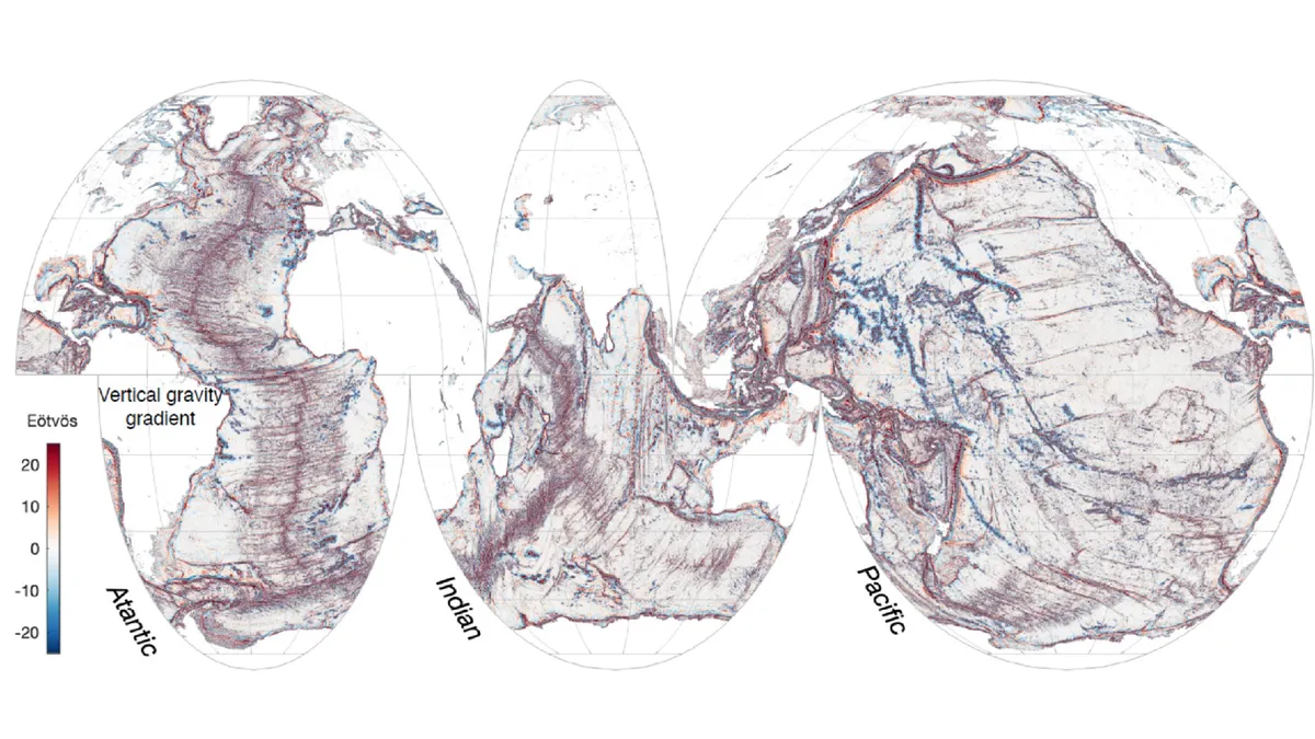
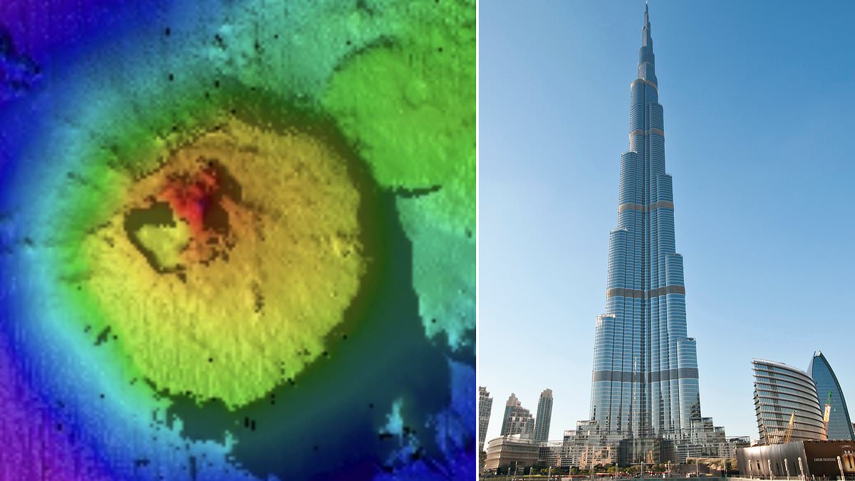
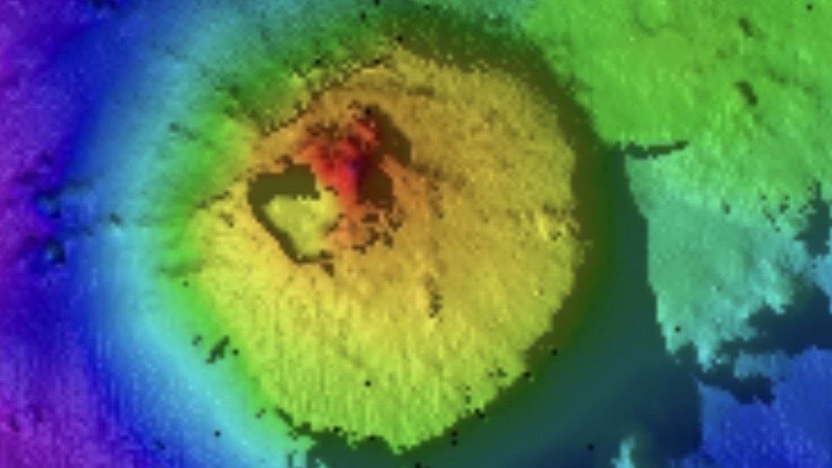
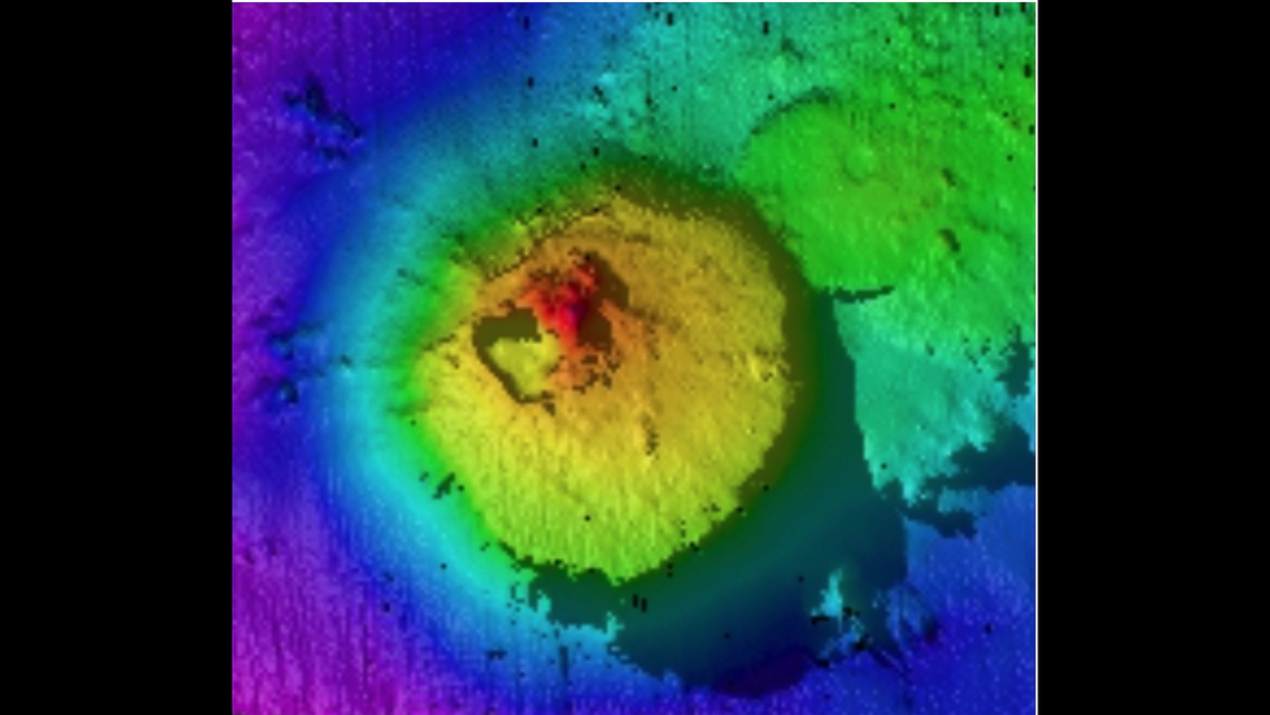
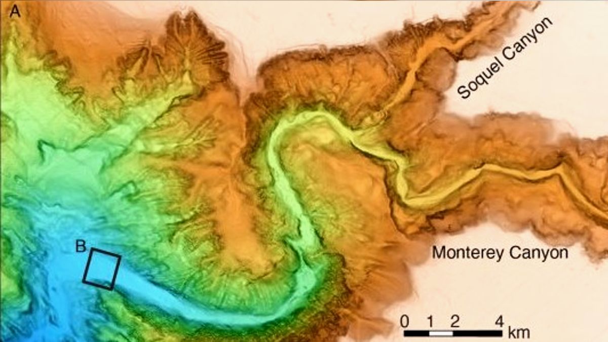
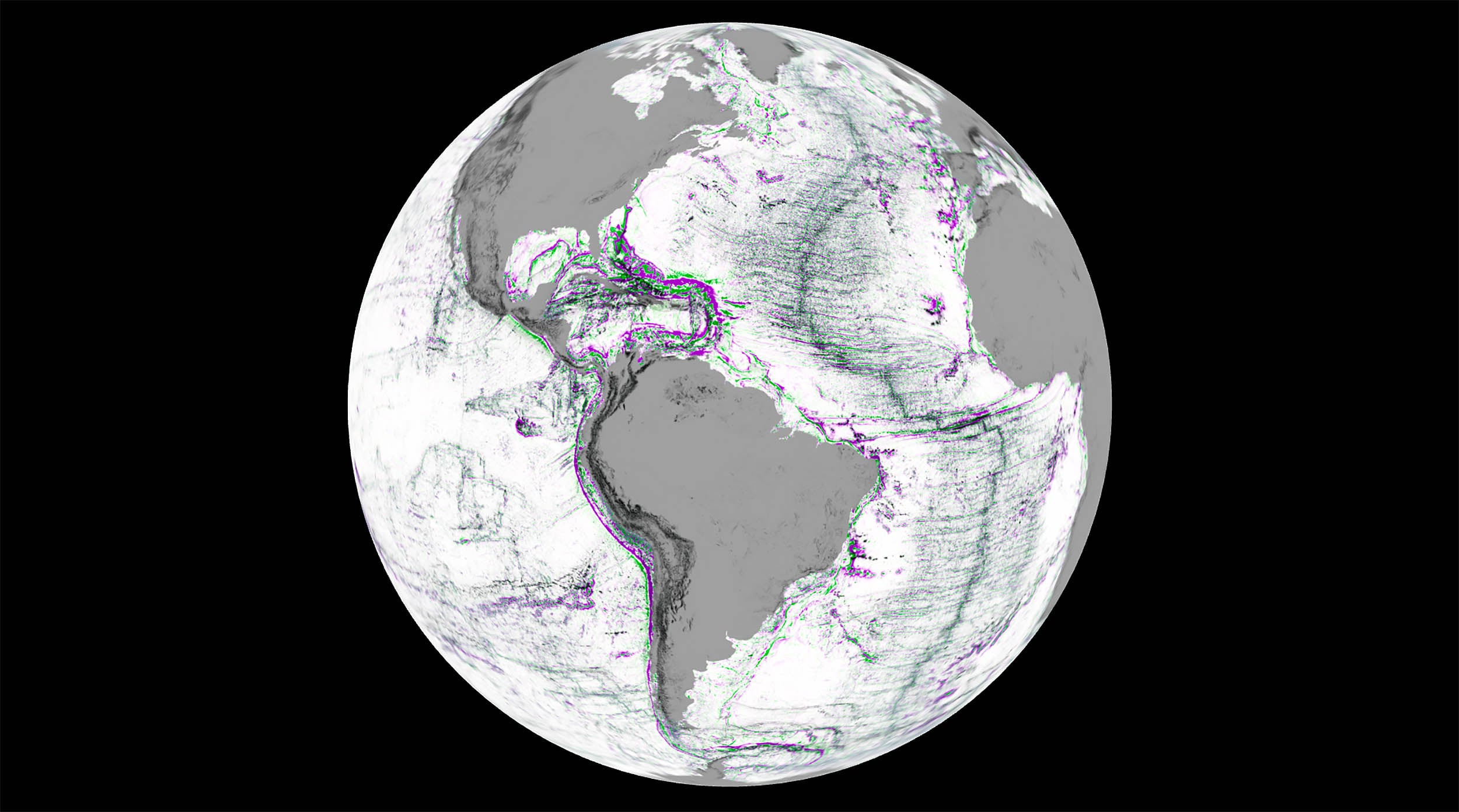
Tag

Seafloor Mapping

All articles tagged with #seafloor mapping

science1 year ago

NASA's Satellite Breakthroughs Illuminate Earth's Seafloor

NASA's SWOT program has produced the most detailed map of the ocean floor to date, revealing hundreds of previously hidden underwater volcanoes and tectonic structures. This new satellite imagery allows researchers to study ocean circulation and tectonic activity with unprecedented precision, offering insights into ocean currents, nutrient transport, and Earth's geologic history. The data covers areas not yet mapped by ship-mounted instruments, marking a significant advancement in oceanographic research.

earth-science1 year ago

Pacific Ocean Tectonic Plate Ripping Apart, Scientists Discover

A new study suggests that large oceanic plateaus in the western Pacific Ocean are not rigid slabs but weak spots being torn apart by distant forces at the plate's edge, challenging previous understanding of tectonic plate dynamics. The research indicates that these plateaus are being stretched and thinned by pull forces at the Pacific plate's edge, even though they are located hundreds to thousands of kilometers from the nearest plate boundary. The findings highlight the need for further exploration and data collection to better understand the complexities of the seafloor and tectonic plate behavior.

science-and-environment2 years ago

"Massive Underwater Mountain Surpasses Burj Khalifa in Height"

Scientists mapping the seafloor off the coast of Guatemala have discovered an enormous underwater mountain, twice the height of the Burj Khalifa, the world's tallest building. The seamount, found using advanced technology on the Falkor research vessel, sits 7,874ft below sea level and covers 5.4 square miles. Seamounts are known to be biodiversity hotspots, and this discovery highlights the vast unknowns of our oceans. The Schmidt Ocean Institute, part of the Seabed 2030 initiative, aims to map the entire seafloor by the end of the decade to aid navigation and marine resource management.

science-and-environment2 years ago

Giant Seamount Unveiled: Towering Beneath the Ocean's Depths

Ocean explorers mapping the seabed off the coast of Guatemala have discovered a seamount twice the height of the Burj Khalifa, the world's tallest building. The cone-shaped seamount, located 7,870 feet below sea level, covers 5.4 square miles and provides crucial rocky habitats for deep-sea corals and invertebrates. The discovery highlights the vast amount of unexplored seamounts in the ocean, with satellite data suggesting there are over 100,000 yet to be discovered. The finding is part of ongoing efforts to map the seafloor and understand the mysteries of the ocean.

science-and-environment2 years ago

"Seafloor Mapping Team Discovers Massive Find in Pacific Ocean"

A seafloor mapping project in the Pacific Ocean has discovered a massive seamount, twice as high as the Burj Khalifa, the world's tallest building. The 5,249-foot-high seamount covers 5.4 square miles and is located 1.5 miles below sea level in international waters. Seamounts are underwater mountains that serve as "oases of life," hosting deep sea corals, sponges, and various invertebrates. This discovery highlights the vast unexplored areas of the ocean and the potential for further scientific exploration.

science-and-environment2 years ago

Unveiling the Breathtaking Deep-Sea 'Grand Canyon' off the US Coast

Researchers have created the clearest-ever maps of the Monterey Canyon, a massive deep-sea ravine off the coast of California. The maps, with centimeter-scale resolution, reveal the constantly changing topography of the underwater valley. The surveys conducted between 2015 and 2017 captured the canyon's seafloor in remarkable detail, providing valuable insights into the processes that shape it. The data showed that fast-moving turbidity currents and tides play a role in sculpting the seafloor, with their effects varying across the canyon. The high-resolution maps could also aid in studying deep-sea ecosystems and threatened species.

science-and-environment2 years ago

Unveiling the Breathtaking Deep-Sea 'Grand Canyon' off the US Coast

Researchers have created the clearest-ever maps of the Monterey Canyon, a massive deep-sea ravine off the coast of California. The maps, with centimeter-scale resolution, reveal the constantly changing topography of the underwater valley, which is comparable to the Grand Canyon. The surveys conducted between 2015 and 2017 captured the canyon's seafloor in remarkable detail, providing valuable insights into the processes that shape it. The data showed the effects of fast-moving turbidity currents and the role of tides in sculpting the seafloor. The researchers believe their new equipment could also be used to study deep-sea ecosystems.