Unveiling the Breathtaking Deep-Sea 'Grand Canyon' off the US Coast
TL;DR Summary
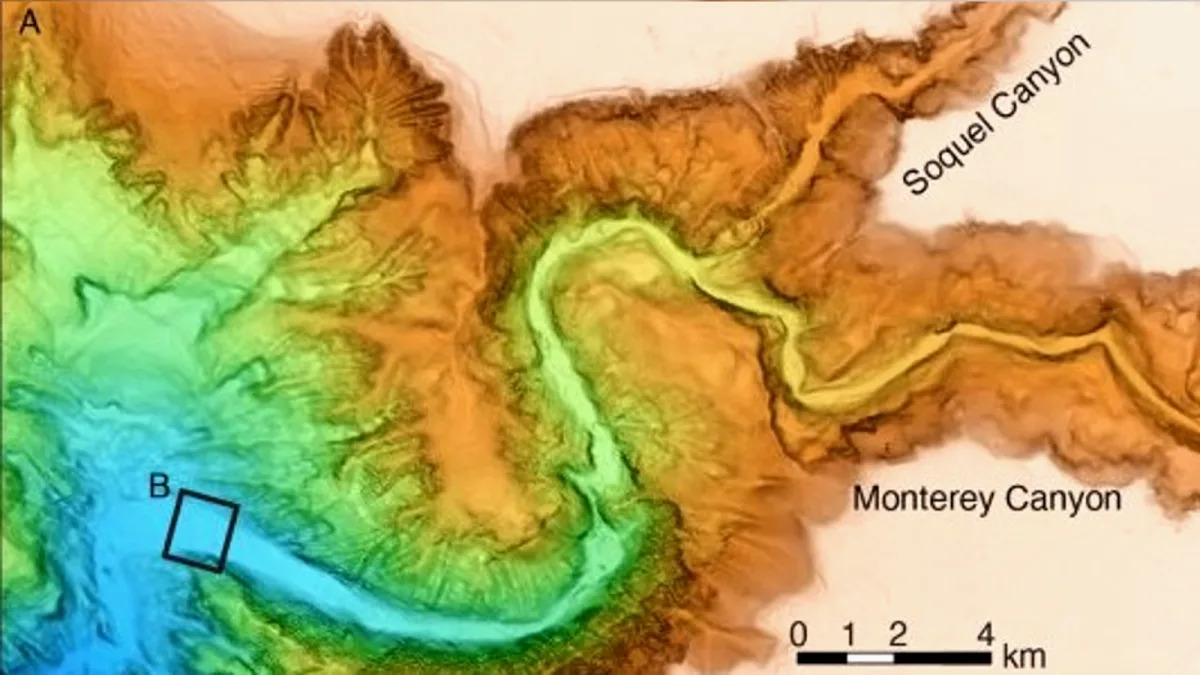
Researchers have created the clearest-ever maps of the Monterey Canyon, a massive deep-sea ravine off the coast of California. The maps, with centimeter-scale resolution, reveal the constantly changing topography of the underwater valley, which is comparable to the Grand Canyon. The surveys conducted between 2015 and 2017 captured the canyon's seafloor in remarkable detail, providing valuable insights into the processes that shape it. The data showed the effects of fast-moving turbidity currents and the role of tides in sculpting the seafloor. The researchers believe their new equipment could also be used to study deep-sea ecosystems.
Topics:science#deep-sea-grand-canyon#monterey-canyon#science-and-environment#seafloor-mapping#turbidity-currents#underwater-topography
Reading Insights
Total Reads
0
Unique Readers
7
Time Saved
3 min
vs 4 min read
Condensed
86%
658 → 95 words
Want the full story? Read the original article
Read on Yahoo Life