NASA's Satellite Breakthroughs Illuminate Earth's Seafloor
TL;DR Summary
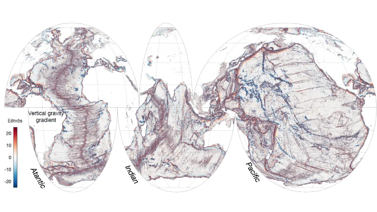
NASA's SWOT program has produced the most detailed map of the ocean floor to date, revealing hundreds of previously hidden underwater volcanoes and tectonic structures. This new satellite imagery allows researchers to study ocean circulation and tectonic activity with unprecedented precision, offering insights into ocean currents, nutrient transport, and Earth's geologic history. The data covers areas not yet mapped by ship-mounted instruments, marking a significant advancement in oceanographic research.
- Nasa unveils hidden volcanoes in 'unprecedented' view of seafloor Oceanographic Magazine
- Transforming coastal mapping from space Science
- Satellites reveal stunningly detailed maps of Earth's seafloors Livescience.com
- Mapping the Ocean Floor from the Mountains Site Selection Magazine
- NASA-Led SWOT Mission Provides Sharper Global Seafloor Focus Aviation Week
Reading Insights
Total Reads
0
Unique Readers
5
Time Saved
4 min
vs 5 min read
Condensed
91%
806 → 69 words
Want the full story? Read the original article
Read on Oceanographic Magazine