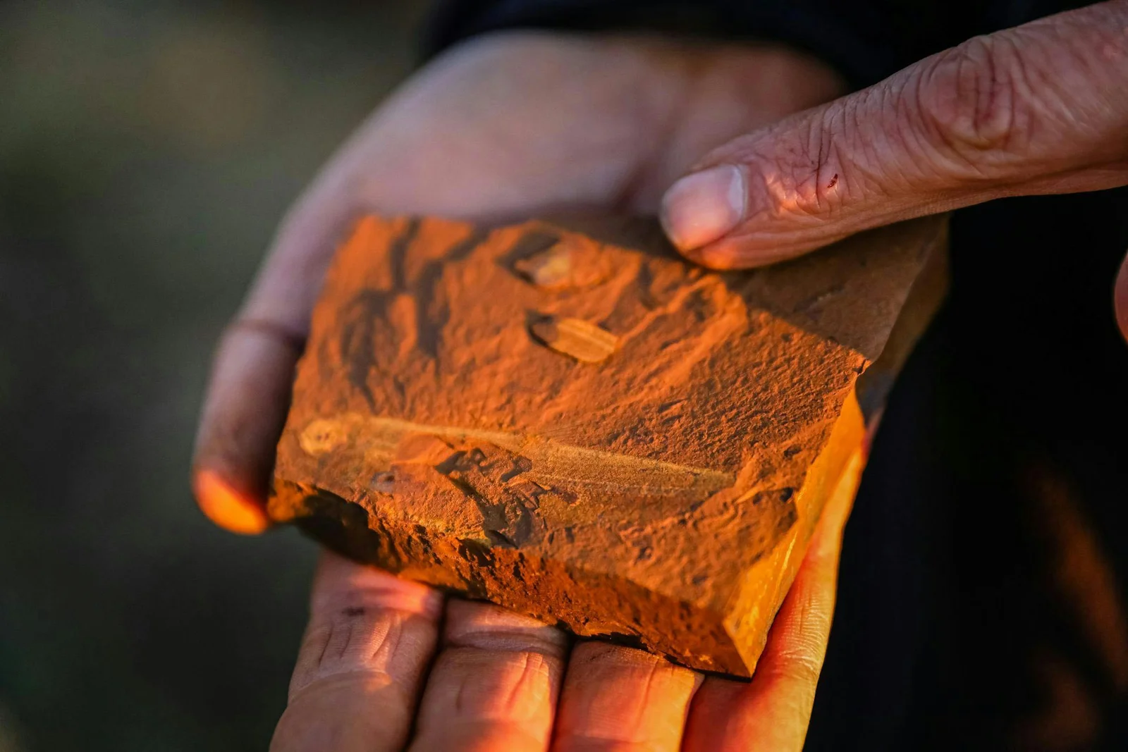
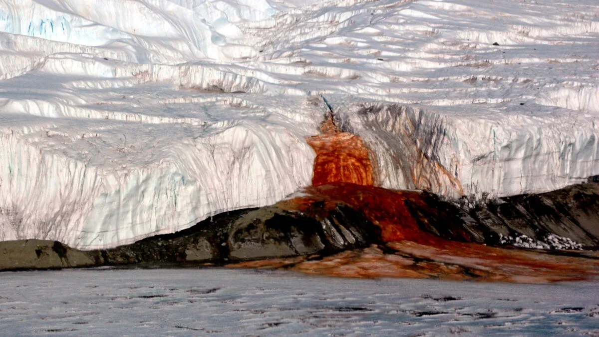
Tag

Earth Science

All articles tagged with #earth science

NASA Shifts Focus from Climate Science to Moon and Mars Exploration

Originally Published 4 months ago — by Space

Featured image for NASA Shifts Focus from Climate Science to Moon and Mars Exploration
Source: Space

Acting NASA Administrator Sean Duffy announced that NASA will shift its focus from climate science to space exploration, aligning with proposed budget cuts that threaten many Earth science missions, raising concerns about the future of climate monitoring and research. Despite these changes, NASA emphasizes its primary role in space exploration, with other agencies potentially taking the lead on climate science, while congressional decisions will ultimately determine the fate of current and planned missions.

Janet Petro Inspires with 'Embrace The Challenge' Holiday Edition

Originally Published 6 months ago — by NASA Watch

Featured image for Janet Petro Inspires with 'Embrace The Challenge' Holiday Edition
Source: NASA Watch

NASA celebrates Independence Day with reflections on exploration, announces new spaceflight assignments, partnerships with Netflix, and ongoing research and outreach efforts, including supporting disaster response and celebrating Marshall Space Flight Center's 65th anniversary, emphasizing embracing challenges and public service.

Controversy Over NASA Budget Cuts Threatens Future Science Missions

Originally Published 7 months ago — by Los Angeles Times

Featured image for Controversy Over NASA Budget Cuts Threatens Future Science Missions
Source: Los Angeles Times

The article discusses the potential long-term damage to NASA and space science caused by proposed budget cuts under the Trump administration, which threaten ongoing projects, future missions, and the agency's leadership, risking a setback in American space exploration and scientific research.

NASA's New Infrared Cameras Revolutionize Science

Originally Published 1 year ago — by NASA

Featured image for NASA's New Infrared Cameras Revolutionize Science
Source: NASA

NASA has developed compact, high-resolution infrared cameras with advanced filters that can enhance wildfire warnings, study Earth's atmosphere, and analyze the molecular composition of other planets. These cameras, using strained-layer superlattice sensors, are lightweight and adaptable, making them suitable for various scientific missions. The technology has already proven successful in space and is being further developed for applications like pollution monitoring and fire observations.

"NASA's Innovative Earth Day Climate Research Initiatives"

Originally Published 1 year ago — by Science@NASA

Featured image for "NASA's Innovative Earth Day Climate Research Initiatives"
Source: Science@NASA

NASA has chosen six new airborne missions to study various aspects of Earth and climate change, including fire-induced clouds, Arctic coastal change, air quality, landslide hazards, shrinking glaciers, and emissions from agricultural lands. These missions, funded through NASA's Earth Venture program, aim to provide finer detail measurements than satellites and complement satellite observations. The selected missions will receive roughly $120 million in funding and will be carried out between 2026 and 2029, with a focus on promoting diversity, equity, and inclusion in the teams.

"Surprising Daily Movements of Antarctic Ice Shelf the Size of France"

Originally Published 1 year ago — by ScienceAlert

Featured image for "Surprising Daily Movements of Antarctic Ice Shelf the Size of France"
Source: ScienceAlert

The Ross Ice Shelf in Antarctica, the size of France, has been found to lurch forward once or twice a day due to elastic waves triggered by slip events on the Whillans Ice Stream. These sudden movements, detected by seismographs, could potentially lead to icequakes and fractures in the ice shelf. While not directly linked to human-induced global warming, understanding these movements is crucial for monitoring the long-term stability of the Ross Ice Shelf, which plays a significant role in slowing down the melting rate and increasing ice accumulation in the region.

"Reevaluating the Role of Earthquakes in Glacial Lake Outburst Floods"

Originally Published 1 year ago — by Phys.org

Featured image for "Reevaluating the Role of Earthquakes in Glacial Lake Outburst Floods"
Source: Phys.org

A new study challenges the assumption that earthquakes are the primary driver of glacial lake outburst floods, suggesting that the triggering processes may be more complex than previously thought. Research in the Andes found that only a small number of earthquakes were associated with outburst floods, and further analysis revealed that seismic activity may not always lead to dam destabilization. The study highlights the need for more research to determine the primary drivers of these floods in order to improve hazard assessments and mitigate their impacts on the environment and communities.

"Scientists Warn of Potential 'Ring of Fire' Threat to Atlantic Ocean"

Originally Published 1 year ago — by Daily Mail

Featured image for "Scientists Warn of Potential 'Ring of Fire' Threat to Atlantic Ocean"
Source: Daily Mail

Scientists warn that the Atlantic Ocean could be swallowed by a subduction zone known as the 'Ring of Fire', currently located beneath the Gibraltar Strait, within the next 20 million years. This process, called subduction invasion, could lead to the shrinking and eventual closure of the ocean basin. The study, led by researchers in Portugal, suggests that the subduction zone below the Gibraltar Strait is currently active and could expand westwards into the Atlantic, forming a new Atlantic subduction system. This could have significant implications for seismic activity in the area, as subduction zones are known for powerful earthquakes.

"Potential Awakening of Sleeping Subduction Zone Threatens to Create New 'Ring of Fire' in Atlantic Ocean"

Originally Published 1 year ago — by Yahoo! Voices

Featured image for "Potential Awakening of Sleeping Subduction Zone Threatens to Create New 'Ring of Fire' in Atlantic Ocean"
Source: Yahoo! Voices

A subduction zone known as the Gibraltar arc, located between Portugal and Morocco, has been creeping westward and could eventually invade the Atlantic Ocean, leading to the formation of an Atlantic subduction system similar to the Ring of Fire in the Pacific. Despite appearing dormant, new research suggests that the subduction zone is merely in a period of quiet and could resume its advance in the next 20 million years, potentially causing the Atlantic Ocean to slowly close up. The zone's movement over the last 5 million years may explain the region's relative lack of seismicity and volcanism, with the last major earthquake occurring in 1755.

"Rising Threat: Subduction Zone Stirring Beneath Atlantic Ocean Could Form New 'Ring of Fire'"

Originally Published 1 year ago — by Yahoo News

Featured image for "Rising Threat: Subduction Zone Stirring Beneath Atlantic Ocean Could Form New 'Ring of Fire'"
Source: Yahoo News

A subduction zone known as the Gibraltar arc, located between Portugal and Morocco, has been creeping westward and could eventually invade the Atlantic Ocean, leading to the formation of an Atlantic subduction system similar to the Ring of Fire in the Pacific. Despite appearing dormant, new research suggests that the arc is merely in a period of quiet and could resume its advance in the next 20 million years, potentially causing the Atlantic Ocean to slowly close up. The subduction zone's movement has been linked to the relative lack of seismicity and volcanism in the region, with the last major earthquake occurring in 1755.

"NASA's Cost-Cutting Revamp of Earth System Observatory"

Originally Published 1 year ago — by SpaceNews

Featured image for "NASA's Cost-Cutting Revamp of Earth System Observatory"
Source: SpaceNews

NASA is restructuring its Earth System Observatory missions to reduce costs, delaying some and relying more on international partners. The agency's fiscal year 2025 budget proposal projects spending about $12.25 billion on Earth science between fiscal years 2025 and 2029, nearly $1.2 billion less than the previous proposal. The strategy includes splitting large missions into smaller ones, making greater use of international partnerships, and opening some missions up to competition. This approach saves money through partnerships and by flying smaller missions when they are ready rather than waiting to complete a larger mission.

"The Water Content of Earth's Crust: Unveiling the Hidden Reservoirs"

Originally Published 1 year ago — by Livescience.com

Featured image for "The Water Content of Earth's Crust: Unveiling the Hidden Reservoirs"
Source: Livescience.com

A 2021 study estimates that there are approximately 43.9 million cubic kilometers of water in Earth's crust, making groundwater the largest reservoir of water globally after the oceans. This deep groundwater, largely isolated and salty, could provide valuable insights into Earth's past and support ancient microbial ecosystems, shedding light on the evolution of life on our planet and potentially on other worlds. The study's findings more than doubled previous estimates of deep groundwater, emphasizing the need for further exploration of water at great depths on Earth and other planets.