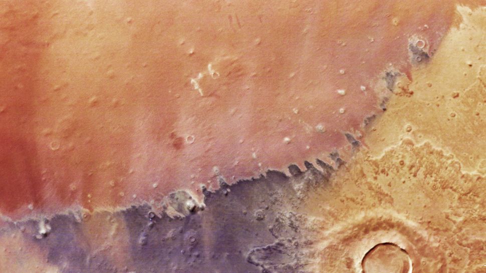
A new high-resolution satellite image from ESA reveals the colorful surface of Mars's Arcadia Planitia, showcasing impact craters, dust devils, and wind-eroded features, with colors indicating different mineral compositions and surface properties.
A new high-resolution satellite image from ESA's Mars Express orbiter reveals the colorful terrain of Arcadia Planitia on Mars, showcasing impact craters, dust devils, and diverse surface compositions, highlighting the planet's geological history and potential for future exploration.
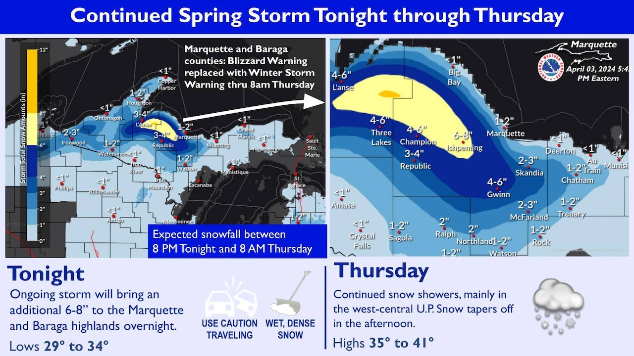
A satellite image captured a cyclone storm sweeping across the U.S., bringing a mix of severe weather from heavy snow in Michigan's Upper Peninsula to tornadoes in Kentucky and West Virginia. The storm caused large destructive tornadoes, hail, and damaging winds, leading to states declaring emergencies and an immense cleanup effort. The storm reports showed damaging winds as the primary threat, with some hail and tornado reports as well. The storm also brought heavy snow to parts of upper Michigan, with some areas receiving up to a foot of snow.
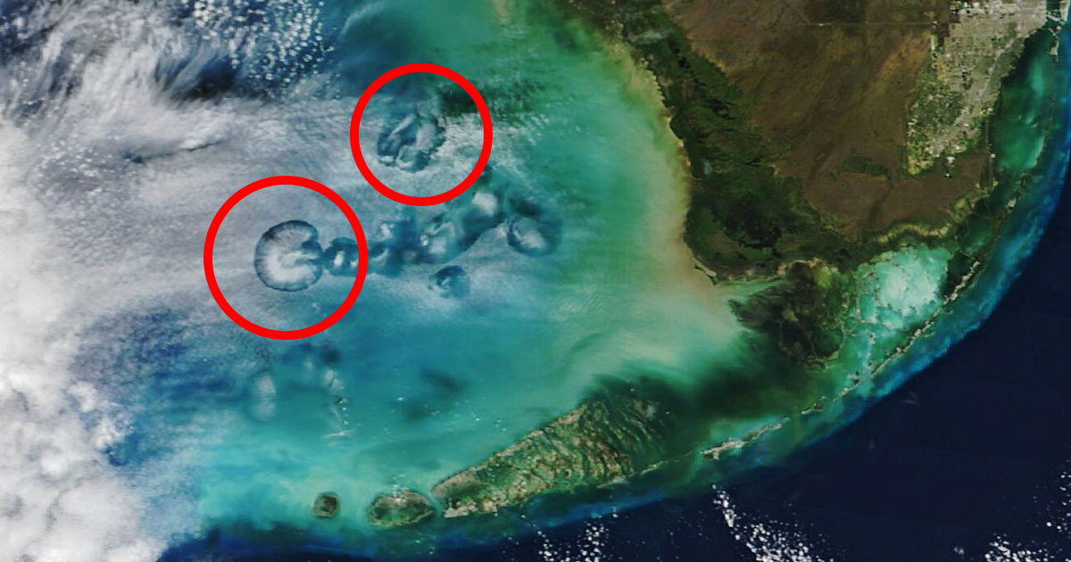
NASA's Terra satellite has captured an image of "fallstreak holes" or "hole-punch clouds" over the Gulf of Mexico, which were likely caused by airplanes flying through altocumulus clouds, freezing supercooled water droplets, and creating circular holes and elongated tunnels. These formations, often mistaken for UFO-related phenomena, are a result of aircraft activity, such as takeoffs and landings at the Miami International Airport, and demonstrate humanity's impact on the natural world.
A satellite image of the crash site of the Russian Il-76 military transport plane has been released, showing a 500-meter-long trail left by the plane during the crash. The debris scatter pattern suggests the plane was falling from west to east, away from Belgorod Airport, but it's unclear if it was flying in that direction before being hit by a missile. The plane was reportedly transporting over 60 Ukrainian prisoners of war when it crashed in Russia's Belgorod region.
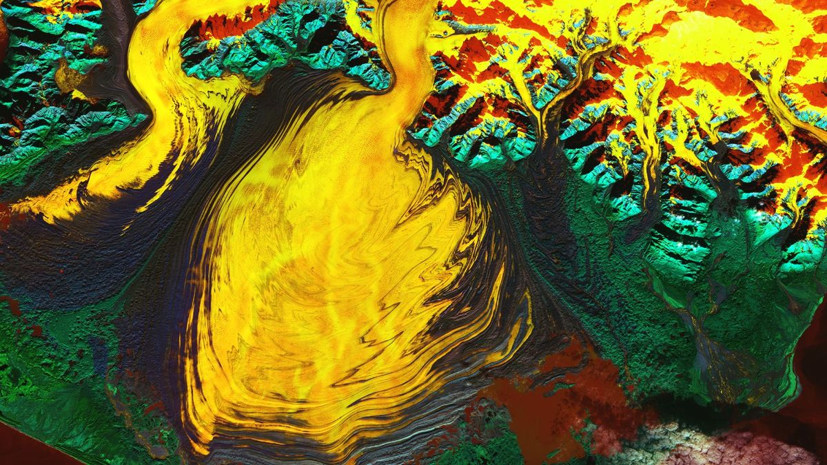
NASA has released a false-color satellite image of Alaska's Malaspina Glacier, showcasing recent discoveries including a "hidden lagoon." The image, captured by the Landsat 9 satellite, reveals the glacier's massive size and features such as moraines and subglacial channels. A study also found that the volume of the glacier's ice had been overestimated by 30%, and if it were to melt completely, it could raise global sea levels by 0.06 inch. The image highlights the Seward and Agassiz glaciers as well.
NASA has released a false-color satellite image of Alaska's Malaspina Glacier, showcasing recent discoveries including a "hidden lagoon." The image, captured by the Landsat 9 satellite, reveals the glacier's fiery, rippling appearance and highlights its massive size as North America's largest glacier. The image also shows the Seward and Agassiz glaciers, as well as subglacial channels of water beneath the ice. A study revealed that the volume of the glacier's ice had been overestimated by 30%, and if it were to melt completely, it could raise global sea levels by 0.06 inch. The discovery of the saltwater lagoon and the presence of subglacial channels could accelerate the glacier's retreat.
A satellite image captured by NASA's DSCOVR satellite shows the moon casting a shadow over a large portion of the United States during an annular eclipse. The image, taken by the Earth Polychromatic Imaging Camera (EPIC), shows the moon's shadow falling across the southeastern coast of Texas. An annular eclipse occurs when the moon passes in front of the sun but is too far away to completely block its light, creating a "ring of fire" effect. The next annular solar eclipse visible from the U.S. will be on June 21, 2039.
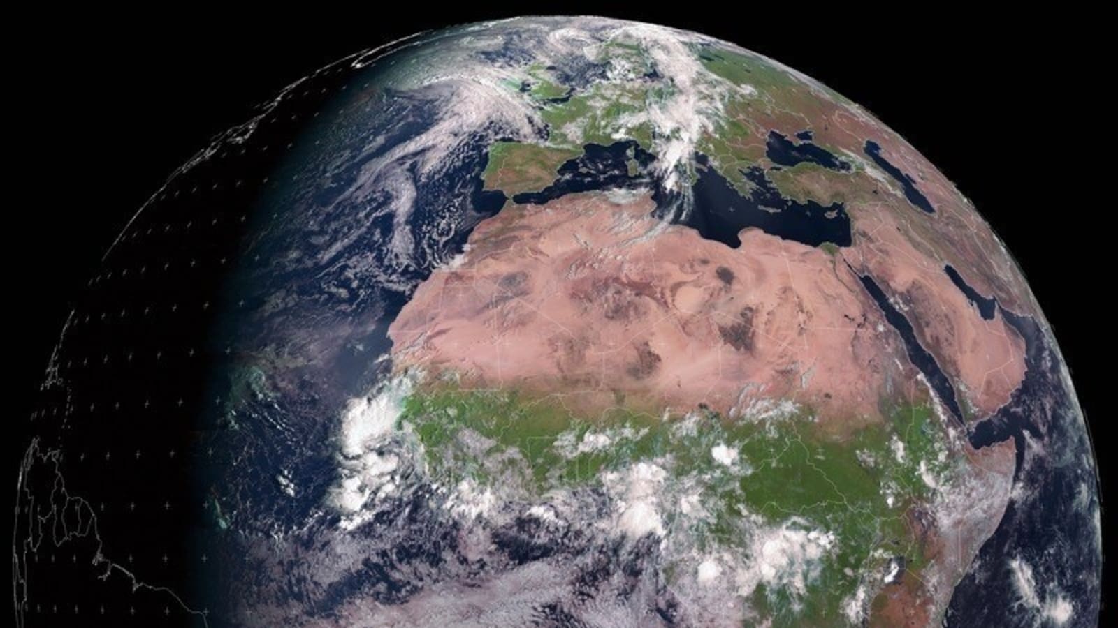
The European Space Agency (ESA) shared a satellite image showcasing the Autumn equinox, which marks the division of day and night on Earth's surface. During an equinox, day and night are approximately equal in length all across the globe. The image is significant as it represents the moment when the Sun crossed the celestial equator, signifying the autumn equinox in the Northern Hemisphere.