"Revealing North America's Largest Glacier: Secrets, Beauty, and Climate Crisis"
TL;DR Summary
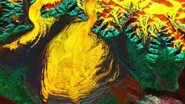
NASA has released a false-color satellite image of Alaska's Malaspina Glacier, showcasing recent discoveries including a "hidden lagoon." The image, captured by the Landsat 9 satellite, reveals the glacier's massive size and features such as moraines and subglacial channels. A study also found that the volume of the glacier's ice had been overestimated by 30%, and if it were to melt completely, it could raise global sea levels by 0.06 inch. The image highlights the Seward and Agassiz glaciers as well.
Reading Insights
Total Reads
1
Unique Readers
9
Time Saved
2 min
vs 3 min read
Condensed
86%
560 → 81 words
Want the full story? Read the original article
Read on Space.com