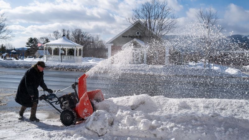
A stretched polar vortex is funneling Arctic air into the United States, setting the stage for a significant winter blast with very cold temperatures and potential snow across parts of the Midwest and Northeast as the pattern unfolds.
A shift in the jet stream pattern in December's second half is likely to reduce the chances of a white Christmas across much of the US, with milder temperatures causing snow to melt in many areas, though northern regions may still see snow on Christmas morning. The odds of a white Christmas vary by location, with northern states having higher chances than southern states, and the possibility of additional snowfall next week remains uncertain.
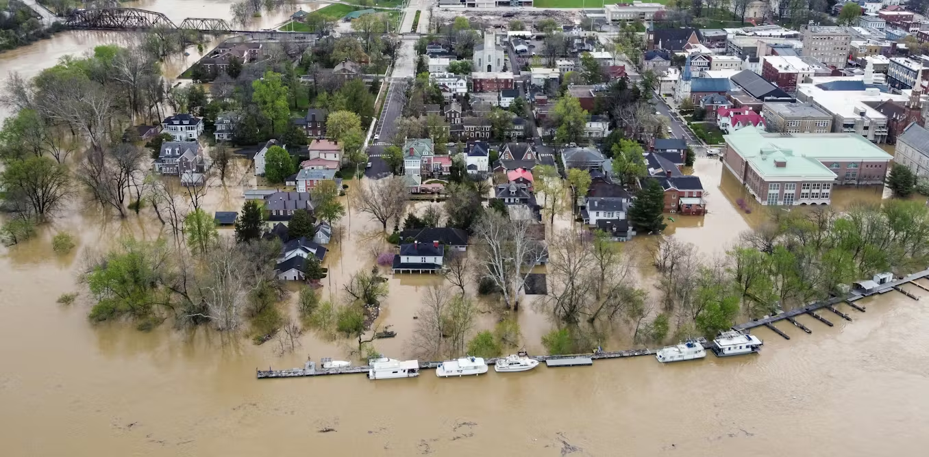
The summer of 2025 saw unprecedented U.S. flooding and unusual hurricane patterns largely influenced by a weakened and southward-shifted polar jet stream, driven by climate change, which caused prolonged storms and prevented hurricanes from hitting the mainland.
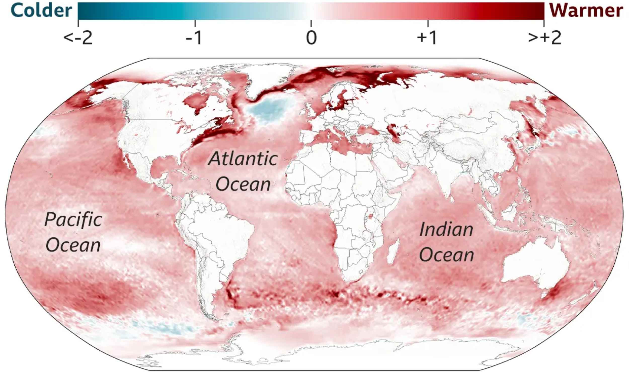
Scientists have identified two major ocean bands near 40 degrees latitude in both hemispheres that are heating at unprecedented rates, influenced by shifts in wind patterns and ocean currents, with significant implications for climate, weather, and marine life. The study highlights the uneven distribution of ocean heat and the importance of long-term data to understand climate change impacts.
A powerful winter storm is bringing deep snow to the West, while much of the central US experiences unseasonably warm weather due to the jet stream's northward position, global warming's impact on temperatures, and the El Niño weather pattern. January 2024 broke the record for the warmest first month of the year, and the East Coast is expected to see warmer weather by mid-week. Southern regions could experience temperatures in the ‘80s and ’90s, with Dallas-Fort Worth likely to break a daily record.
Freak winds in the Atlantic jet stream propelled five commercial flights to speeds exceeding 800mph, faster than the speed of sound, cutting their travel times significantly. While this allowed for earlier arrivals, it also led to more severe turbulence due to faster jet stream speeds, a consequence of global warming. Scientists suggest that redirecting flights to take better advantage of favorable winds could save fuel and reduce carbon emissions, but the trade-off is an increase in turbulence.
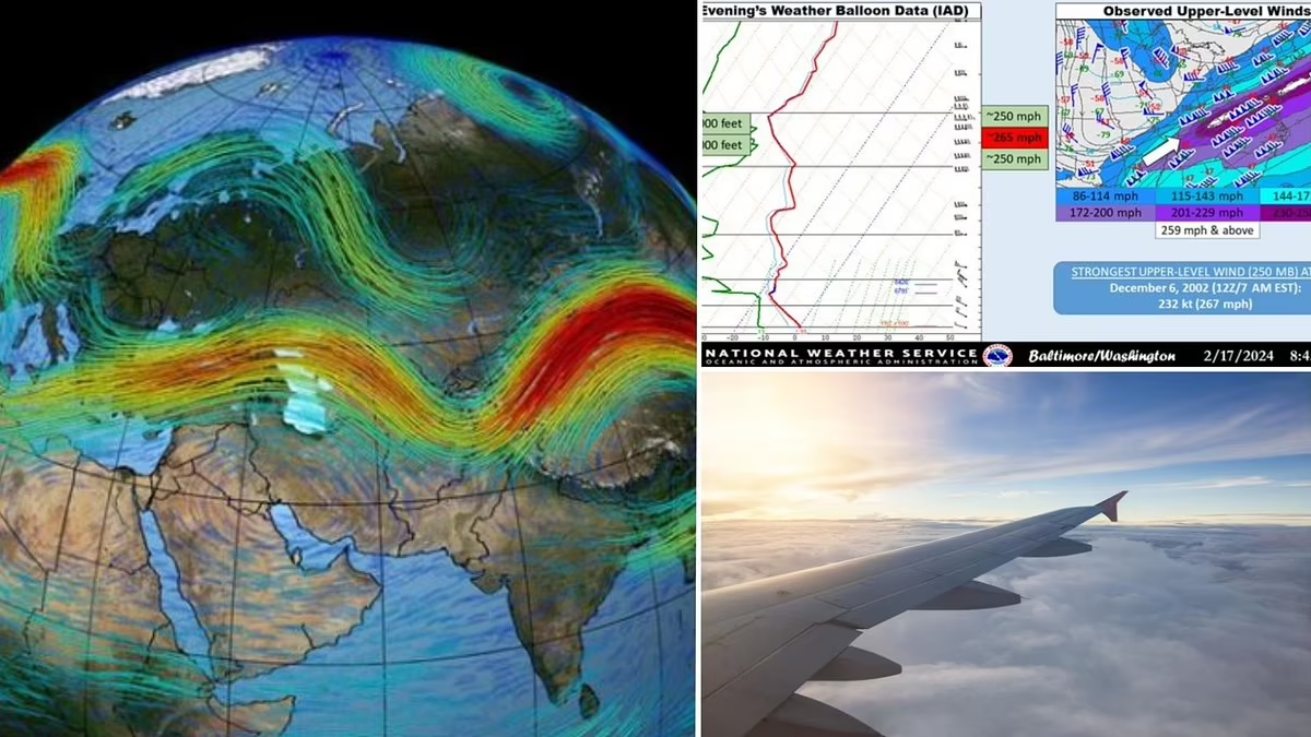
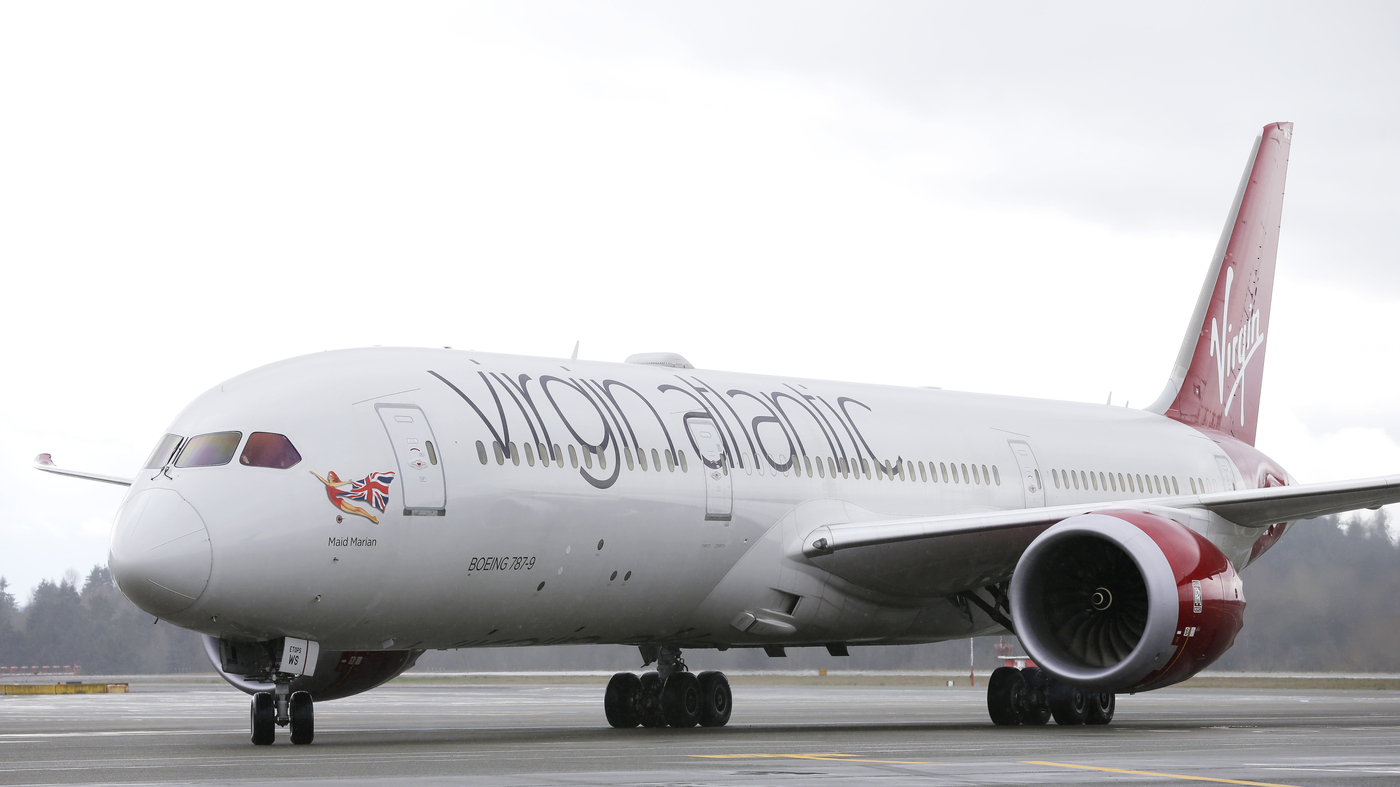
Near-record high-altitude winds over the Northeast propelled commercial passenger planes to speeds exceeding 800 mph, with a Virgin Atlantic flight from Washington, D.C., to London arriving 45 minutes ahead of schedule and reaching a ground speed of 802 mph. A United Airlines flight from Newark to Lisbon also experienced a peak ground speed of 838 mph, cutting 20 minutes off its scheduled flight time. The powerful jet streams, driven by temperature contrasts, are responsible for these unusually high speeds.
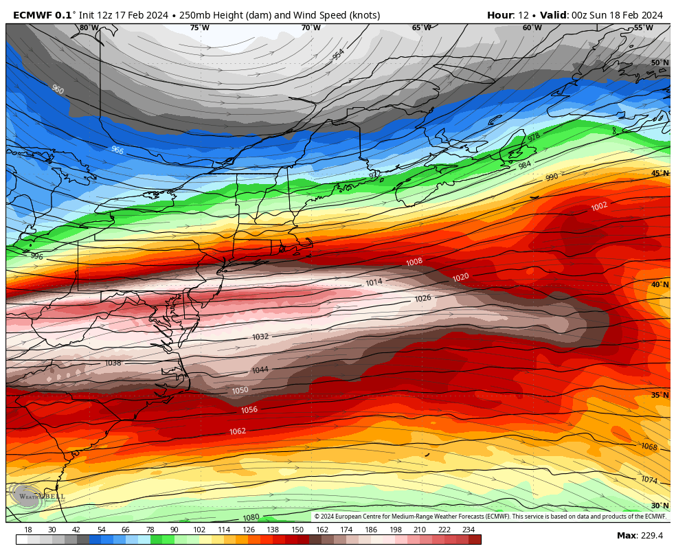
Near-record winds of 265 mph at 35,000 feet over the Mid-Atlantic allowed commercial flights to reach speeds over 800 mph, with one flight from Washington to London landing 45 minutes ahead of schedule. The high winds were caused by a powerful jet stream resulting from the contrast between cold air over the Northeast and warm air over the Southeast. The fast high-altitude flow also contributed to less snowfall than predicted in Washington.
A major weather pattern change is set to bring a significant swing in temperatures across the US next week, with above-average temperatures forecast for the entire Lower 48. The shift is driven by a change in the jet stream's positioning, which will trap cold air in Canada and allow warm air from the tropics to surge northward into the US. This will result in milder conditions and drastic temperature changes, with some areas experiencing 40- to 50-degree swings from this week's cold to next week's unseasonable warmth. The above-average warmth is expected to persist through the end of January, according to the Climate Prediction Center.
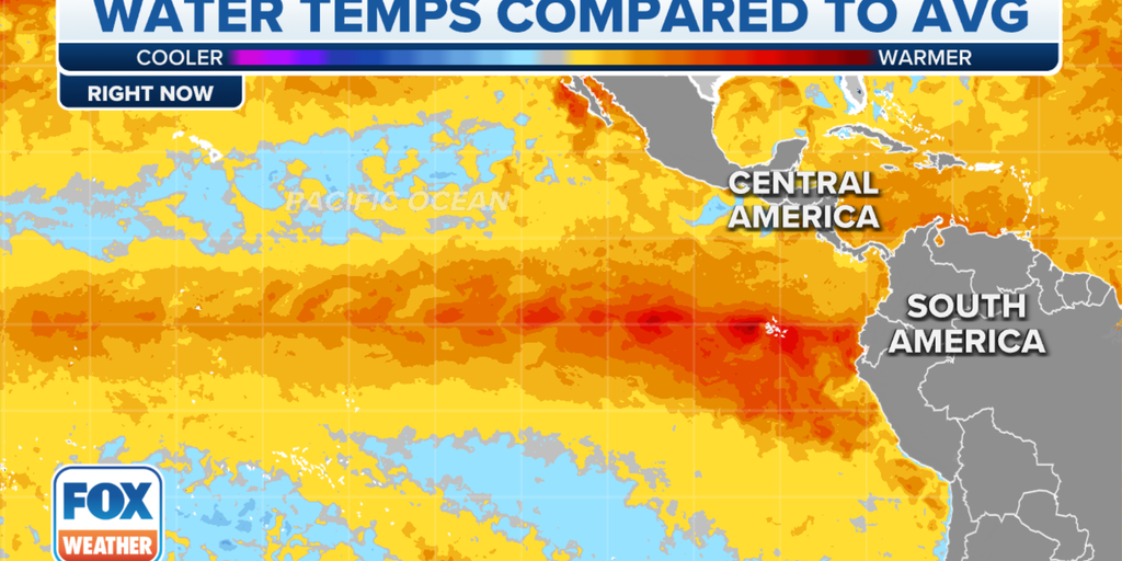
The El Niño event is strengthening, with sea-surface temperatures in the central tropical Pacific Ocean reaching above-average levels. NOAA forecasts a 55% chance of a strong El Niño lasting through winter and a 62% chance of El Niño conditions persisting into spring. There is also a 35% chance of reaching historically strong levels. El Niño impacts include a shift in the jet stream, which can have major effects on weather patterns in the United States. However, computer models and tropical activity around the globe make it challenging to predict the exact strength and duration of the El Niño event. Past historically strong El Niño events have caused destructive storms and significant weather impacts.
Flights traveling from the US to Europe are benefiting from a strong jet stream over the Atlantic Ocean, reaching speeds of nearly 780 mph. While these speeds are not breaking the sound barrier, they have significantly reduced flight times. The jet stream, a core of strong winds blowing from west to east, is amplified by temperature differences caused by the cooling weather in the US. Storm Ciaran is expected to be strengthened by the jet stream as it reaches Europe. Despite the current fast flights, previous records set pre-pandemic were even higher, with a Virgin Atlantic plane reaching 801 mph and a British Airways Boeing 747 reaching 825 mph.
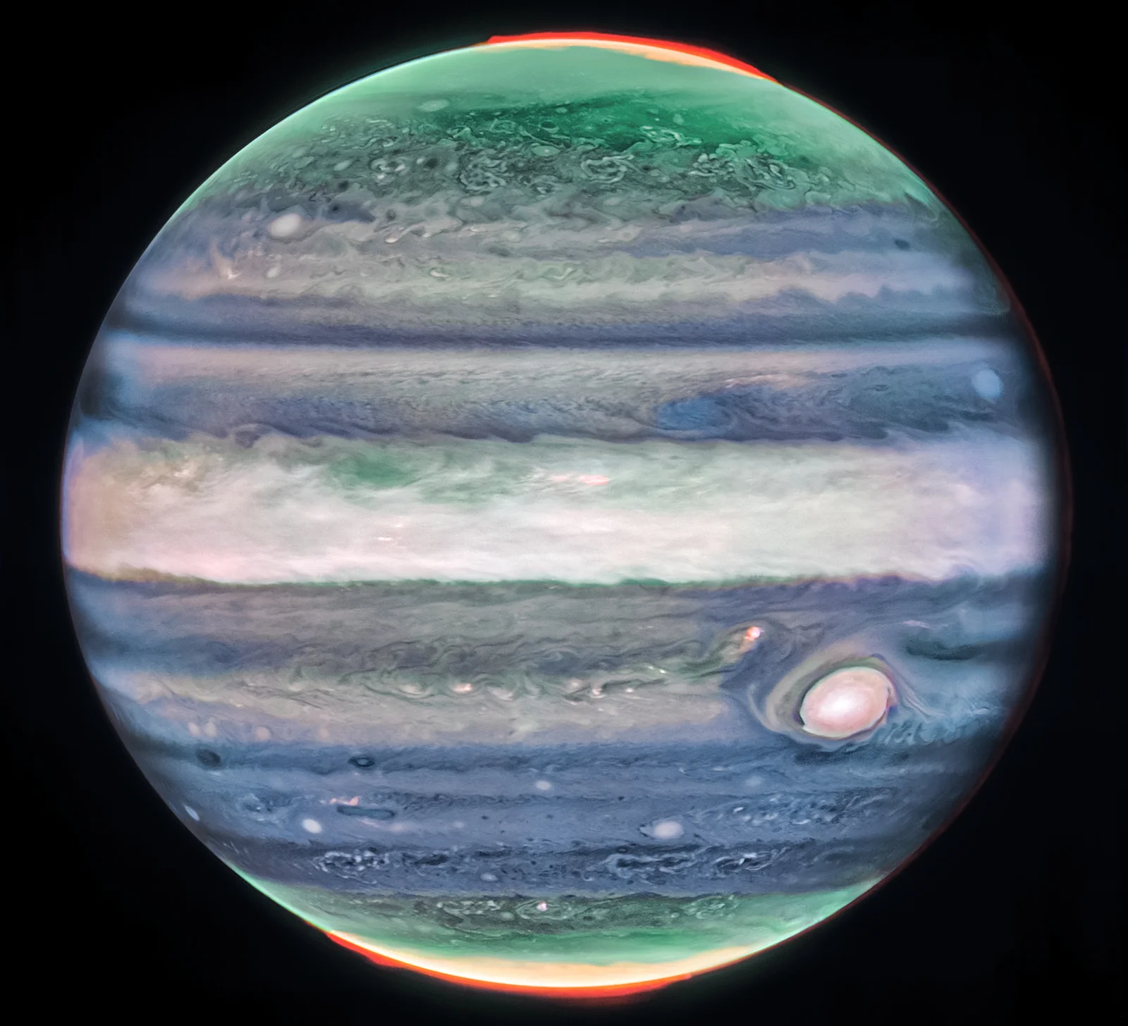
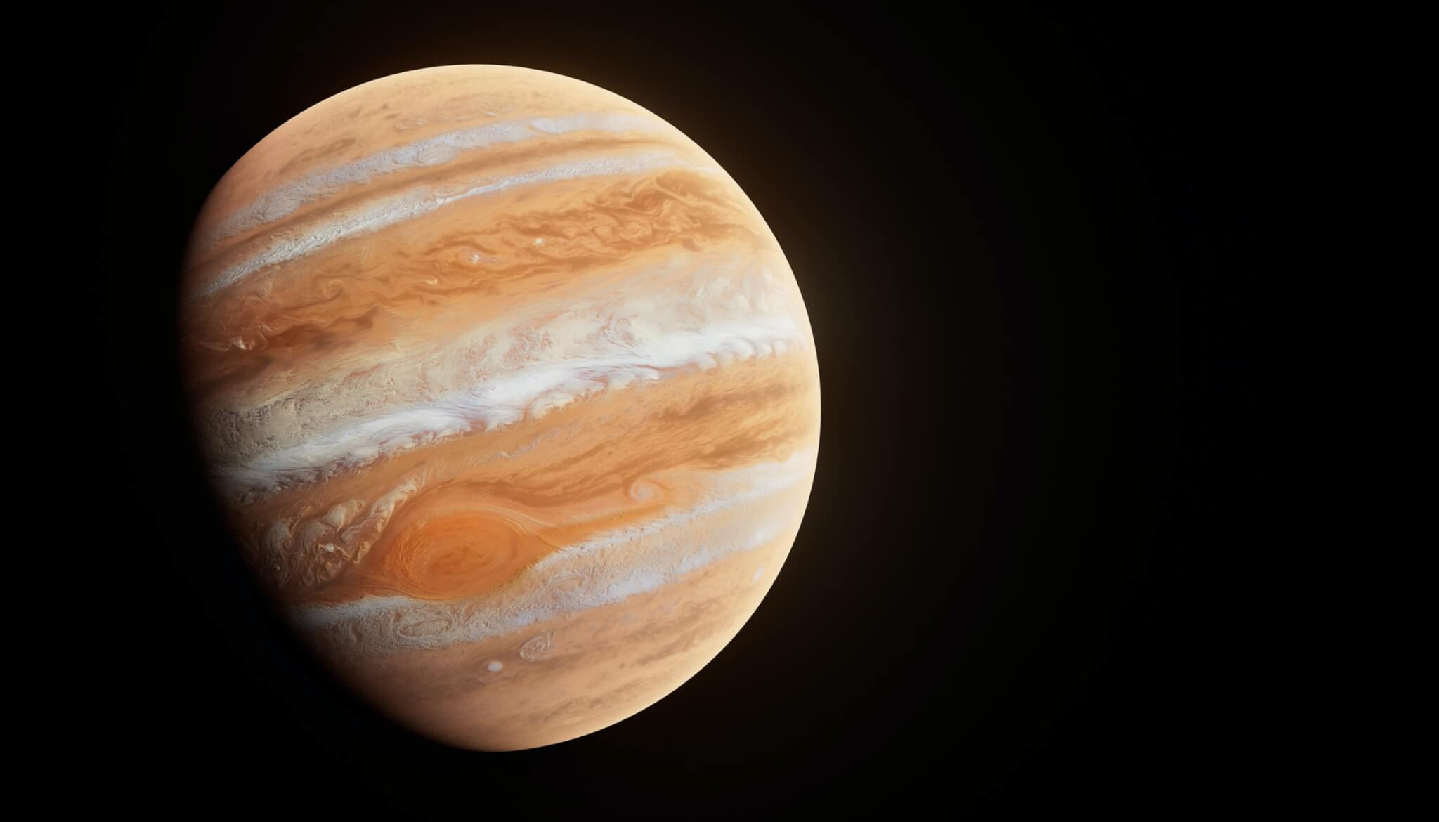
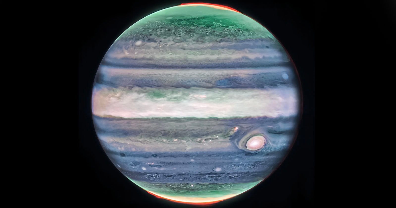
Scientists using the James Webb Space Telescope have discovered a high-speed jet stream at Jupiter's equator, measuring winds of up to 515 kilometers per hour. The jet stream, located 40 kilometers above the clouds, was observed for the first time using Webb's infrared instruments, providing detailed images of Jupiter's atmosphere. The discovery will help scientists understand how the layers of Jupiter's turbulent atmosphere interact and shed light on the dynamics of giant planets.
NASA's James Webb Space Telescope has made a surprising discovery in Jupiter's atmosphere, revealing a high-speed jet stream with speeds over 300 miles per hour and spanning 3,000 miles in width. This jet stream, located above Jupiter's equator and beyond its main cloud layers, sheds light on the interaction between Jupiter's atmosphere layers and showcases the unique capabilities of the Webb telescope. By analyzing data captured by Webb's Near-Infrared Camera, scientists were able to track the jet stream and observe changes in wind speed with altitude. The newfound understanding of Jupiter's atmosphere is a result of Webb's ability to look deeper into the near-infrared spectrum, providing a view of the higher-altitude layers of the planet. Further observations with Webb will help determine if the jet's speed and altitude change over time.
The James Webb Space Telescope has discovered a high-speed jet stream in Jupiter's lower stratosphere, with wind speeds of 320 miles per hour, twice the velocity of sustained winds in a Category 5 hurricane on Earth. This surprising finding was made possible by the telescope's unique ability to explore the higher-altitude layers of Jupiter's atmosphere. The discovery, made in collaboration with NASA's Hubble Space Telescope, provides new insights into Jupiter's intricate atmospheric dynamics and may help scientists understand how wind speeds on the planet change with altitude.
The James Webb Space Telescope has captured never-before-seen images of a high-speed jet stream in Jupiter's atmosphere. Spanning over 3,000 miles wide and moving at 320 miles per hour, the jet stream was observed in the gas giant's lower stratosphere. The study sheds light on the dynamic interactions within Jupiter's stormy atmosphere and provides new insights into the planet's weather patterns. The Webb telescope's unique capabilities allow it to study the higher-altitude layers of Jupiter's atmosphere, providing previously indistinct details. Future observations may uncover more insights into the jet stream and other surprises on Jupiter.