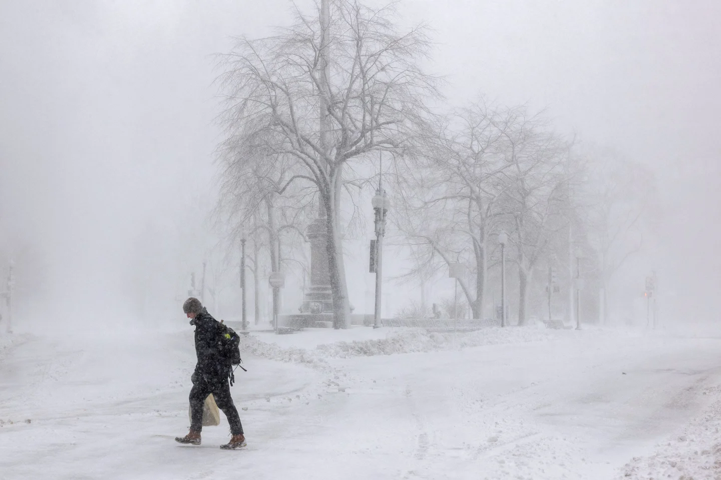
A historic Northeast blizzard dumped up to three feet of snow, with Warwick, Rhode Island reporting 36.2 inches, prompting emergency declarations in seven states and causing thousands of flight cancellations, road closures, and widespread transit disruptions for more than 40 million residents.
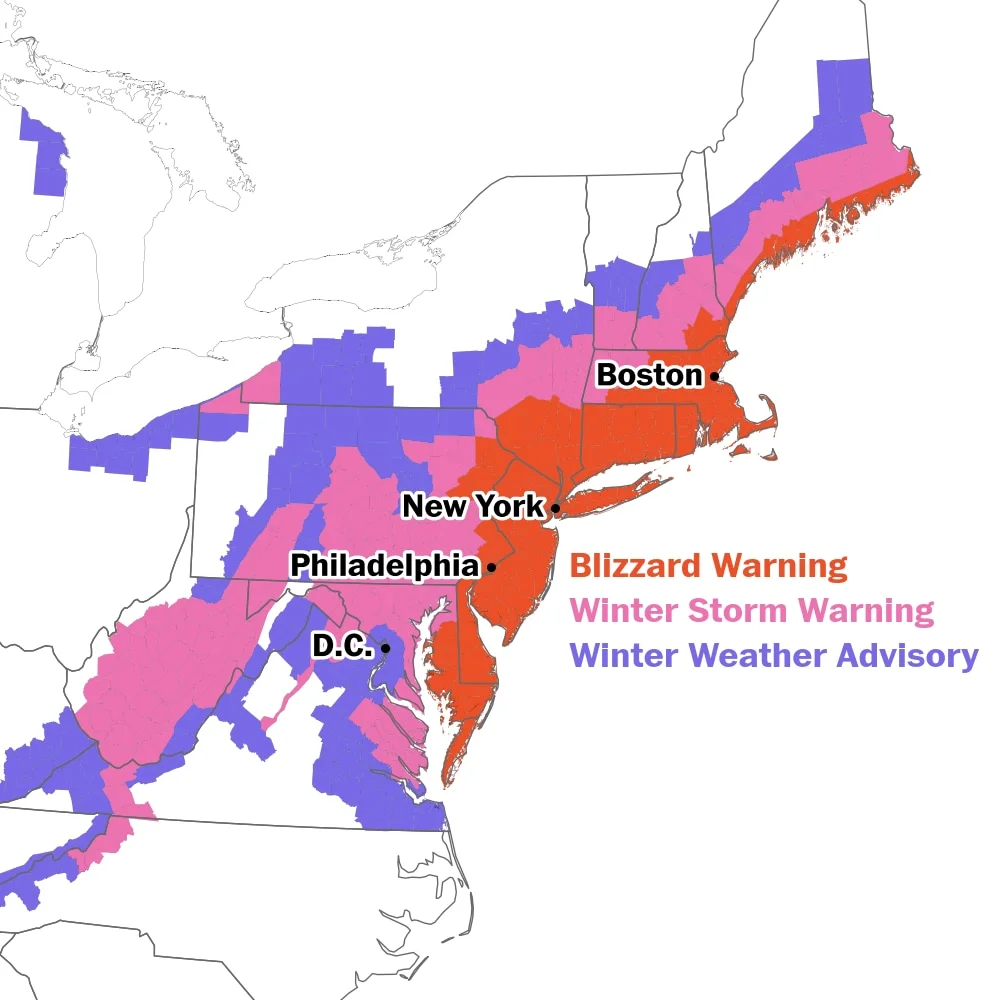
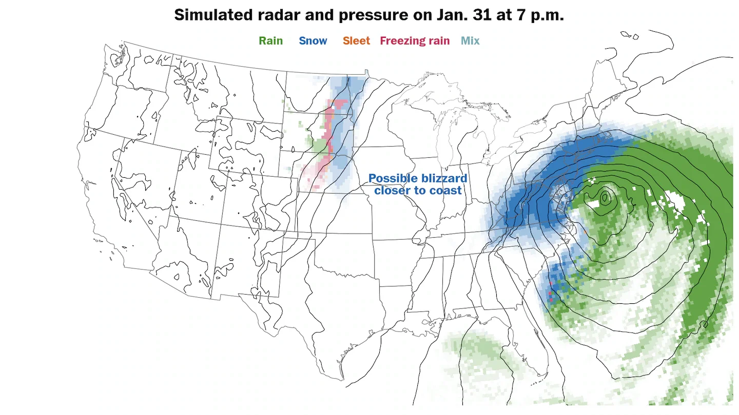
A developing nor'easter off the Mid-Atlantic coast is expected to rapidly intensify Sunday night into Monday, with about 35 million people under blizzard warnings and roughly 65 million under weather alerts as the storm tracks up the Northeast. The worst conditions are anticipated overnight Sunday into Monday, with forecasts of heavy snow—potentially a foot or more in parts of the Delaware-to-SE Massachusetts corridor—alongside travel disruptions and school closures across the region.
A multi-state weather outbreak unleashes dangerous wildfires driven by 60–70 mph winds and dry fuels across the Central and Southern Plains, with blowing dust causing crashes and PSPS power shutoffs, while the Upper Midwest braces for a major blizzard and heavy snow, prompting evacuations, road closures, and widespread travel disruptions.
The EU’s climate advisory board warns Europe could reach about 2.8-3.3°C of warming by 2100 and says current adaptation is insufficient; it calls for mandatory climate risk assessments, embedding resilience in all policies, and leveraging more funding (including private capital) for protective measures, plus stress-testing hotter scenarios and upgrading early warning systems to curb escalating heat and flood risks.
Storm Marta batters Portugal and Spain with fresh flood warnings, prompting evacuations, road closures, and transport disruption as the Iberian Peninsula continues to recover from consecutive storms.
A cold snap in Florida freezes green iguanas, causing them to drop from trees; residents are gathering and killing the invasive reptiles as part of wildlife management and pest control.
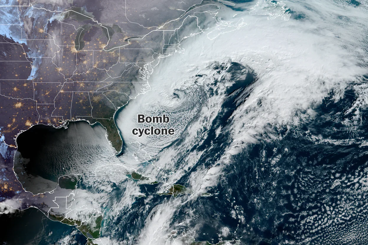
A rapidly intensifying nor’easter offshore of North Carolina evolved into a bomb cyclone, dumping historic snowfall in parts of the Southeast, bringing blizzard conditions and strong winds that snarled traffic on I-85 north of Charlotte, and even producing flurries as far south as Florida as the system pulled away.
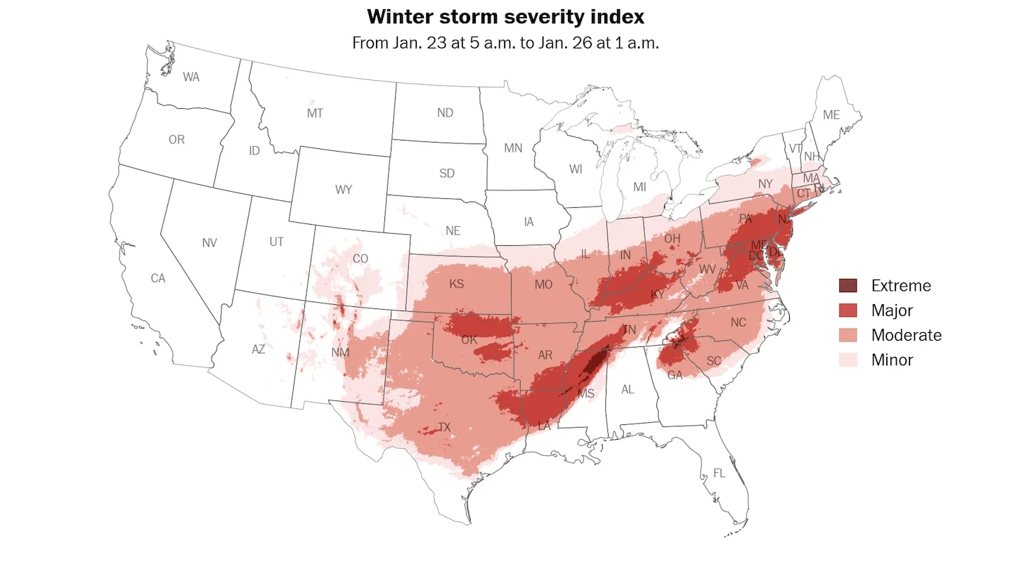
An intense nor’enaster is rapidly intensifying into a bomb cyclone off the Carolinas, bringing blizzard conditions, coastal flooding and a deep cold snap to about 35 million people along the Southeast and Eastern Seaboard, with the worst impacts expected in the Carolinas and southern Mid-Atlantic as frigid air spreads across a wide region and travel disruptions and power outages loom.
Between models and recent trends, another potentially plowable snowstorm could threaten parts of the East Coast this weekend, with New England most likely to see accumulating snow. The exact impact hinges on the storm’s track: some forecasts project a farther offshore path limiting snow, while others bring more inland snow to coastal areas. Washington Post meteorologists Matthew Cappucci and Ben Noll compare recent model runs and illustrate how proximity to the coast will determine how widespread the snow ends up.
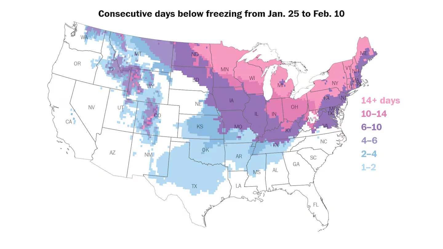
As the massive winter storm moves on, dangerous, record-setting cold could persist for days across the northern U.S., with forecasts showing a week or more of freezing temperatures, travel hazards from ice, and potential power outages; cold alerts cover about 210 million people as forecasters warn of continued severe conditions and a new storm system potentially forming.
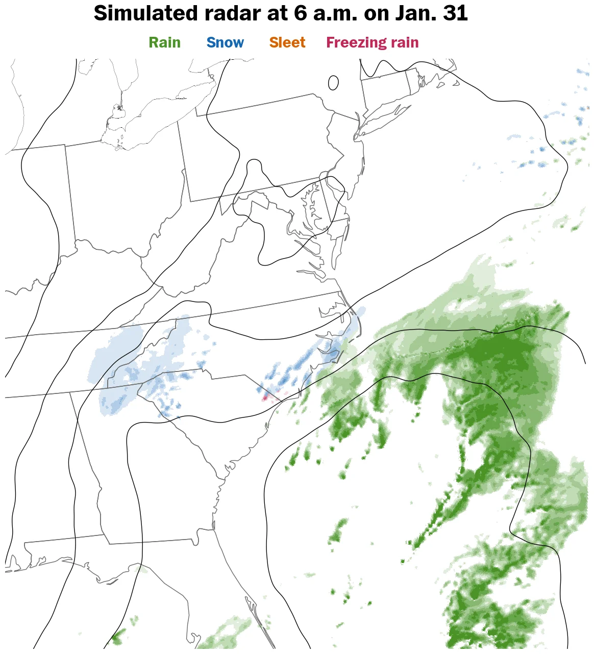
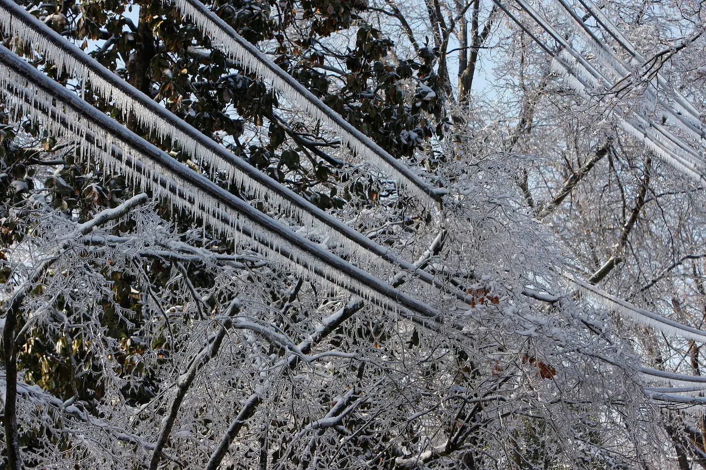
A massive winter storm is sweeping from the central U.S. eastward with sleet, ice, and snow, prompting the declaration of emergencies in at least 22 states as officials warn of catastrophic impacts. The storm has already triggered widespread power outages, thousands of flight cancellations and delays, and shelters opening in North Carolina, with DHS/FEMA coordinating the response and President Trump approving emergency declarations in several states. The system is forecast to move into the Mid-Atlantic, Southeast and Northeast over the weekend, bringing heavy snow to many cities and even a tornado risk along the Gulf Coast, while authorities urge people to stay off roads and prepare for prolonged outages and dangerous travel conditions.
A large winter storm sweeping from the Southwest to the Mid-Atlantic could trigger widespread travel disruptions and freezing conditions, with officials warning that long-lasting power outages may stress grids and utilities even as authorities claim improved preparedness for snow and ice.
The Department of Homeland Security paused non-renewals of dozens of FEMA disaster-response employees as it ramps up preparations for a massive, life-threatening winter storm projected to strike about half the country this weekend.
A sprawling winter storm is set to intensify this Friday across the Midwest to the Northeast, potentially becoming the season’s biggest snow-and-cold event in years or decades and affecting about half the U.S. population with heavy snow, ice and frigid temperatures.
A major national winter storm is forecast to lash the United States starting Friday, with about 205 million people under winter-weather alerts from the Southwest to New England. The system is expected to impact the Midwest and Northeast the most, with twelve cities identified as hardest hit and broad travel disruptions and potential power outages ahead, according to NOAA forecasts.