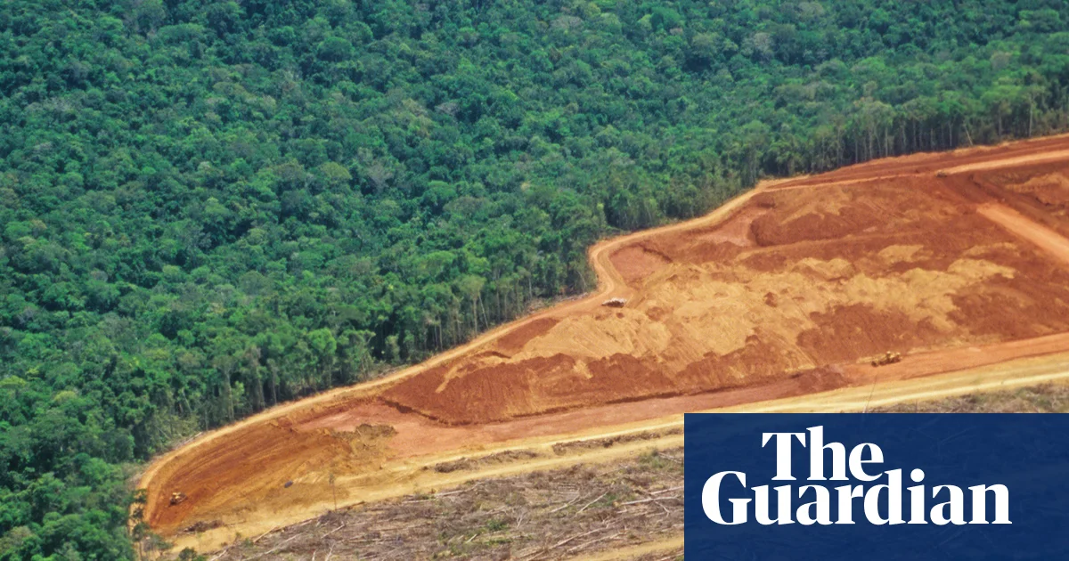
A study finds that deforestation in the tropics over the past 20 years has caused over half a million deaths due to heat-related illnesses, highlighting the direct human toll of forest loss and its contribution to regional warming and climate disruption.
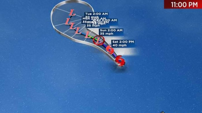
Tropical Depression Katia has strengthened into Tropical Storm Katia, located 580 miles northwest of The Cabo Verde Islands. It is moving towards the north-northwest at 13 mph with maximum sustained winds of 40 mph. The storm is expected to weaken and could become a remnant low by Sunday evening. There are currently no coastal watches or warnings in effect.
A Heat Advisory is in place for most of the Big Bend and South Georgia, with an Excessive Heat Warning for certain areas. Heat index values can reach up to 112, with actual temperatures in the upper 90s. Showers and storms may develop later today and tomorrow. The tropics are being monitored, with a potential tropical depression forming by the end of the weekend or Monday. The forecast track and intensity will be better determined once it becomes a tropical system. Potential impacts to the Gulf Coast of Florida may occur on Tuesday and Wednesday.
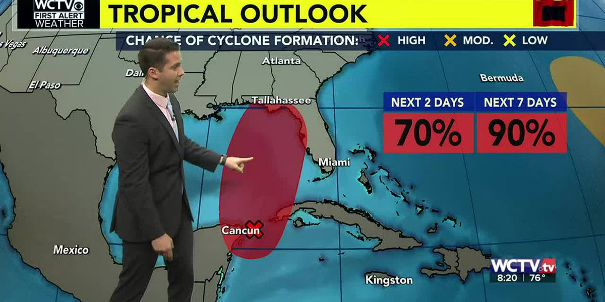
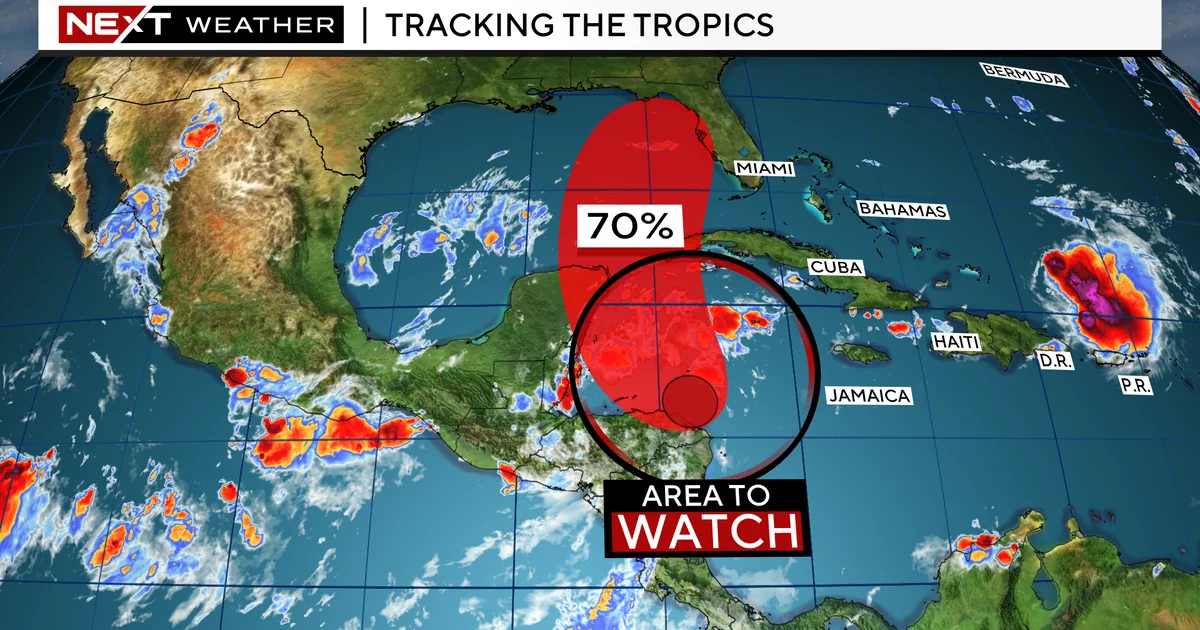
A disturbance in the northwestern Caribbean Sea has a 70% chance of development over the next seven days, potentially becoming a tropical depression or tropical storm. The evolution of the system will depend on an upper-level trough, with the European model suggesting more favorable conditions for development and the American model indicating stronger shear. Regardless, South Florida can expect heavy rain and the potential for flooding from late Monday to early Wednesday. Meanwhile, Tropical Storm Franklin is expected to strengthen and could become the first Category 2 hurricane of the season.
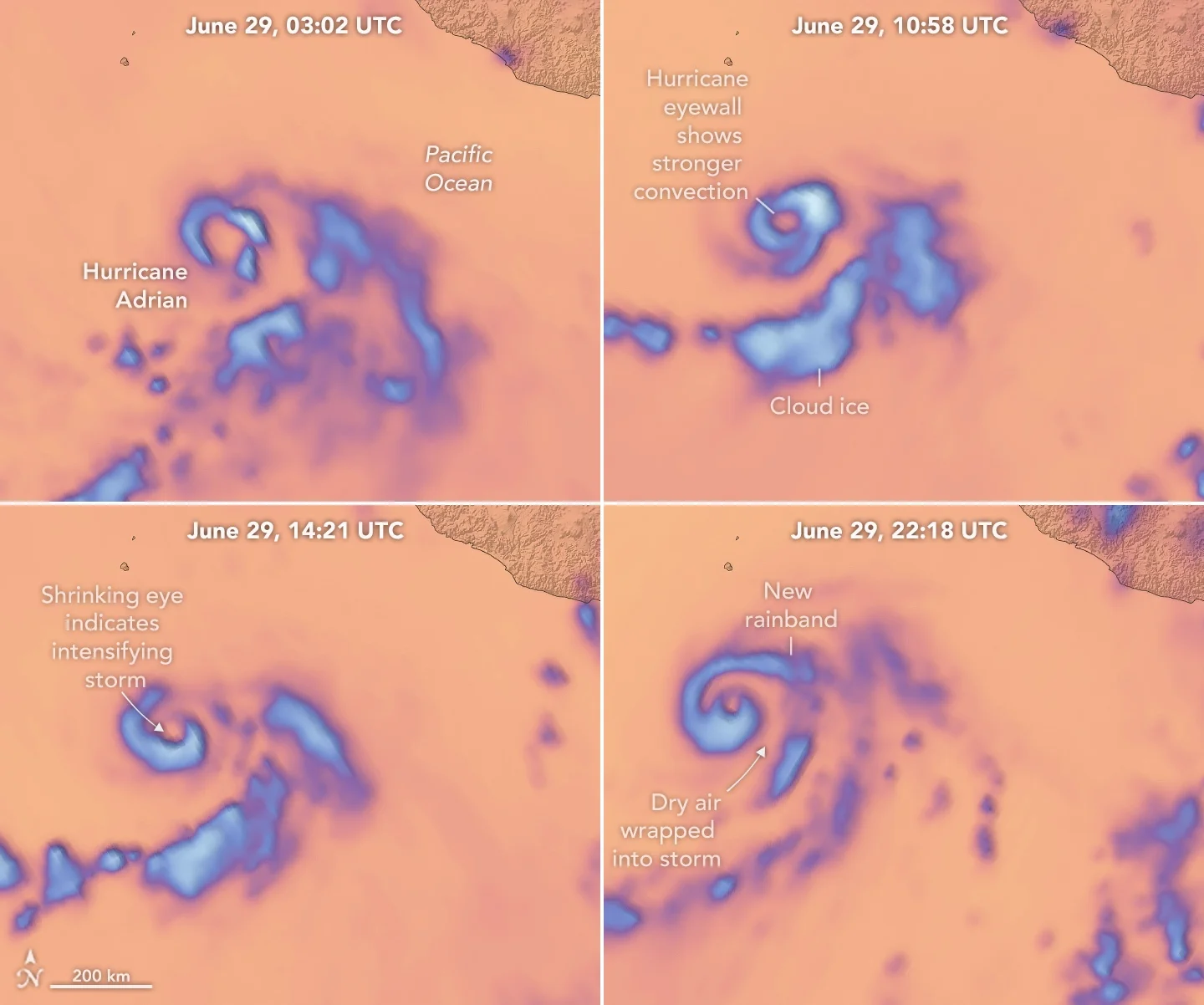
NASA's TROPICS cubesat constellation, consisting of four small satellites equipped with microwave radiometers, is ready to monitor tropical storm systems during the Atlantic hurricane season. The constellation, optimized for the tropical storm belt, can provide high-quality data and revisit weather systems every hour, allowing for better tracking of storm dynamics. Initial analysis of the data is promising, and the mission aims to make the data available to the public in the coming months. The TROPICS technology is also being transferred to the private sector for use in Tomorrow.io's constellation of 18 cubesats for collecting weather data.
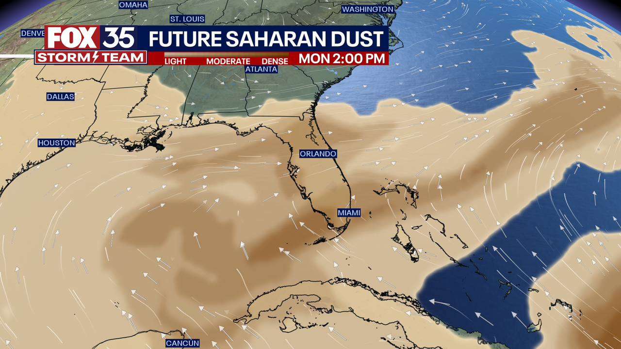
A large cloud of Saharan dust known as the Saharan Air Layer (SAL) is expected to reach Florida late this weekend and early next week, potentially affecting local air quality and creating vibrant sunrise and sunset colors. The arrival of the dust may also lead to a slight decrease in rain chances and a quieter tropical environment due to the dry air inhibiting cyclone development.
Central Florida is experiencing high temperatures with "feels-like" temperatures reaching 105-110 degrees. Rain chances are at 30% on Wednesday and 20% on Thursday, with temperatures expected to reach the upper 90s later in the week. A heat advisory has been issued for Sumter and Polk counties. An area of low pressure in the tropics has a 10% chance of development within the next seven days.
Central Florida is experiencing a heat index of 105-110 degrees this week, with high temperatures remaining in the mid 90s and low rain chances. An area of low pressure associated with the remnants of Cindy has a 30% chance of development over the next seven days, but will stay away from the U.S.
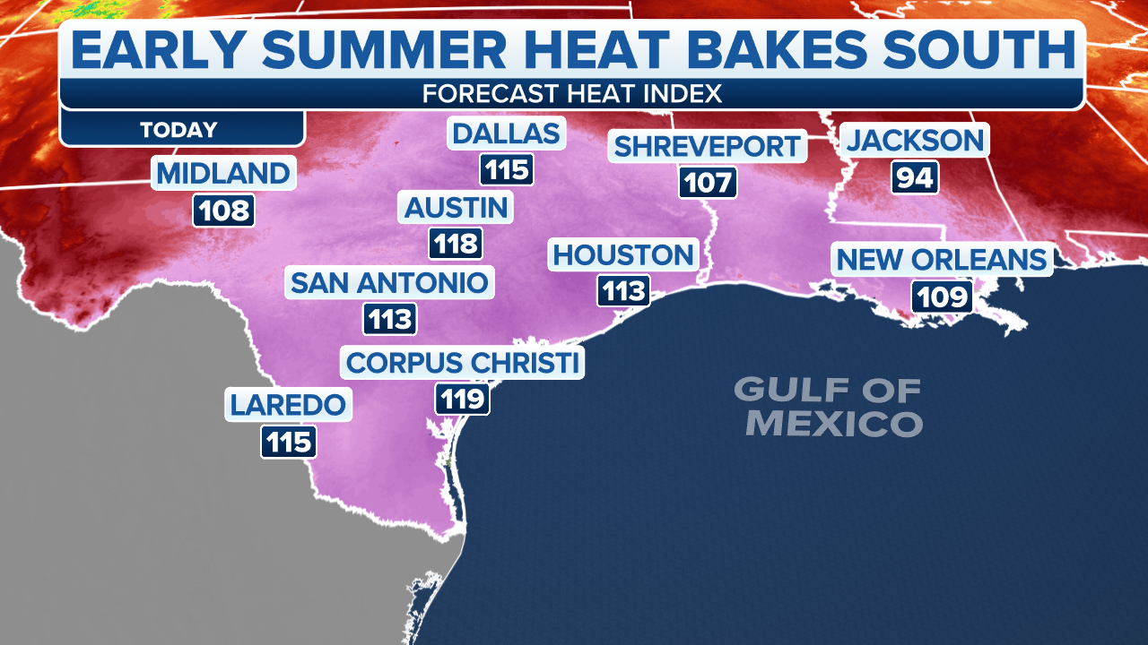
The Southeast and Florida are expected to experience strong to severe thunderstorms with the risk of large hail, damaging winds, and heavy rainfall that could cause flash flooding and isolated tornadoes. Excessive heat warnings and heat advisories are in effect for dozens of counties across Texas, New Mexico, Oklahoma, Louisiana, and Mississippi. The Southeast is forecast to be drenched with rain this week, with up to 8 inches expected to fall in parts of the Carolinas and the Florida Panhandle. Fire danger is at a critical stage for Arizona and New Mexico. The tropics are being monitored for possible development in the Atlantic.
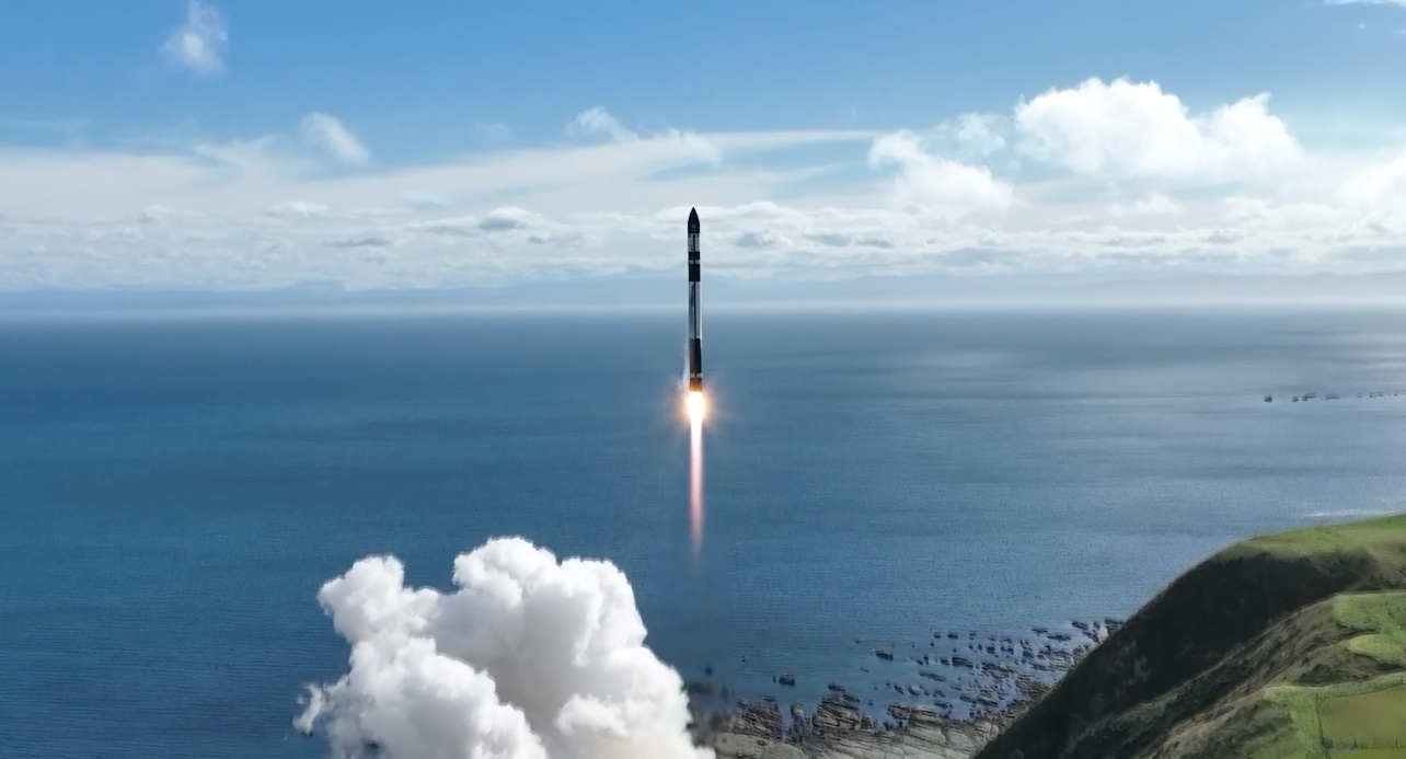
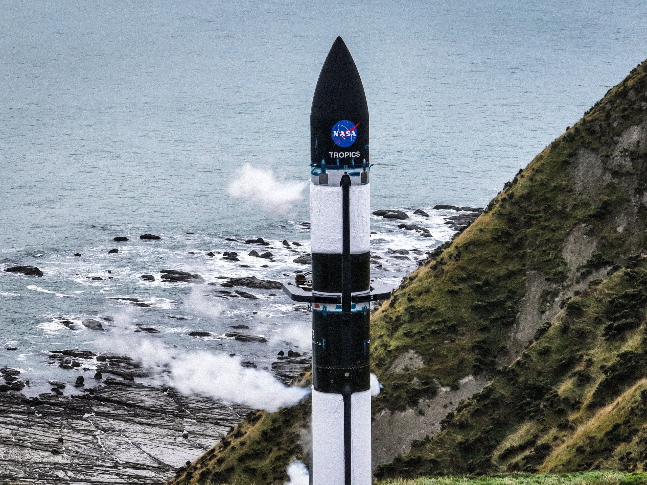
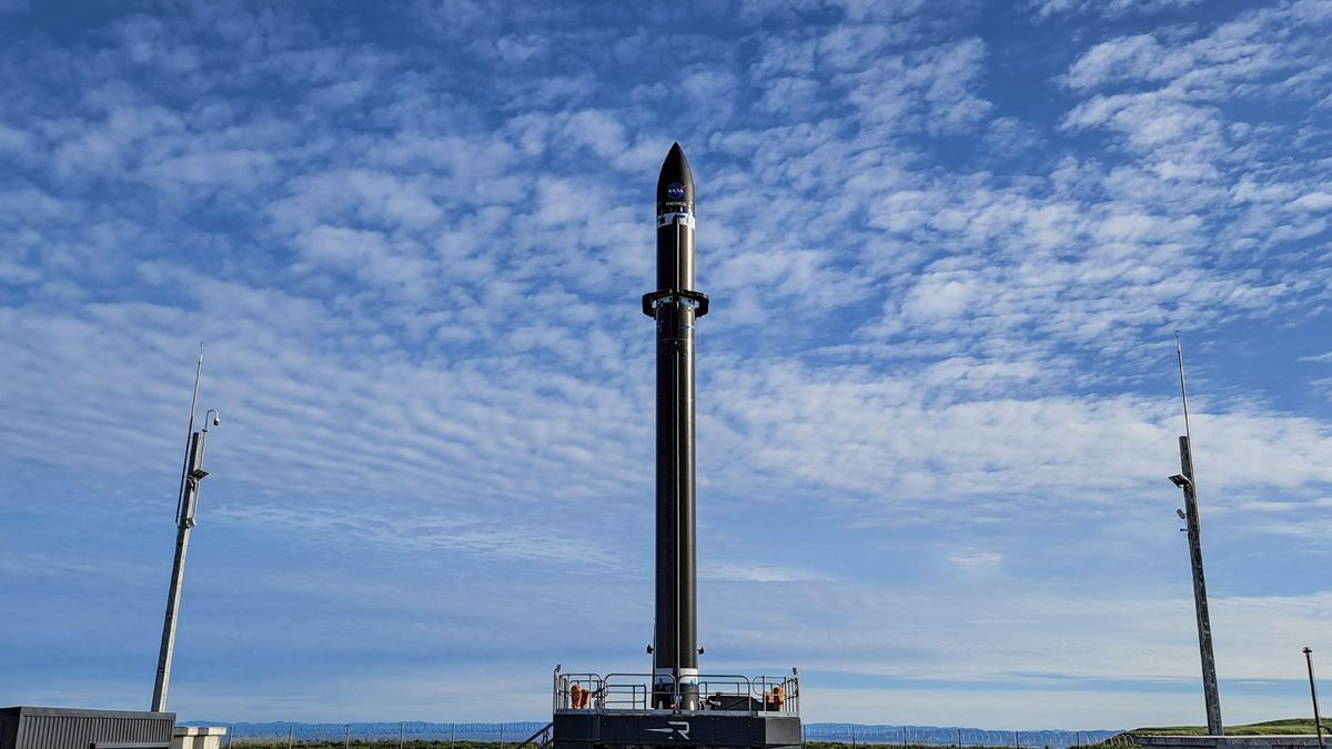
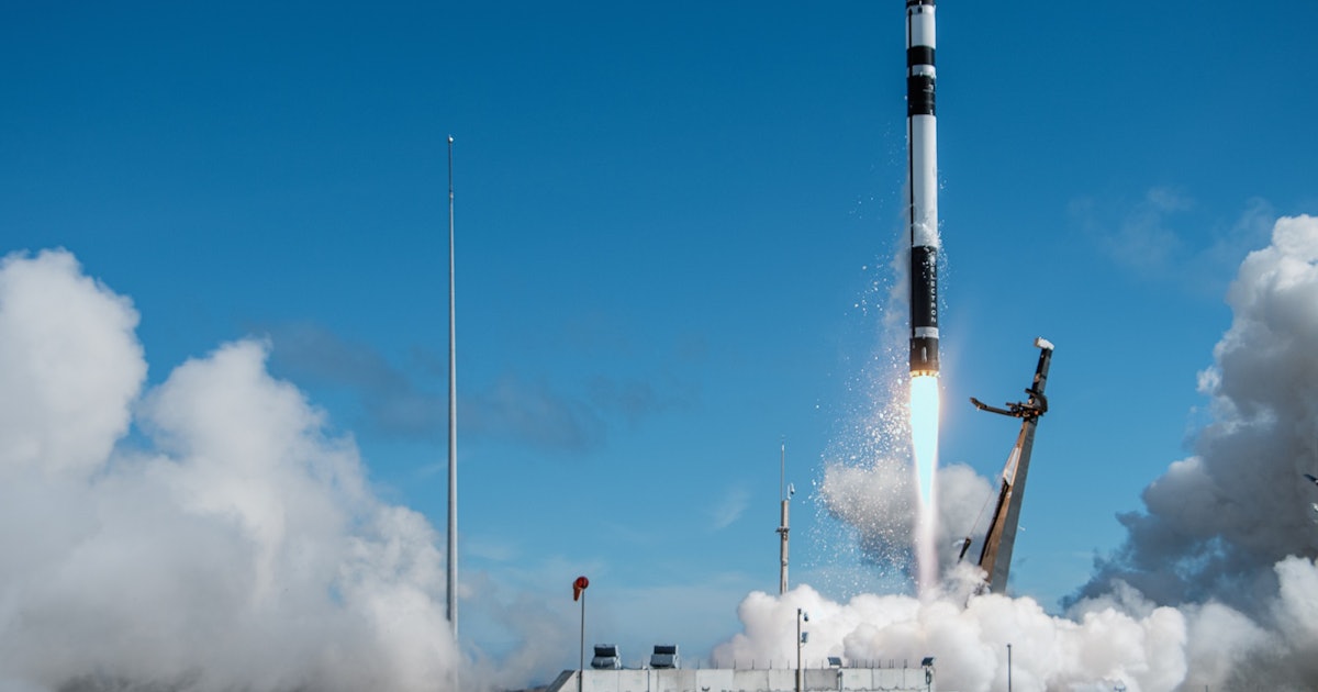
Rocket Lab's Electron launcher successfully launched NASA's final two TROPICS CubeSats, completing a four-satellite constellation of tropical cyclone research platforms. The TROPICS satellites will collect imagery, temperature, and moisture data over tropical cyclones, with a fleet of four operational satellites capable of monitoring rapid changes in cyclones at least once per hour. The mission, relying on CubeSat technology and emerging launch providers, might carry a higher risk of a spacecraft or rocket failure. The low-inclination orbit selected for the TROPICS mission will focus the satellite observations on hotspots for tropical cyclone development.
Rocket Lab's Electron rocket has launched a second pair of NASA TROPICS cubesats, which will join two others in the four-satellite TROPICS constellation. The cubesats carry microwave radiometers that NASA scientists will use to monitor the formation of tropical storms, collecting data at an hourly cadence. The launch was the fifth this year by Rocket Lab, which has projected up to 15 Electron launches this year, including both orbital missions and HASTE flights.
Rocket Lab is set to launch the final batch of NASA's TROPICS constellation, made up of five 3U cubesats, into orbit on its Electron rocket on May 27. The TROPICS satellites will provide hourly measurements on cyclone activity in the Atlantic and West Pacific regions, improving our understanding of how these storms evolve over time and intensity and direction forecasts for cyclones. The constellation was originally supposed to be made up of 12 satellites but was later reduced to just seven.
Rocket Lab is set to launch two tiny NASA satellites, TROPICS cubesats, on a hurricane-studying mission from New Zealand's North Island. The satellites will investigate intense tropical storms in terms of precipitation, temperature, and humidity nearly hourly, providing more frequent imaging to improve situational awareness when a hurricane forms. The TROPICS constellation will orbit Earth at an altitude of around 342 miles with an inclination of around 30 degrees.
Rocket Lab's Electron rocket successfully launched two NASA CubeSats, part of the TROPICS constellation, designed to provide frequent updates on typhoon and hurricane development for new insights into how tropical storms evolve and intensify. The unique orbits over Earth's tropics allow the satellites to travel over any given storm about once an hour, compared with current weather tracking satellites that have a timing of about once every six hours. The TROPICS constellation is part of NASA's Earth System Science Pathfinder Program and aims to help scientists better understand the processes that affect high-impact storms, ultimately leading to improved modeling and prediction to help protect lives and livelihoods.
NASA's TROPICS mission has launched its first two mini-satellites to collect data on hurricanes and typhoons. The satellites will offer hourly updates on storm growth to improve forecasting and figure out how temperature, humidity, and precipitation factor into the intensity of tropical cyclones. The $30 million mission aims to put four TROPICS satellites in space in slightly different low-Earth orbits, all circling the globe at about 30 degrees above the equator. The next two satellites could take off in about two weeks, and the mission is expected to last for a year.