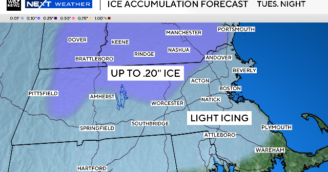
Massachusetts will experience four storm systems this week bringing a mix of snow, ice, and rain, with the most significant impact from freezing rain Tuesday night into Wednesday morning, followed by two rain events on Friday and Saturday, and a blustery day on Sunday affecting outdoor activities like the Patriots game.
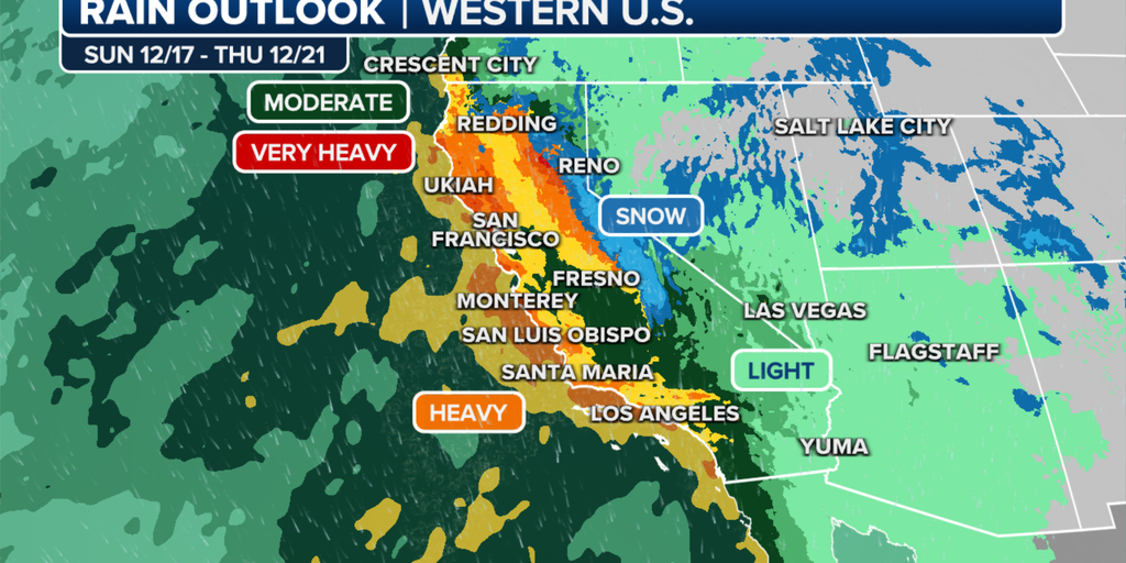
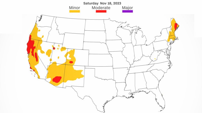
California is bracing for heavy rain and snow as multiple storm systems move through the region, with flooding and damaging winds expected. The storms will bring feet of snow to the mountains and heavy rainfall, with 26 million people under Flood Alerts and 16 million under Wind Alerts. Meanwhile, the northeast faced significant snowfall, with areas in New Jersey and Pennsylvania already having more than a foot of snow on the ground.
San Diego County is experiencing widespread rain from two storm systems, with the heaviest rainfall expected on Monday. As of Sunday morning, various areas in the county have received different levels of precipitation, with more details available on the National Weather Service website. Showers are expected to diminish by Tuesday, followed by a dry and warmer midweek to Friday.
Southern California is bracing for another round of rain and storm systems over the weekend and into the workweek, with one to three inches of rain projected for most communities and up to five inches in foothill and mountain areas. High surf and coastal flood advisories are in effect for coastal areas, and a Winter Weather Advisory is set for San Bernardino County mountain communities, with snow possible as low as 7,000 feet.
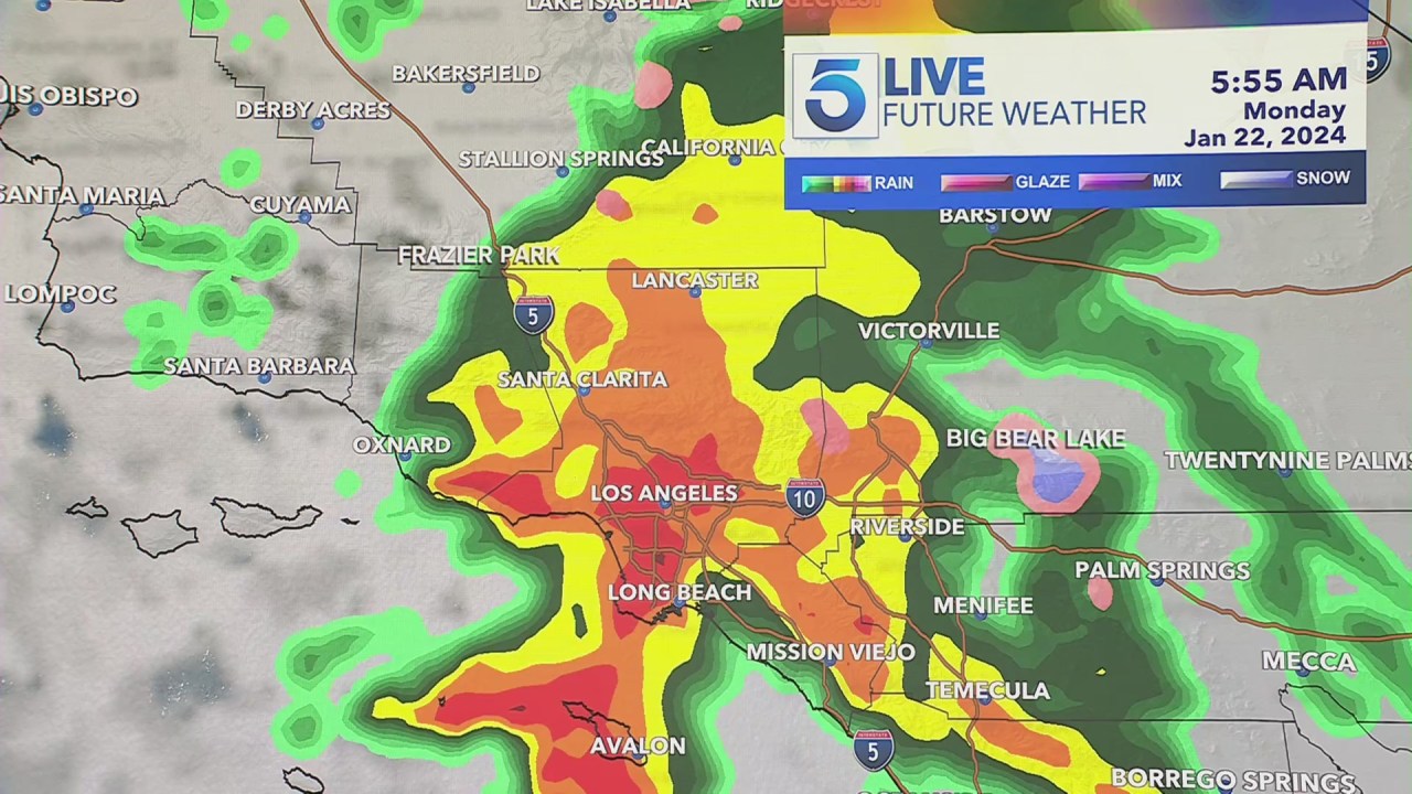
Two storm systems are expected to bring days of rain to Southern California this week, with the second system potentially causing flash flooding. The first storm will bring light rainfall on-and-off through late Tuesday, while the second system, arriving overnight Tuesday, could bring a damaging amount of water and last through late Friday. There are multiple scenarios for the rainfall, with the heaviest scenario involving up to six inches of rain and a 10-15% chance of flooding in some areas. Tuesday's forecast includes light rain in various regions, with temperatures ranging from 45 to 69 degrees Fahrenheit.
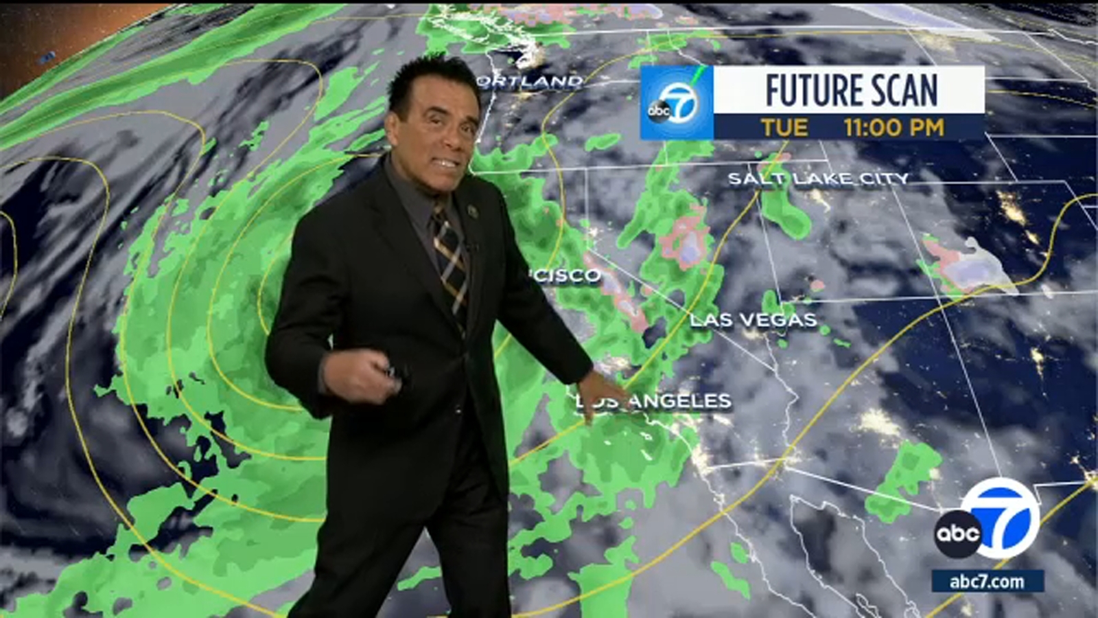
California is set to experience a week of showers and thunderstorms as two storm systems settle offshore, bringing the potential for flooding and travel challenges. The first storm system will approach the coast on Sunday, with showers expected across the northern 2/3rds of the California coast. Rainfall will increase on Monday, spreading south into Los Angeles and east into the Sierra Nevada, with the possibility of thunderstorms and localized flash flooding. A second storm system is expected later in the week, concentrating its rain on the southern half of the state, including Los Angeles and Southern California.
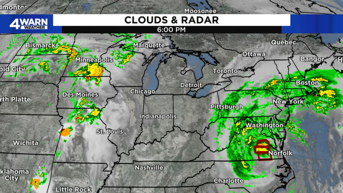
Multiple storm systems are expected to impact Thanksgiving travelers, with one system bringing rain and gusty winds to coastal New England and snow showers to the White and Green Mountains. Another system along the West Coast will stretch from Portland to San Diego, spreading rain into desert cities and causing wind advisories for over 6 million people. The system will then shift eastward, bringing rain and snow to the Mountain West and Central Plains. By Monday, the Gulf Coast could experience tornadoes, hail, and damaging winds. The eastern half of the country, including major airport cities, may face rain and thunderstorms on Tuesday, potentially causing delays and frustrations for travelers.
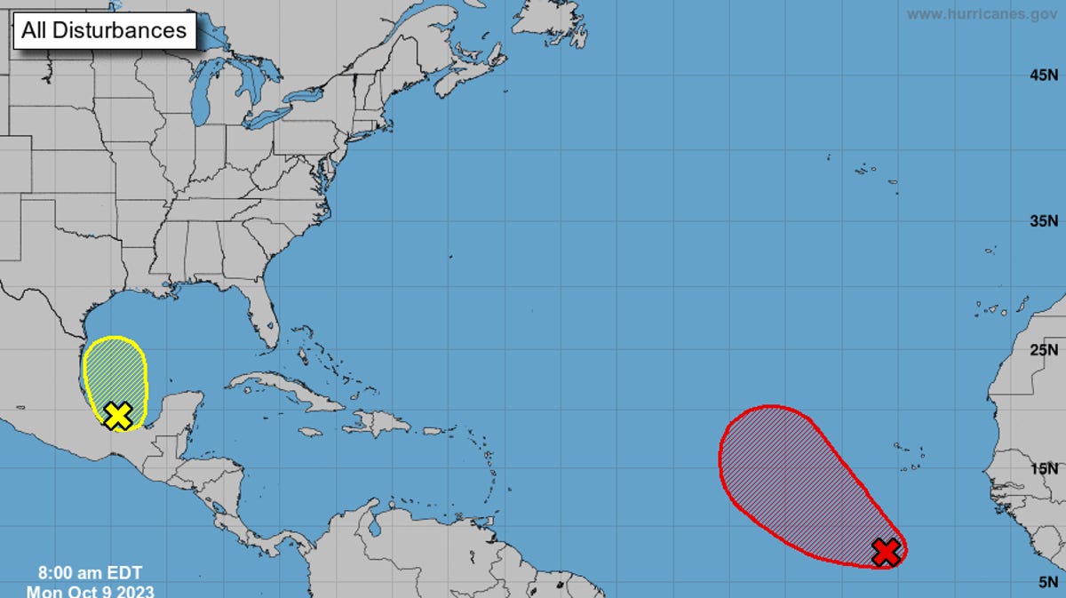
The National Hurricane Center is monitoring two storm systems, including Invest 92L in the eastern Atlantic, which is expected to strengthen into a tropical depression as it moves west-northwest. Another system in the southwestern Gulf of Mexico has a low chance of development but could bring clouds, rain, and rough surf to the northern Gulf coast and Florida. Residents are advised to stay updated and prepared for potential impacts.
Metro Detroit is enjoying pleasant fall weather with mostly clear skies and seasonable temperatures in the lower 70s. However, a storm system approaching from the Midwest will bring clouds and a chance of rain by Monday. Temperatures will cool down midweek with highs in the mid to upper 60s. Meanwhile, other parts of the country are experiencing severe weather, including damaging winds, hail, and tornadoes, as well as the impact of Tropical Storm Ophelia along the Eastern Seaboard.
Minnesota will experience slightly below normal temperatures this week with two storm systems bringing moisture. The first system will bring rain and snow showers late Tuesday, while the second system will bring rain and snow to southern Minnesota on Wednesday night. Temperatures will remain in the low 40s and 30s mostly, with northern Minnesota remaining in the 20s.