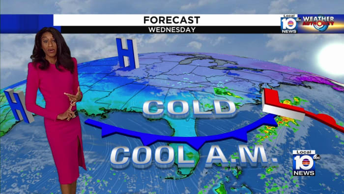
Gusty winds are expected for Halloween with clear, dry conditions and highs in the mid-50s to around 60 degrees, potentially causing some tree limbs to fall, especially north of Highway 50, but the weather will be slightly milder this weekend.
Scattered showers and storms are expected in Minnesota on Friday, with northern areas seeing more rain and southern areas experiencing some afternoon sunshine. The holiday weekend will feature a mix of clouds, sun, and spotty rain chances, with temperatures ranging from the 50s to low 70s. Saturday will be the sunniest day, while Sunday may see more scattered showers and cooler temperatures. Memorial Day will have isolated showers or thunderstorms, with seasonable temperatures in the 60s and low to mid-70s.
Temperatures in Metro Detroit are set to surge 15 to 20 degrees above normal, reaching the mid 70s on Sunday, following overnight rain. Monday will bring more sunshine with temperatures in the upper 60s to 70 degrees, while Tuesday and Wednesday may see rain and possible thunderstorms. The second half of the week will gradually cool, with highs in the lower to mid 60s on Thursday and lower to mid 50s on Friday and Saturday.
A cold storm is set to bring unseasonably low temperatures and snow to California, with a dramatic drop of 15 to 20 degrees expected from Wednesday's highs. The storm will also bring low-elevation snow, showers, and the potential for severe thunderstorms, with snow levels dropping significantly lower than most storms. Southern California areas could experience historic low temperatures, and the storm's cold nature is expected to increase atmospheric instability, potentially leading to hail, downpours, small tornadoes, and waterspouts. Travel difficulties and subfreezing temperatures are anticipated in various regions across the state.
New York City is set to experience up to four days of rain this week, with showers expected to begin on Monday and continue intermittently through Wednesday, accumulating about two inches in total. The National Weather Service forecasts that the sun may not come out until Thursday, with temperatures remaining in the 40s through Friday. This follows one of the rainiest Marches on record in the city, with over 9 inches of rain measured at Central Park last month.
A storm system continues to impact Minnesota with temperatures dropping below freezing and periods of snow expected throughout the day, particularly in eastern Minnesota where additional snowfall accumulations are anticipated. Gusty winds will persist, and temperatures will remain chilly into Wednesday and Thursday. However, there is hope for a gradual warm-up heading into the weekend, with highs returning to the 40s in southern Minnesota and 30s in the north, along with a couple of chances for rain and snow showers. The recent snow and rain have provided much-needed moisture, closing in on 1 to 2 inches of liquid equivalent precipitation from Duluth through the Twin Cities and Rochester, potentially alleviating previous precipitation deficits.
Another rainstorm is expected to hit Southern California this weekend, bringing cooler temperatures and beneficial rain. The storm, not as intense as February's, is forecasted to bring about a quarter inch of rain to lower elevations and up to 4 inches of snow in mountain regions. No major hazards are expected, with temperatures dropping into the low to mid-60s on Saturday and Sunday before warming back up early next week.
Denver and the mountains are expected to experience warm temperatures in the 40s and 50s this weekend, with some snowfall on Friday evening. The snow is forecasted to accumulate 2 inches in Denver, Fort Collins, and the foothills, while the mountains may see 2-5 inches. However, the warm temperatures should melt most of the snow in the Denver area, while the mountains will receive an additional 2-3 inches on Sunday.
The weather for Fat Tuesday is expected to be quiet, with temperatures near freezing in the morning and reaching the upper 40s in the afternoon, while some passing flurries are possible on Valentine's Day. A mid-day front on Thursday will bring later morning/lunchtime showers, followed by colder air arriving Thursday night into Friday. Another chance for snow is expected Friday night into Saturday, with much colder air possibly following behind the storm center.
Central Florida is experiencing cooler temperatures following a cold front, with highs reaching 70 degrees and morning temperatures dropping into the mid-40s north of the I-4 corridor. A gradual warmup is expected later in the week, but rain chances will increase over the weekend, leading to cooler temperatures in the upper 60s to low 70s.
Michigan is set to experience record warmth over the next few days, with both high and low temperature records expected to be broken. Some cities may see temperatures up to 18 degrees warmer than normal, and the warm spell is expected to be widespread across the state. This unusual warm-up is a rare occurrence and is predicted to break records set over the past 125 years.
Denver experienced a record-setting weekend storm with deep snow totals, but a mild break is expected before another weekend storm brings more snow. Tonight will be cold with patchy fog, while Monday will be mild with melting snow and highs in the 40s and 50s. Rain showers are expected on Wednesday, followed by the possibility of accumulating snow and chilly temperatures next weekend.
A dry cold front is approaching South Florida, bringing lows in the mid-50s and dominating the nights this week. Temperatures are expected to warm up to the 60s and 70s during the day, with mostly clear skies as the cold front passes on Wednesday and Thursday. Another system will increase the chance of rain over the weekend, with temperatures remaining in the 50s to 70s-degree range through Friday.
The Phoenix Valley will experience unseasonably warm temperatures through Wednesday before a storm system brings rain and cooler temperatures late Thursday into Friday, with the potential for 0.05 to 0.75 inches of rainfall. The National Weather Service anticipates lingering showers into Saturday and a significant cooldown for the weekend, with high temperatures in the low 60s. There's also a possibility of additional weather systems next week. Phoenix has received 0.73 inches of rain so far in January, just short of the normal total, and is expected to end the month at that mark.
A cold front has arrived in South Florida, bringing temperatures and wind chill values below normal, with forecast highs only reaching the upper 60s and breezy northerly winds making it feel cooler. Monday night to Tuesday morning is expected to be even colder, with wind chills in the mid-upper 40s for eastern South Florida. Winds will gradually decrease by Wednesday, and morning lows will stay in the 50s for the rest of the week.