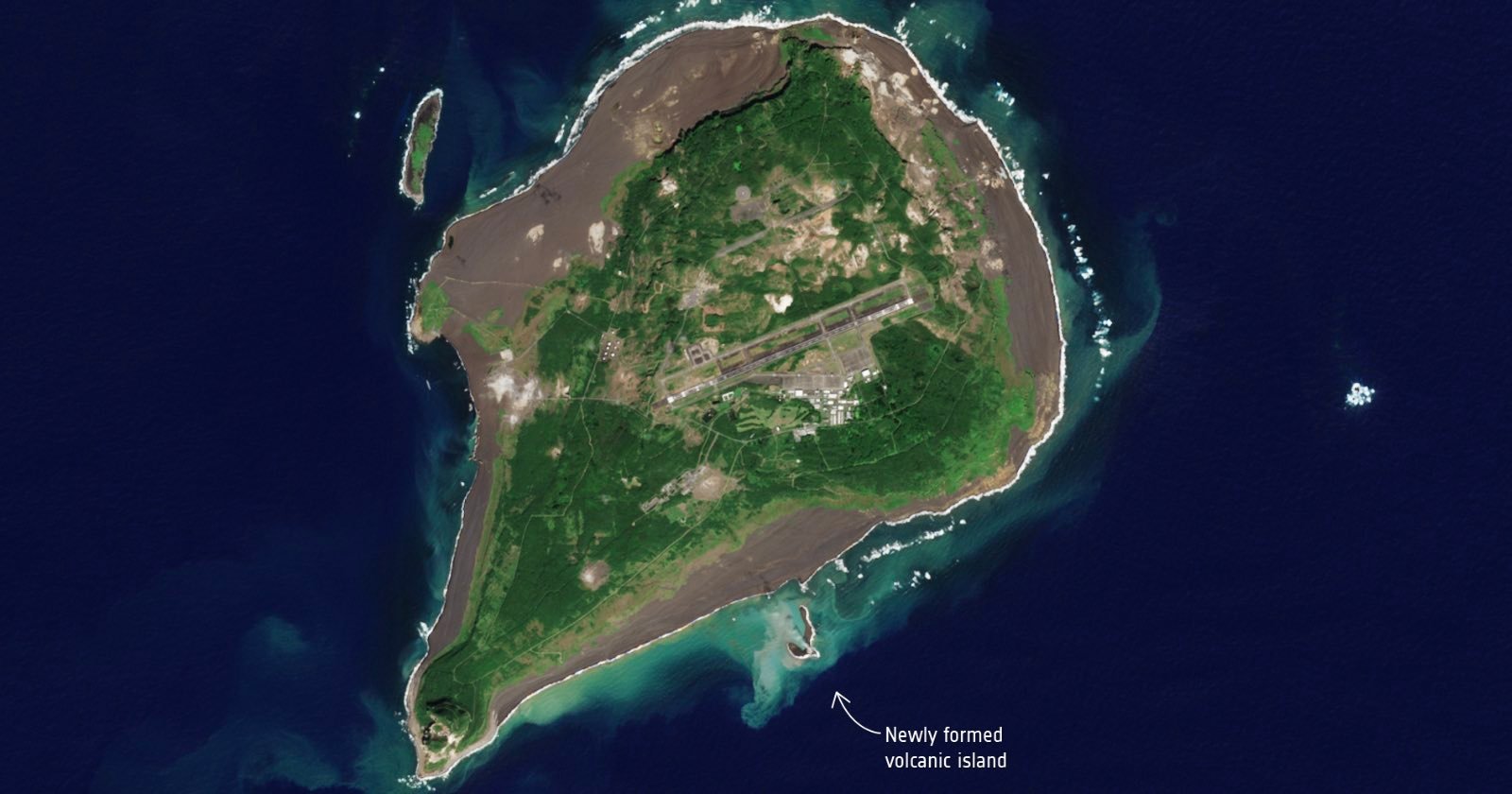
Satellite photos taken by the European Space Agency reveal the growth of Niijima, the Earth's newest volcanic island off the coast of Iwo Jima, Japan. The island has almost doubled in size since its emergence in October, indicating ongoing volcanic activity. The island was formed from an underwater eruption and is the first major island created in Japan since 2013.
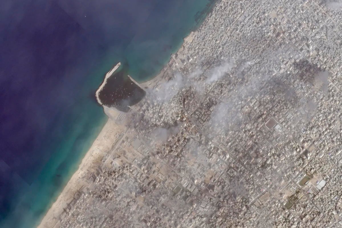
Satellite photos analyzed by the Associated Press (AP) reveal that Israeli tanks and armored vehicles advanced further into the Gaza Strip last week, as part of an offensive against Hamas militants. The images show Israeli forces positioned just south of Gaza City's marina, with vehicles on the beach and deep impact craters from missile fire. Plumes of smoke were also seen around Gaza City, including near the main hospital, Shifa. The Israeli military did not immediately comment on the satellite photos. The war has resulted in thousands of casualties, with Israel accusing hospitals of providing cover for Hamas militants, while staff members deny the allegations.
Satellite photos of Greenland's ice sheet reveal significant melt, with up to 50% of the surface ice melting on several days in July. The melting is attributed to plumes of warmer air blowing across Greenland, which have been measured at higher temperatures than average. The melting of Greenland's ice sheet has contributed to a 0.4-inch rise in global sea levels since the 1990s. If the ice sheet were to disappear entirely, it would cause a 23-foot rise in sea levels. The loss of the ice sheet not only contributes to sea level rise but also accelerates global warming. Scientists have explored methods like putting sulfur into the stratosphere to reduce solar radiation, but reducing planet-warming pollution, restoring ecosystems, shifting to sustainable food systems, and removing carbon from the atmosphere are crucial in addressing climate change.
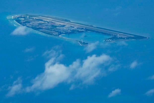
China is reportedly constructing an airstrip on Triton island in the disputed South China Sea, which is also claimed by Vietnam and Taiwan. Satellite photos analyzed by the Associated Press show the construction, although it appears to be more modest in scale compared to other Chinese-built islands in the region. The runway is currently laid out to accommodate turboprop aircraft and drones, but not fighter jets or bombers. China claims sovereignty over the entire South China Sea, defying an international ruling that invalidated its assertion. The construction work on Triton island is seen as another step in China's efforts to assert control over the disputed waters.
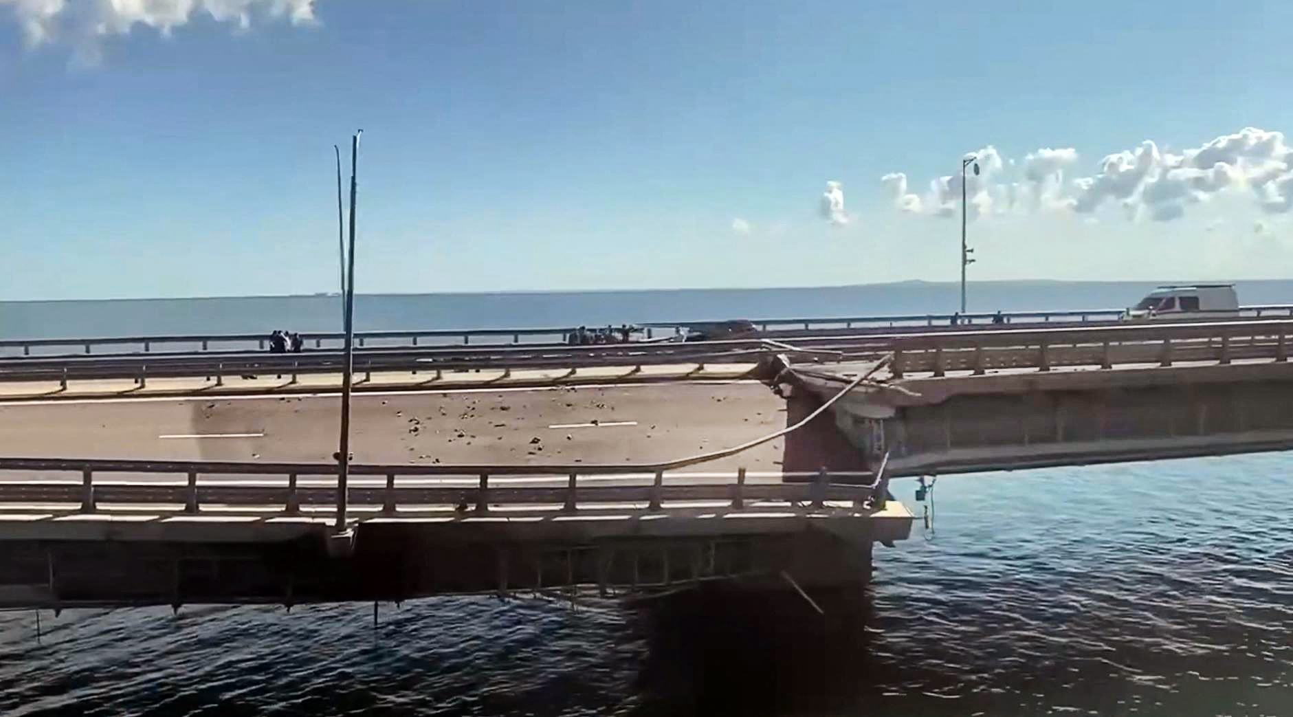
Satellite photos obtained by Newsweek reveal that a second strike by Ukraine on the Kerch Strait Bridge in Crimea damaged its crucial railway, contradicting Russian claims that only the roadway was affected. The bridge, which is a key supply route for Russia's forces and its sole land link with Crimea, was previously damaged in an explosion in October 2022. The recent damage to the railway section could hinder the Russian military's ability to transport heavy equipment and have strategic implications for their presence in the region. Ukraine has claimed responsibility for both strikes on the bridge.
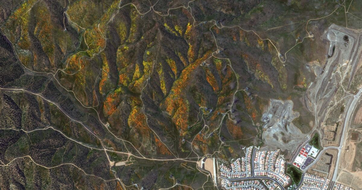
Satellite photos from Maxar show the stunning California superbloom, with hillsides adorned with colorful flowers visible from space. However, conservationists are concerned about the impact of tourism on the fragile flowers. While celebrating the phenomenon, they urge visitors to be more strategic and thoughtful about where they go to avoid trampling and ruining the blooms.
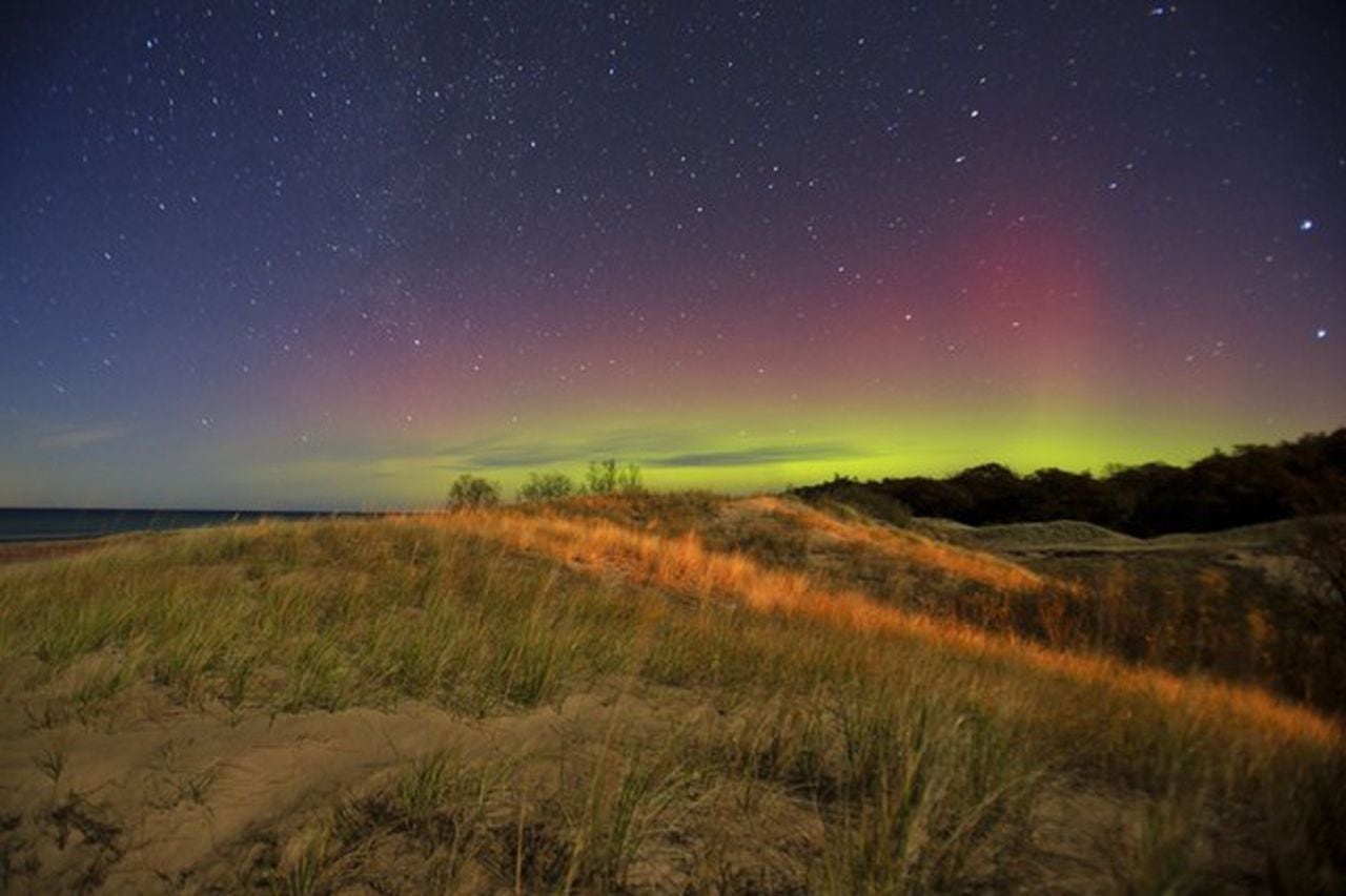
Satellite photos captured the Northern Lights flowing in a "ribbon candy pattern" over the Great Lakes, with the waning gibbous moon illuminating cloud tops below. The Aurora Borealis is typically visible closer to Earth's poles, but last month it was visible as far south as Virginia and Arizona. The bright, wavy lights are collisions between electrically charged particles from the sun and the earth's atmosphere.
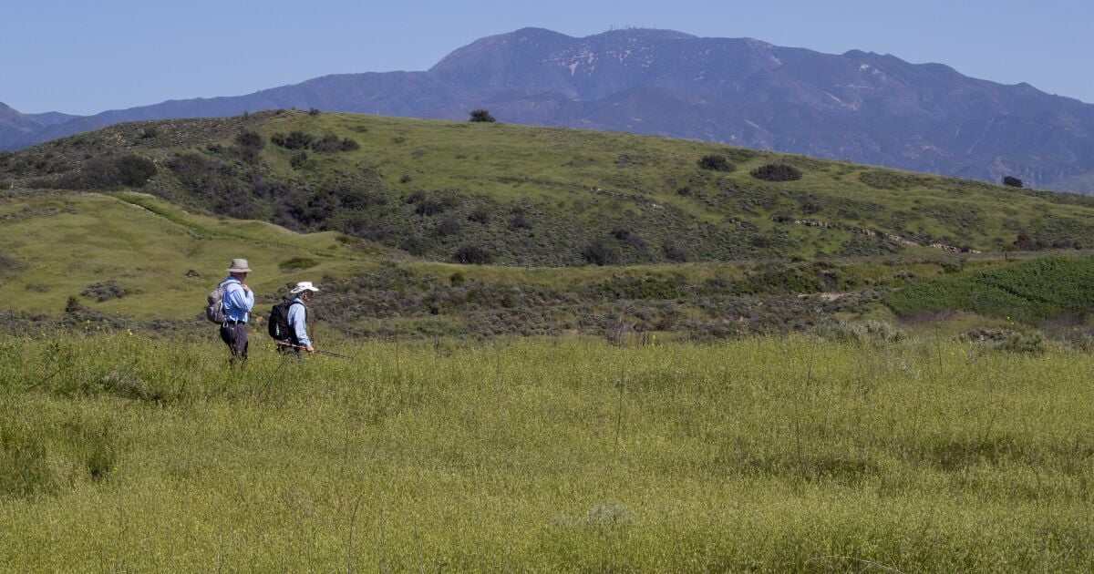
Satellite photos show a major transformation in California's landscape from parched browns to lush greens and snow-covered mountains due to an incredibly wet winter. Gov. Gavin Newsom rolled back drought restrictions as nearly two-thirds of the state was no longer in drought as of March 21. The state's ability to move from very wet to very dry and back to very wet is unique across the western U.S.