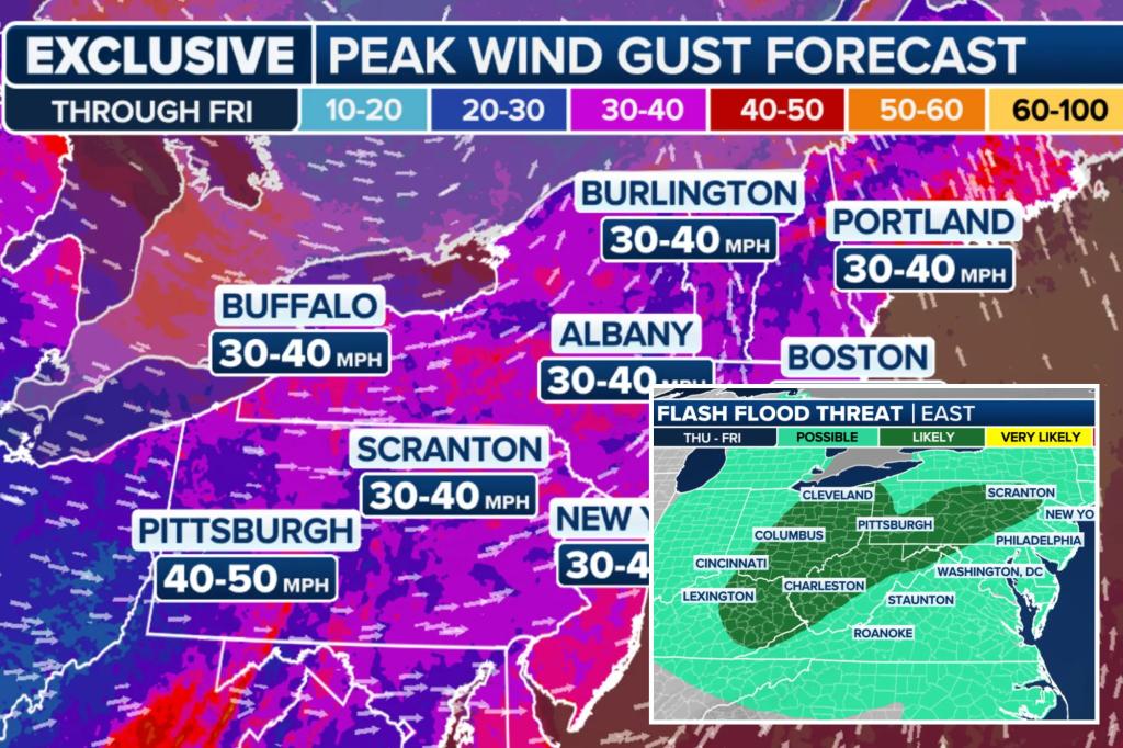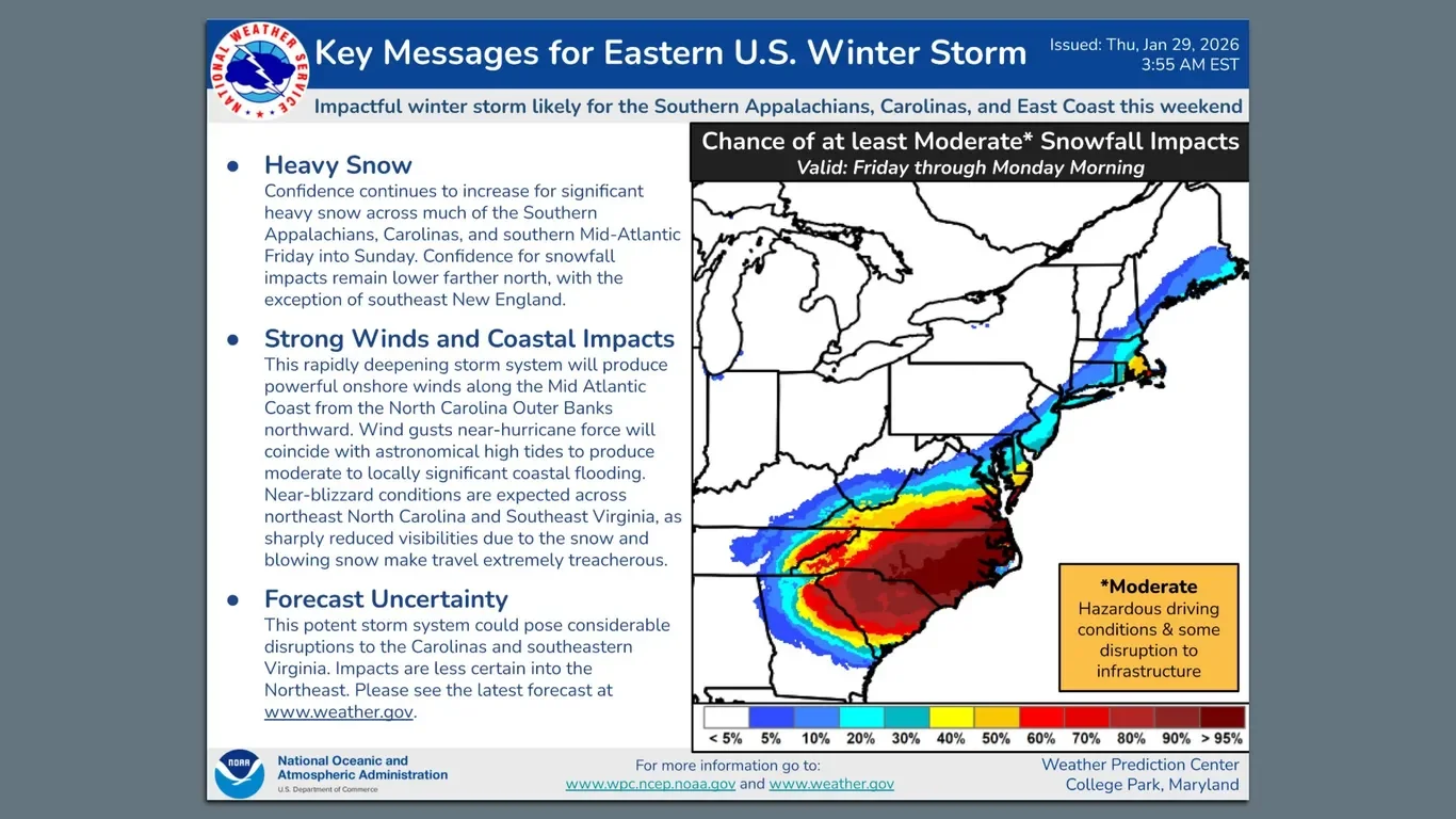
East Coast Weekend Storm: Snow Totals Uncertain as Forecasts Shift
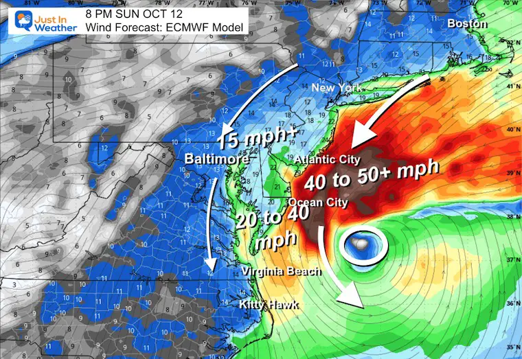
A rapidly deepening winter storm threatens the Southeast to Northeast this weekend, delivering heavy snow inland and along the North Carolina coast, plus onshore winds with near-hurricane gusts and coastal flooding. About 22.5 million people are under winter-storm watches; Raleigh could see around 8 inches, Richmond 1–8 inches, and impacts could affect major cities like Washington, Philadelphia, New York, and Boston, though forecast totals vary widely and may shift as the storm tracks near or off the coast.