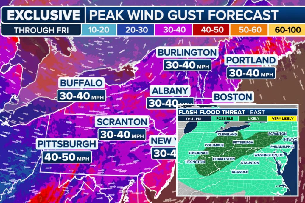
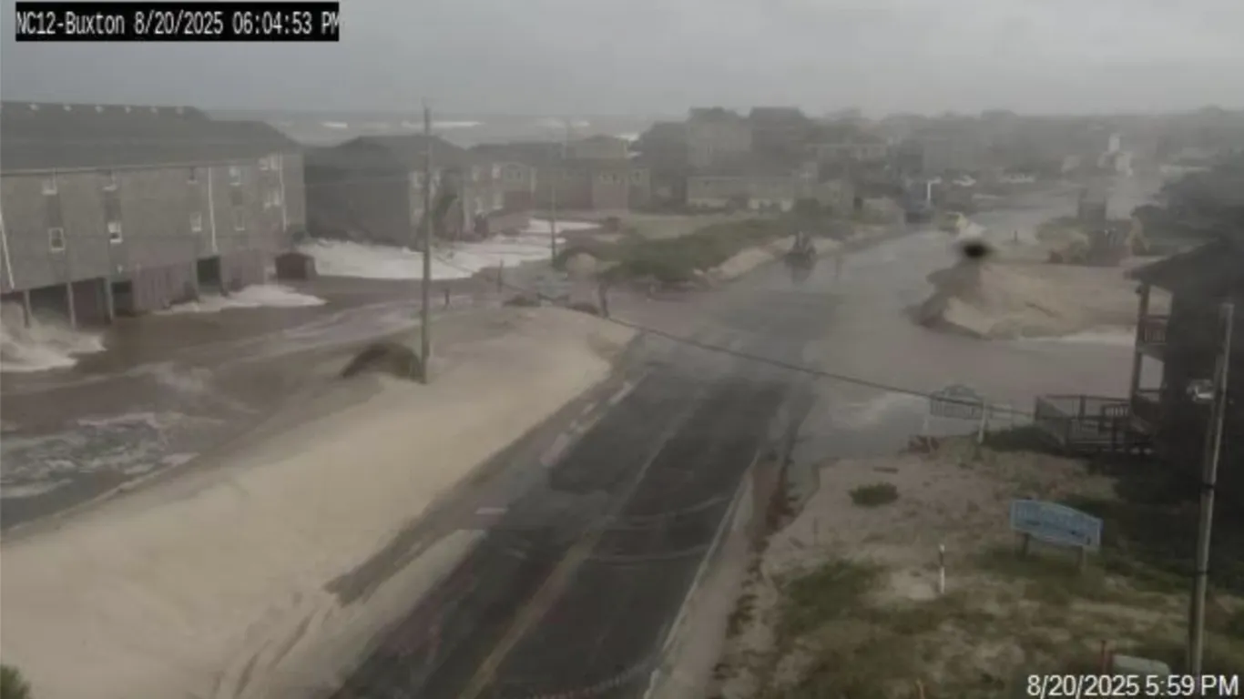
Hurricane Erin, a large Category 2 storm, is impacting the U.S. East Coast, especially North Carolina, with high surf, storm surge warnings, and beach closures, as nearly 40 million people are under coastal flood alerts. The storm's size and intensity, influenced by climate change, pose significant risks of flooding, dangerous surf, and rip currents, with the Outer Banks experiencing potential 2-4 feet of inundation. While not forecasted to make landfall, Erin's outer bands are causing deteriorating conditions and widespread warnings across the region.
A powerful storm system is expected to bring heavy rain and the threat of flooding to the Northeast and mid-Atlantic regions, with 1-2 inches of rain forecasted for areas from the mid-Mississippi Valley to the Great Lakes. The ground is already saturated from relentless rain earlier in the year, increasing the risk of flash flooding. Coastal flood alerts have been issued along the East Coast, with onshore winds and higher tides threatening communities along the shore. Additionally, the risk of flooding due to rain and snowmelt continues in northern New England, Ohio, and Indiana.
Tropical Storm Ophelia, now a post-tropical cyclone, is weakening as it moves up the East Coast, bringing heavy rain and coastal flood alerts from North Carolina to New Jersey. Areas from eastern Pennsylvania to just south of Long Island could experience heavy rainfall and scattered instances of flash flooding. New York City issued a travel advisory, and residents in flood-prone areas were told to prepare for potential evacuation. Ophelia made landfall in North Carolina, causing power outages, flooding, and rescues. The storm is expected to continue weakening and dissipate by Monday.