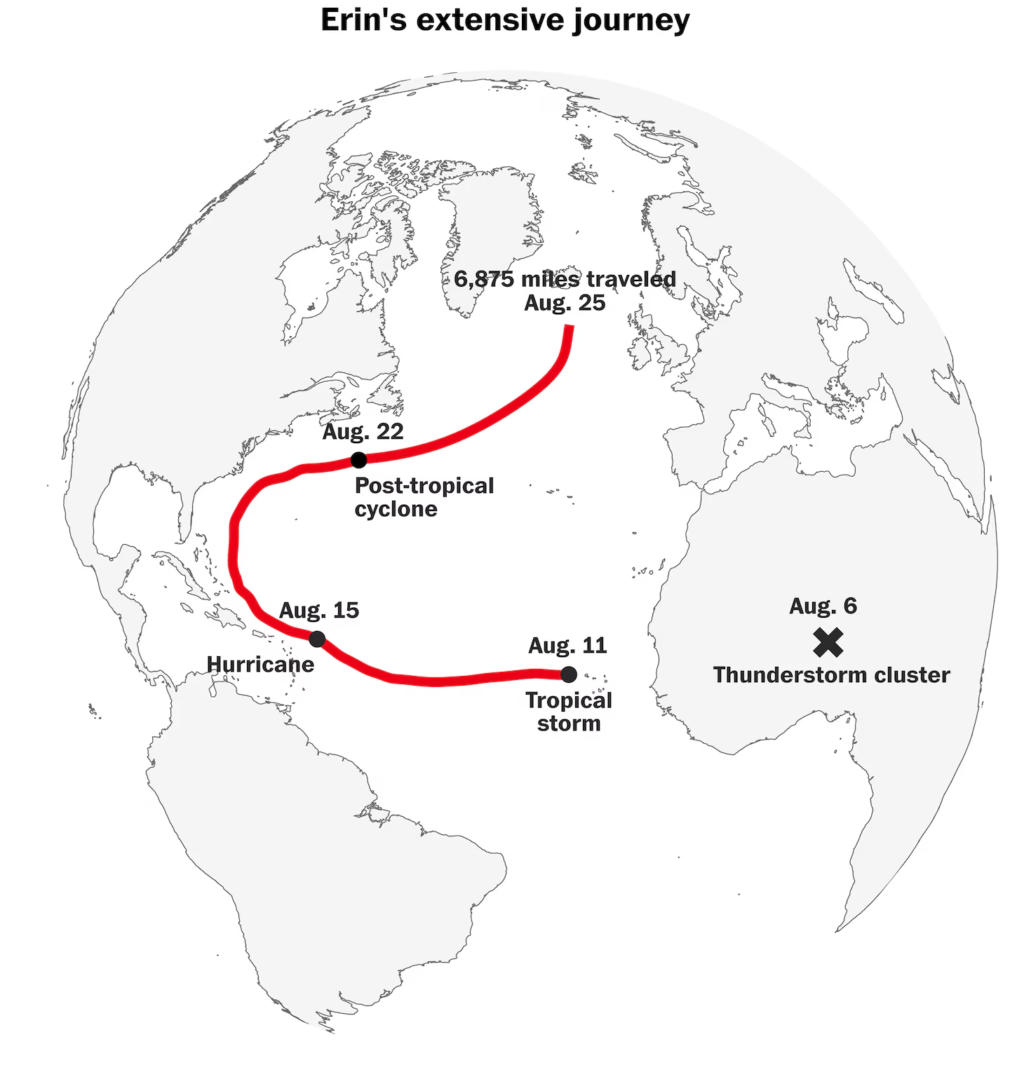
Hurricane Erin was one of the largest hurricanes to come close to or make landfall on the U.S. East Coast, comparable only to Hurricane Sandy in 2012, based on an analysis of storm wind diameters since 1964.
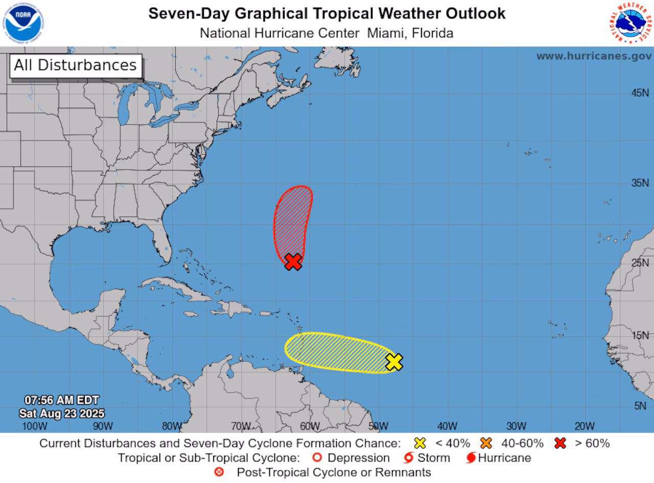
A new tropical storm, potentially named Fernand, may develop in the Atlantic and head towards Bermuda over the weekend, while Hurricane Erin has become a non-tropical system and poses no threat to the US. Another disturbance near the Windward Islands could bring heavy rain but is unlikely to develop further.
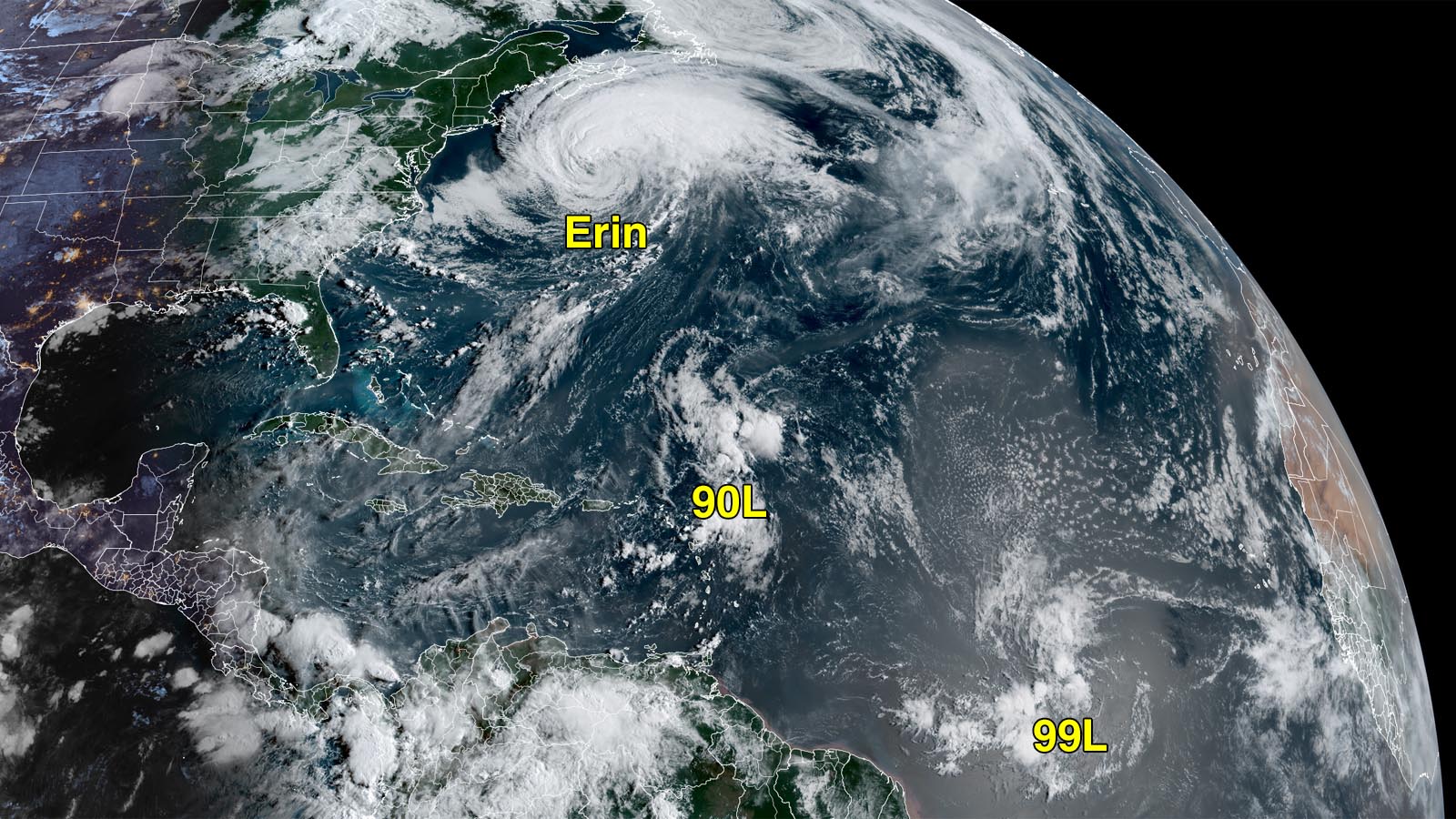
Hurricane Erin, a large Category 1 storm, is moving northeast in the Atlantic, causing rip currents and coastal flooding along the U.S. East Coast, Bermuda, and Atlantic Canada, while transitioning into a post-tropical cyclone. New systems, including Invest 90L and 99L, are developing in the Atlantic, with 90L likely to become a tropical storm and potentially impact Bermuda.
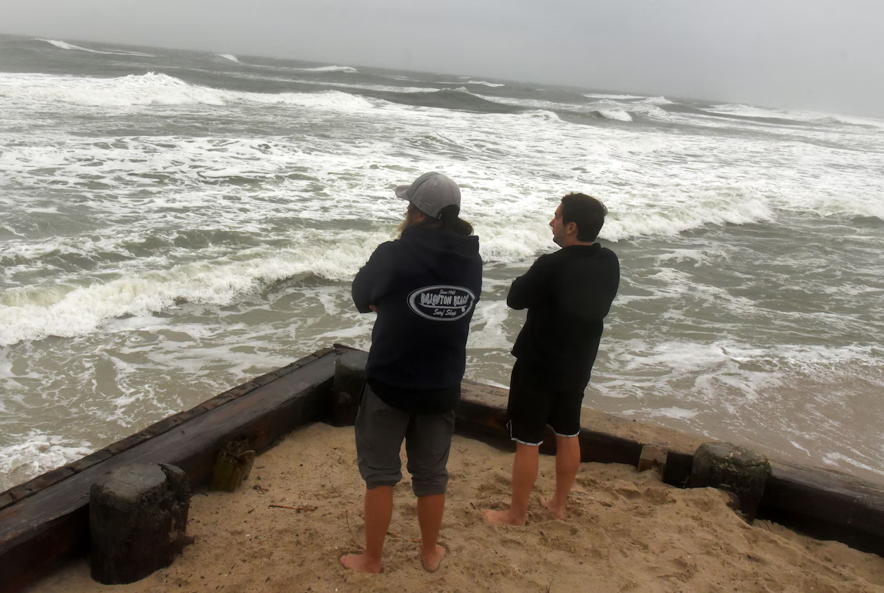
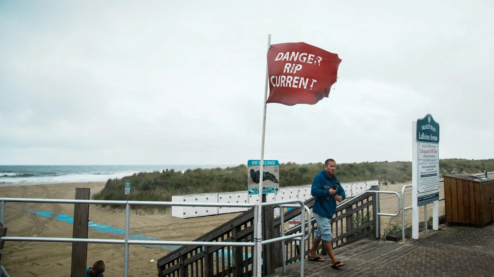
Hurricane Erin is causing significant flooding and high waves along the New Jersey coast, leading to evacuations in Egg Harbor Township and closures in other shore towns, with coastal flood warnings and advisories in effect as the storm moves northward, bringing dangerous surf conditions and rip currents.
Hurricane Erin caused significant flooding, water rescues, and evacuations along the New Jersey coast, particularly in Atlantic City and Ocean City, with ongoing flood threats expected into Saturday due to storm waves and the influence of the new moon, though the region is expected to clear up with improved weather over the weekend.
Hurricane Erin, a Category 2 storm, is heading out to sea without expected landfall but has garnered significant public attention and concern, highlighting the ongoing anxiety and preparedness efforts during hurricane season amid evolving climate impacts.
Governor Murphy declared a state of emergency in New Jersey due to Hurricane Erin, which is causing dangerous rip currents, high surf, and potential coastal flooding across the state, leading to beach closures and safety warnings.
Hurricane Erin has moved away from the U.S. coast, but significant coastal flooding is expected along the Mid-Atlantic during Thursday night’s high tide, with storm surge causing major flooding and damaging waves, especially in North Carolina and New Jersey. Erin is weakening and heading out to sea, while other tropical systems, including 90L near the Leeward Islands and 99L in the eastern Atlantic, are being monitored for potential development.
Hurricane Erin, a Category 2 storm, has moved away from the U.S. coast but continues to cause dangerous waves, storm surges, and flooding along the Atlantic coast, especially in North Carolina and the mid-Atlantic region, with warnings of significant impacts and potential for further development of nearby storms.
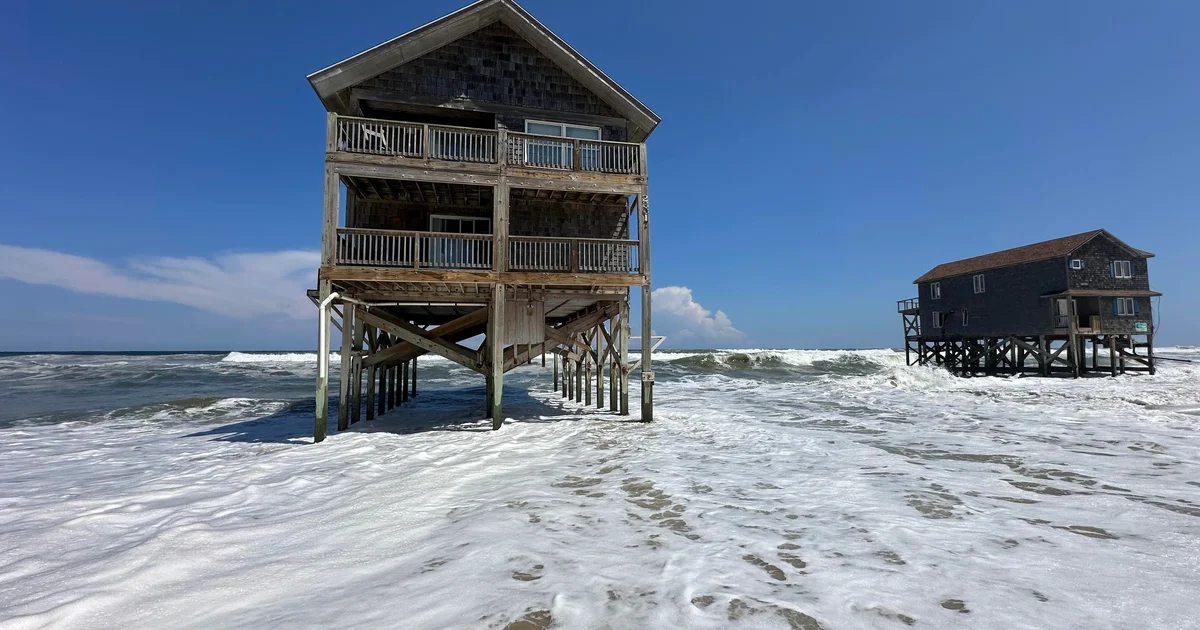
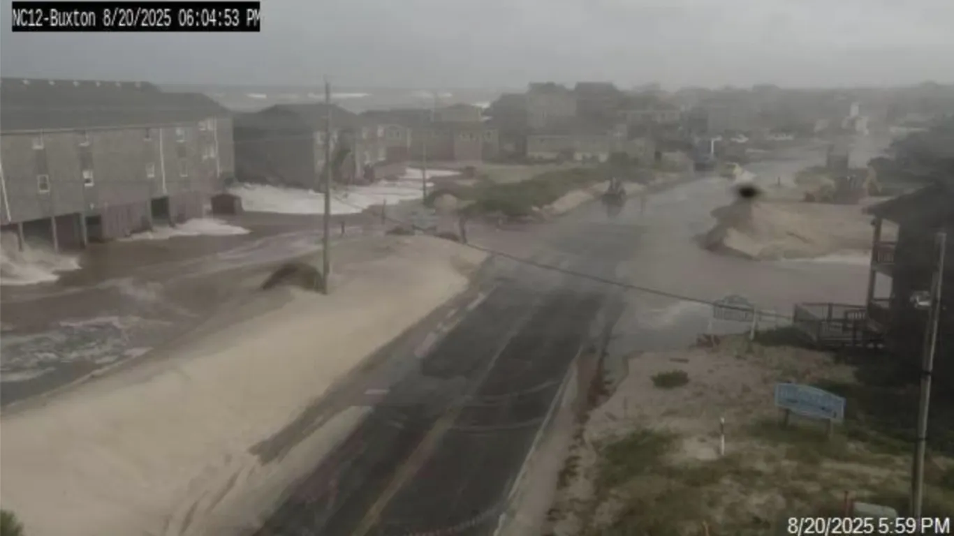
Hurricane Erin caused high waves and strong winds along the U.S. East Coast, particularly impacting North Carolina's Outer Banks where homes are at risk of collapse due to ongoing erosion and storm surges, with some structures teetering on the brink of falling into the ocean.
Hurricane Erin, a Category 2 storm, has moved away from North Carolina's Outer Banks after causing significant damage with high winds, storm surge, and flooding. Coastal areas along the East Coast remain under threat from hazardous conditions, including rip currents, high surf, and flooding, with authorities advising caution and evacuations in affected regions.
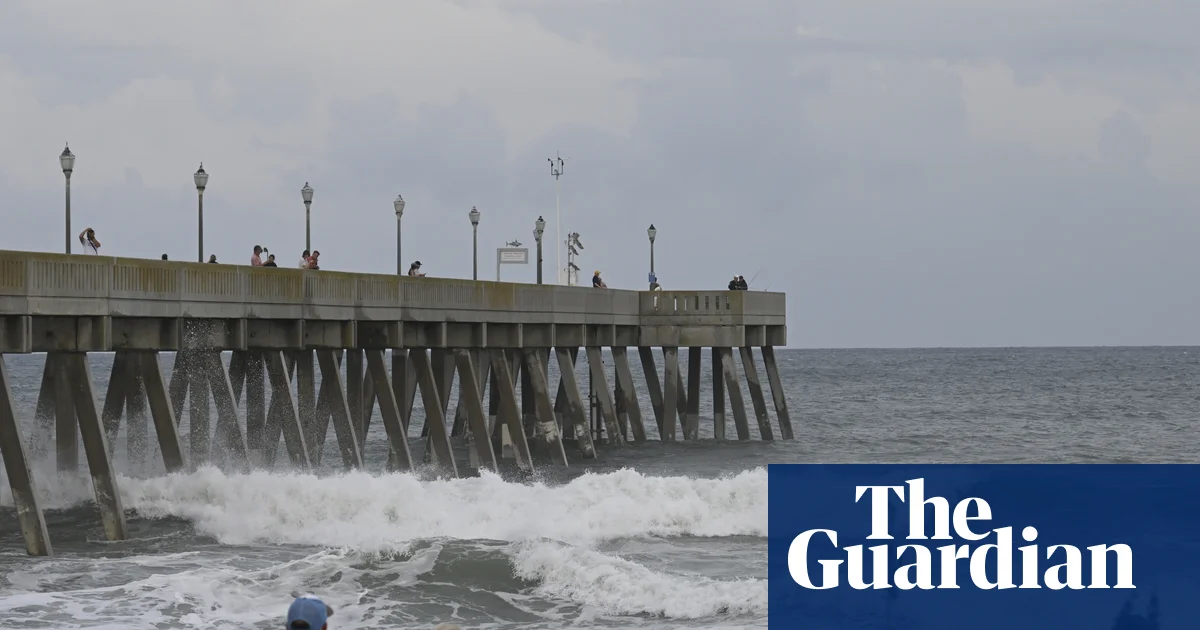
Hurricane Erin is causing dangerous surf conditions, high waves, and rip currents along the US East Coast, particularly affecting North Carolina and Virginia, with warnings of potential flooding and road closures, although it has not yet made landfall.
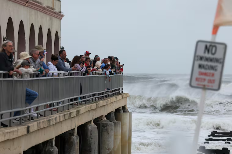
Hurricane Erin, a large Category 2 storm, is impacting the U.S. East Coast, especially North Carolina, with high surf, storm surge warnings, and beach closures, as nearly 40 million people are under coastal flood alerts. The storm's size and intensity, influenced by climate change, pose significant risks of flooding, dangerous surf, and rip currents, with the Outer Banks experiencing potential 2-4 feet of inundation. While not forecasted to make landfall, Erin's outer bands are causing deteriorating conditions and widespread warnings across the region.
A couple of showers are expected tonight in the DC area, with Hurricane Erin passing offshore bringing breezy conditions tomorrow. The weather will improve Friday and Saturday with sunshine and low humidity, but chances of showers and storms return Sunday. A significant cooldown with below-normal temperatures and low humidity is forecast for the upcoming weeks, influenced by high pressure systems over Canada and Greenland. Coastal areas from Virginia to New Jersey will experience dangerous surf, rip currents, and coastal flooding due to Hurricane Erin, which, despite being offshore, poses a serious threat to the East Coast.
Hurricane Erin is intensifying with 110 mph winds and is expected to pass east of North Carolina, causing storm surge, coastal flooding, and large waves, before weakening and becoming extratropical as it recedes out to sea. Two tropical waves are also being monitored for potential development.