Home Reef Expands Amid Ongoing Eruptions, Growing Island in Tonga
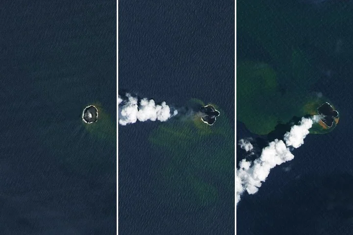
NASA’s Earth Observatory reports that Home Reef, a mid-ocean volcano near Tonga, continued erupting from December 2025 into February 2026, expanding its land area by about 8 hectares as lava flows extended the island; satellite data from Landsat 8/9, MODIS, and VIIRS tracked growth and gas plumes, while authorities say the current activity poses low risk to nearby populations.