Revolutionary Satellite Technology Maps Ocean Floors Remotely
TL;DR Summary
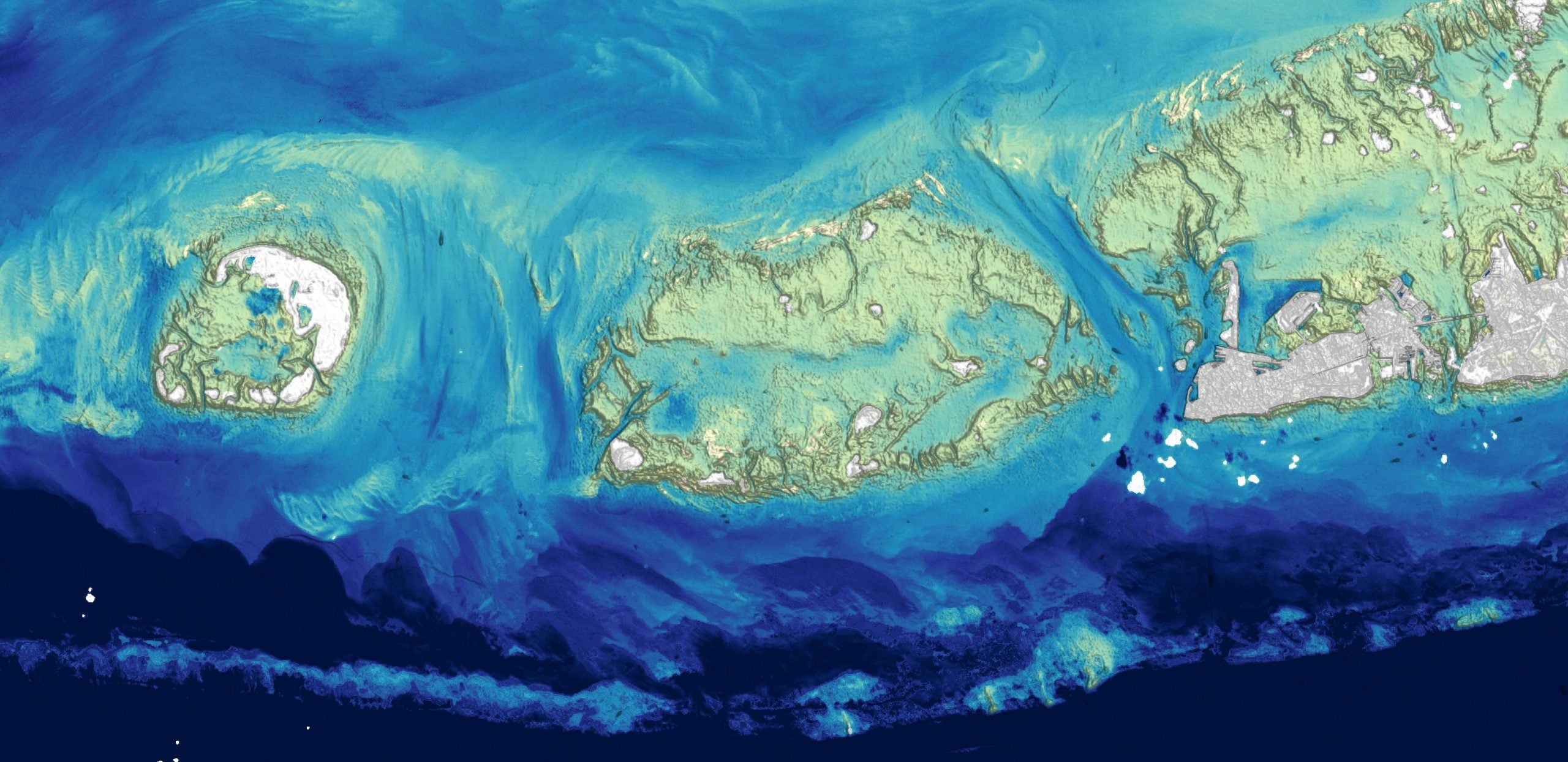
Researchers at the U.S. Geological Survey have developed a new method to map ocean depths in shallow coastal waters using Landsat satellite data. This approach uses a physics-based algorithm to derive bathymetry from visible-light observations, overcoming traditional challenges of sonar and lidar mapping. The method, which can map depths greater than 20 meters in clear water, is particularly useful for tracking coastal changes and studying coral reef health. This satellite-based technique offers a more efficient and practical solution for seafloor mapping, contributing to initiatives like the National Ocean Mapping and Seabed 2030 projects.
Reading Insights
Total Reads
0
Unique Readers
1
Time Saved
5 min
vs 6 min read
Condensed
91%
1,013 → 93 words
Want the full story? Read the original article
Read on SciTechDaily