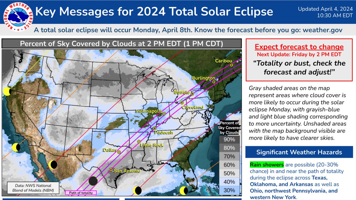
"Indiana Eclipse Weather and Safety Update: Cloud Cover, Glasses, and Travel Tips"
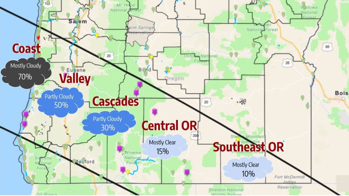
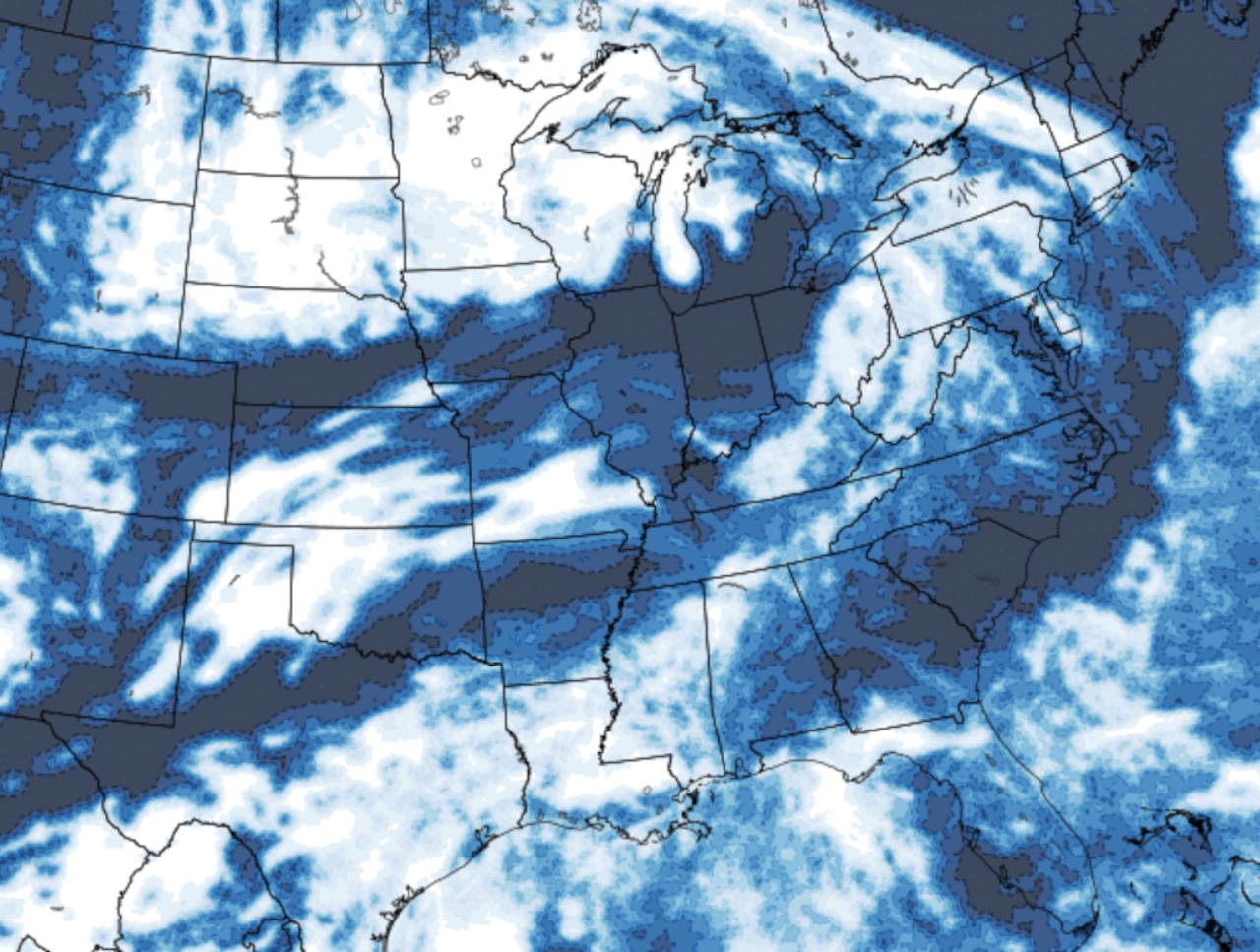
New high-resolution weather models show decreasing cloud cover along the path of the upcoming solar eclipse, particularly in Ohio, Indiana, Illinois, Missouri, Arkansas, and Texas, with the Northeast expecting clear skies. The updated forecast provides more options for viewing locations, offering encouraging news for eclipse enthusiasts.