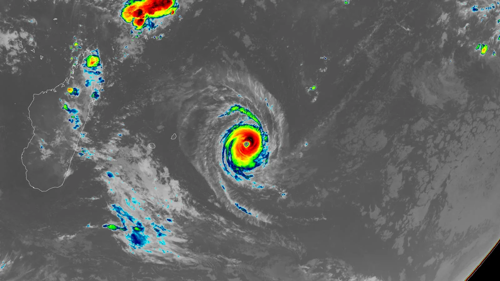
Tropical Cyclone Tino is approaching the Philippines, potentially becoming a typhoon and marking the 20th cyclone this year, prompting evacuations and preparations. Meanwhile, Queensland experienced a severe supercell with large hail, damaging property and causing injuries, with more stormy weather forecasted across Australia.
Hurricane Humberto, the eighth storm of the 2025 Atlantic season, has strengthened to a Category 4 but is not expected to impact South Florida directly; it is currently moving northwest and is projected to head towards the Carolinas, with potential indirect marine hazards for South Florida.
Hurricane Humberto has formed in the Atlantic and is expected to strengthen into a major hurricane, while Gabrielle has moved away from the Azores, with potential impacts on southeastern US coasts and Portugal. A tropical wave near Hispaniola may develop into a storm threatening the US early next week, and Hurricane Narda in the Pacific remains a Category 1 storm.
The National Hurricane Center has introduced a prototype five-day hurricane forecast cone, nicknamed the "cone of terror", to better convey the hazards of a tropical cyclone. This new version includes color-coded wind watches and warnings that extend inland, aiming to provide a truer depiction of the wind threat and a better understanding of the risks associated with hurricanes. The current iteration of the cone will continue to be used during testing of the new version, and the prototype cone also has its limitations, as it does not show watches and warnings for flooding rains.
A tropical cyclone named Anggrek is strengthening over the Indian Ocean, not expected to make landfall; western US and Canada are set to experience heavy rain from atmospheric rivers, potentially causing flooding; Spain experienced a heatwave with temperatures close to 30C, about 10C above average for January; Canada and northern US are expected to see above average temperatures after suffering from bitterly cold temperatures in January.
Massive floods caused by a tropical cyclone and record rainfall have inundated Australia's northeastern coast, stranding hundreds of people and prompting crocodile warnings. The heavy rain, which surpassed 60 inches in some areas, has caused widespread rescues and threatened drinking water supplies. The rainfall may have set all-time records in Australia for its intensity and duration. Recovery efforts are underway, but additional heavy rainfall is projected, which could worsen the flooding.
Torrential rainfall and flooding caused by a tropical cyclone have left a key tourism area in Australia's far north in a state of emergency. The city of Cairns, a major tourist destination and gateway to the Great Barrier Reef, has been severely affected, with the airport closed and some aircraft underwater. River levels have reached over 10 meters (33 feet) high in some areas, and drinkable water is expected to run out soon. Nine people, including a sick child, are stranded on the roof of a clinic in an Aboriginal community. The flooding is expected to have a billion-dollar impact on the state's property sector and general economy.
Natural gas futures rallied as traders anticipated increased demand due to a strengthening outlook for September heat. However, the potential impact of tropical cyclone Idalia threatens to temper this demand. Both the European and American models indicate hotter trends for next week, leading to an increase in cooling degree days. Additionally, estimates for this week's Energy Information Administration storage report have declined following a surprising 18 Bcf injection, which exceeded expectations.