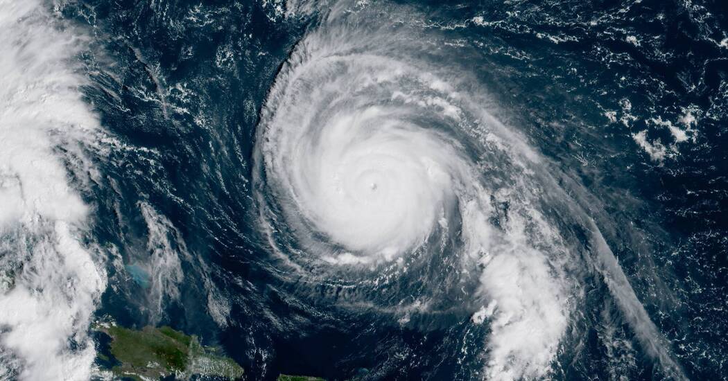
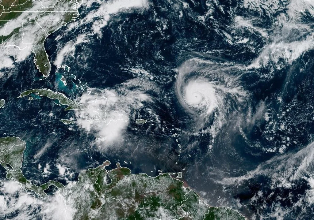
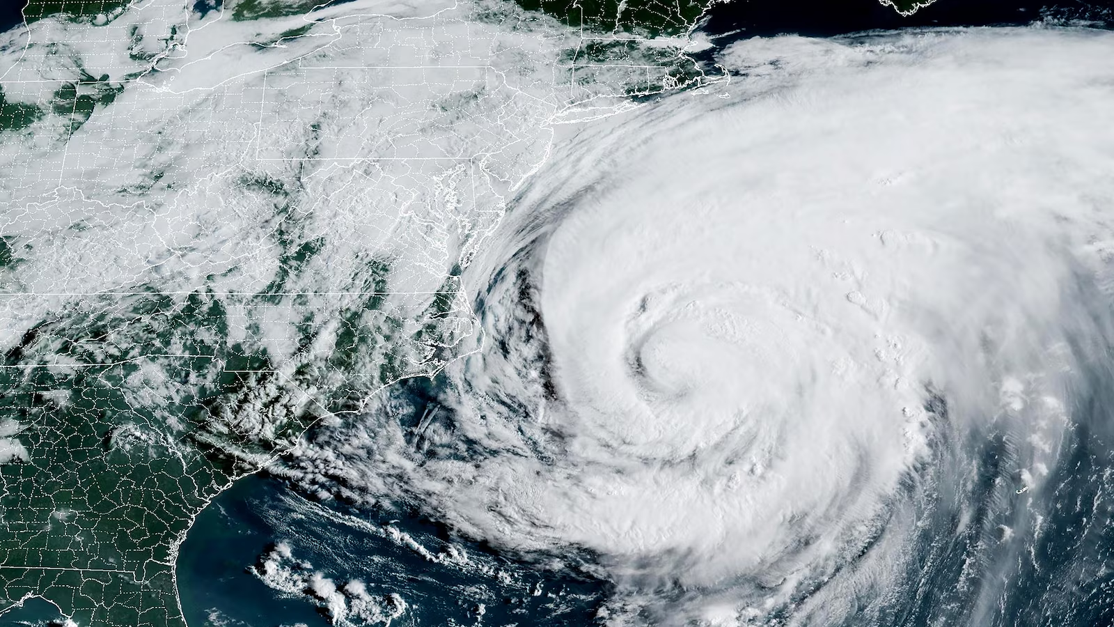
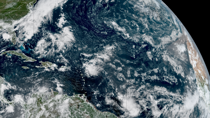
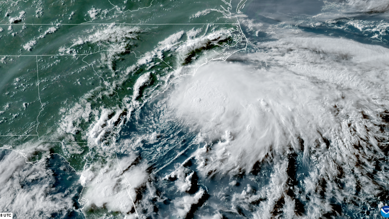
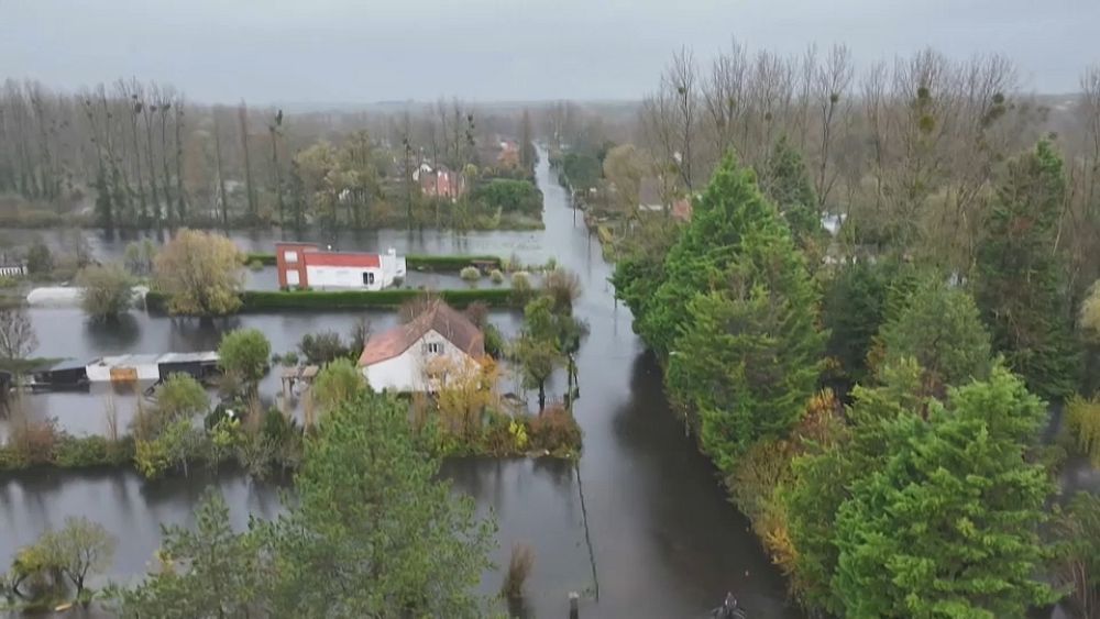
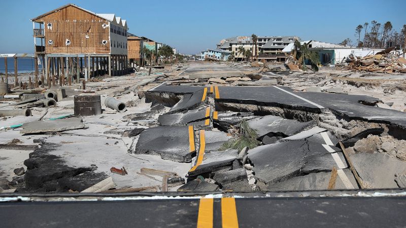
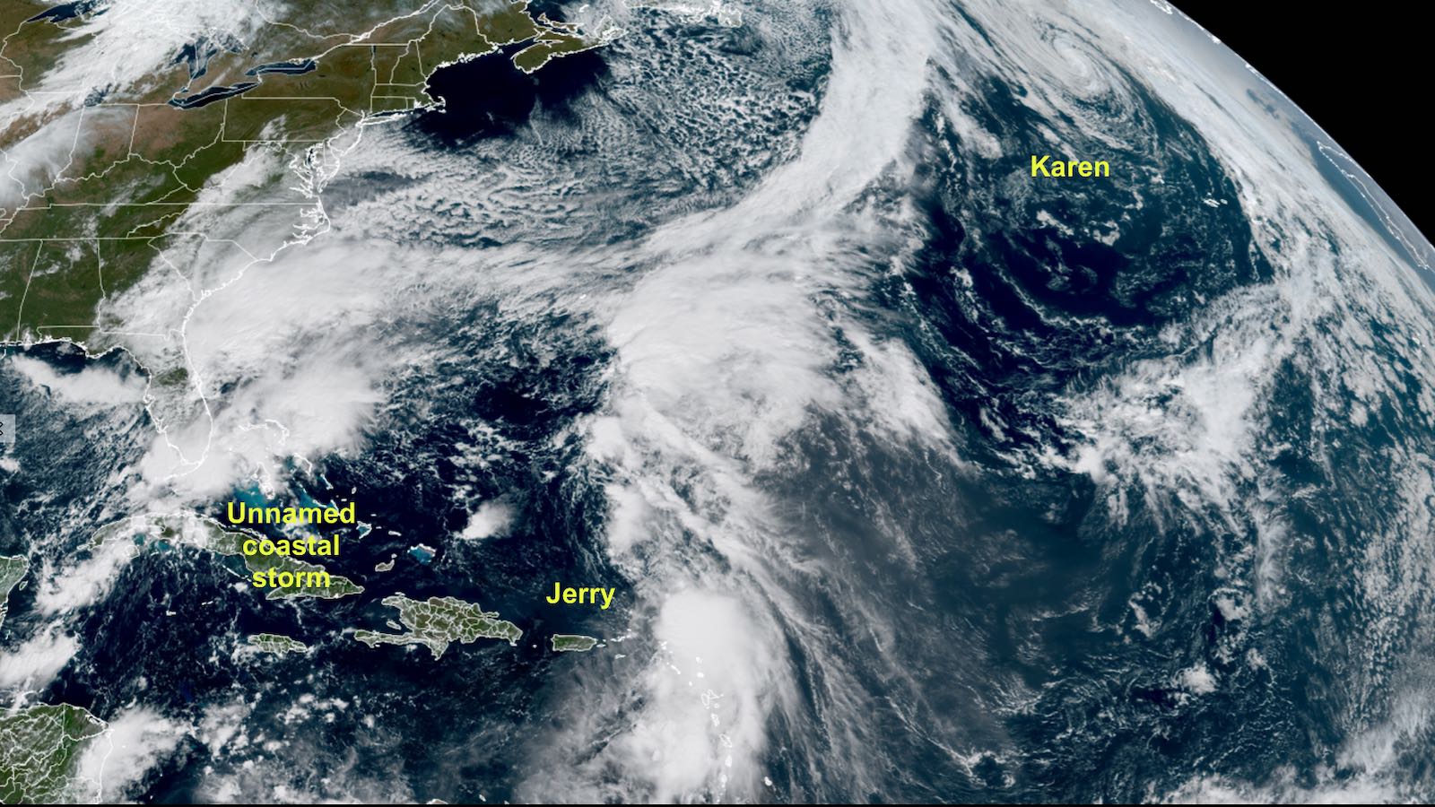
Multiple storms are impacting the Atlantic and eastern Pacific, with Karen becoming the northernmost named storm on record in the Atlantic, Jerry bringing heavy rains to the Leeward Islands, Priscilla's remnants causing flash floods in the U.S. Southwest, and a non-tropical storm causing significant coastal flooding in the U.S. Mid-Atlantic region.
Tropical Storm Imelda has formed near the Bahamas, joining Hurricane Humberto in the Atlantic, with both storms potentially impacting the Caribbean and US East Coast through heavy rain, storm surge, and rip currents. The interaction between the two storms, known as the Fujiwhara effect, adds uncertainty to their paths and intensities, but forecasts suggest Imelda may turn away from the US coast while still bringing heavy rain to the Carolinas. Humberto remains a powerful Category 5 hurricane, posing a threat to Bermuda and Atlantic shipping lanes.
Hurricane Humberto has formed in the Atlantic and is expected to strengthen into a major hurricane, while Gabrielle has moved away from the Azores, with potential impacts on southeastern US coasts and Portugal. A tropical wave near Hispaniola may develop into a storm threatening the US early next week, and Hurricane Narda in the Pacific remains a Category 1 storm.
The Atlantic hurricane season is at its peak around September 10, with activity expected to increase in the coming weeks despite current quiet conditions. Forecasters predict a rise in tropical cyclone development later in September and October due to favorable environmental factors, with NOAA forecasting above-normal activity and an increase in named storms, hurricanes, and major hurricanes. Historically, late September and early October are among the most active periods for hurricanes, especially in the Caribbean and Gulf regions.
The Atlantic hurricane season has been unusually quiet, with no active storms for the first time since 2016, due to dry air and wind shear despite warm ocean waters. While the peak of the season has passed, the season still has time to produce impactful storms, and residents should remain prepared.
Forecasters from NOAA predict an above-normal Atlantic hurricane season with 13-18 named storms, including 5-9 hurricanes and 2-5 major hurricanes, driven by warmer sea temperatures and active monsoon conditions, emphasizing the importance of preparedness.
Northern France remains on high alert for flooding after heavy rains caused by Atlantic storms. Two and a half months' worth of rain has fallen in Pas-de-Calais, leading to the closure of schools in 200 communities. More rain is forecasted for Monday, while a new weather warning has been issued for Italy's Tuscany region and the River Yser has burst its banks along the French border in Belgium.
The remainder of the hurricane season is expected to be eventful and exceptional due to unusually warm ocean temperatures and a slow-to-emerge El Niño. The Atlantic hurricane season has already been above average with 18 named storms. Normally, the number of storms decreases by the end of October, but this year, high sea surface temperatures could expand the reach of storm formation into the late season. The clash between warm ocean temperatures and the effect of El Niño has posed a forecasting challenge, but the warmer ocean temperatures and weaker winds are currently winning. Any tropical system that forms would likely be strengthened by the exceptionally warm water. The Atlantic is in uncharted waters, making it difficult to make confident forecasts.
Hurricane Idalia has transitioned into a post-tropical system and is currently affecting Bermuda, while Tropical Storm Katia has formed as the 11th named storm of the hurricane season. Another potential tropical system is expected to form off the west coast of Africa and could target the Caribbean. Tropical Storm Gert is still present but is expected to be absorbed by Idalia. The National Hurricane Center gives the new system a 20% chance of forming in the next two days and a 70% chance in the next seven.