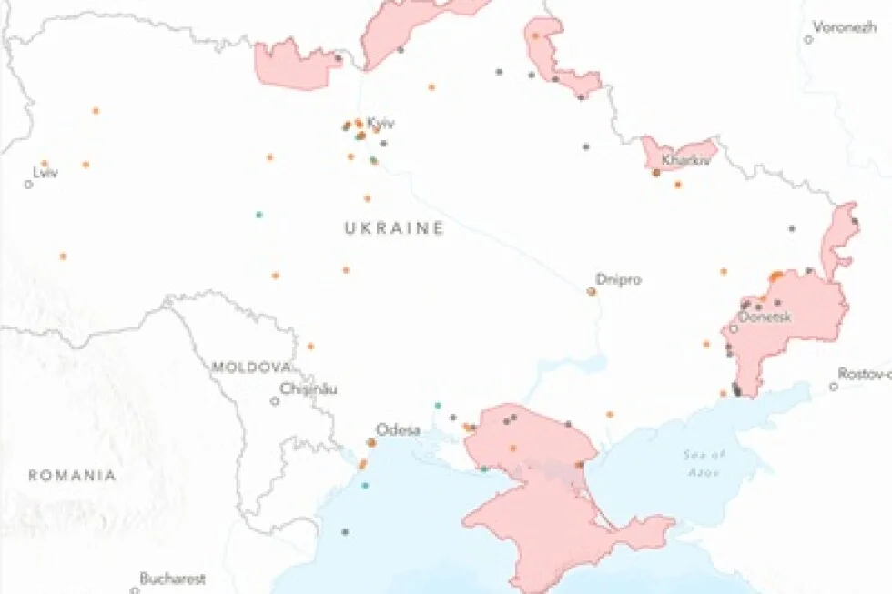
AP News debuts an interactive map that visualizes four years of the Ukraine war, allowing readers to explore key events across the country; produced by Will Jarrett, Susie Blann, and Illia Novikov, AP's Kyiv-based reporter since 2022.
The 2024 total solar eclipse will be visible in several cities in Kentucky, with varying start, peak, and end times. The peak of the eclipse is expected to occur around 2:00 p.m. local time in most locations, with durations ranging from 23.8 seconds to 4 minutes. An interactive map allows individuals to input their ZIP code to see specific eclipse details for their location. Additionally, the article provides a detailed breakdown of viewing times for various cities in Kentucky and Indiana.
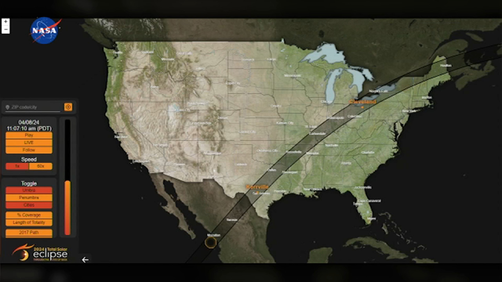
NASA has released an interactive map that allows users to input their location and view the best times and places to watch the upcoming total solar eclipse on April 8, the first to cross the U.S. in seven years. While Southern California will only experience a partial view, areas in the path of totality, including Texas, Oklahoma, and parts of the Northeast, will witness the entire sun being covered during the event.
NASA has released an interactive map to help people plan their viewing experience for the upcoming solar eclipse on April 8, 2024. The Eclipse Explorer tool provides information on the eclipse timing, max coverage, and weather for specific locations. It also offers tips for maximizing visibility and safety, including the importance of certified eclipse glasses and preparing for potential traffic and travel challenges.
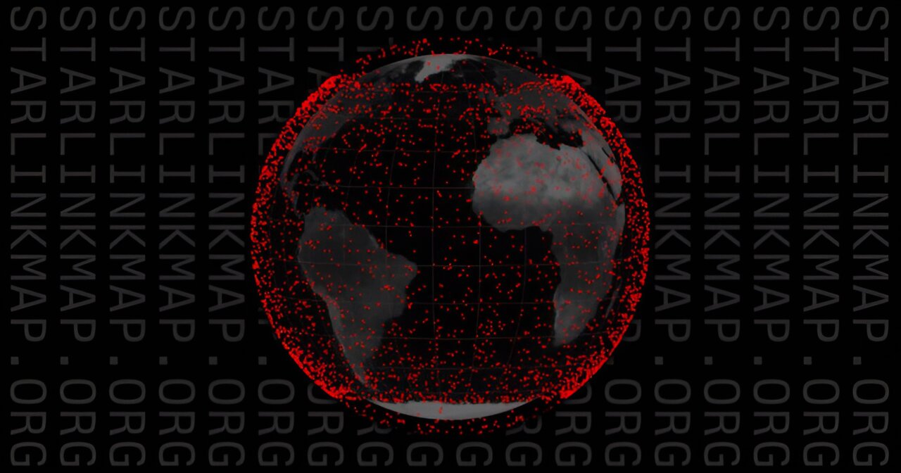
SpaceX has launched an interactive global map of their Starlink internet satellites, allowing users to track the live coverage of every satellite in orbit around the Earth. The map provides information on the number of satellites launched and currently in orbit, as well as data on the amount of data sent to Earth and upcoming Starlink launches. Despite its goal of providing worldwide high-speed internet, Starlink has faced criticism for its negative impacts on astronomy and concerns about potential interference with radio astronomy and space debris.
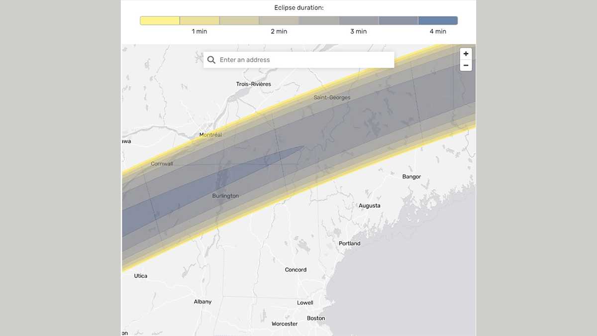
An interactive tool has been created to help people find out the time of the total solar eclipse on April 8, 2024, in specific areas across the country, including New Hampshire. Users can enter an address or community into the map to access total solar eclipse information for their chosen location.
On April 8, 2024, a total solar eclipse will move across North America, with the longest duration of totality being 4 minutes and 28 seconds near Torreón, Mexico. The eclipse will be visible in Mexico and across several U.S. states, with those in the path of totality experiencing the moon completely covering the sun and the sky becoming dark. NASA provides an interactive map to track the eclipse's visibility across the U.S., and people outside the path of totality will experience a partial solar eclipse and a temperature drop of about 10 degrees.
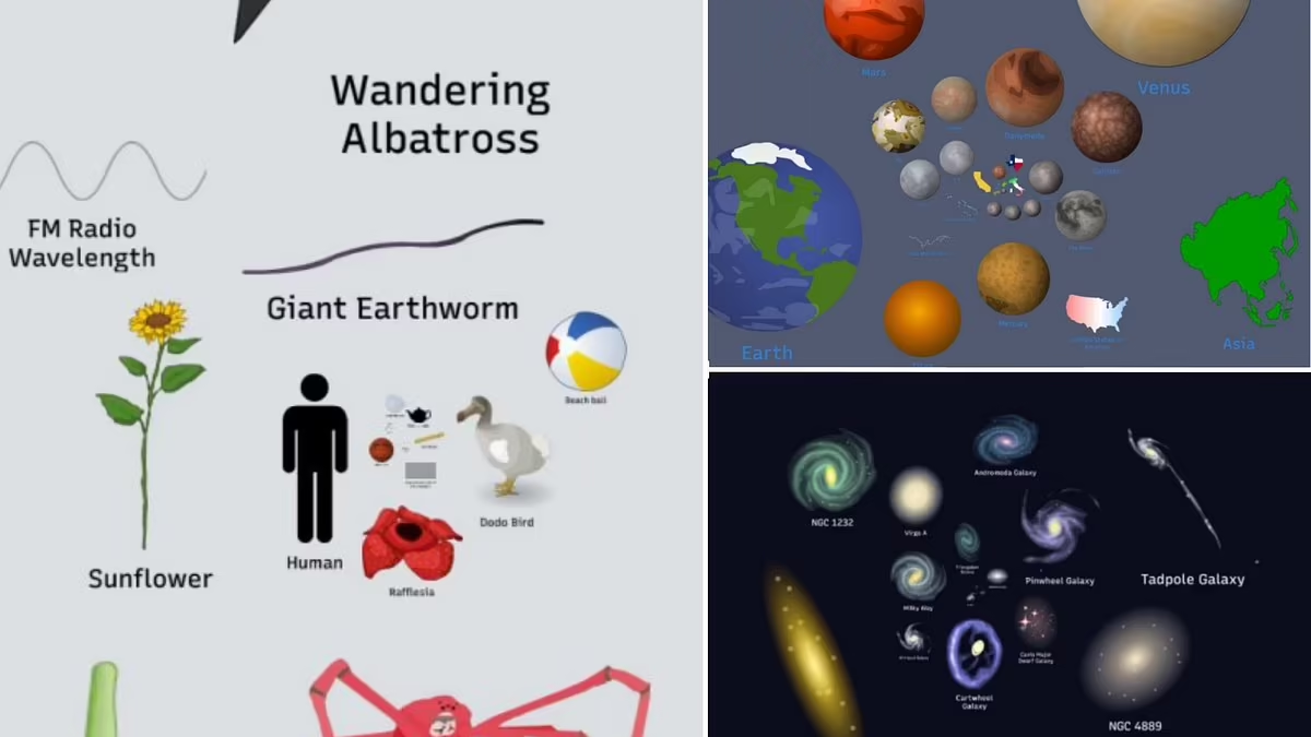
An interactive graphic titled 'Scale of the Universe' allows users to explore the sheer scale of the universe, from the human perspective to the edges of the observable universe, revealing mind-boggling numbers such as 2 trillion galaxies and 40 quintillion black holes. The map, created by computer scientist Cary Huang, showcases the incomprehensible vastness of the universe, with the observable universe estimated to be 46.508 billion light-years across. The article also delves into the staggering numbers of stars and planets, the structure of the Milky Way, and the potential for habitable planets, providing a humbling perspective on our place in the cosmos.
On April 8, a total solar eclipse will be visible over the United States, Mexico, and Canada. An interactive map allows people to find the timing and extent of sun coverage for their location. In Rochester NY, ideal eclipse viewing locations include parks and waterfront areas, with the Rochester Museum and Science Center hosting a festival. The eclipse's path of totality will cut across 13 U.S. states, with Mexico's Pacific coast experiencing it first. The eclipse will begin in Rochester at 2:07 p.m., with totality at 3:20 p.m. lasting for 3 minutes and 38 seconds. NASA and other organizations will provide online viewing options.
In April, Texas will experience a solar eclipse, with Austin, Waco, Dallas, Fort Worth, and Tyler in the path of totality, while San Antonio will see 99.99% coverage and Houston 94.41%. All of Texas will see at least 80% coverage, with Radar Base near Eagle Pass experiencing the longest totality at 4 minutes and 26.8 seconds. A total of 176 communities will have totality lasting at least 4 minutes and 20 seconds, and the next total eclipse visible in the U.S. won’t occur until 2044.
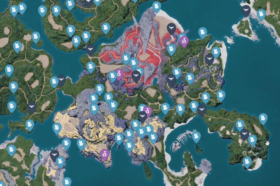
An interactive map from MapGenie is now available for Palworld players to locate the 244 Lifmunk Effigy statues, essential for increasing catching power in the game. The map allows users to toggle different points of interest and mark off found locations. It also proves useful for finding dungeons and eggs, aiding completionists and those seeking game secrets.
A new interactive map developed by paleontologist Ian Webster allows users to discover which dinosaurs once lived in their region by inputting any city or town into the search bar. The map provides a list of former reptilian inhabitants, with the option to learn more about each dinosaur and adjust the time period settings. The website also highlights the connection between birds and dinosaurs, as birds belong to the theropod clade, which includes the Tyrannosaurus rex.
Several websites have been created to document and educate the public about the brutal October 7 massacre carried out by Hamas. One website, www.hamas-massacre.net, shares graphic photos and videos of the slaughter, while another, www.october7.org, features firsthand testimonies from survivors. Additionally, www.oct7map.com provides an interactive map that visualizes the locations and details of each murdered and kidnapped individual. These websites aim to shed light on the tragic events and serve as a testament to the survivors' resilience.
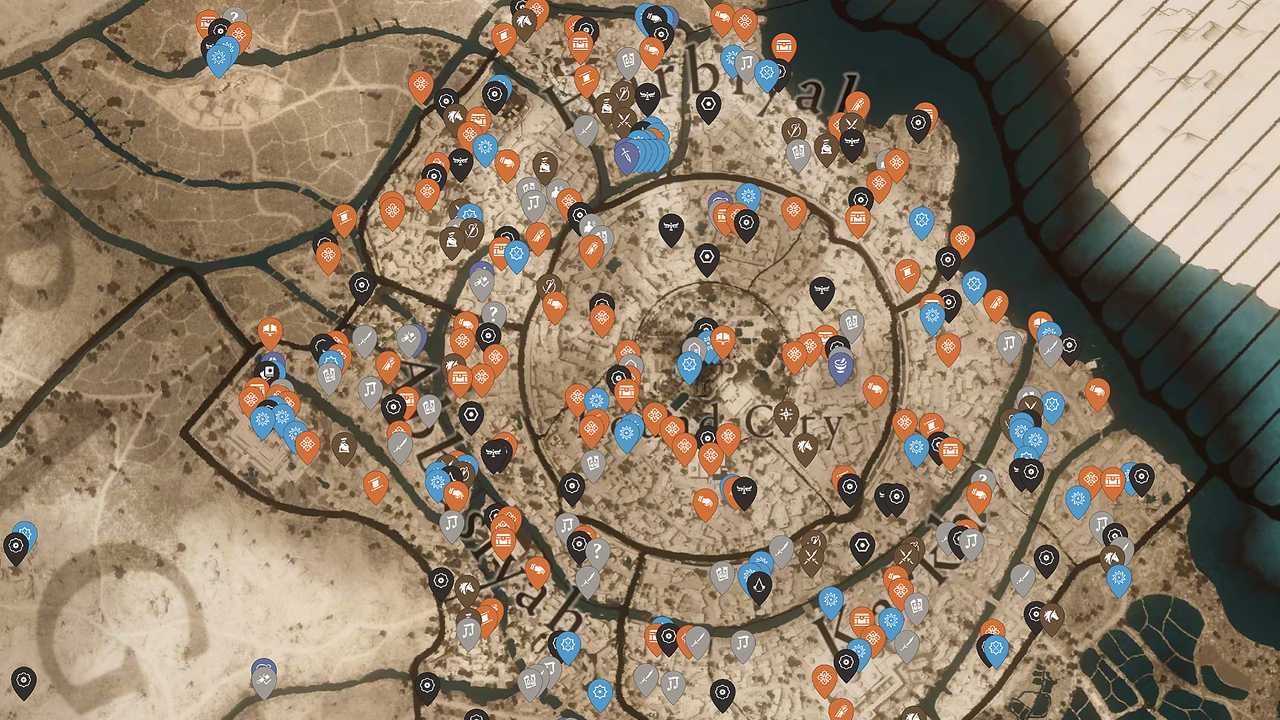
IGN has released an interactive map for Assassin's Creed Mirage, providing players with the locations of quests, hidden gear chests, enigmas, historical sites, and mysterious shards in the vast city of Baghdad. The map includes markers for various points of interest such as viewpoints, landmarks, quests, collectibles, equipment locations, services, and favor token groups. It also offers guides for finding gear chests, solving enigmas, and collecting mysterious shards. Additionally, IGN's comprehensive game guide provides walkthroughs, tips for stealth and combat, and collectible guides.
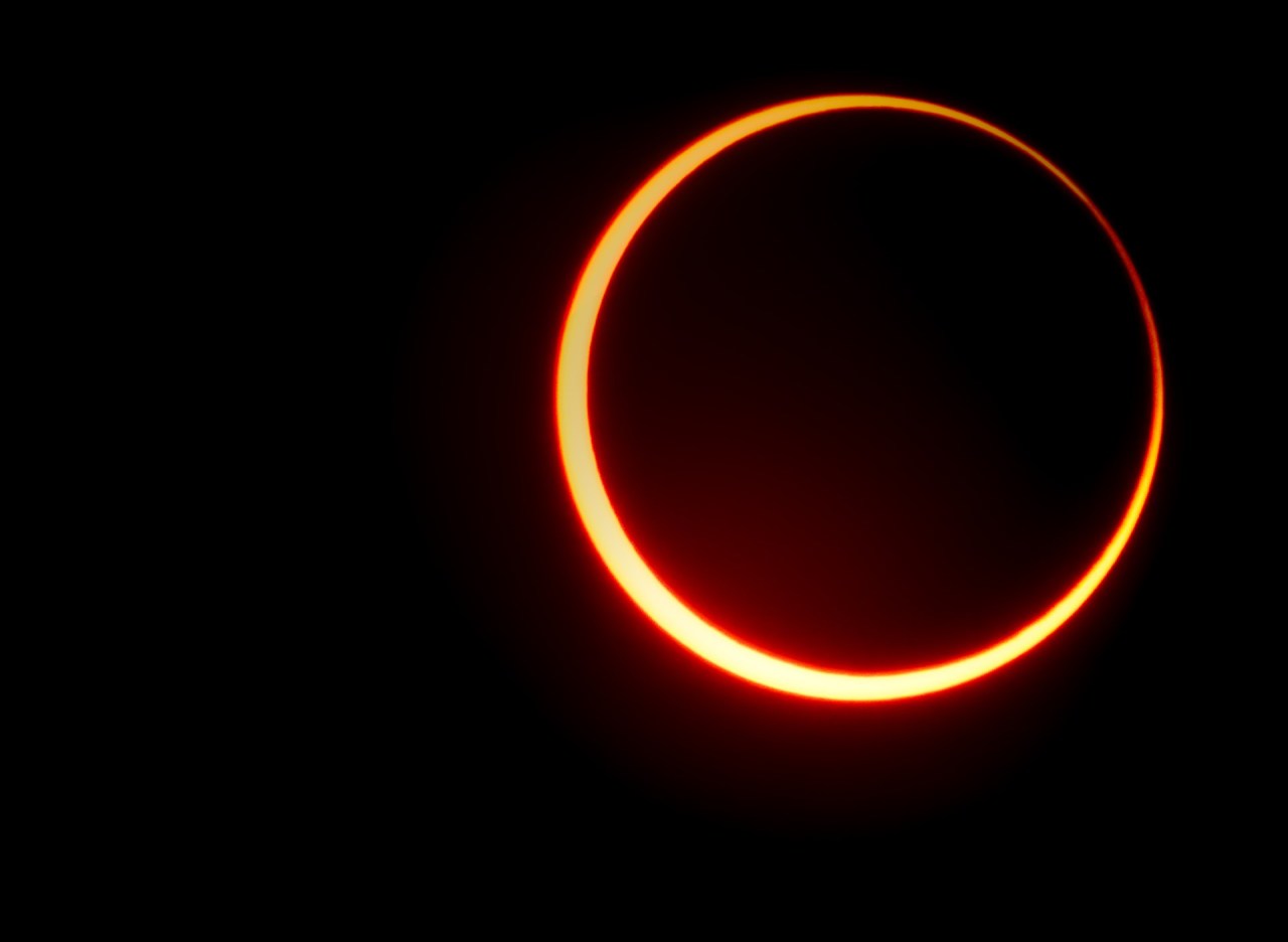
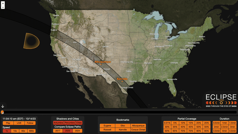
NASA's 2023 Eclipse Explorer offers an interactive map that allows users to track the upcoming annular solar eclipse on October 14. The map provides details on the visibility, path, and duration of the eclipse, allowing users to explore the eclipse viewing experience. Developed by NASA's Scientific Visualization Studio, the interface includes dynamic layers, a time slider, city information, countdown widget, and auto-play feature. The eclipse will cross eight U.S. states before moving across several countries in Central and South America. It is important to use solar filters and follow safety guidelines when observing the eclipse.