"Mapping the Risk: Predicting Damaging Earthquakes Across the US"
TL;DR Summary
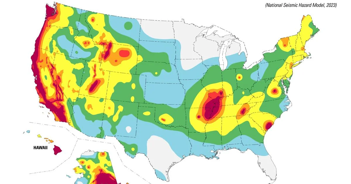
The United States Geological Survey has warned that nearly 75% of the U.S. could face potentially damaging earthquakes and intense ground shaking in the next 100 years, with new maps showing the areas most at risk. The model highlights seismic activity in California, Alaska, Hawaii, and the central and northeastern Atlantic Coastal corridor, including major cities like Washington, D.C., Philadelphia, New York, and Boston. The USGS hopes the model will enhance public safety and provide critical information for architects, engineers, and policymakers, with implications for earthquake retrofitting and construction practices.
Topics:nation#earthquake#earthquake-risk#natural-disasters#public-safety#seismic-activity#united-states-geological-survey
- Nearly 75% of the U.S. could experience a damaging earthquake in the next 100 years, new USGS map shows CBS News
- New models show chances of 'damaging earthquake shaking' in the PNW KING 5 Seattle
- Earthquakes a risk for 75% of US in next century: This map shows where USA TODAY
- Color-coded map shows where ‘damaging’ earthquakes are most likely to occur KGET 17
- Will San Francisco's Golden Gate Bridge survive the next magnitude 7+ earthquake? USGS details new threat Bay Area could face KGO-TV
Reading Insights
Total Reads
0
Unique Readers
0
Time Saved
2 min
vs 3 min read
Condensed
81%
469 → 90 words
Want the full story? Read the original article
Read on CBS News