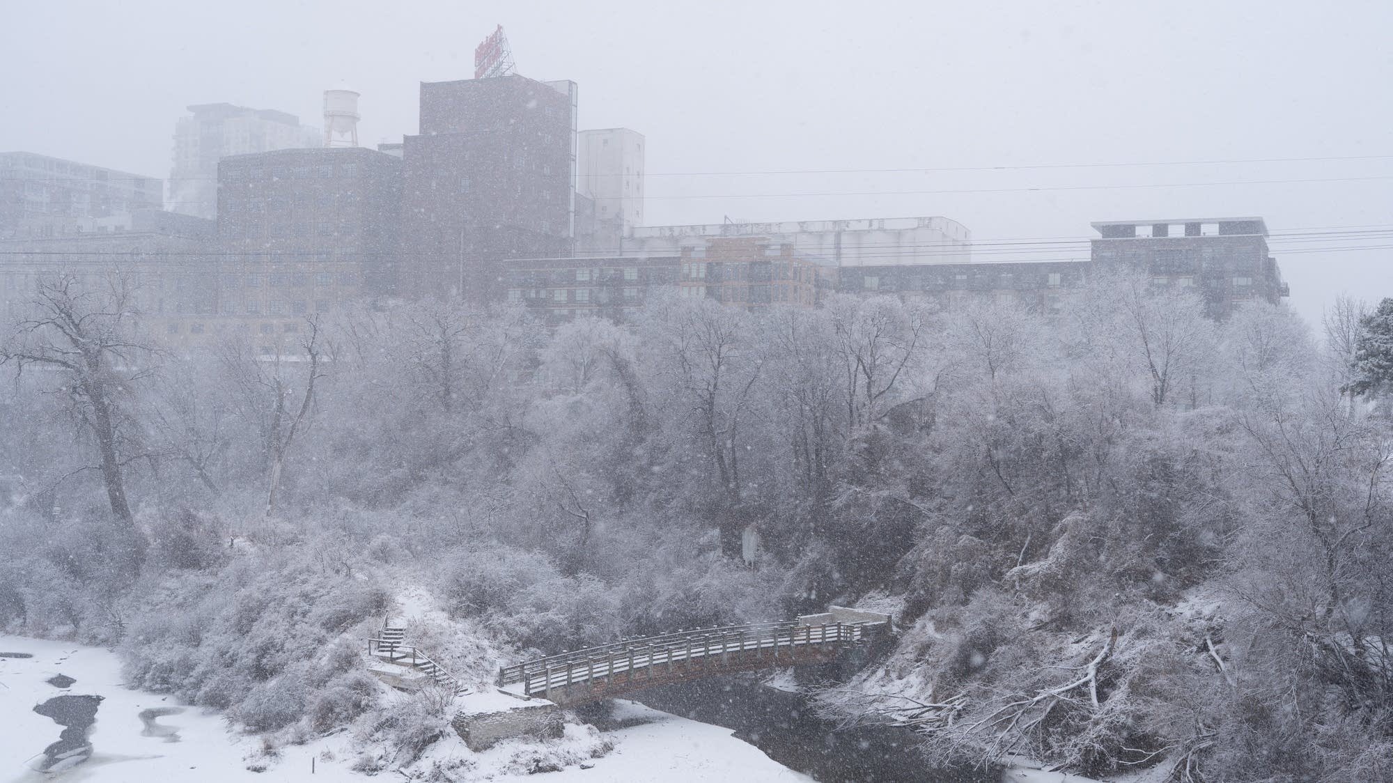
Following a major blizzard, Minnesota experienced significant snowfall with some areas receiving over 11 inches, leading to snow emergencies and improved driving conditions as cities work to recover.
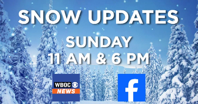
A snow event on Delmarva has brought 1-5 inches of snow, with heavier accumulations near I-95, causing potentially slippery conditions. WBOC provides ongoing updates through broadcasts and online, encouraging viewers to share snow photos and stay informed.
Snow continues to fall across central Illinois with various locations reporting snow totals ranging from 3.5 to 7.5 inches, and totals may increase as the storm persists.
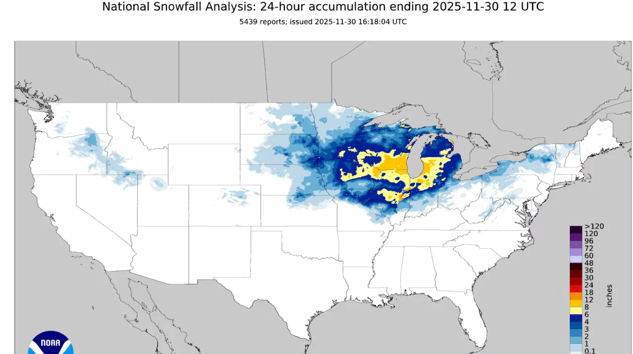
A recent winter storm brought significant snowfall across Michigan, with some areas like Zeeland, Spring Lake, and Hudsonville receiving a foot of snow, making it one of the heaviest snowfalls in the region during the last 24 hours.
Gusty winds are expected for Halloween with clear, dry conditions and highs in the mid-50s to around 60 degrees, potentially causing some tree limbs to fall, especially north of Highway 50, but the weather will be slightly milder this weekend.
Ahead of the Notre Dame vs USC game, weather conditions are expected to be wet with possible delays, prompting the team to prepare for various scenarios. Marcus Freeman discussed the importance of adaptability and outlined personnel changes, including the absence of defensive tackle Gabe Rubio and the starting role for Joe Otting at center, emphasizing the team's readiness despite challenges.
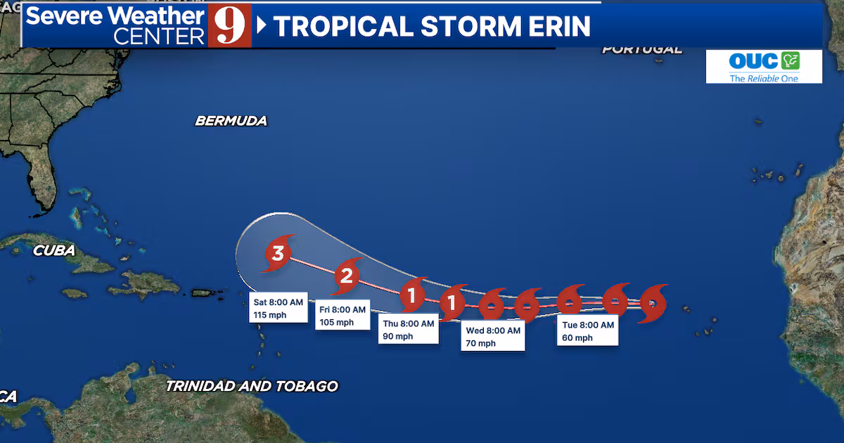
Tropical Storm Erin has formed in the Atlantic and is rapidly strengthening, with potential to become a major Category 3 hurricane by the weekend, though its exact path remains uncertain as meteorologists monitor its development and possible impact on the Caribbean and the US.
Tropical Storm Chantal has formed off the southeastern U.S. coast, prompting storm warnings for parts of the Carolinas, with conditions expected to worsen as it moves northward, potentially strengthening before reaching the coast.
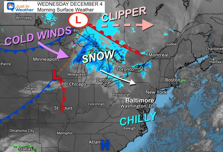
A wind advisory and blizzard warning have been issued for December 4, 2024, as a clipper system moves through Canada, bringing strong winds and snow to the Great Lakes region. The cold front will reach metro areas before sunrise on Thursday, causing temperatures to drop rapidly and wind chills to fall into the teens and 20s. Snowfall is expected to be less than 1 inch, with potential whiteout conditions in the mountains due to strong winds. The weekend will be cold and dry, with rain expected early next week.
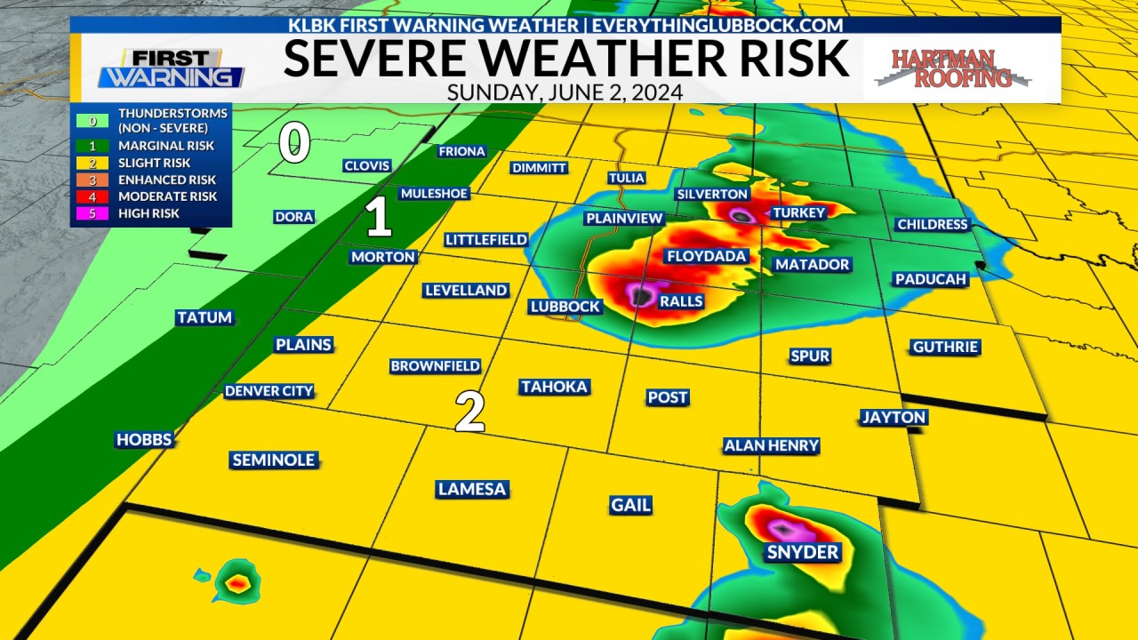
A Weather Aware Day has been issued for June 2, 2024, across the South Plains due to the potential for severe weather, including damaging winds, large hail, isolated tornadoes, and localized flooding. A Tornado Watch is in effect for multiple counties until 11 PM CDT. Residents are advised to stay informed and take necessary precautions.
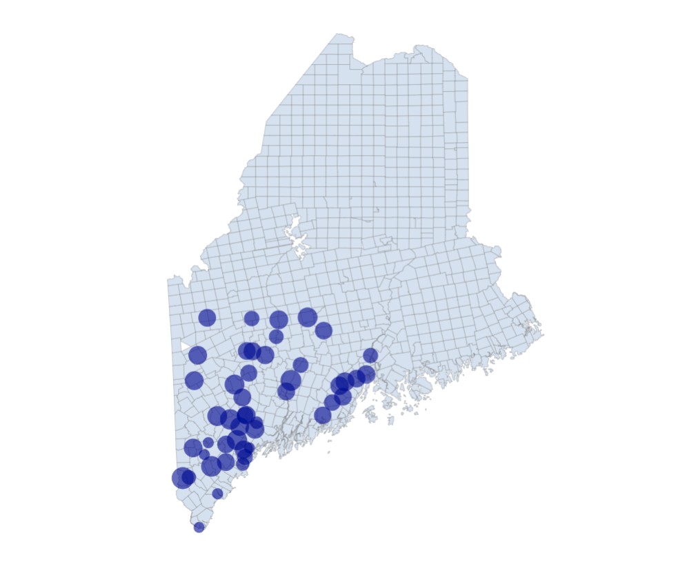
The National Weather Service has updated snow totals in Maine on Thursday at 9:30 p.m., allowing people to track the amount of snowfall in different locations.
Temperatures across the Hudson Valley have risen above freezing, but as the sun sets, icy conditions could develop, especially in areas north of I-84 experiencing light to moderate wet snow. Areas south of that line are mainly dry, but precipitation is expected to fill back in before midnight. With temperatures falling closer to freezing, icy spots are possible, particularly on bridges and overpasses. The atmosphere will cool from north to south through the afternoon, resulting in rain changing to snow or staying mixed in the southernmost areas. Icing may begin as temperatures dip below 32°F, creating a layer of ice under any snow or ice that falls on top of it.
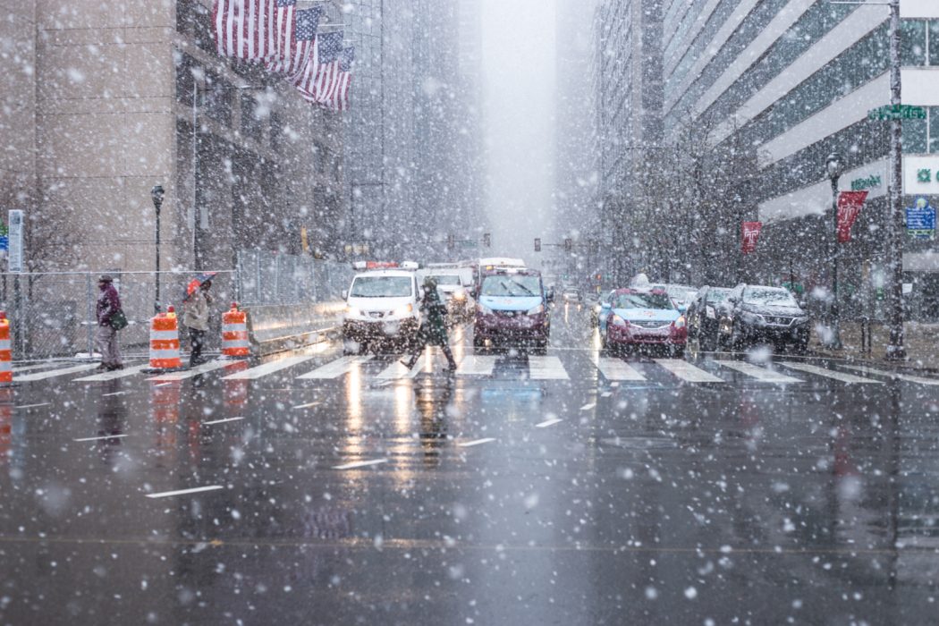
Philadelphia has declared a snow emergency starting January 19 at 7 a.m., requiring all parked vehicles to be moved off snow emergency routes for plowing. Residents are urged to stay off the roads as much as possible due to frigid temperatures and slippery conditions. Various city services and operations, including sanitation collections, city buildings, schools, and transportation, are affected by the snow emergency. Additionally, residents are reminded of safety precautions for pet care, businesses, and utilities during the extreme weather conditions.
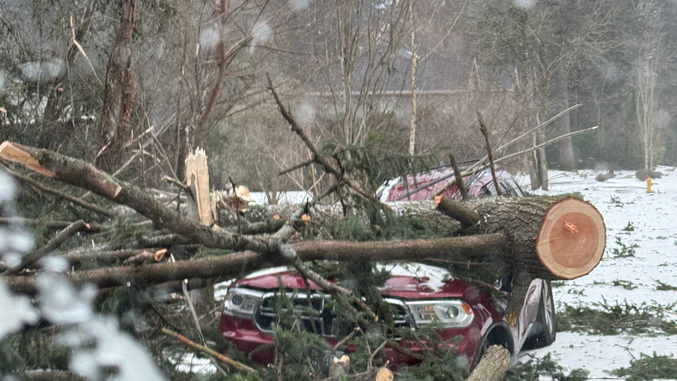
The Portland Bureau of Transportation reports 44 closed roads due to downed trees and power lines following a winter storm, urging residents to run important errands today before more winter weather hits tomorrow. PBOT advises caution for drivers on treated but potentially slick roads, and warns of an expected storm bringing freezing rain and wind. The bureau is coordinating with other agencies for tree and power line removal on emergency routes, and thanks the community for their support while urging continued caution and patience.
After a few days of above-average temperatures and rain, Central New York (CNY) will experience light snow showers on Monday. The roads will remain wet but not icy. However, colder air crossing over Lake Ontario will bring lake effect snow to CNY on Monday night and Tuesday morning. The snowfall forecast indicates accumulating snow during this period. The Weather Authority team is monitoring the situation and will provide updates on the forecast.