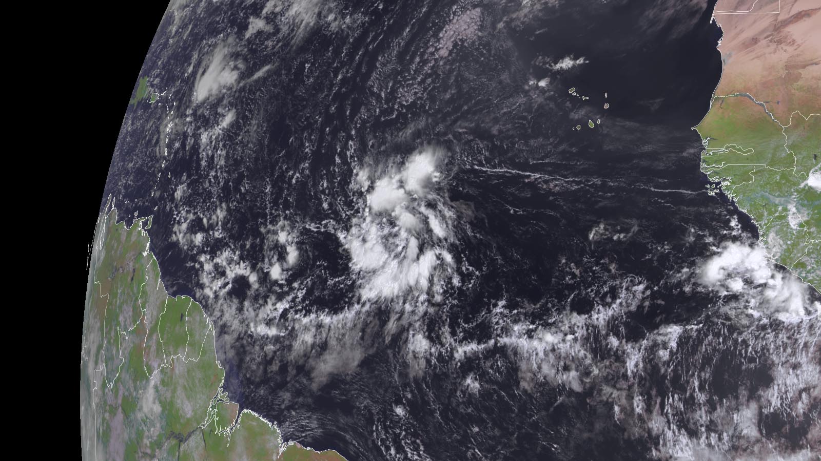
A tropical wave named Invest 95L in the central Atlantic is likely to develop into a tropical depression or storm this week, with a track that may pass northeast of the Leeward Islands and potentially impact Bermuda, as it benefits from favorable conditions for development.
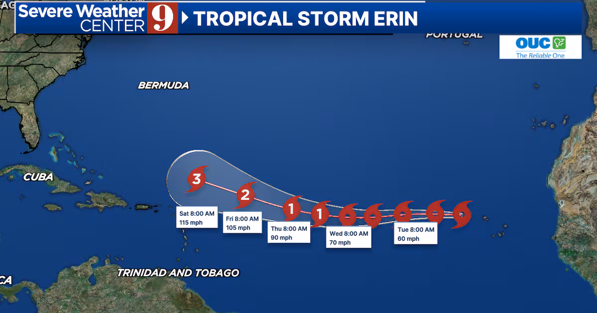
Tropical Storm Erin has formed in the Atlantic and is rapidly strengthening, with potential to become a major Category 3 hurricane by the weekend, though its exact path remains uncertain as meteorologists monitor its development and possible impact on the Caribbean and the US.
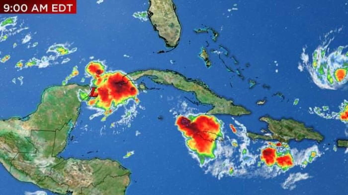
Invest 93L, a disturbance in the western Caribbean, is expected to slowly develop over the weekend and potentially strengthen in the Gulf of Mexico by late Sunday or Monday. The storm will interact with land, keeping it weak and unorganized. By Wednesday, impacts could be felt in parts of Florida, although the strength and exact landfall location remain uncertain. Hurricane Hunters will investigate the storm and provide crucial data on its potential strength. Warm water temperatures and the presence of the loop current may fuel the storm's development. Dry air and slow organization may keep the storm on the weaker side. It is important to review storm plans as development, strengthening, and potential landfall could occur within a 48-hour period from Monday to Wednesday.