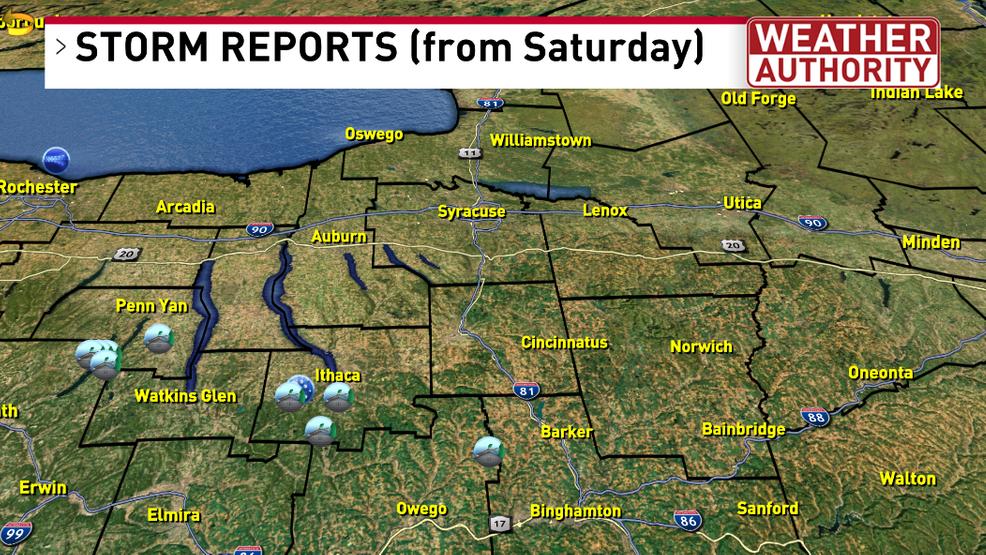
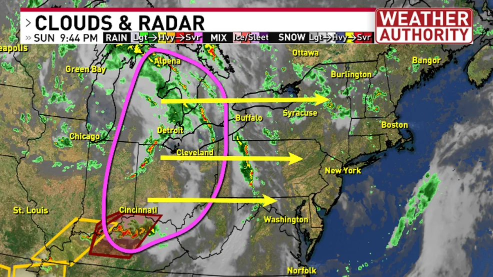
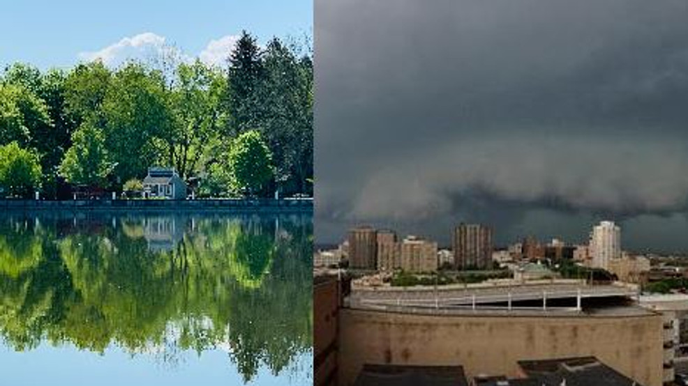
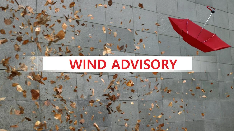
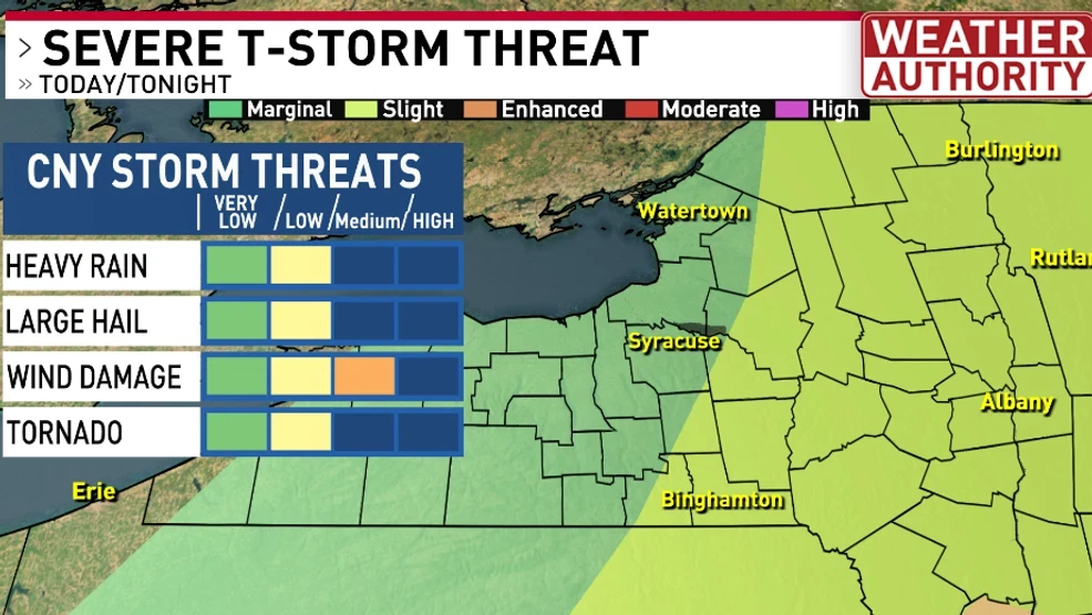
Strong to severe thunderstorms are expected tonight in Central New York, especially east of I-81, due to a cold front bringing storms and cooler temperatures tomorrow. The region will experience hot and humid conditions with a potential for high heat indices next week, following a day of thunderstorms and a brief cool-down.
Lake effect snow is expected to impact Central New York, including Syracuse, from now until Tuesday, causing snow-covered and slippery roads, particularly in Wayne, Cayuga, and Onondaga counties. The cold air crossing the Great Lakes is contributing to the snowfall, with significant accumulations expected overnight and throughout Monday. The weather will remain cold and windy, with additional light snowfall possible later in the week.
A strong weather system is bringing rain, snow, and strong winds to Central New York, with Winter Storm Warnings and Wind Advisories in effect until Monday. Snowfall accumulation is expected through midday Monday, with the highest amounts in the North Country and highest elevations. Wind speeds of 20-30mph with gusts up to 50mph could cause downed tree branches and isolated power outages. The weather is expected to improve Monday afternoon as high pressure moves in, bringing sunshine but continuing strong winds.
Winter weather is returning to Central New York from Sunday through Monday, with the Tug Hill and Adirondacks already experiencing the transition. Alerts are in effect for the area, and colder air from Canada is expected to be pulled down as a low-pressure area forms offshore of New England. Meteorologist Violet Scibior will provide updates on the snow forecast on Saturday night and Sunday morning, with final tweaks expected on Sunday night.
Lake effect snow is expected across the North Country today, with snow squalls possible in Central New York tonight. A Lake Effect Snow Warning is in effect for Jefferson County until 1am Monday, and a Winter Weather Advisory is in place for Oswego and Lewis counties. The snow is moving due to a passing weather system, with a cold front expected to push it south through CNY this evening. Snow squalls may cause near whiteout conditions and rapidly deteriorating road conditions. Accumulations are forecasted to be highest in Jefferson County, with lesser amounts in surrounding areas.
After a mild start to the week, temperatures will drop, bringing a more wintry feel to central New York. While a nor'easter will miss the area, it will still bring some snow to parts of upstate New York. Colder air behind the storm will lead to lake effect snow showers on Tuesday evening into Wednesday morning, with the potential for 1-3 inches of snow. There's also a chance for snow on Thursday night into Friday and possibly on Saturday.
After a few days of above-average temperatures and rain, Central New York (CNY) will experience light snow showers on Monday. The roads will remain wet but not icy. However, colder air crossing over Lake Ontario will bring lake effect snow to CNY on Monday night and Tuesday morning. The snowfall forecast indicates accumulating snow during this period. The Weather Authority team is monitoring the situation and will provide updates on the forecast.
Meteorologists are warning of potential severe weather in Central New York on Monday, with the possibility of thunderstorms, strong winds, and heavy rain. Residents are advised to stay informed and take necessary precautions to ensure their safety.
A weather system that caused severe storms and tornadoes in the Midwest is expected to hit Central New York on Saturday, bringing a risk of severe storms to the region.