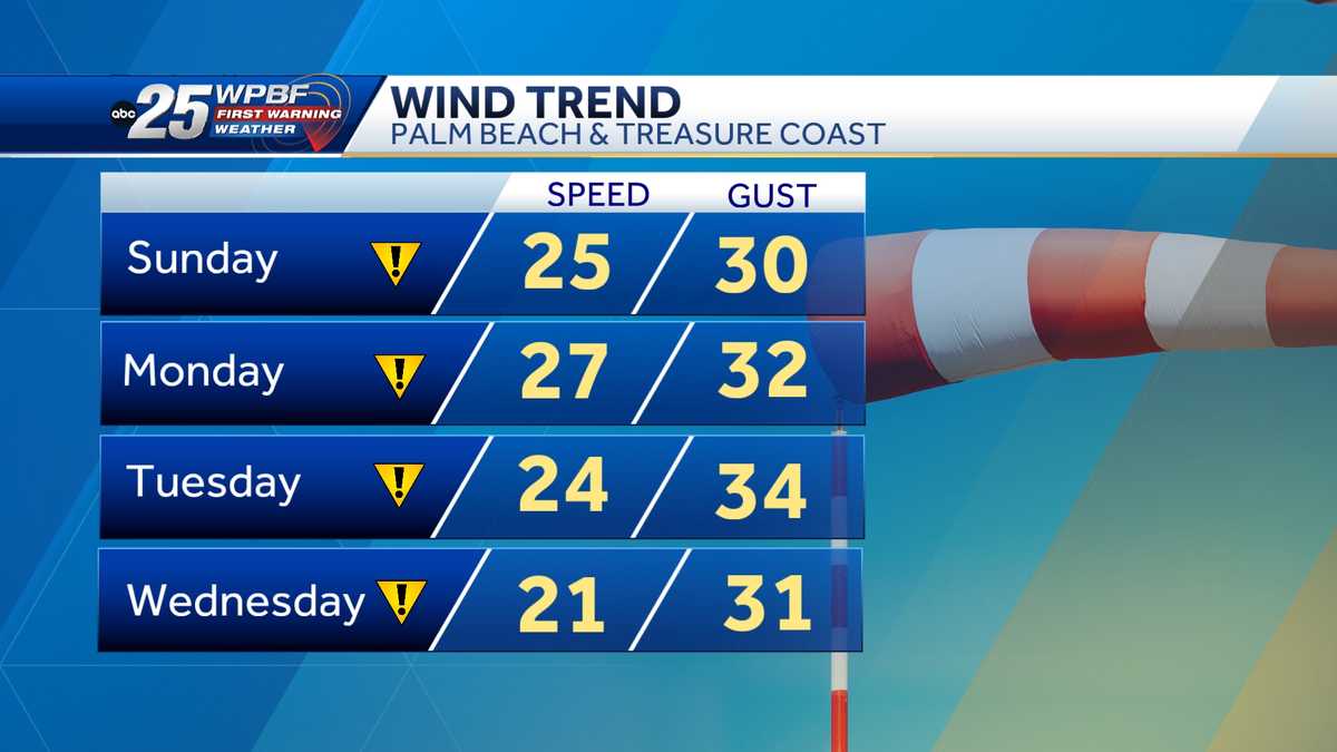
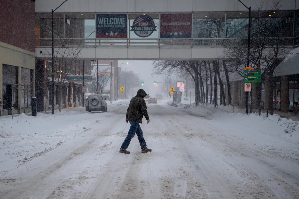
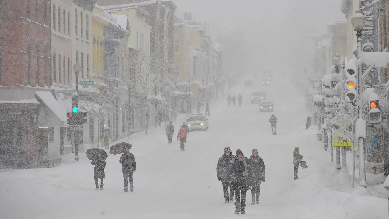
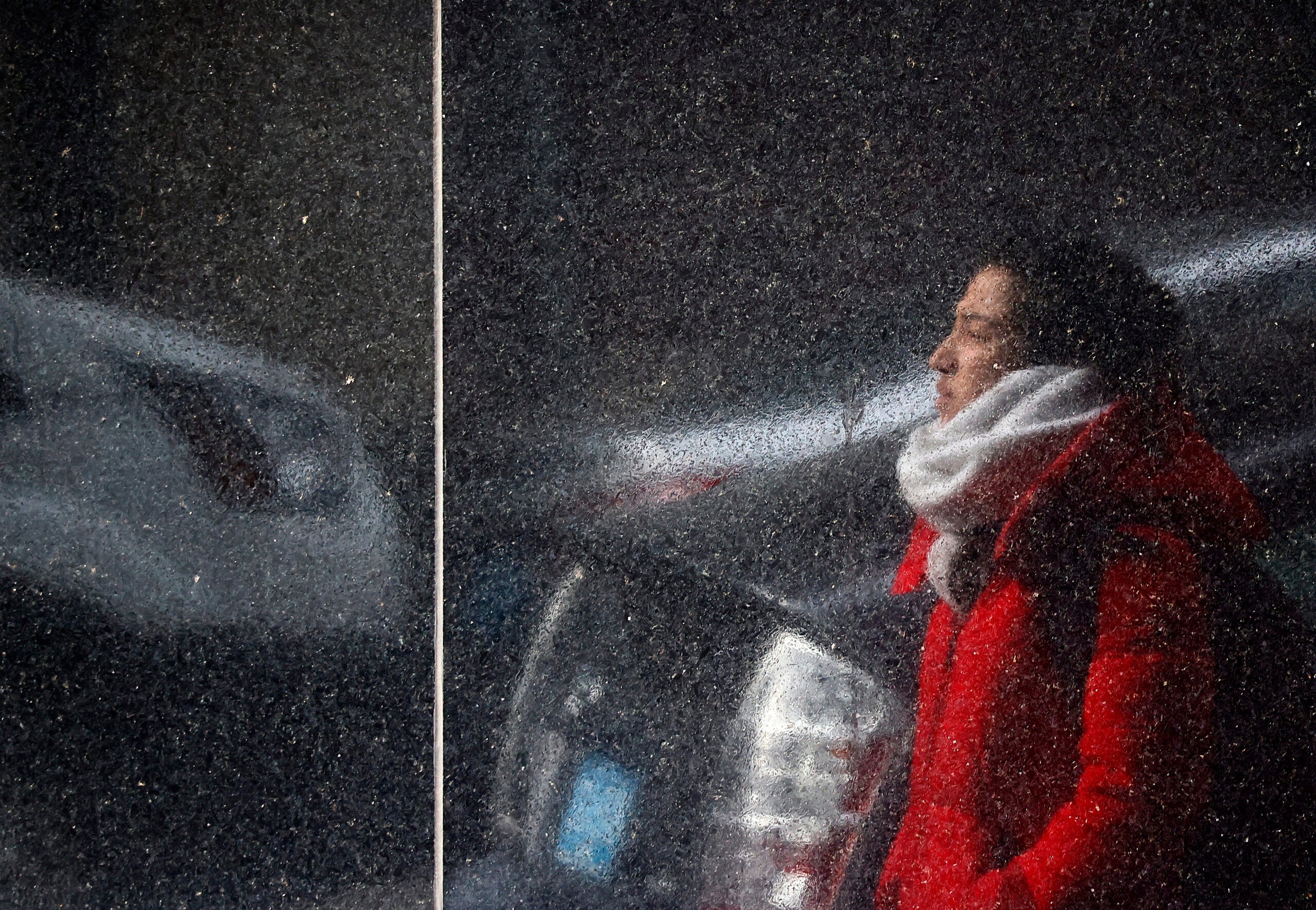
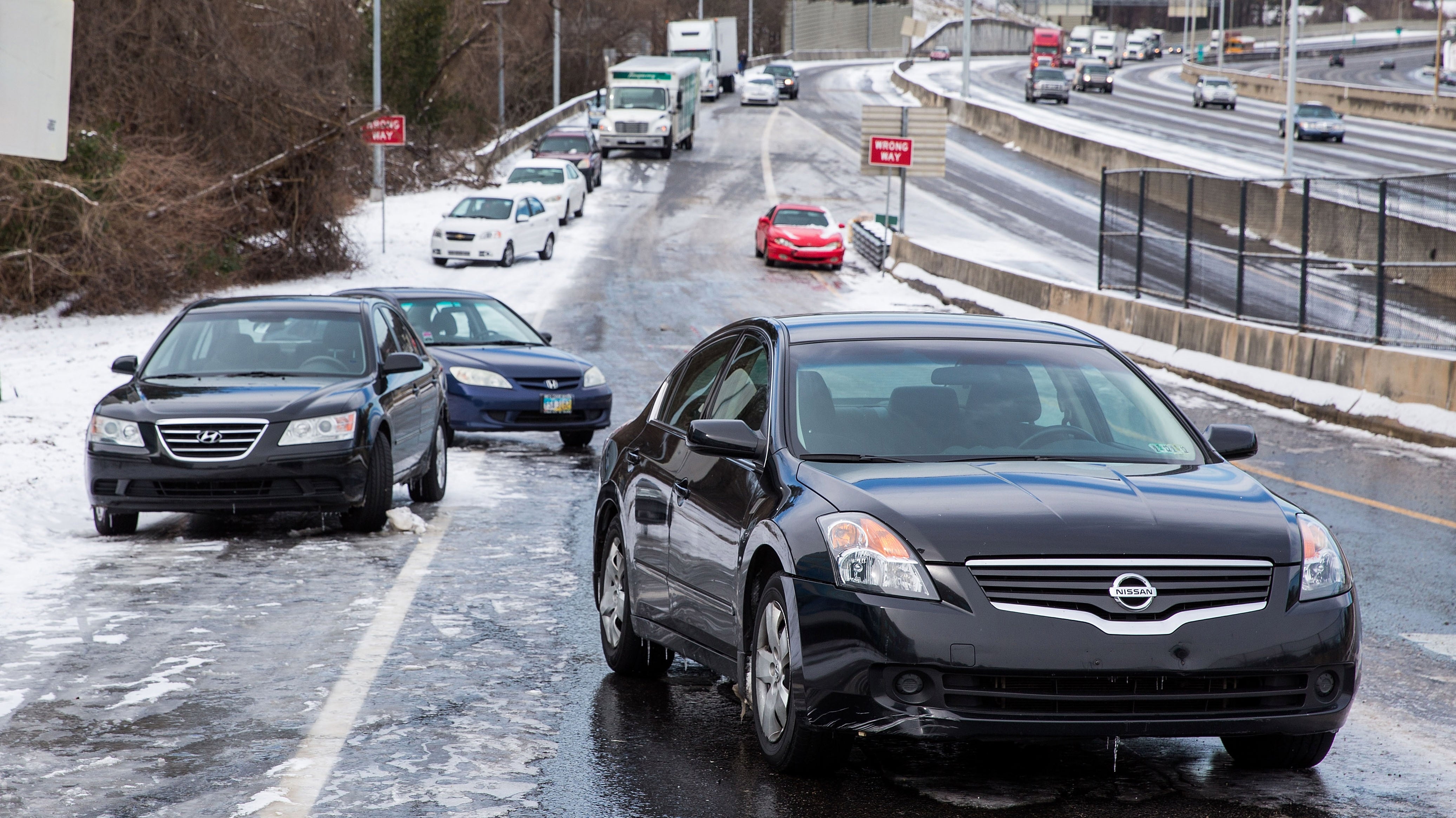
Meteorologists are divided on snowfall predictions for Washington D.C. this winter, with forecasts ranging from 6 to 20 inches. While La Niña conditions suggest a milder winter, the Capital Weather Gang predicts 12 to 18 inches, potentially making it the snowiest season since 2018-2019. However, other forecasts vary, with some predicting as little as 4 inches. The region hasn't seen normal snowfall in five years, and predicting weather beyond 10 days remains challenging.
North Texas faces a marginal risk of severe storms as weather conditions shift westward, with potential for small hail and damaging winds. The threat of severe weather is expected to weaken as storms move east. A weather alert remains in place for Thursday night into Friday morning due to the risk of strong storms and flooding. Residents are advised to stay updated with forecasts and have multiple ways to receive warnings.
Meteorologists and climate scientists believe that the extreme rainfall in Dubai was not caused by cloud seeding, but rather by natural weather patterns and human-caused climate change. Cloud seeding, a controversial weather modification method, has been difficult to prove effective and is unlikely to produce the amount of rainfall seen in Dubai. While some governments invest in cloud seeding technology in hopes of increasing water supply, experts emphasize that it is not a significant factor in extreme weather events like the recent deluge in the United Arab Emirates.
A drone video captured the increasing activity of the Icelandic volcano, with more lava seen overflowing from the Sundhnúkur crater, marking the fourth eruption in the area since December. The Icelandic Met Office stated that this eruption is likely the largest since 2021, with two active craters and most of the lava flow coming from the larger Sundhnúkur crater. While the lava flow has not progressed past the barriers built to protect the town of Grindavik, volcanic gas has spread throughout Iceland due to southeast winds at the eruption site, and dry weather poses a risk of vegetation fires around the lava field.
Fox Weather will provide special marathon coverage of the 2024 solar eclipse with "America’s Total Eclipse," featuring correspondents and meteorologists across the nation, including live reporting from prime viewing locations. The eclipse, which could last up to four minutes, will be the first total solar eclipse in the US since 2017. Fox Weather will also offer a multiscreen viewing experience in New York City and feature forecasts and special content on FOXWeather.com.
The USA experienced its warmest winter on record, with temperatures soaring and snowfall lacking in many parts of the country. The warm weather was attributed to El Niño and the influence of a warming climate. The eastern US is expected to continue experiencing mild temperatures in March, while the West is predicted to have a cool and soggy month.
Meteorologists and weather enthusiasts are excited about the upcoming release of "Twisters," a stand-alone sequel to the 1996 movie "Twister." The debut trailer, aired during the Super Bowl, has sparked both enthusiasm and concern within the weather community, with some expressing excitement over the realistic depiction of tornado chasing and others critiquing safety concerns and CGI usage. Despite differing opinions, many are looking forward to the movie's release on July 19.
Scientists and meteorologists are debating the need for a Category 6 on the Saffir-Simpson Hurricane Wind Scale to account for the increasing dangers of climate change-fueled hurricanes. While some argue that a new category could better reflect the intensifying impacts of storms, others emphasize the importance of considering factors beyond wind speed, such as storm surge and rainfall flooding. The discussion highlights the need for improved messaging to the public about the multifaceted threats posed by hurricanes in a changing climate.
Boston meteorologists are predicting a strong coastal storm for Monday night into Tuesday, with uncertainty about snowfall amounts and potential coastal flooding. The National Weather Service warns of uncertainty in the storm's track, while meteorologists like Pete Bouchard and Cindy Fitzgibbon anticipate heavy snow north and west of coastal Massachusetts, along with strong winds and potential coastal flooding. Chris Lambert notes a colder pattern following the storm, while Shiri Spear advises checking back for specifics as the storm approaches.
Ten years after Atlanta's 2014 'Snowmageddon' storm, meteorologists reflect on the chaos caused by just 1 to 3 inches of snow, leading to thousands stranded on roads, numerous vehicle crashes, injuries, and deaths. They attribute the severity to solidly below freezing temperatures allowing snow to accumulate on roads, lack of road treatment, heavy traffic, and hilly terrain. Reflecting on the communication confusion and impact, they emphasize the need for clearer, more direct weather alerts to prevent similar chaos in the future.
A strong cold front has brought much cooler conditions to South Florida, prompting meteorologists to declare Sunday an Impact Weather Day. Inland areas are under a wind chill advisory until 8 a.m. Sunday, with feels-like temperatures in the upper 30s and 40s. However, a nice warm-up is expected in the afternoon with highs in the 60s, and breezy conditions are forecasted for the week. Another cold front is anticipated for next Sunday. Warming centers are available for those seeking shelter from the cold, and the latest weather updates can be found on the WPBF 25 News app.
Meteorologists are predicting a significant warmup across nearly 90% of the United States by the middle of next week, with temperatures expected to be 8-14 degrees above normal in the Plains and Midwest. This "dramatic" January thaw is attributed to a high-pressure area off the East Coast that will bring milder air originating primarily over the waters south of the nation. However, before the warmer air arrives, a new surge of colder air is forecast for this week. The January thaw typically lasts for about a week and is expected to bring above-normal temperatures for at least the next 10 days across the entire Lower 48.
As frigid Arctic air descends on the United States, the definition of "extreme cold" varies by region, with meteorologists calibrating warnings based on prevailing climate. In Duluth, Minnesota, warnings are issued at minus 25 degrees, while in Dallas-Fort Worth, Texas, it's at minus 18. The South's infrastructure and population are less acclimated to severe winter weather, increasing the risk of frostbite. In northern Manitoba, the threshold for a wind chill advisory is minus 58 degrees Fahrenheit, highlighting the stark differences in cold tolerance across regions.
Boston meteorologists are warning of a rain and wind storm with peak winds expected between midnight and 5am, bringing 50mph+ gusts in eastern Massachusetts. A flood watch has been issued for several counties until 1/10 1:00PM, and the National Weather Service advises against driving through flooded roadways. Another storm is expected late Friday night through Saturday morning.
Meteorologists are predicting that a "green Christmas" will be more likely than a white one for most of the United States this year. Warmer temperatures and drier conditions across the northern tier may limit snowfall on Christmas morning. The best chances for a white Christmas are in the higher elevations of the West and near the Canadian border from North Dakota to Maine. Only 18% of the contiguous U.S. is currently snow-covered, the lowest percentage since 2006. Historically, states such as Minnesota, Maine, upstate New York, and the Allegheny Mountains have the best chance of a white Christmas. However, this year, even cities like Minneapolis, Green Bay, Buffalo, and Burlington may be snowless.