Hurricane Melissa has intensified to a Category 5 storm, surpassing Hurricane Katrina in 2005, and is approaching Jamaica with a central pressure of 901 millibars, making it one of the strongest Atlantic hurricanes on record.
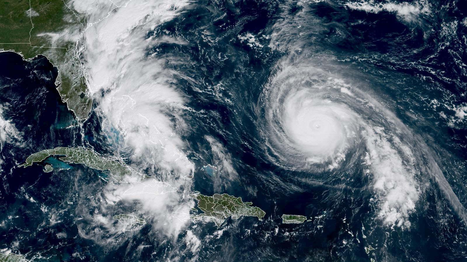
Tropical Depression 9 is moving through the Bahamas and is expected to become a Category 1 hurricane before turning eastward out to sea, avoiding landfall in the U.S., while Hurricane Humberto peaked as a Category 5 storm and is weakening as it recursves west of Bermuda.
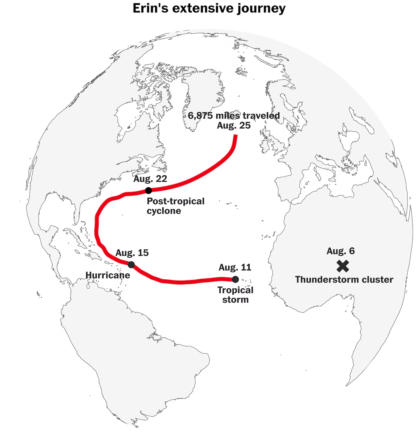
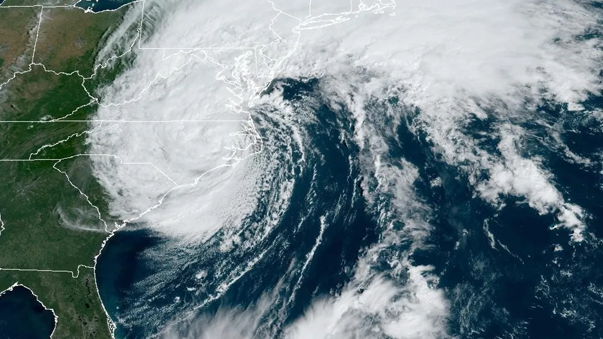
Hurricane Erin was one of the largest hurricanes to come close to or make landfall on the U.S. East Coast, comparable only to Hurricane Sandy in 2012, based on an analysis of storm wind diameters since 1964.
The 2024 Atlantic hurricane season begins today, with NOAA predicting a record number of named storms. Historical data shows over 300 hurricanes have hit the U.S. since 1851, with Florida experiencing 40% of them. The deadliest hurricane was the Galveston hurricane of 1900, and Hurricane Katrina in 2005 was the costliest. The peak season is from mid-August to mid-October, though storms can form as early as March.
A study by the University of Miami has found that human-induced aerosol emissions are a major driver of temperature fluctuations in the tropical Atlantic Ocean, which in turn impact rainfall in West Africa's Sahel region and the formation of Atlantic hurricanes. The researchers used a grand ensemble simulation technique to demonstrate the climate changes resulting from external forcings, revealing that historical reductions in aerosol emissions led to increased hurricane activity and Sahel rainfall. The study suggests that ongoing reductions in aerosol emissions, combined with greenhouse gas-induced warming, will likely prevent a return to a quieter period of hurricane activity in the Atlantic in the coming decades.