Streamline Data Entry with Excel Data Types
The article explains how to use Microsoft Excel's geography data types to quickly insert country-related information like population and birthrate, saving time and effort compared to manual web searches.
All articles tagged with #geography
The article explains how to use Microsoft Excel's geography data types to quickly insert country-related information like population and birthrate, saving time and effort compared to manual web searches.

The Sunday Puzzle involves identifying major U.S. cities hidden within sentences, each city name embedded in consecutive letters and associated with the state mentioned in the sentence, with answers like Lexington and others. It also includes previous and current puzzle challenges related to famous singers and word manipulations.
The article discusses the limitations and biases of traditional maps, highlighting calls for a mapping revolution that emphasizes human connections, uncertainty, and multiple perspectives, moving away from state-centric and simplified representations to better reflect complex realities and histories.
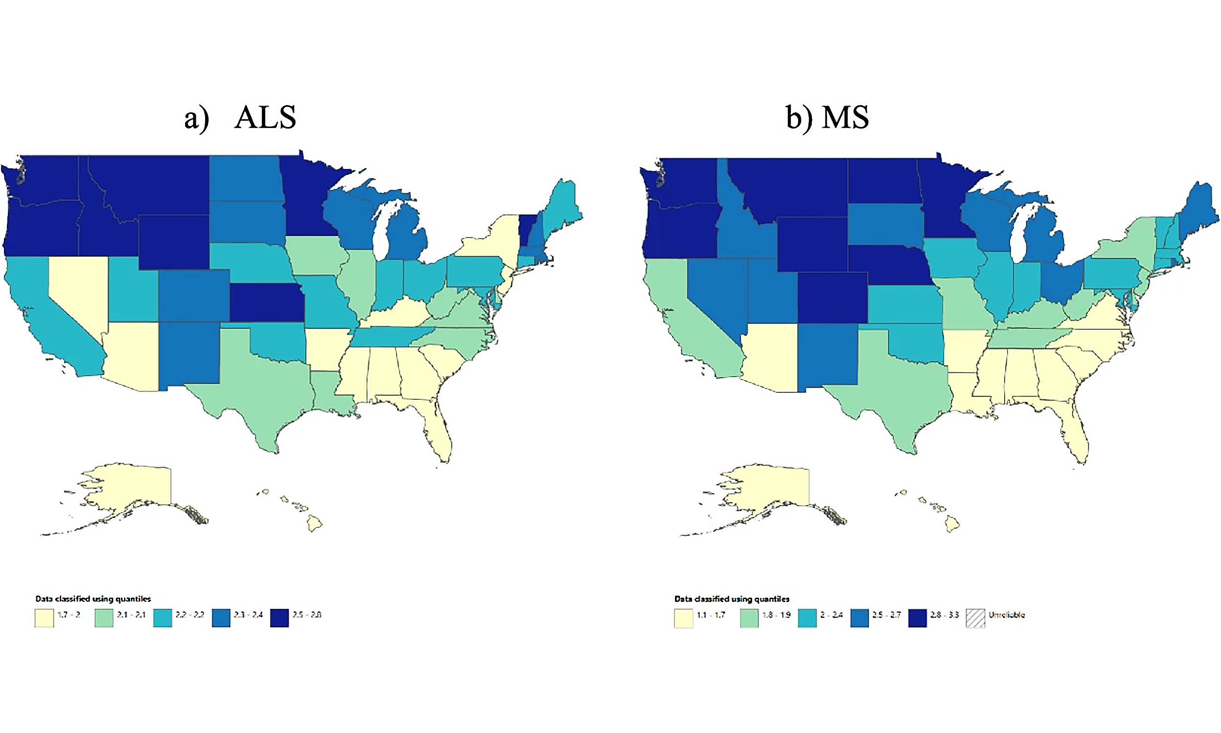
A recent study reveals a strong geographic link between amyotrophic lateral sclerosis (ALS) and multiple sclerosis (MS), suggesting shared environmental or social factors influence their distribution, challenging previous genetic-focused theories and opening new avenues for research and prevention.
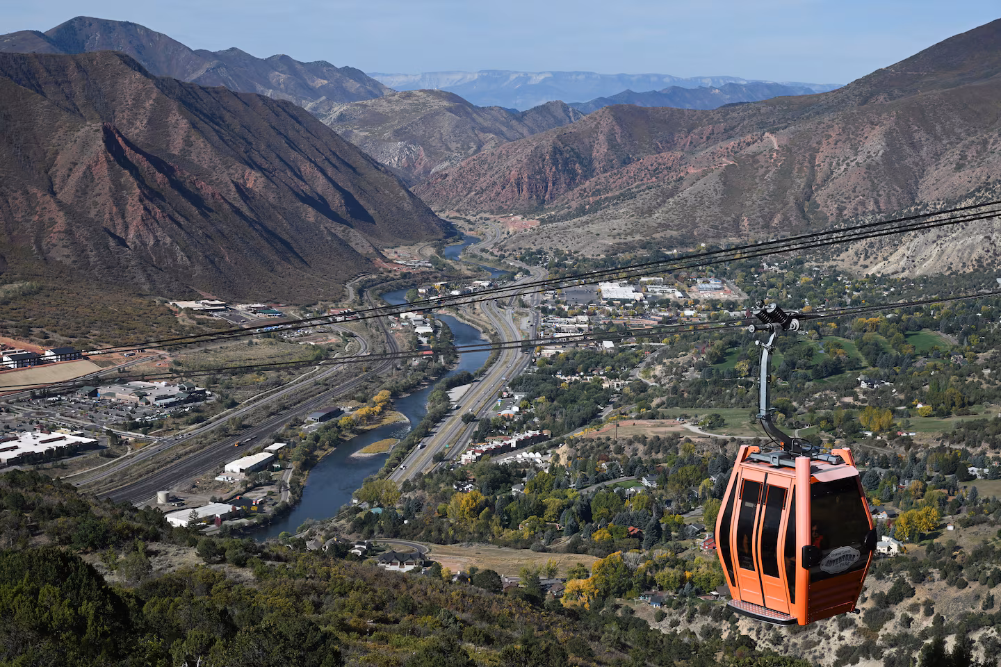
The article discusses the varying perceptions of what constitutes a mountain versus a hill, highlighting the cultural differences in the American West and East, and exploring data on the height at which a hill is considered a mountain.
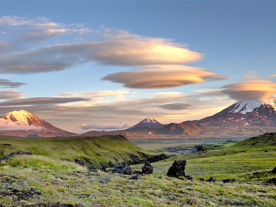
The article explores 20 natural optical illusions and phenomena around the world, such as salt flats, cloud formations, waterfalls, and mirages, explaining how they are created and highlighting accessible locations for visitors to experience these stunning visual tricks firsthand.
Earth has five oceans, with the Southern Ocean officially recognized in 2021 by National Geographic, defined by the Antarctic Circumpolar Current rather than land boundaries, highlighting its ecological importance and the impact of climate change on its future.

Microsoft's claim that AI will make geographers obsolete is challenged by Trisalyn Nelson, who argues that AI actually enhances the field by enabling geographers to analyze vast amounts of geographic data more efficiently, thereby increasing their impact on solving global challenges. Geographers use advanced technology to address issues like urban planning, environmental management, and disaster response, making their profession more vital and relevant than ever in the age of AI.
MLB commissioner Rob Manfred indicated that if the league expands, it will likely undergo geographic realignment to reduce travel and improve postseason appeal, potentially leading to a division structure similar to the NHL or NFL. The league has not expanded since 1998, but candidates like Nashville and Salt Lake City are considered for future expansion, which could increase teams to 32 and prompt a divisional reorganization.
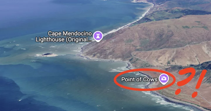
A recent discovery on Google Maps has revealed that a scenic spot in Humboldt County, known for its breathtaking views along the Mattole Road, is labeled as "Point of Cows." This has sparked curiosity and confusion among locals, as many claim they've never heard the area referred to by this name. A poll has been launched to determine if this is a common local term or a Google Maps anomaly.
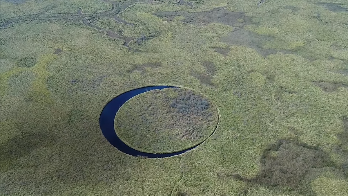
El Ojo is a mysterious, perfectly round floating island located in the Paraná Delta of Buenos Aires Province, Argentina. Discovered by filmmakers in 2016, the island is made of plant matter and floats in a crystal-clear, circular lake, rotating due to a circular current. Its origins are unclear, and it has sparked local myths, including beliefs about ancient deities and UFOs. The island's unique formation is attributed to erosion, similar to ice disks observed in Maine, USA.
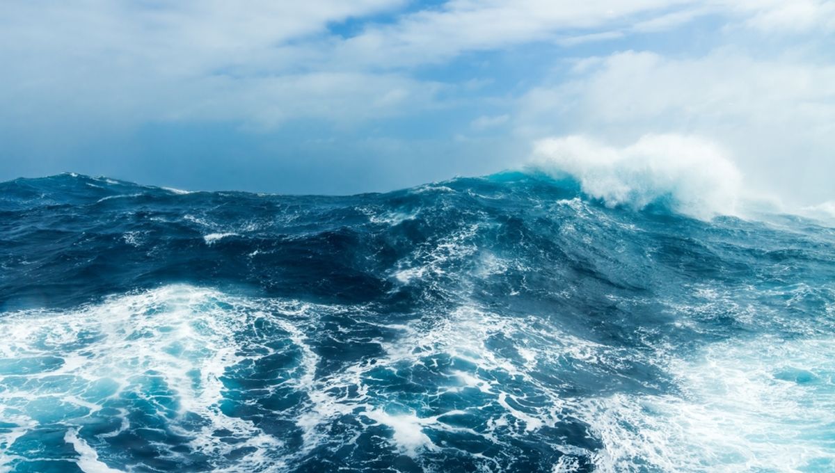
The coastline paradox highlights the difficulty in measuring coastlines due to their complex, fractal-like nature, where the length varies depending on the measurement scale used. This paradox arises because coastlines are not straight lines but intricate shapes with many features, leading to different measurements by different organizations. The issue has significant implications for international laws and resource rights, as coastal baselines are used to determine maritime boundaries. The paradox underscores the challenge of defining coastlines accurately, as they are constantly changing due to natural factors like erosion and sea level rise.
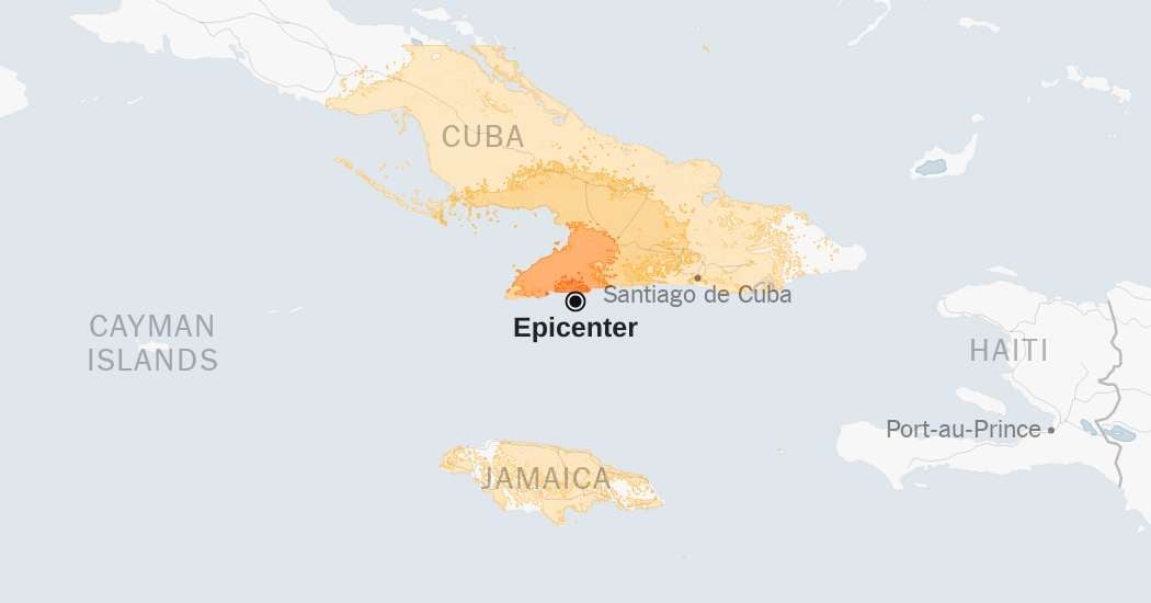
A 6.8 magnitude earthquake has struck Cuba, causing significant concern and prompting emergency responses. The quake's impact on infrastructure and population is being assessed, with authorities urging caution and preparedness for potential aftershocks.
The article showcases a series of satellite images capturing the changes in Ventura County over several decades, providing a unique perspective on the region's development and geographical transformations.
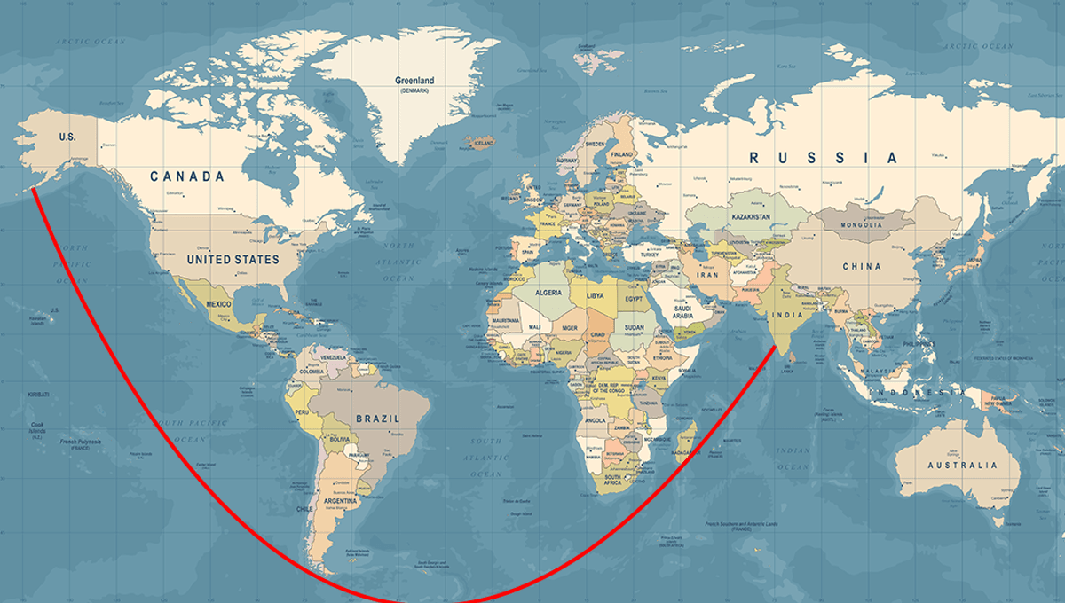
People are confused about how one can sail from the USA to India in a straight line due to the distortions caused by the Mercator projection, a common map representation. This cylindrical map projection distorts size and shape, especially away from the equator, making straight lines on a globe appear differently on a flat map. Despite these distortions, a straight-line course from the USA to India is possible with minimal steering adjustments.