geography2.545 min read
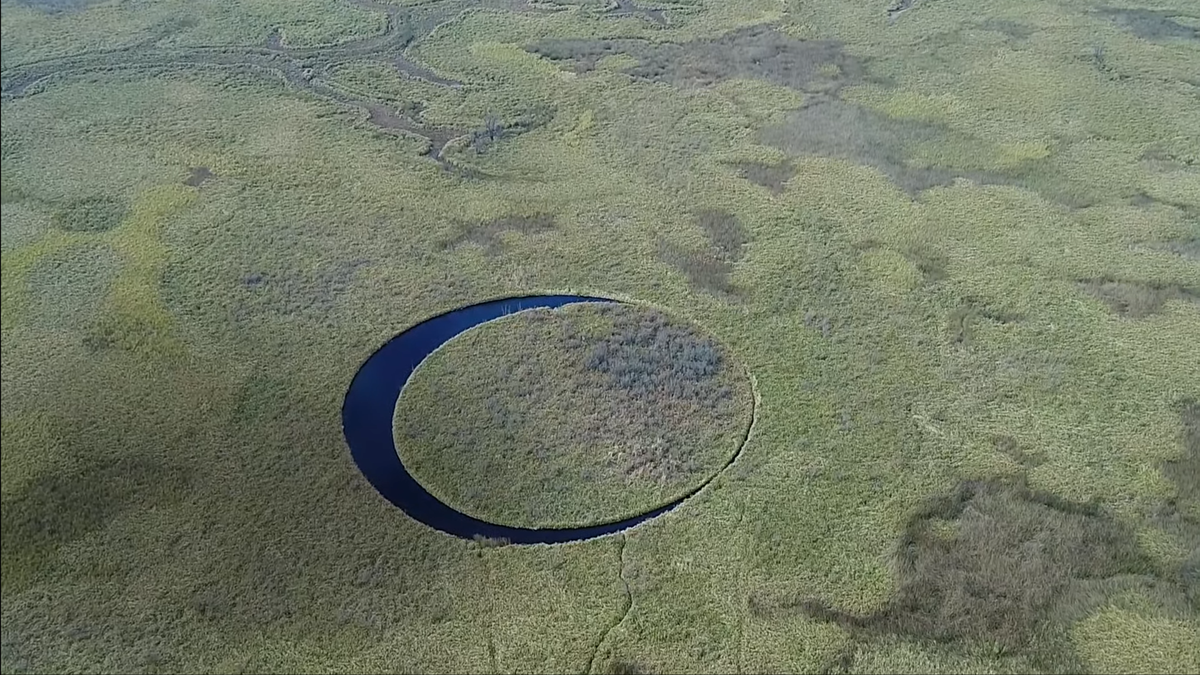
El Ojo: Argentina's Enigmatic Floating Eye Island
1 year ago•Source: Livescience.com
The latest geography stories, summarized by AI
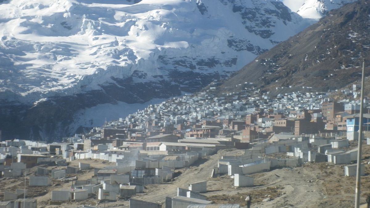
La Rinconada in Peru is the highest permanent settlement on Earth, located between 16,000 and 17,000 feet above sea level. The town's 50,000 residents face extreme living conditions, including low oxygen levels and lack of basic amenities. Despite these challenges, inhabitants have adapted to the high altitude, though many suffer from chronic mountain sickness.
nasa.gov•1 year ago
nasa.gov•2 years ago
A Gizmodo article discusses the distorted perception of geography caused by 2D rectangular maps and presents three geography puzzles for readers to solve. The puzzles include determining which U.S. state is closest to Africa, which South American country you would hit first when flying south from Key West, Florida, and how it is possible for two people in different U.S. states to have the same time of day. The article highlights the need to consider the spherical nature of the Earth when understanding geographical distances and features.
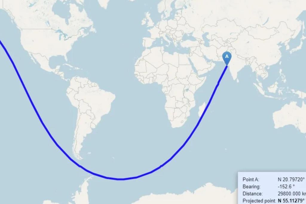
A map showing a curved blue line between India and the US, indicating that it is possible to sail between the two countries in a straight line without touching land, has gone viral on social media. The map has garnered attention from Elon Musk, who commented "Whoa." Some users struggled to understand why the line was curved, prompting one user to recreate the path on a 3D globe. The discussion highlighted the Earth's spherical shape and sparked debates about the definition of a straight line.
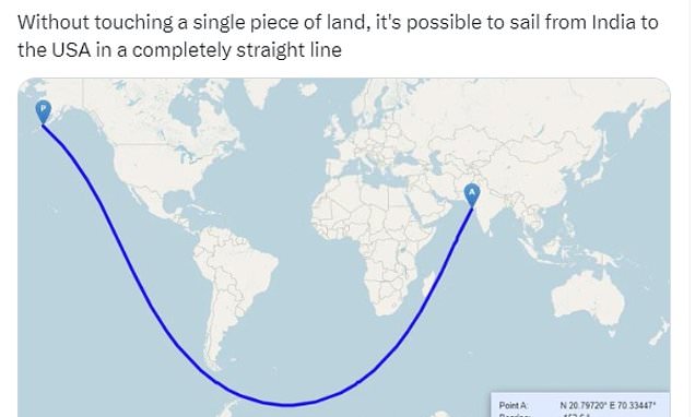
A map showing a straight line route from India to the USA has captivated social media users, despite the practical challenges posed by ocean currents and Antarctic ice sheets. The map, which appears curved on a 2D surface, is actually a straight line when drawn on a globe. The Mercator projection, commonly used in maps, distorts the shape of landmasses and makes straight lines appear curved. In 2012, a Reddit user identified an even longer straight line sea journey from Pakistan to Russia, inspiring computer scientists to develop an algorithm to find the longest possible routes on Earth.
A vintage visualization from 1850 showcases the principal rivers and lakes of the world, organized neatly by size and location. The visualization highlights the longest rivers at the time, including the Mississippi, Amazon, Nile, and Yangtze. It also features the largest lakes, such as the Caspian Sea and Lake Superior. While some names have changed over time, the visualization provides a unique glimpse into humanity's early efforts to quantify the world.

The world's largest cities are ranked based on different metrics. By city proper, Chongqing in China leads with a population of 32.1 million, followed by Shanghai and Beijing. By urban area, Tokyo takes the top spot with 37.7 million people, followed by Jakarta and Delhi. Tokyo also leads in the metropolitan area ranking, followed by Jakarta and Delhi. As urbanization continues to grow, new cities in Africa and Asia are expected to compete for the title of the largest city.
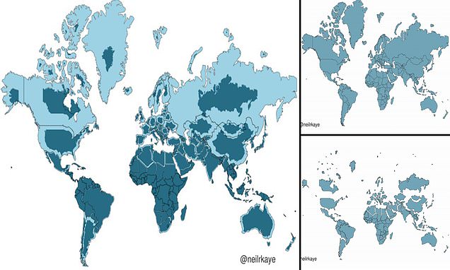
A climate data scientist at the Met Office has created a two-dimensional representation of what the world really looks like, revealing that many countries, including Russia, Canada, and Greenland, are not nearly as big as we think. This phenomenon can be attributed to the Mercator projection, a map most commonly seen hanging in classrooms and in textbooks, which was created in 1596 to help sailors navigate the world. It gives the right shapes of land masses, but at the cost of distorting their sizes in favour of the wealthy lands to the north. Africa is actually three times the size of North America and also significantly larger than Russia, despite the opposite appearing true when looking at a map.
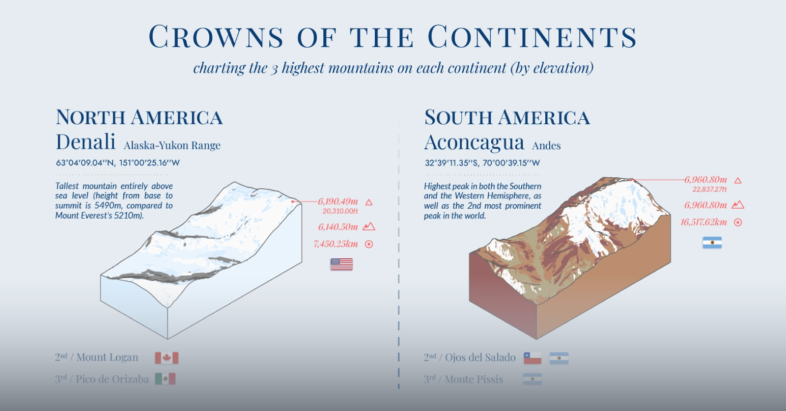
Arijit Gupta has used data from various sources to highlight the three highest mountains on each of the world's continents. Mount Everest, towering over the Himalayas, is the highest mountain peak on Earth by elevation. South America's crowning peaks are seen along the Andes Mountain range, starting with the highest mountain peak in the Southern Hemisphere—Aconcagua. Africa is home to three of the world's highest peaks, and some of the most diverse mountain-side climates surrounding them. The Caucasus Mountains at the edge of Eastern Europe contains the continent's highest mountains. Oceania's highest peak is Puncak Jaya, also known by other local names including Carstensz Pyramid, the mountain of which Puncak Jaya is a distinct summit. Antarctica's mountains are relatively low-lying and often completely covered in ice and snow.
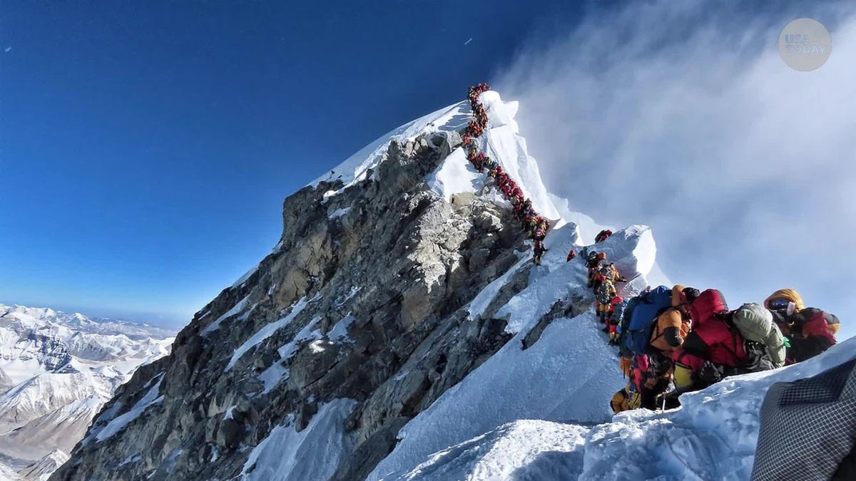
While Mount Everest is considered the tallest mountain in the world based on its elevation above sea level, other mountains such as Mauna Kea, Denali, and Mount Chimborazo have been argued to be taller based on different definitions of "tallest." Mauna Kea is the tallest from base to peak, but its underwater base disqualifies it from the competition. Denali, with its base situated on land, is roughly 3,000 feet taller than Everest when measured from base to peak. Mount Chimborazo's peak is farther from the center of the Earth than any other mountain, but it only reaches an elevation of 20,564 feet above sea level.