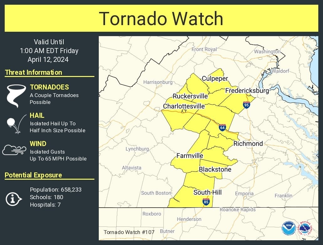
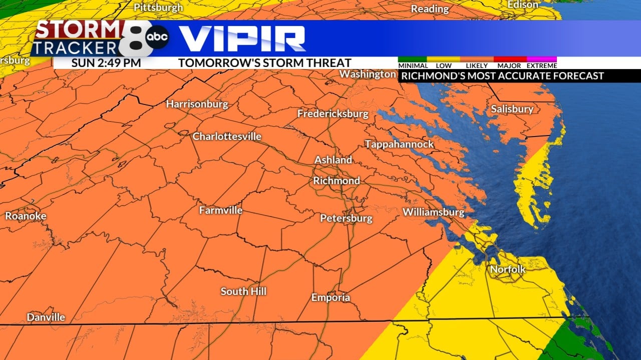
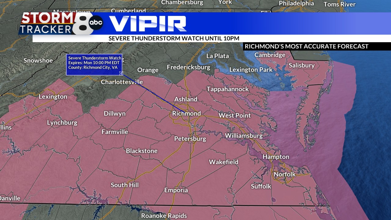
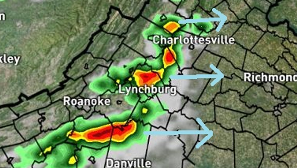
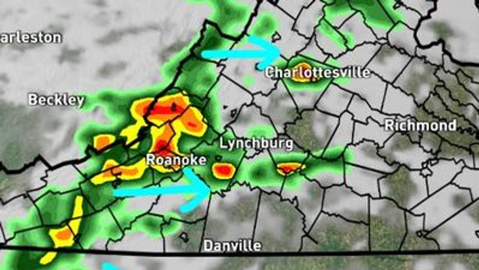
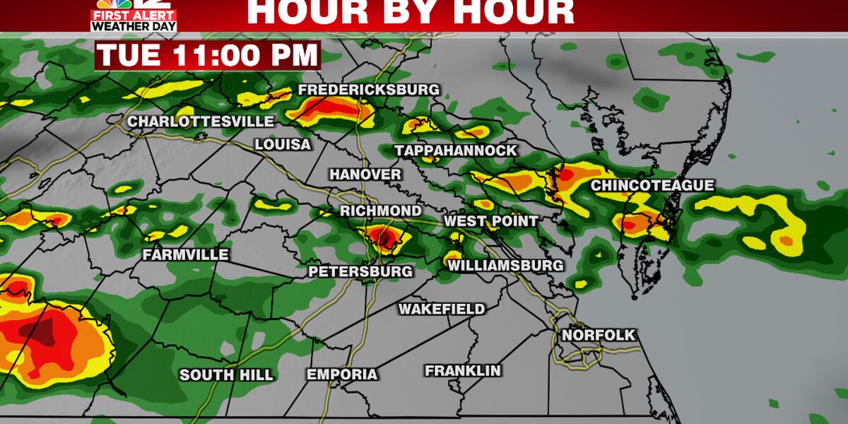
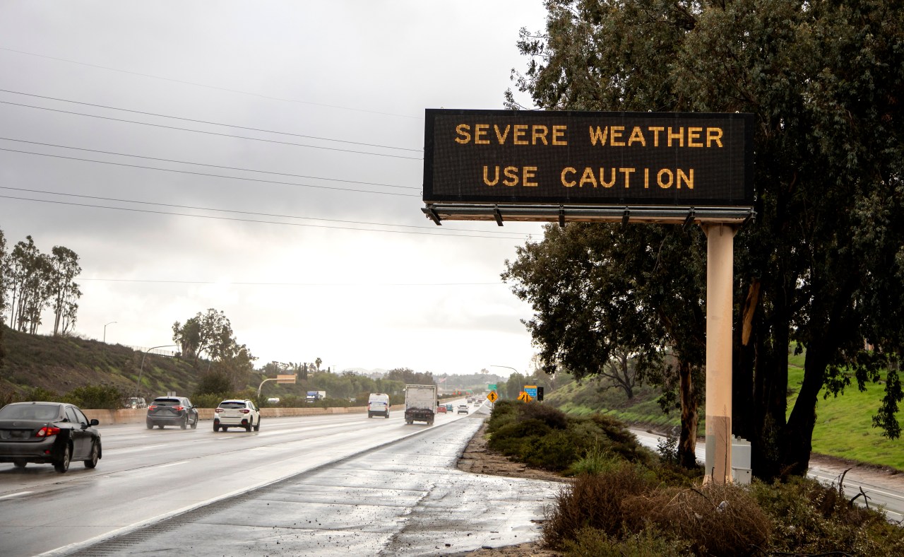
Severe thunderstorm warnings were issued for several central Virginia counties on Sunday, with hazards including 60 mph wind gusts and potential damage to trees and powerlines. Residents were advised to seek shelter in interior rooms on the lowest floors of buildings. The warnings have since expired.
A tornado watch has been issued for Central Virginia, including Culpeper and Fredericksburg, until 1 a.m., with the possibility of strong storms affecting the D.C. area. The National Weather Service warns of intense storms with potential wind damage and the chance of isolated tornadoes. Residents are advised to stay alert and seek shelter if a tornado warning is issued. Showers and storms are expected to continue into the evening, with temperatures dropping tomorrow and the possibility of some showers or storms in the afternoon.
Many central Virginia schools will be closed or on a 2-hour delay due to icy conditions following snow and freezing rain, with closures including Amelia, Goochland, King William, and Louisa County Schools, and delays for Caroline, Henrico, and Richmond Public Schools.
Health officials in Central Virginia are anticipating a rise in respiratory illnesses, including influenza, COVID-19, and respiratory syncytial virus (RSV), as the holiday season approaches. While specific data on influenza and RSV is difficult to obtain due to their non-reportable nature, local pediatricians have reported an increase in RSV hospitalizations. Health officials are urging people to stay updated on immunizations and practice good hygiene measures such as handwashing and covering coughs and sneezes to prevent the spread of respiratory illnesses.
Central Virginia is expected to experience strong to severe storms between 4 p.m. and 9 p.m. on Monday, with the severity depending on the amount of sun received. The main threats include damaging wind gusts, heavy downpours, lightning, and a smaller risk of isolated hail. Wind gusts over 60 mph could cause power outages and downed trees, and there is a possibility of isolated tornadoes. Tuesday will be more humid, with temperatures in the lower 90s and a heat index in the triple digits. Stay alert for both the storm threat and the heat.
The National Weather Service has issued a severe thunderstorm watch for Central Virginia, warning of damaging wind gusts over 60 mph, heavy downpours, large hail, and the possibility of localized flash flooding.
Central Virginia is expected to experience strong storms on Tuesday, with the possibility of severe weather and thunderstorms. A weather warning has been issued, and residents are advised to take precautions to stay safe.
Tuesday is now a First Alert Weather Day in central Virginia due to the potential for strong to severe storms from 4 p.m. until just after midnight. The Storm Prediction Center has outlined areas south and west of Richmond in a level 2 out of 5 slight risk, while the rest of central Virginia is in a level 1 out of 5 marginal risk. Strong wind gusts are the greatest risk, along with hail, downpours, and lightning, and an isolated tornado cannot be completely ruled out. It's important to have ways to get a warning even if you are sleeping, such as the NBC12 First Alert weather app with notifications and sound turned on.