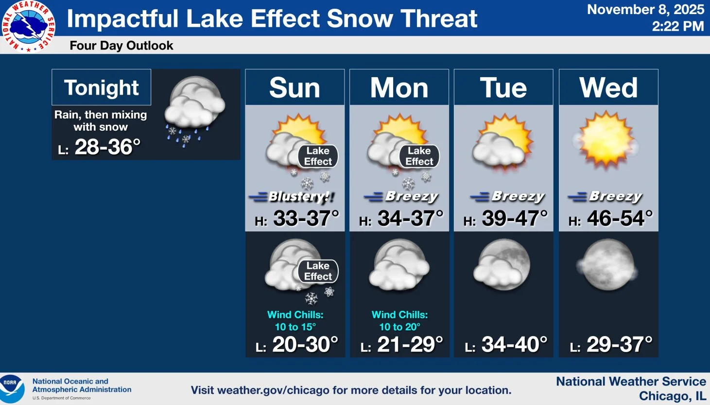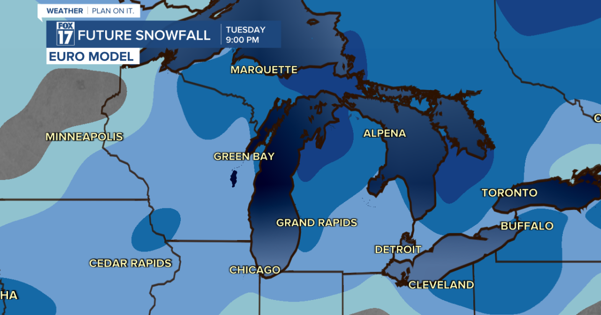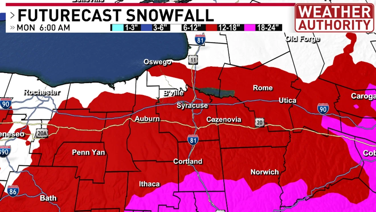
Central New York Braces for Major Snowfall as Lake-Effect Follows
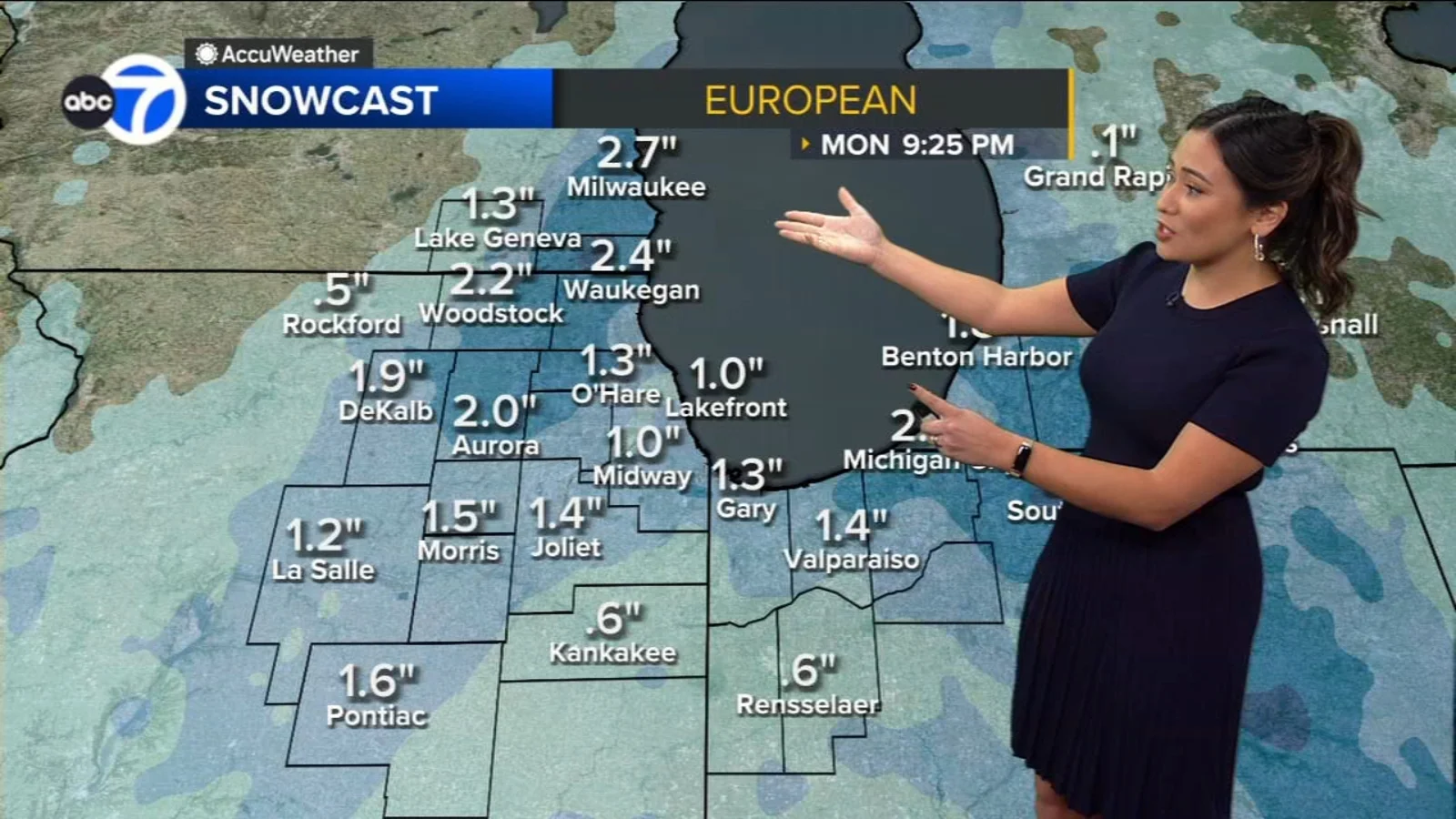
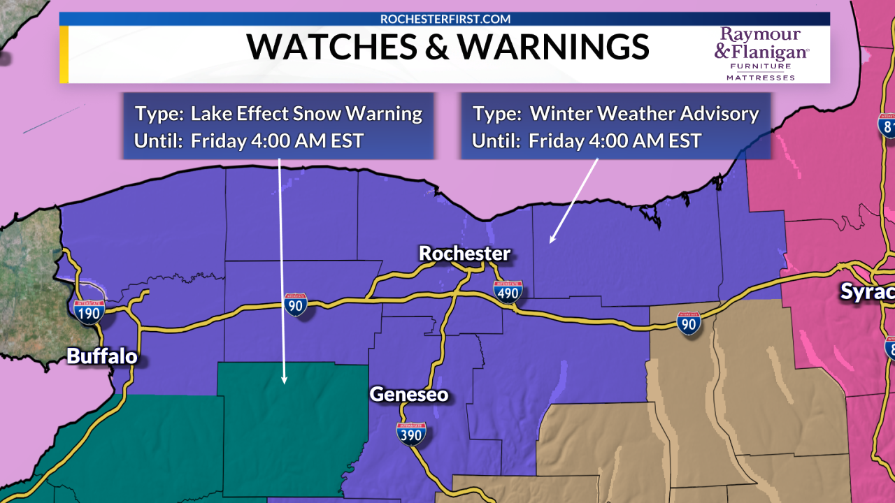
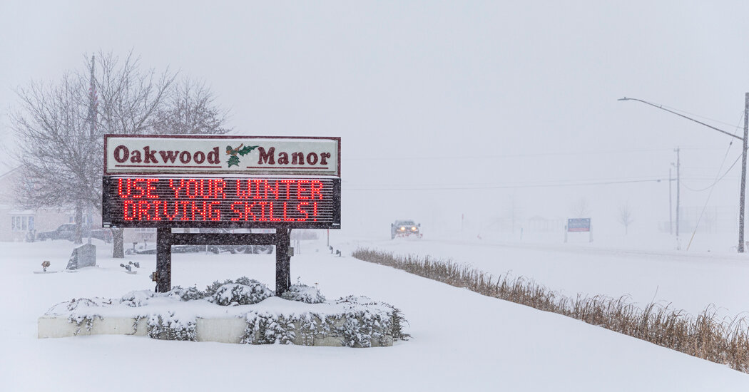
A powerful winter storm is bringing heavy snow to the southern Tier and central New York, with 6–12 inches expected by Sunday afternoon and 12–18 inches by Monday morning (higher elevations could exceed 18 inches). Wind chills dip to -5 to -10 with 20–25 mph gusts, creating blowing/drifting conditions and 1–2 inch per hour snowfall rates Sunday afternoon into Monday. Travel will be significantly impacted, and lake-effect snow is likely to follow Monday afternoon with continued snow showers through the week.