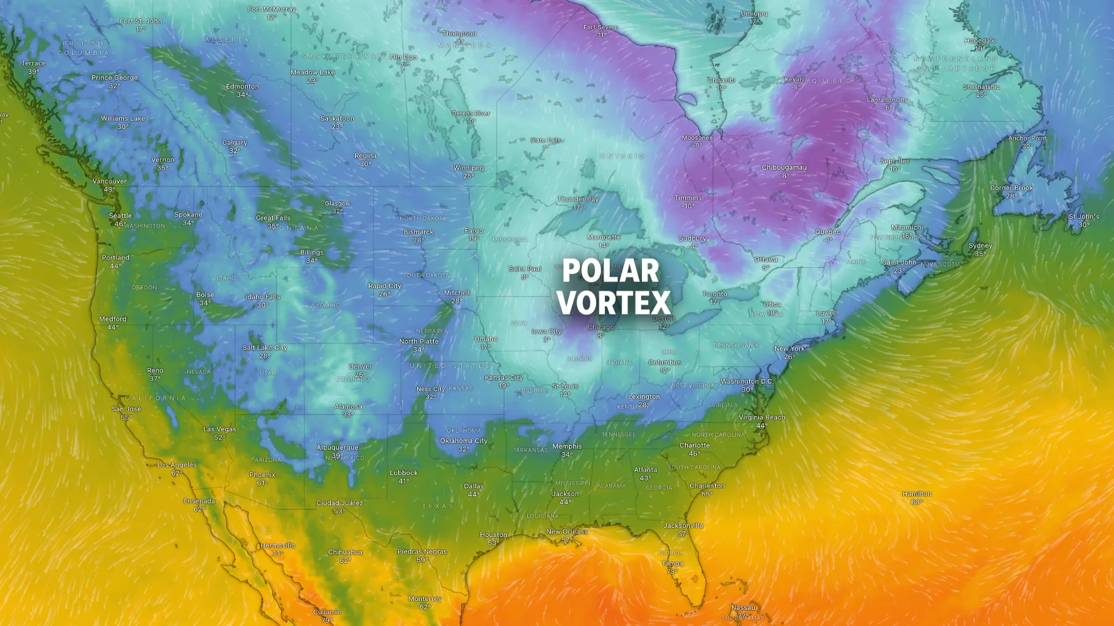
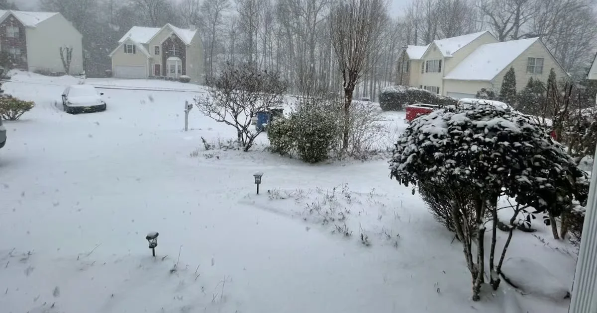
The article discusses how the decline in winter cold and frost days due to climate change disrupts key biological processes in plants and pests, affecting agriculture and ecosystems. Cold is essential for plant vernalization, pest control, and ecological balance, but warming winters threaten these functions, leading to potential crop failures and ecological shifts. Scientists are exploring ways to mimic or stabilize cold responses in plants through genetic and epigenetic techniques to adapt to a changing climate.
The Northeast experienced snow and bitter cold as 2026 began, with significant snowfall and arctic blasts, while Southern California faces heavy rains and flood threats, including disruptions to the Rose Parade and potential flooding across the region.
A weather system brings light snow and colder temperatures to Minnesota on Wednesday, with snow showers ending by early afternoon and temperatures dropping into the teens and single digits, but warming up to seasonable levels by the weekend.
A strong weather system is bringing howling winds, dropping temperatures, and a high wind warning to Maryland, with gusts up to 70 MPH in mountain areas, causing potential tree damage and power outages, and continuing cold and breezy conditions through New Year's.
A strong wind event is expected in Massachusetts on Tuesday, with gusts up to 60 mph in elevated areas, potentially causing tree damage and power outages, amid cold temperatures and refreezing conditions.
The Philadelphia region experienced a snowstorm followed by a prolonged cold snap, with 18 consecutive days of below-average temperatures, which will continue until Thursday when temperatures are expected to rise into the 50s. The upcoming week will see gradually warming temperatures, with rain expected on Friday.
Due to icy conditions and cold temperatures, many schools and organizations in the Pittsburgh area are operating on delays or have adjusted plans for Monday, with Pittsburgh Public Schools starting two hours late and several heating centers opening to assist residents.
Philadelphia experienced its first major snowfall of the season with over 8 inches in some areas, followed by dangerously cold and icy conditions due to high winds and below-freezing temperatures, prompting an Enhanced Code Blue advisory and increased shelter efforts.
A weekend storm brought heavy snow to the Northeast and frigid temperatures across the Midwest and East Coast, causing airport delays and hazardous road conditions, while the Pacific Northwest faces more rain after recent flooding.
A triple-dip polar vortex is expected to bring frigid Arctic air to much of the central and eastern US over the coming weeks, causing significant cold surges, snow, and increased energy demands, with temperatures potentially dropping below -25°F in some areas.
A significant Arctic cold front is sweeping across much of the US, bringing snow, record low temperatures, and hazardous travel conditions, with Florida experiencing unseasonably cold wind chills and potential impacts on local wildlife like iguanas.
A significant winter storm is impacting the U.S., with heavy snow expected in the Great Lakes region and cold temperatures across the South, leading to hazardous travel conditions and winter warnings.
Millions of people in the northern United States are currently under winter storm warnings as a significant weather system is expected to bring heavy snowfall and cold temperatures to the region. Authorities are advising residents to prepare for potentially hazardous travel conditions and disruptions.
The D.C. area is experiencing a cold weather pattern with sunny but breezy conditions, as polar high pressure dominates the region. Temperatures are expected to remain below seasonal norms, with highs in the 30s and 40s, until they begin to moderate by Sunday. A chance of snow or rain showers is possible late Wednesday into Thursday, but significant precipitation is unlikely. Despite the current cold, November was the warmest on record for D.C., contributing to 2024 being one of the warmest years so far.
An Arctic blast is set to hit Michigan starting late on Thanksgiving Day, bringing below-freezing temperatures and several inches of lake-effect snow, particularly in West Michigan. The National Weather Service warns of slick roads and reduced visibility from Friday through the holiday weekend, with areas like Grand Rapids and Kalamazoo expected to be heavily affected. The cold and snowy conditions are anticipated to persist into the following week.