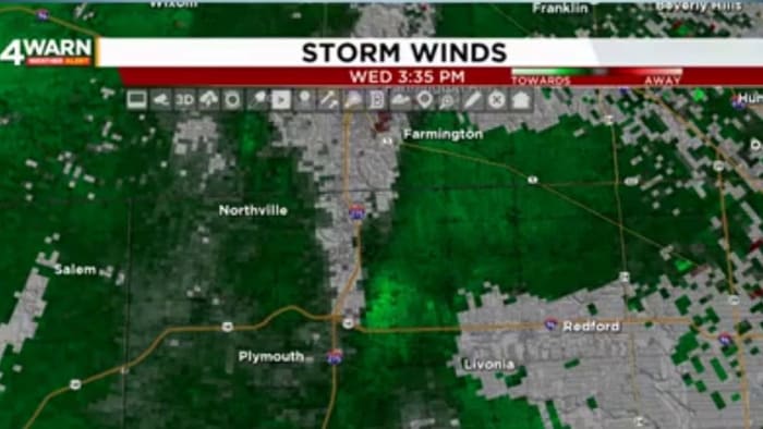
A tornado touched down in Livonia, Michigan, on Wednesday afternoon, causing extensive tree damage. The National Weather Service confirmed it was an EF-1 tornado with winds of 90-95 MPH. Damage reports also came in from other areas in Wayne and Oakland counties.
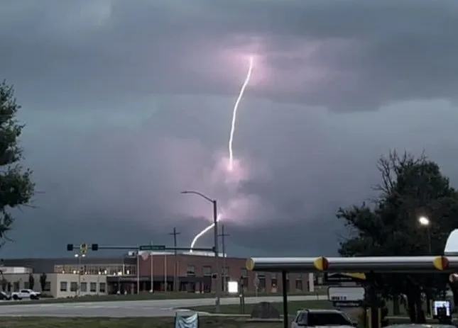
Severe weather, including tornadoes and damaging winds, caused widespread power outages affecting over 700,000 people across Michigan, Ohio, and Pennsylvania. The storms resulted in downed trees, flipped vehicles, and roof collapses. A confirmed tornado was tracked in Michigan, and search and rescue efforts were underway to locate possible victims. The storms also caused damage in other areas, including fallen trees and flooded roads. More storms are expected as the system moves eastward, with airports experiencing ground stops and severe thunderstorm warnings in effect for parts of West Virginia.
The entire Kansas City area is under a severe thunderstorm watch, with some parts already experiencing thunderstorm warnings. The National Weather Service has issued the watch until 7 p.m. Strong winds at 70+ mph and large hail are expected, with power outages already reported. Damage reports include downed power lines and fallen trees, with vendor tents blown over at the Wyandotte County Fair.
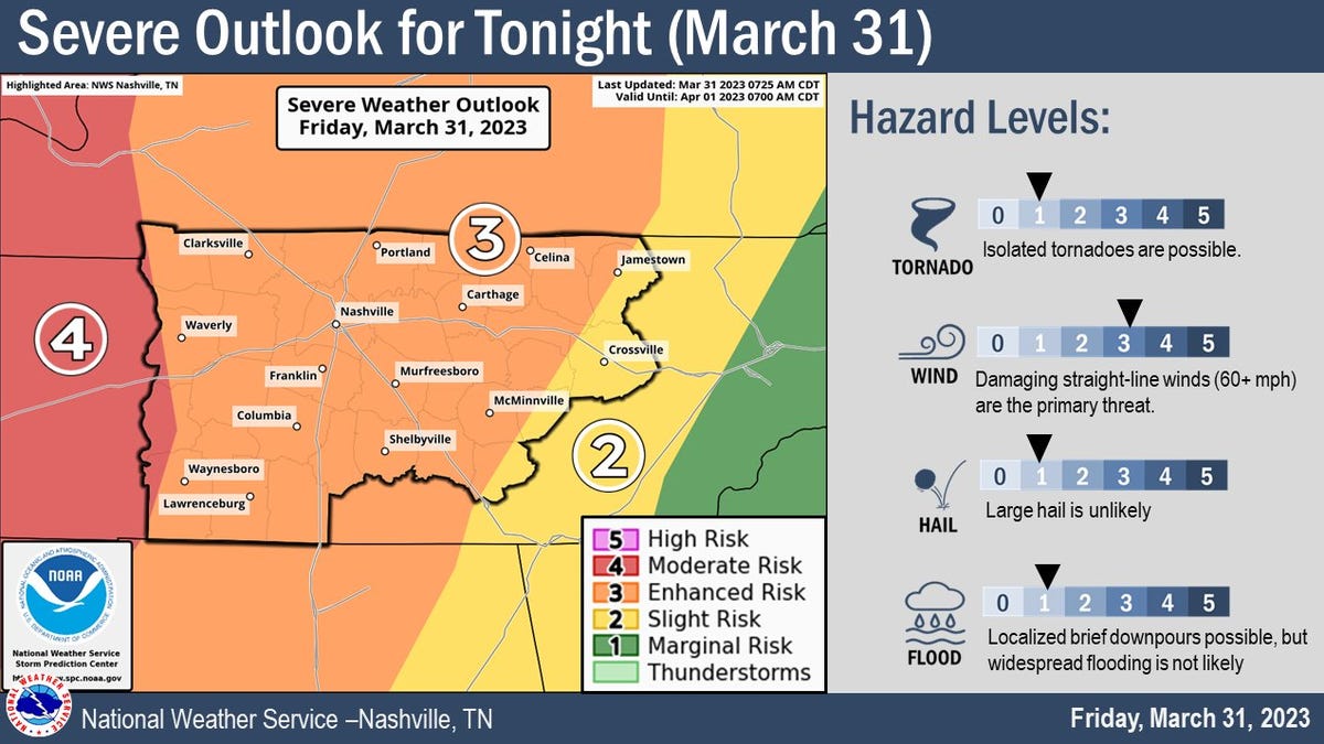
Severe storms and possible tornadoes are expected to hit Middle Tennessee throughout the night and into early Saturday. A tornado watch has been issued for Middle Tennessee and parts of East Tennessee until 7 a.m. Saturday. The National Weather Service in Nashville is predicting the tornado will be near Murfreesboro around 1:40 a.m. Reports of damage are coming in from Middle Tennessee, including downed trees, power lines, and structural damage. It's important to remain weather aware and have a plan in place.