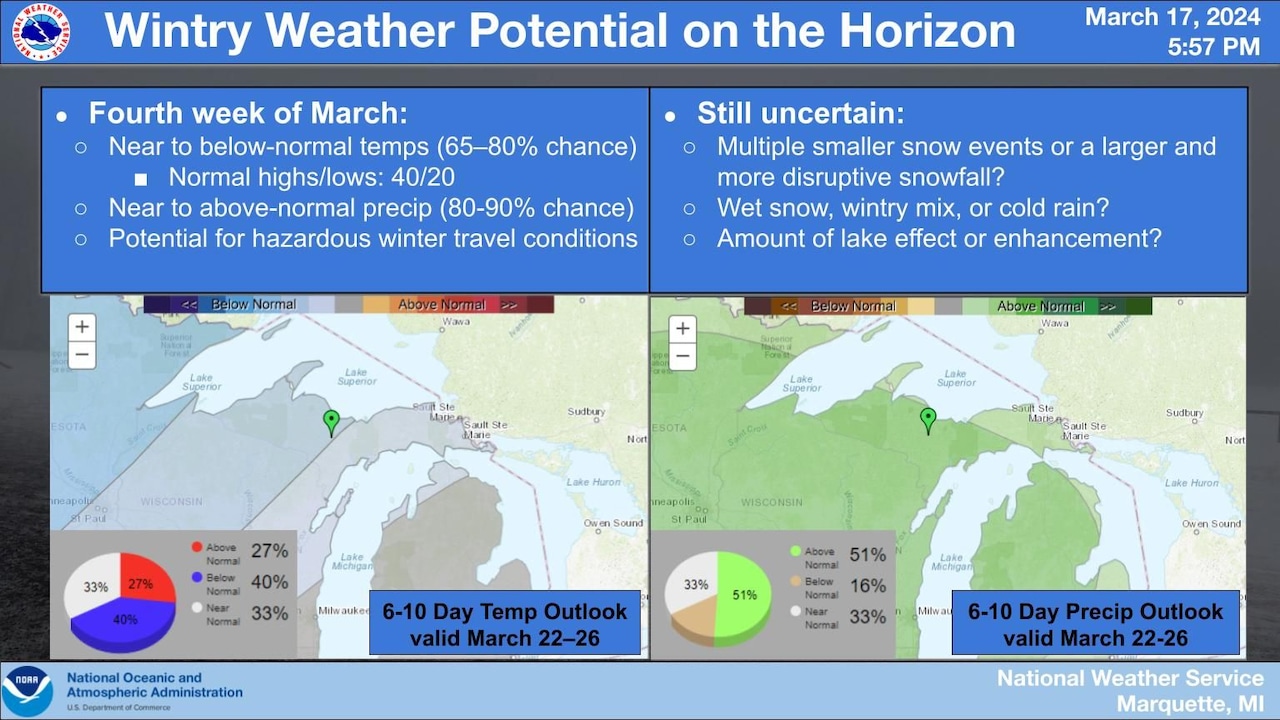
The National Weather Service is predicting unsettled weather in Michigan from March 22 to 26, with the possibility of either several small wintry events or a larger disruptive snowstorm. Travelers are advised to monitor the forecast closely as hazardous driving conditions may arise, especially over the weekend and into early next week.
Unsettled weather is expected to return to Northern California as we "fall back" this weekend. Rain will focus mainly across northern portions of the Sacramento Valley into the Pacific Northwest, while areas from Chico to the south will stay dry until the weekend. Rain and cooler temperatures are forecasted through early next week, with the Sierra expected to receive slightly more rain accumulations. Snow levels will drop on Sunday, potentially causing slick roads and low visibility in the passes. Models hint at 2 to 5 inches of snow possible for the passes, especially across Highway 50 and I-80. Showers will fill in across the valley on Sunday evening through Monday, while the Sierra will experience cool and cloudy conditions with scattered showers. The Delta will see more clouds and slightly cooler temperatures, while the Bay Area can expect rain on Sunday with up to two-tenths of an inch expected by Sunday night.
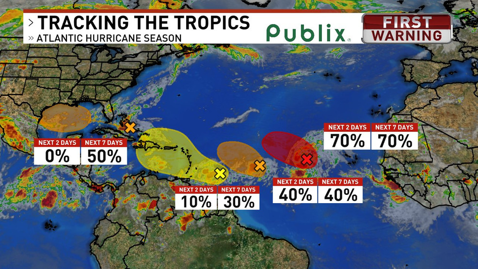
Multiple potential tropical systems are developing in the Atlantic Basin, including the Gulf of Mexico, with four areas showing a range of formation chances.
Central New York will experience a prolonged stretch of unsettled and muggy weather with high humidity and daily chances of showers and thunderstorms until at least Thursday. There is a risk of isolated flash flooding due to heavy downpours in low lying and poor drainage areas. Despite the flood threat, the rain is welcomed as parts of CNY continue to be abnormally dry. Temperatures are expected to warm into the low-80s Saturday and possibly mid-80s Sunday.
Unsettled and stormy weather will continue through Friday with a high chance of showers and storms. However, the weekend will see a return to typical summer weather with rain chances dropping to 30% on Saturday and just 20% on Sunday. Temperatures will continue to warm into the 80s with some inland areas near 90.
The local forecast predicts a week of unsettled weather with a chance of showers and thunderstorms throughout the week. Residents are advised to keep an eye on the weather conditions and take necessary precautions to stay safe. The week will start off with a chance of showers on Monday, followed by showers and thunderstorms likely on Tuesday and Wednesday. Thursday and Friday are expected to be mostly sunny.
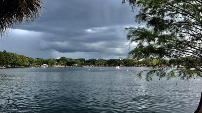
Central Florida will experience a warmup with temperatures in the mid-80s on Friday before a strong cold front moves through on Saturday, increasing rain chances. By Sunday, highs will struggle to climb out of the 50s in some areas due to a system developing along the cold front. The weather will remain unsettled through the early portion of the upcoming workweek before improving weather arrives by the second half of Tuesday into Wednesday.