Satellites Map Pacific Wave Field, Clarifying 35-Meter Wave Claims
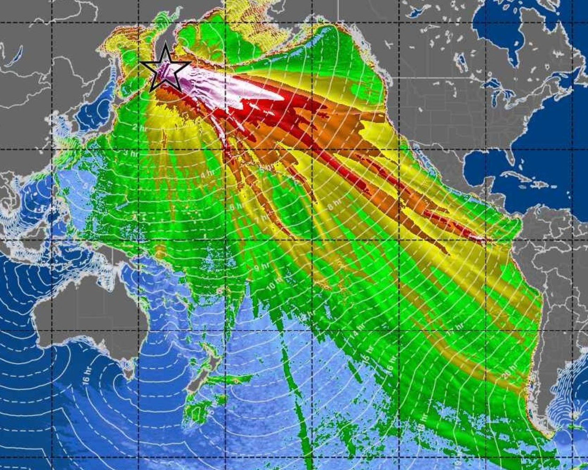
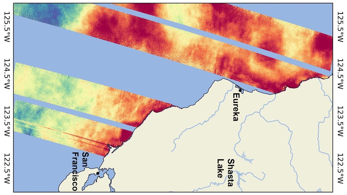
New satellite-altimetry analyses show SWOT captured large-scale, two-dimensional ocean-height patterns during the 2025 Kamchatka tsunami and concurrent storm waves, helping refine rupture models and post-event understanding; however, the reported 35-meter waves were a misinterpretation of significant wave height, and real-time hazard alerts still rely on in-situ systems like DART buoys and meteorological models.