A study reveals that Chicago is slowly sinking due to land subsidence caused by natural glacial adjustments and human groundwater extraction, with potential long-term risks to infrastructure, and suggests managed aquifer recharge as a mitigation strategy.
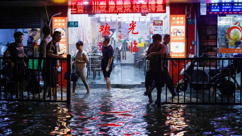
A new study reveals that nearly half of China's urban areas, home to 270 million people, are sinking due to factors such as rampant groundwater extraction and the growing weight of cities. This land subsidence, exacerbated by climate change-fueled drought, puts coastal areas at risk of flooding and rising sea levels. The impact is not limited to China, as other countries also face similar challenges. While some coastal areas in China have built protections against inundation, the study emphasizes the need for continued efforts to control groundwater pumping and maintain coastal dike systems to address the issue of land subsidence.
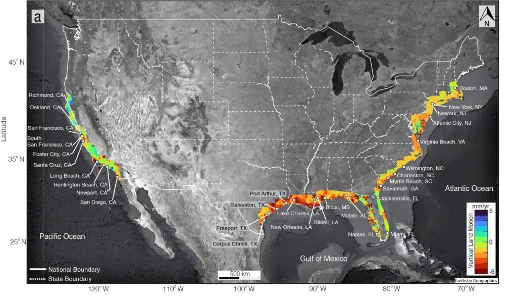
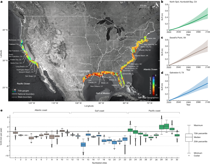
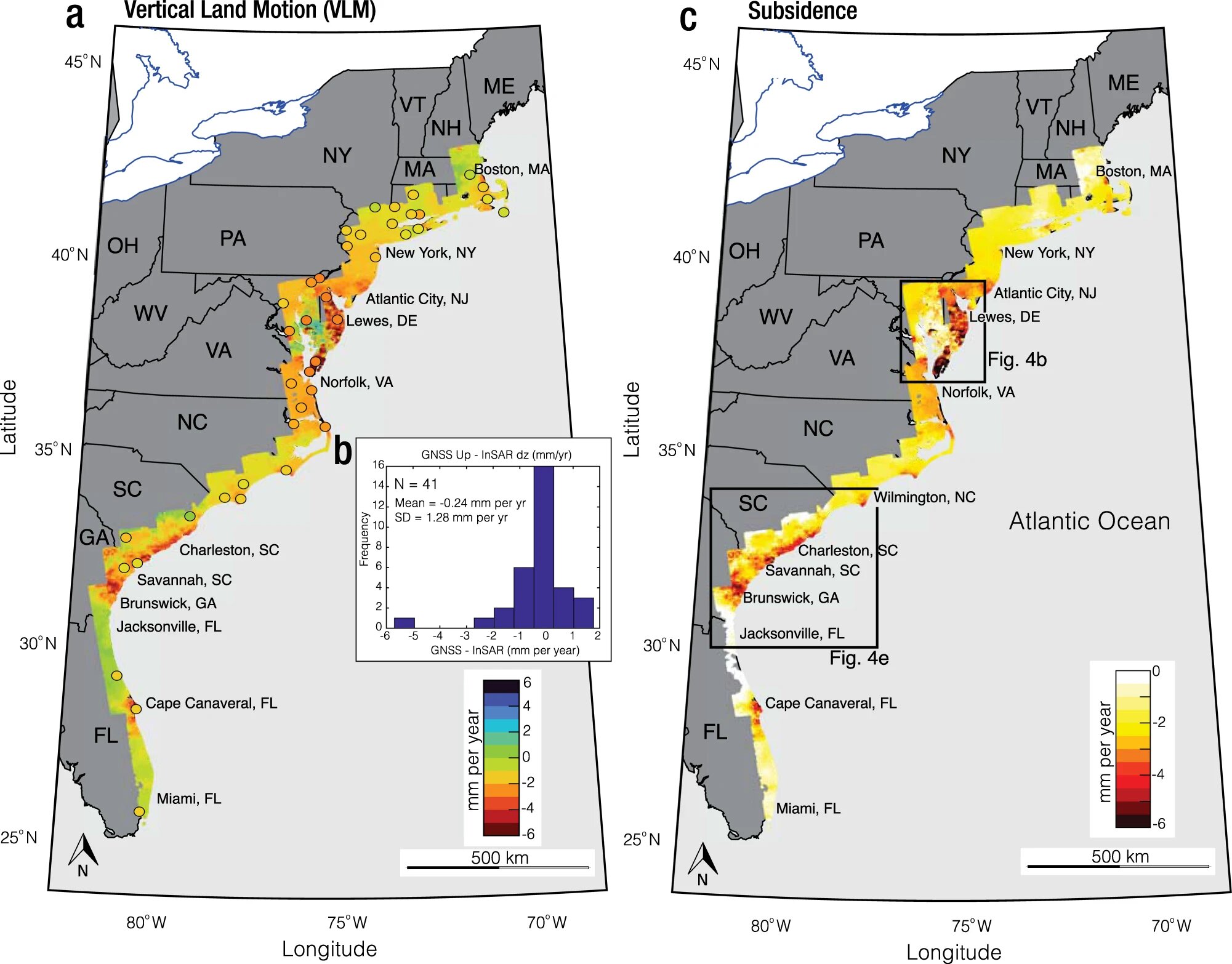
A study led by Virginia Tech projects that by 2050, one in 50 people in 32 coastal cities in the US could face significant flooding due to sinking land and sea-level rise, affecting up to 500,000 people and 1 in 35 properties. The research combines satellite data on land subsidence with sea-level rise projections, highlighting the short-term impact and racial and socioeconomic disparities in affected areas. The study emphasizes the need for comprehensive flood resiliency planning and management decisions, providing a call to action for policymakers.
A study on the US coasts reveals that climate-induced sea levels are rising faster than the global average, posing substantial socioeconomic challenges for coastal cities. By 2050, an estimated 25 million people and 10 million properties in 32 coastal cities could be exposed to high-tide flooding, with potential impacts on population, properties, and home values. The study also highlights the critical role of land subsidence in exacerbating coastal hazards and emphasizes the disproportionate impacts of relative sea-level rise on vulnerable communities, particularly on the Gulf coast.
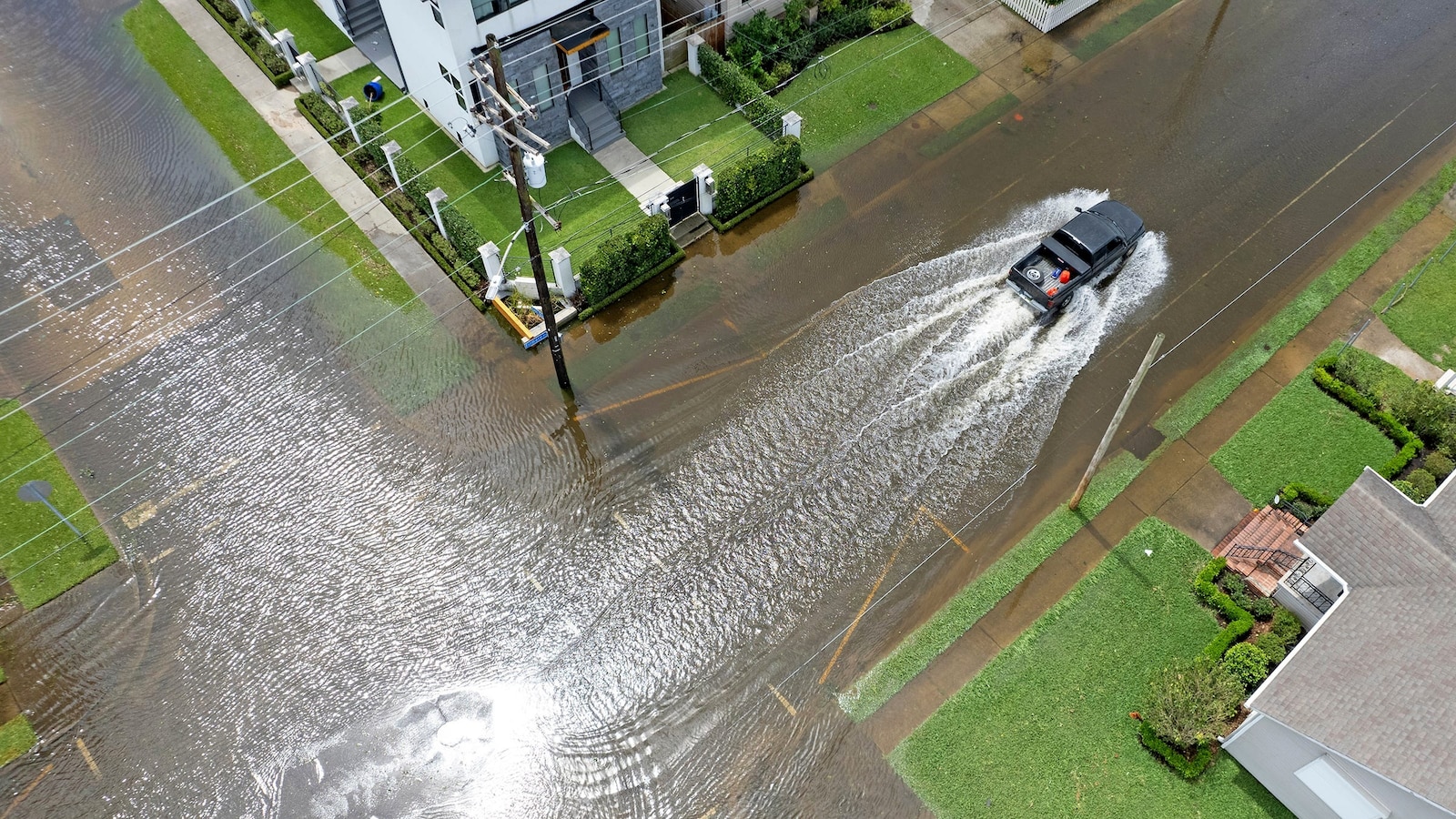
New research shows that 32 coastal cities in the US are at risk of flooding by 2050 due to land subsidence, exacerbating the impact of sea level rise. Major cities like Boston, New Orleans, and San Francisco are among those facing potential flooding, with up to 273,000 people and 171,000 properties at risk. Groundwater extraction and sediment compaction are driving the subsidence, and current hazard mitigation efforts are deemed inadequate. The study emphasizes the need for local management policies and solutions such as sea walls and raising properties to address the escalating threat.
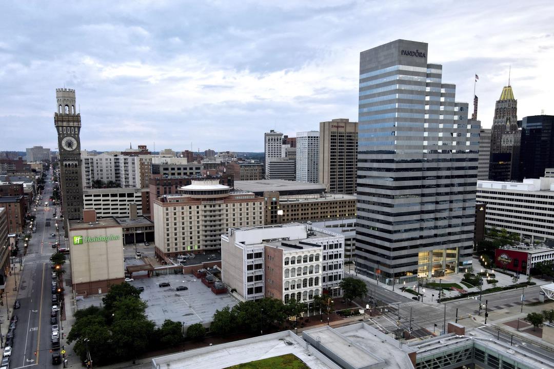
NASA images show that the land on which major U.S. cities like New York and Baltimore are built is sinking, exacerbating the threat of rising sea levels. The land subsidence, occurring at a rate of 1 to 2 millimeters per year, poses a significant risk to infrastructure, farmland, and wetlands along the East Coast. The problem is particularly acute in cities like Charleston, where downtown is just 10 feet above sea level and experiences subsidence of about 4 millimeters per year. The issue, caused by a combination of natural and human factors, could lead to increased damage to homes, saltwater intrusion, and other challenges for coastal communities.
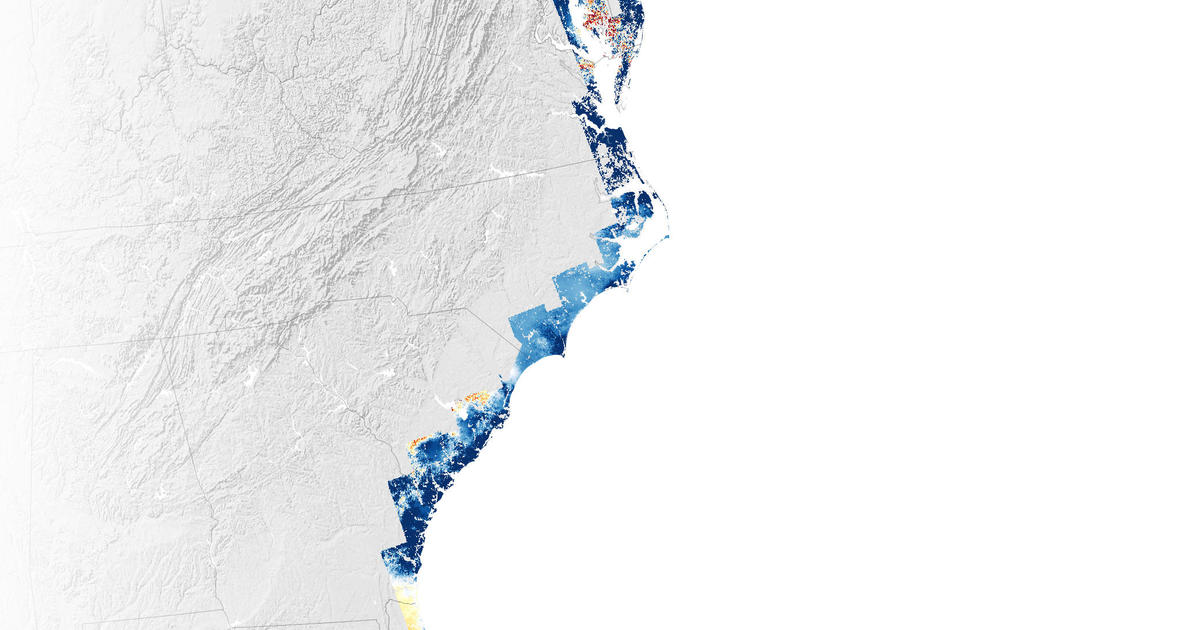
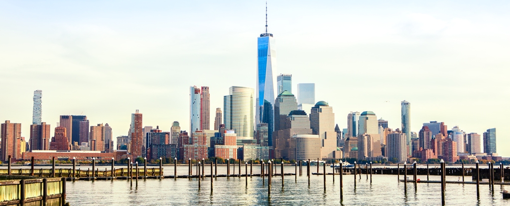
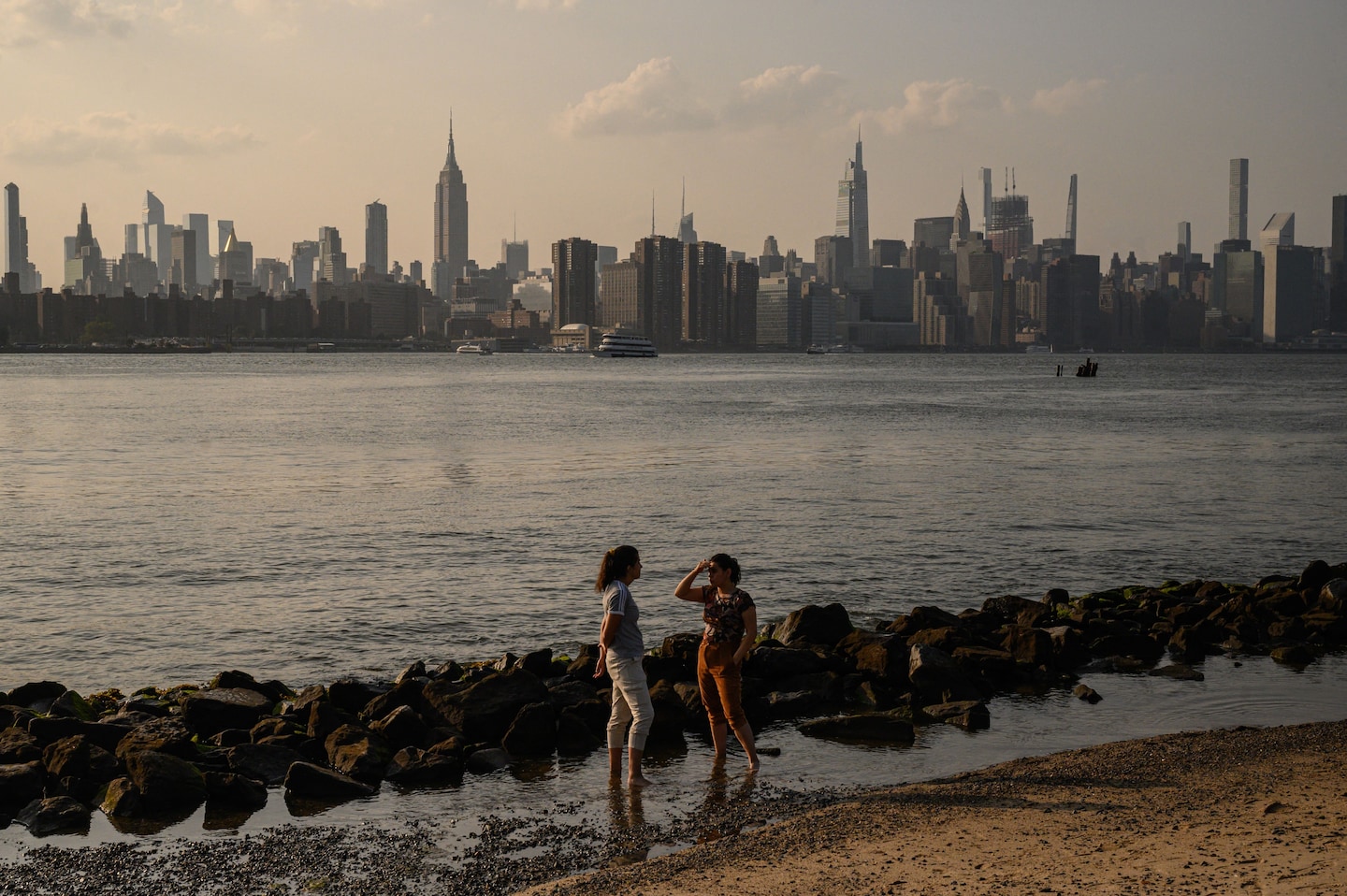
Geologists have found that major cities on the US Atlantic coast, including New York City, are sinking at a faster rate than previously estimated, with some areas sinking 2 to 5 millimeters per year. This land subsidence poses significant risks to infrastructure such as roadways, airport runways, building foundations, rail lines, and pipelines, and exacerbates the impact of climate change-related storms. The research highlights the exposure of millions of people and properties to these subsidence rates and emphasizes the urgent need for community and infrastructure resilience planning.
Researchers from Virginia Tech have found that major cities along the East Coast are experiencing land subsidence at rates that exceed global sea level rise, posing a threat to critical infrastructure such as airports, railways, and levees. The sinking elevation, caused by factors including groundwater extraction and urban weight, is leading to increased flood risks and potential damage to infrastructure. This issue is not unique to the East Coast, as coastal areas worldwide are at risk of flooding, erosion, and displacement due to rising sea levels and sinking land.
Certain areas in New York City, including LaGuardia Airport, Arthur Ashe Stadium, Interstate 78, and Highway 440, are sinking at a rate of more than 2 millimeters per year, faster than the city's average subsidence of 1.6 millimeters per year, according to a new study. The sinking land exacerbates flooding risks as sea levels rise. The study, which used satellite data, highlights the importance of understanding vertical land motion and its impact on flooding susceptibility. The sinking hotspots were found to be former landfill sites, which compress faster than areas built on solid ground. The study also identified areas where land is rising, such as Brooklyn's East Williamsburg, which could destabilize infrastructure. The researchers plan to expand their analysis to other cities to inform flood risk and city planning.
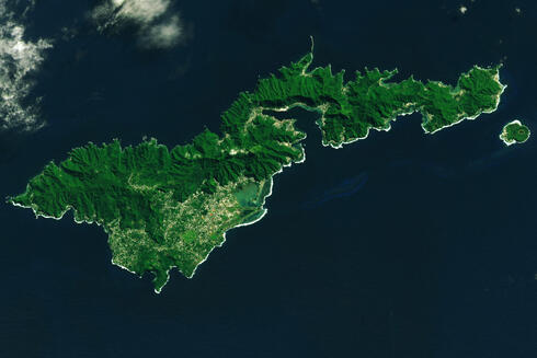
A study by NASA researchers highlights the sinking of American Samoa island in the South Pacific Ocean, exacerbated by a powerful earthquake in 2009 and rising sea levels. The study emphasizes the urgent need for immediate action to aid small islands facing the risk of disappearing due to the rising ocean surface. The researchers used satellite and terrestrial observations to measure land subsidence, revealing an annual average subsidence of 6 mm to 9 mm between 2015 and 2022. The study aims to provide insights for protecting vulnerable small islands and their populations from the impacts of climate change.
Researchers at Virginia Tech's Earth Observation and Innovation Lab have created high-resolution maps of land subsidence, or sinking land, using publicly available satellite imagery. The maps reveal that many areas along the US Atlantic coast are more vulnerable to floods and erosion than previously thought, with places like New York City and Charleston sinking up to two millimeters per year. The lab's mapping has drawn the attention of multiple government agencies, leading to investment in an effort to fill a critical gap of information and help people better plan at the local, state, federal, and global level.