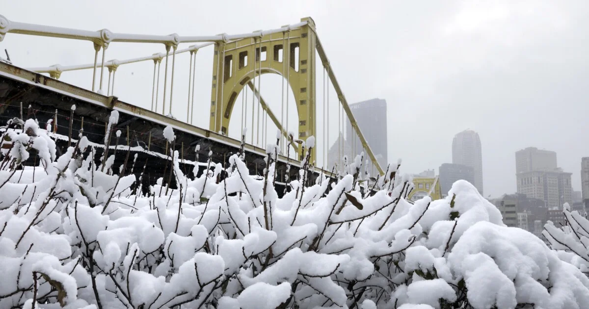
Tag

Winter Storm Watch

All articles tagged with #winter storm watch

weather1 year ago

Northeast Ohio Braces for Intense Lake Effect Snow and Winter Storm

The National Weather Service has extended the Lake Effect Snow Warning for Ashtabula and Lake counties in Northeast Ohio until Tuesday morning, with a new Winter Storm Watch issued for Cuyahoga and Geauga counties from Sunday to Monday. Significant snowfall is expected, with 8-20 inches predicted along the I-90 corridor and 6-15 inches across Northeast Ohio and northwest Pennsylvania. Travel is discouraged in affected areas, particularly along I-90 and Highway 20.

weather1 year ago

Midwest Braces for Heavy Snow and Strong Winds in Late Winter Storm

A winter storm is expected to hit Minnesota and western Wisconsin late Saturday through Monday, bringing heavy snow and strong winds. Snow totals from Thursday into Friday morning ranged from 2.5 to 7.5 inches in the Twin Cities metro area. The storm is forecasted to bring mainly snow to much of Minnesota and parts of western Wisconsin, with rain or a rain/snow mix in eastern Minnesota and western Wisconsin. A winter storm watch is in effect from Sunday morning through Monday morning for much of Minnesota and northwestern Wisconsin, with heavy snow accumulations and difficult travel conditions expected.

weather1 year ago

Northeast Braces for Weekend Winter Storms with Up to 10 Inches of Snow

Central New York is under a winter storm watch from Sunday 5 a.m. until Monday 2 p.m., with heavy snow and accumulations of 5 to 10 inches possible, along with gusty winds. The hazardous conditions could impact Monday morning commute, and the National Weather Service advises monitoring the latest forecasts for updates. Additionally, the weather service provides winter driving tips to ensure safety on snow-covered roads, including sharing travel plans, preparing the vehicle with essential supplies, staying calm when stranded, being mindful of snow plows, and checking road conditions before embarking on the journey.

weather1 year ago

"Midweek Mix: Snow, Wind, and Rain Forecast for the Region"

Mild El Niño winter weather is expected to continue for the next 10 days, with a brief cool period forecasted for Wednesday to Friday in the Gorge and Portland metro area due to a weak surge of cool air. Sticking snow is unlikely west of the Cascades, but snow may fall in the eastern Gorge and north-central Oregon. Rainy and chilly days are expected in the metro area, with significant precipitation likely. Winter Storm Watch has been issued for the Gorge and Cascades. Mild weather will resume after the cool period, with more days in the 50s ahead.

weather1 year ago

"Nor'easter Brings Snow to Southern Maine Coast on Tuesday"

Seacoast NH and southern Maine are expected to receive several inches of snow on Tuesday, with 6-8 inches along the coastline and up to 10 inches inland. The storm may bring minor coastal flooding and wind gusts up to 35 mph, with slick driving conditions expected during the morning and evening commutes. Following the storm, colder temperatures are expected, with more rain and snow forecasted for Thursday night into Friday.

weather1 year ago

"Central Pa. Snowfall Forecast: What to Expect This Week"

Central Pennsylvania is expected to experience snowfall Monday night into Tuesday, with the north-central part of the Commonwealth likely to be hit the hardest. The National Weather Service has issued a winter storm watch, with snowfall projections indicating around an inch in Harrisburg and significantly higher amounts further north, reaching up to 12 inches near the New York border. Rain is expected to precede the snow, and windy conditions are anticipated on Tuesday, with gusts up to 26 mph in the Harrisburg area.

weather1 year ago

"Winter Storm Watch: Snow Returns to Rochester Region"

A winter storm watch has been issued for parts of the Rochester region with total snow accumulations of 7 or more inches possible, and snowfall rates reaching 2 to 3 inches per hour at times. The advisory covers several counties, and hazardous conditions could impact the morning commute. This alert follows record-breaking temperatures in the area, with a low pressure system bringing warm conditions before temperatures began to fall.

weather1 year ago

"Winter Storm Alerts for Southern Tier and CNY as Seasonal Temperatures Return"

Winter Storm Watches have been issued for the Southern Tier including Cortland, Tompkins, Broome, Chenango, and Otsego counties from Monday night through midday Tuesday, with 3-6 inches of snow possible and up to 7" or more for areas farthest south. The path of the weather system is still uncertain, but it looks to take a path to the south, bringing widespread snow to Central New York.

weather1 year ago

"Northeast Braces for Potential Nor'easter Bringing Up to a Foot of Snow"

A powerful nor’easter is expected to bring heavy rain, gusty winds, and plowable snow to the Northeast, impacting travel along the Interstate 95 corridor and at major airports. Over 20 million Americans in nine states are under a Winter Storm Watch, with cities like Hartford, Providence, and Boston at risk. The storm, currently taking shape across the southern U.S., is forecasted to bring moderate to heavy snow on Tuesday, potentially causing dangerous commuting conditions and school closures. Snow totals of 5-8 inches are expected across the region, with some areas at risk of seeing up to a foot of snow.

weather1 year ago

"Northeast Braces for Up to a Foot of Snow in Early Winter Storm"

The National Weather Service has issued a Winter Storm Watch for much of Massachusetts ahead of a system expected to bring up to a foot of snow to some parts of the state next week, with early predictions ranging from 1 to 12 inches of snow across different regions. Possible travel issues are anticipated, and residents are advised to stay updated with the latest weather forecasts.

weather1 year ago

"Northeast Braces for Winter Storm with Potential Foot of Snow"

A winter storm watch has been issued for several counties in Massachusetts as a system is expected to bring plowable snow to the region early next week. The storm, anticipated to hit New England on Monday night into Tuesday morning, will likely impact Tuesday morning commutes and bring heavy snow, with coastal flooding becoming a concern in the afternoon. Snow totals are predicted to range from nine inches to a foot in most of eastern Massachusetts, with lower amounts expected on the South Shore and Cape Cod. Stay updated with the Boston 25 Weather Team for further developments.

weather1 year ago

"Northeast Braces for Nor'easter Bringing Up to a Foot of Snow"

The National Weather Service predicts that a significant snowstorm will hit Massachusetts on Tuesday, with areas such as Springfield, Worcester, Fitchburg, and Lawrence expected to receive between 8 and 12 inches of snow. Boston, Plymouth, and New Bedford are forecasted to get 4 to 6 inches, while the southeastern coast will see lesser amounts. A winter storm watch is in effect for most of the state, and other forecasters also anticipate a major snow event.

weather1 year ago

"Tuesday's Winter Storm: Watches and Projections for Pennsylvania"

A winter storm watch has been issued for parts of the Northeast, with conflicting predictions from the GFS and ECMWF models causing uncertainty about the storm's track and intensity. The GFS model suggests snow near Baltimore, while the ECMWF model indicates a more northern path. The storm is expected to bring slushy and moderate snowfall to central Pennsylvania and possibly metro New York, with temperatures in the mid-30s allowing for potential slushy accumulation. The National Weather Service has issued alerts for the event, with the potential for travel impacts. The article also discusses the influence of the jet stream and provides updates on recent snow reports and NOAA's outlook.

weather1 year ago

"Colorado Braces for Weekend Winter Storm and Road Closures"

A winter storm is set to hit Colorado this weekend, bringing heavy snow to the mountains and a rain/snow mix to the eastern plains. The storm, fueled by Pacific moisture and remnants of an atmospheric river, is expected to bring significant moisture and warmth from the Gulf of Mexico to the Front Range. Denver has a Winter Storm Watch in place for Saturday through Sunday morning, with the metro area expecting 3 to 6 inches of wet heavy snow, while the foothills and south metro area may see 6 to 12 inches. The storm will also impact ski traffic and has prompted various Winter Storm Warnings and Advisories for heavy mountain snow.

weather1 year ago

"Colorado Braces for Weekend Winter Storm with Heavy Snow Threat"

A storm with the potential to drop between six and 12 inches of snow in the Denver metro area is expected to arrive Friday afternoon, with a lot of variability in the possible outcome. Forecasters at the National Weather Service in Boulder have low confidence in the forecast due to variables such as a possible barrier jet and precipitation rates. Temperatures in Denver will remain mild, with highs in the 40s through the weekend, while the mountains have the highest confidence of heavy snow, with up to 20 inches expected in some areas. A winter storm watch has been issued for elevations above 9,000 feet, and snow is expected to continue through Saturday night, potentially causing dangerous travel conditions.